Mowry Bluff Archeological Site
|
Mowry Bluff Archeological Site | |
 | |
  | |
| Location | Western side of Medicine Creek, immediately east of the center of Section 25, Township 5 North, Range 26 West[1] |
|---|---|
| Nearest city | Cambridge, Nebraska |
| Coordinates | 40°22′19″N 100°13′26″W / 40.37194°N 100.22389°WCoordinates: 40°22′19″N 100°13′26″W / 40.37194°N 100.22389°W |
| Area | 10 acres (4.0 ha) |
| NRHP Reference # | 74001115[2] |
| Added to NRHP | July 12, 1974 |
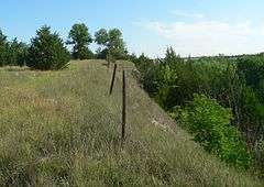
The Mowry Bluff Archeological Site, in Frontier County, Nebraska, near Cambridge, Nebraska, is a 10-acre (4.0 ha) archeological site that was listed on the National Register of Historic Places in 1974. Its Smithsonian trinomial designation is 25 FT 35. It is a village site that was listed for its information potential.[2] A "house mound" at the site was explored, and the site was described, by archeologist W. Raymond Wood, of the University of Missouri, before 1970.[1]
References
- 1 2 Wood, W. Raymond. "The Mowry Bluff Site, 25FT35". Plains Anthropologist 14.44 (1969): 3-6: 3.
- 1 2 National Park Service (2010-07-09). "National Register Information System". National Register of Historic Places. National Park Service.
External links
- More photos of the Mowry Bluff archaeological site at Wikimedia Commons
| Topics | |
|---|---|
| Lists by states |
|
| Lists by insular areas | |
| Lists by associated states | |
| Other areas | |
| |
This article is issued from Wikipedia - version of the 11/30/2016. The text is available under the Creative Commons Attribution/Share Alike but additional terms may apply for the media files.