Napton, Missouri
| Napton, Missouri | |
|---|---|
| Unincorporated community | |
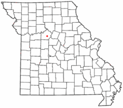 Location of Napton, Missouri | |
| Coordinates: 39°03′10″N 93°05′02″W / 39.05278°N 93.08389°WCoordinates: 39°03′10″N 93°05′02″W / 39.05278°N 93.08389°W | |
| Country | United States |
| State | Missouri |
| County | Saline |
| Elevation | 640 ft (200 m) |
| Time zone | Central (CST) (UTC-6) |
| • Summer (DST) | CDT (UTC-5) |
| Area code(s) | 660 |
| GNIS feature ID | 723116[1] |
Napton, originally known as Jonesboro, is an unincorporated community in southeastern Saline County, Missouri, United States. Napton is located on Missouri Supplemental Route E 8 miles (13 km) southeast of Marshall. It was the county seat of Saline County from 1831 to 1839. It was later renamed Napton, after Judge William B. Napton, who wrote the pro-slavery Napton Resolution in the winter of 1848-1849.
Napton once had a post office, which is now closed; mail delivery now comes from Marshall. Napton also had a bank, grist mill (the grindstone of which is now located at the entrance of the old high school), railroad station, grain elevator and several stores.
References
Municipalities and communities of Saline County, Missouri, United States | ||
|---|---|---|
| Cities | 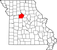 | |
| Villages | ||
| Townships |
| |
| Unincorporated communities | ||
| Footnotes | ‡This populated place also has portions in an adjacent county or counties | |
This article is issued from Wikipedia - version of the 9/5/2016. The text is available under the Creative Commons Attribution/Share Alike but additional terms may apply for the media files.