National Register of Historic Places listings in Door County, Wisconsin
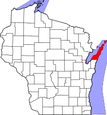
Location of Door County in Wisconsin
This is a list of the National Register of Historic Places listings in Door County, Wisconsin. It is intended to provide a comprehensive listing of entries in the National Register of Historic Places that are located in Door County, Wisconsin. The locations of National Register properties for which the latitude and longitude coordinates are included below may be seen in a map.[1]
There are 70 properties and districts listed on the National Register in the county. Another property was once listed but has been removed.
- This National Park Service list is complete through NPS recent listings posted December 2, 2016.[2]
Current listings
| [3] | Name on the Register[4] | Image | Date listed[5] | Location | City or town | Description |
|---|---|---|---|---|---|---|
| 1 | Anderson Dock Historic District |  |
(#85001249) |
Roughly bounded by Anderson Lane and North Water St. 45°09′43″N 87°10′19″W / 45.161944°N 87.171944°W |
Ephraim | Norwegian immigrant Aslag Anderson started a pier here in 1858, from which Ephraim shipped out poles and ships brought in cargo and passengers.[6] Remaining are the store started in 1858, Aslag's house built in 1864, the warehouse, an ice house, and other structures.[7] |
| 2 | Australasia Shipwreck (Wooden Bulk Carrier) | Upload image | (#13000466) |
820 feet southeast of Whitefish Dunes State Park in Lake Michigan 44°55′20″N 87°11′13″W / 44.9222°N 87.1870°W |
Sevastopol vicinity | 285-foot bulk carrier built in 1884 in Bay City, the largest wooden ship ever built at that time. She hauled salt, wheat, etc from Duluth to Buffalo to Cleveland. On Oct 10, 1896, heading for Milwaukee carrying 2,200 tons of coal, she caught fire off Baileys Harbor and the crew scuttled her in shallow water.[8][9] |
| 3 | Baileys Harbor Range Light |  |
(#89001466) |
Roughly Co. Rd. Q, Ridges Rd., and WI 57 45°04′19″N 87°07′13″W / 45.071944°N 87.120278°W |
Baileys Harbor | A pair of lights built in 1869 to show ships a safe channel into Bailey's Harbor. The rear light was also a house for the lightkeeper. Served until 1969.[10] |
| 4 | Baileys Harbor Town Hall-McArdle Library | 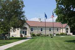 |
(#00000408) |
2392 Cty Trunk Highway F 45°03′58″N 87°07′28″W / 45.066111°N 87.124444°W |
Baileys Harbor | 1937 Colonial revival building clad with local limestone, designed by Two Rivers architect Sylvester Schmitt, and funded by local-boy-become-Chicago-industrialist William McArdle and the WPA. Still serves the community.[11] |
| 5 | Bohjanen's Door Bluff Pictographs |  |
(#93000881) |
Address Restricted |
Liberty Grove | |
| 6 | J.B. Bouche House | 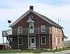 |
(#04000411) |
9697 School Rd. 44°44′02″N 87°37′15″W / 44.733889°N 87.620833°W |
Brussels | Brick front-gabled house started in 1880, with wooden gable-roofed barn.[12] |
| 7 | Bullhead Point Historical and Archeological District | Upload image | (#03000167) |
N. Duluth Ave. 44°50′37″N 87°23′43″W / 44.843611°N 87.395278°W |
Sturgeon Bay | Remains of three ships visible in shallow water from shore. All hauled limestone for the Sturgeon Bay Stone Company at the ends of their lives and were burned in 1931. They are the 212-foot steamer Empire State built in 1862, the 134-foot centerboard schooner Oak Leaf, and the 168-foot schooner-barge Ida Corning.[13] |
| 8 | Cana Island Lighthouse |  |
(#76000201) |
NE of Baileys Harbor on E side of Cana Island 45°05′18″N 87°02′54″W / 45.088333°N 87.048333°W |
Baileys Harbor | In 1869 a 65-foot brick tower was built, with a lightkeeper's house and third-order Fresnel lens. A steel skin was added to protect the deteriorating brick in 1902.[14] |
| 9 | Cardy Site | |
(#10000197) |
Address Restricted |
Sturgeon Bay | Paleo-Indians camped here about 11,000 BCE, not far from the retreating last glacier and Lake Algonquin. Date is based on Clovis-like points found at the site.[15] |
| 10 | Carnegie Free Library | 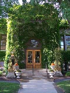 |
(#88003069) |
354 Michigan St. 44°50′06″N 87°22′32″W / 44.835°N 87.375556°W |
Sturgeon Bay | Carnegie Library designed by Fred Crandell in Classical Revival style, and built in 1912 with exterior of Sturgeon Bay limestone and Bedford stone.[16] |
| 11 | Chambers Island Lighthouse | 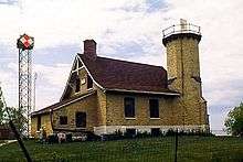 |
(#75000063) |
7 mi. NW of Fish Creek at NW tip of Chambers Island 45°12′05″N 87°21′50″W / 45.201389°N 87.363889°W |
Fish Creek | 42-foot brick tower built in 1868 with fourth order Fresnel lens, integrated with light-keeper's dwelling.[17] |
| 12 | Christina Nilsson (shipwreck) | 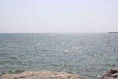 |
(#03000668) |
Baileys Harbor 45°03′23″N 87°05′52″W / 45.056389°N 87.097778°W |
Baileys Harbor | 139-foot schooner built by Hanson & Scove in Manitowoc in 1871 and named for a Swedish diva. In October 1884, hauling 575 tons of pig iron to Chicago, she was driven by a gale onto a reef and wrecked.[18] |
| 13 | Church of the Atonement | 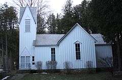 |
(#85000487) |
Fire No. 9410 45°07′41″N 87°14′58″W / 45.128056°N 87.249444°W |
Fish Creek | Oldest remaining church building in Fish Creek, built in 1878 in Carpenter Gothic style with board and batten exterior as an Episcopal mission church.[19] |
| 14 | Clafin Point Site | |
(#99001660) |
Address Restricted |
Gardner | Wreck of a 170-foot wooden vessel next to remains of a crib-and-stone pier in Little Sturgeon Bay, lost under murky circumstances around 1898. It is believed to be a once-fast steamship reduced after burning to a barge for hauling limestone. A.k.a. Claflin Point.[20] |
| 15 | The Clearing | 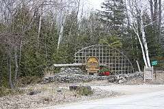 |
(#74000080) |
Off WI 42 45°15′48″N 87°04′25″W / 45.263333°N 87.073611°W |
Ellison Bay | Nature retreat and education center founded in 1935 by Danish immigrant and landscape architect Jens Jensen.[21] |
| 16 | Cupola House | 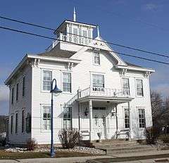 |
(#79000073) |
7836 Egg Harbor Rd. 45°03′06″N 87°16′48″W / 45.051667°N 87.28°W |
Egg Harbor | Italianate/Gothic Revival house built in 1871 by merchant Levi Thorp, paid for with money he made in the California gold rush of 1849. Now houses shops.[22][23] |
| 17 | August Draize Farmstead |  |
(#04000398) |
814 Tru-Way Rd. 44°42′37″N 87°39′01″W / 44.710278°N 87.650278°W |
Union | Front-gabled brick farmhouse built in 1880,[24] with outbuildings.[25] |
| 18 | Eagle Bluff Lighthouse | 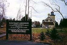 |
(#70000032) |
3.5 mi. N of Fish Creek on Shore Rd.,in Peninsula State Park 45°09′35″N 87°14′11″W / 45.159722°N 87.236389°W |
Fish Creek | Brick lighthouse built in 1868, with a third and a half order Fresnel lens atop a square 44-foot tower.[26] |
| 19 | Ephraim Moravian Church | 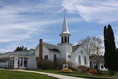 |
(#85000662) |
9970 Moravia St. 45°09′17″N 87°10′07″W / 45.154722°N 87.168611°W |
Ephraim | First church on the Door Peninsula, begun in 1857 by Moravian evangelist Andreas Iverson. It originally sat near the shore, but was moved up the hill in 1883.[27] |
| 20 | Ephraim Village Hall |  |
(#85000663) |
9996 S. Water St. 45°09′22″N 87°10′16″W / 45.156111°N 87.171111°W |
Ephraim | Community hall built in 1927 in Arts and Crafts style, clad in limestone from Eagle Bluff. Hosted village meetings, basketball, a library, fish boils, rummage sales, etc.[28] |
| 21 | Joachine J. Falque House |  |
(#04000407) |
1059 County Trunk Highway C 44°43′19″N 87°37′17″W / 44.721944°N 87.621389°W |
Brussels | Brick farmhouse built in 1880, with barn. A.k.a Vlies house.[29] |
| 22 | FLEETWING (shipwreck) | |
(#01000734) |
Garrett Bay[30] 45°17′15″N 87°02′59″W / 45.2875°N 87.049833°W |
Liberty Grove | 132-foot two-masted schooner built in 1867 in Manitowoc by Henry Burger. Carried grain, coal and lumber from Chicago to Buffalo. On Sept 26, 1888, heading from Menominee toward Chicago in a gale, she tried to pass through Death's Door, but ran off course and grounded.[31] |
| 23 | FRANK O'CONNOR (bulk carrier) | |
(#94000656) |
2 miles (3.2 km) off Cana Island[30] 45°06′52″N 87°00′44″W / 45.1145°N 87.012167°W |
North Bay | 301-foot wooden bulk carrier built in 1892 by James Davidson's shipyard in Bay City. On Sept 29, 1919, heading from Buffalo to Milwaukee hauling 3000 tons of coal, she caught fire and sank off Cana Island.[32] |
| 24 | Free Evangelical Lutheran Church-Bethania Scandinavian Evangelical Lutheran Congregation |  |
(#85000664) |
3028 Church St. 45°09′20″N 87°10′08″W / 45.155556°N 87.168889°W |
Ephraim | Gothic Revival styled church built in 1882 by local Scandinavians, initially independent of any Lutheran denomination to be inclusive.[33] Worship on summer Sundays.[34] |
| 25 | Gibraltar District School No. 2 | 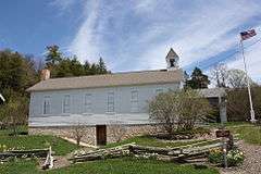 |
(#85001250) |
9988 Moravia St. 45°09′22″N 87°10′07″W / 45.156111°N 87.168611°W |
Ephraim | Balloon frame, clapboard-clad schoolhouse started after a school consolidation in 1868. Served as a school for 80 years, and now a museum.[35] |
| 26 | Globe Hotel |  |
(#82000663) |
8090 Main St. 45°03′47″N 87°07′26″W / 45.063056°N 87.123889°W |
Baileys Harbor | Greek Revival building started in 1867. Served as a hotel from 1874 to 1886, run by Roger Eatough, early businessman and politician.[36] |
| 27 | GRAPE SHOT (schooner) Shipwreck | Upload image | (#16000564) |
0.2 miles (0.32 km) NW of USCCG Station on Plum Island 45°19′28″N 86°58′02″W / 45.324422°N 86.967096°W |
Washington | |
| 28 | GREEN BAY shipwreck (sloop) | |
(#09000952) |
In Green Bay, four miles off Sturgeon Bay |
Sevastopol | Remains of an unidentified commercial freighting sloop from circa 1840 to 1860 - the only wreck of this type in Wisconsin waters.[37] |
| 29 | HANOVER (schooner) Shipwreck | Upload image | (#15000710) |
1.75 mi. NW. of Fish Cr. Coordinates missing |
Gibraltar | The Hanover was a 109-foot 2-masted schooner constructed in New York in 1853. It hauled bulk cargo (primarily grain) up and down the Great Lakes until 1863, when a gale drove it aground off the Strawberry Islands, where it was stripped and abandoned.[38][39] |
| 30 | Hillside Hotel |  |
(#85000665) |
9980 S. Water St. 45°09′19″N 87°10′10″W / 45.155278°N 87.169444°W |
Ephraim | One of the first hotels in Ephraim, opened around 1900 as the area transitioned from lumber and fishing to tourism. Started by Norwegian immigrant Martin Oleson and his family. Includes wooden hotel, cottages and outbuildings, with one started as early as 1864.[40] |
| 31 | IRIS (Shipwreck) | Upload image | (#06000638) |
Adjacent of Rock Island Ferry Dock, Jackson Harbor 45°24′03″N 86°51′12″W / 45.400817°N 86.853325°W |
Washington Island | 74-foot scow schooner built in 1866 at Port Huron. Abandoned in 1913 after grounding in Jackson Harbor.[41] |
| 32 | Jacksonport Wharf Archeological District | Upload image | (#12000053) |
Near Lakeside Park off Cty. Rd. V 44°58′43″N 87°11′00″W / 44.978582°N 87.183216°W |
Jacksonport vicinity | Remains of three old piers started in 1848 for loading shingles and poles into schooners headed for Milwaukee and Chicago. Remains of three schooners lie nearby: the Perry Hannah was wrecked by the Alpena Blow of 1880, the Cecilia wrecked by a storm in 1885, and possibly the Annie Dahl, wrecked by a storm in 1898.[42] Additional documentation and boundary increase July 27, 2015 (#15000478) |
| 33 | Jischke's Meat Market | 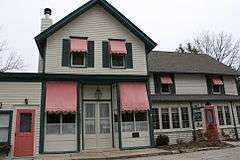 |
(#86002306) |
414 Maple Dr. 45°11′16″N 87°07′26″W / 45.187778°N 87.123889°W |
Sister Bay | Butcher shop built in 1902 by German immigrant Frank Jischke and his family. Some walls are of unusual stovewood construction. A.k.a. White Apron[43] and Inn on Maple.[44] |
| 34 | Joint Brussels and Garner District School Number One |  |
(#04000408) |
8571 State Trunk Highway 57 44°45′42″N 87°32′57″W / 44.761667°N 87.549167°W |
Brussels | School built in 1910 in Neoclassical style with cupola and exterior of rock-faced concrete block. A.k.a. Tornado School.[45] |
| 35 | JOYS (Shipwreck) |  |
(#07001218) |
500 ft. W of Sunset Park 44°51′04″N 87°23′21″W / 44.851111°N 87.389167°W |
Sturgeon Bay | 131-foot wooden steam barge built in 1884 by the Milwaukee Shipyard Company. Hauled lumber, iron and stone. Caught fire in the Sturgeon Bay ship canal in 1898, burned and sank.[46][47] |
| 36 | LAKELAND (steam screw) Shipwreck | Upload image | (#15000403) |
6 mi. E. of Sturgeon Bay Canal 44°47′34″N 87°11′32″W / 44.792683°N 87.192217°W |
Sturgeon Bay vicinity | In 1886, the Cambria was built as a bulk freighter and was an early user of steel hull plates and a triple-expansion steam engine. In 1910 it was remodeled into a passenger steamer, and in 1920 into a car carrier. In December 1924, hauling a load of automobiles from Chicago, some of her steel plates buckled in heavy seas, and she eventually went down in 205 feet of water.[48] |
| 37 | L. A. Larson & Co. Store |  |
(#85001357) |
306 S. 3rd Ave. 44°49′55″N 87°22′25″W / 44.831944°N 87.373611°W |
Sturgeon Bay | Elegant Italianate office built in 1875, with a large cornice atop a Boomtown front. Built by Adolph Larson, who manufactured ornamental woodwork, furniture and coffins. A.k.a Challoner Morse McBride Law Office.[49] |
| 38 | Little Lake Archeological District | |
(#02000147) |
Address Restricted |
Washington | Site of Woodland village and burial ground, which has produced artifacts dating back 3000 years.[50] |
| 39 | LOUISIANA (Shipwreck) | |
(#92000104) |
Southeast side of Washington Harbor[30] 45°23′59″N 86°55′22″W / 45.399667°N 86.922667°W |
Washington Island | 267-foot bulk steamer built in 1887 in Marine City, Michigan. Driven aground at Death's Door in a snowstorm Nov. 2, 1913, while heading for Escanaba to pick up a load of iron ore.[51] |
| 40 | Louisiana Street/Seventh Avenue Historic District | 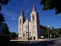 |
(#83003372) |
Roughly bounded by Louisiana and Kentucky Sts., N. 5th, N. 7th, and N. 8th Aves. 44°50′13″N 87°22′19″W / 44.836944°N 87.371944°W |
Sturgeon Bay | Historic district with 28 contributing buildings, including the 1909 Romanesque Revival St. Joseph's church and various homes built from 1890 to 1920.[52] |
| 41 | MERIDIAN (schooner) Shipwreck Site | |
(#96000294) |
Sister Island Shoals[30] 45°12′01″N 87°10′10″W / 45.200318°N 87.169561°W |
Sister Bay | 120-foot schooner built in 1848 at Black River, Ohio. Hauled timber around the Great Lakes for 25 years until October of 1873, when she was driven by a fall storm onto the Sister Islands shoal in Green Bay and wrecked.[53] |
| 42 | Joseph Monfils Farmstead | 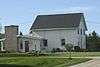 |
(#04000409) |
1463 Dump Rd. 44°44′29″N 87°34′50″W / 44.741389°N 87.580556°W |
Brussels | Farm built around 1921, with house, 2 barns, silo and shed. A.k.a. Dale Hendrickson house.[54] |
| 43 | Murphy Farms Number 1 | Upload image | (#12000314) |
7195, 7199, 7203, 7207, 7212, & 7213 Horseshoe Bay Rd. 45°01′12″N 87°19′40″W / 45.019974°N 87.327856°W |
Egg Harbor | Show farm built 1918 to 1925 by Green Bay millionaires Frank and Eldridge Murphy to show off their Holstein-Friesian cattle breeding project. Includes Dutch Colonial Revival homes and gambrel-roofed barns.[55] |
| 44 | Namur Belgian-American District | 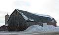 |
(#87002553) |
Roughly bounded by CR K, Brussels Rd., WI 57, Belgian Dr., and the Green Bay 44°45′02″N 87°39′58″W / 44.750556°N 87.666111°W |
Namur | Rural historic district settled by French-speaking Belgian farmers, consisting of 261 buildings built between 1871 and 1930,[56] including farmsteads, homes, the 1891 St. Mary of the Snows Catholic Church, the 1910 Fairland School, and the 1916 William Struck store.[57] |
| 45 | Alexander Noble House | 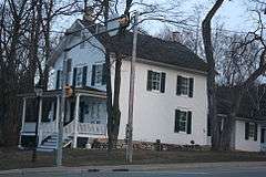 |
(#96000159) |
4167 WI 42 45°07′39″N 87°14′48″W / 45.1275°N 87.246667°W |
Fish Creek | The first home in Fish Creek fancier than a log cabin, built 1868 or 1875. Noble was a blacksmith, farmer, postmaster, and town chairman. Today the house is a museum, and the oldest building in town on its original location.[58][59] |
| 46 | OCEAN WAVE (Shipwreck) |  |
(#06000639) |
2 mi. off Whitefish Point 44°53′07″N 87°09′08″W / 44.885278°N 87.152222°W |
Lake Michigan | Woodean scow schooner built 1860 at Harrison's Island, Michigan. Sank in a storm September 23, 1869, hauling limestone.[60] |
| 47 | Peter Peterson House | 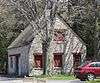 |
(#85000666) |
10020 N. Water St. 45°09′28″N 87°10′14″W / 45.157778°N 87.170556°W |
Ephraim | Norwegian immigrant Peterson was storekeeper, town chairman, justice of the peace, and founder of the congregation that would become Bethany Lutheran. The 1874 house was used as a parsonage after Peterson returned to Norway in 1883.[61] |
| 48 | Pilot Island Light | |
(#83004279) |
Portes des Norts Passage, Pilot Island 45°17′03″N 86°55′10″W / 45.284167°N 86.919444°W |
Gills Rock | Brick lightkeeper's house built in 1858 with a 41-foot tower on top, on an island at the east end of Death's Door. Regular heavy fogs in the area prompted addition of Daboll's trumpets foghorns in 1864, with later upgrades.[62] |
| 49 | Pilot Island NW Site | 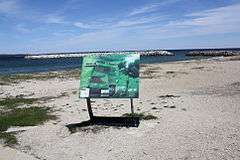 |
(#92000103) |
Address Restricted |
Pilot Island, Washington | Wrecks of three wooden ships commingled on the reef SW of the island: the 115-foot scow-schooner Forest built in 1857 and wrecked by a storm in October of 1891, the 147-foot schooner A. P. Nichols built in 1861 and wrecked by a storm in October of 1892, and the 138-foot canaller-schooner J. E. Gilmore, built in 1867 and wrecked by another storm only 11 days after the Nichols.[63] |
| 50 | Plum Island Life-Saving and Light Stations | 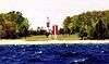 |
(#10000385) |
Plum Island 45°18′44″N 86°56′53″W / 45.312222°N 86.948056°W |
Washington vicinity | The first light to guide ships through Death's Door was built here in 1846, but moved to Pilot Island around 1858. In 1896 a set of range lights was built, with foghorn, keeper's house and a life-saving station.[64] |
| 51 | Plum Island Range Rear Light | 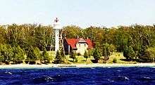 |
(#84003659) |
Plum Island 45°18′28″N 86°57′28″W / 45.307778°N 86.957778°W |
Gills Rock | One of a pair of range lights built around 1897 so ships could line up on a safe course through the dangerous Death's Door passage. The front light was replaced in 1964.[64] |
| 52 | Porte des Morts Site | |
(#76000058) |
Address Restricted |
Northport | Prehistoric lakeshore camp of Woodland and Mississippian peoples, which has produced varied tools and styles of pottery.[65] |
| 53 | Pottawatomie Lighthouse | 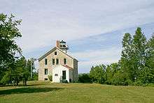 |
(#79000074) |
NW Rock Island 45°25′40″N 86°49′42″W / 45.427778°N 86.828333°W |
Rock Island | Keeper's dwelling and light tower, built in 1858 of native limestone on a bluff 137 feet above water level at the tip of the Door Peninsula. Served until 1988. An earlier lighthouse on the site, built 1836-7, was the first lighthouse on Lake Michigan and first in Wisconsin.[66] |
| 54 | Rock Island Historic District |  |
(#72000050) |
Rock Island, off NE tip of Washington Island 45°24′27″N 86°49′21″W / 45.4075°N 86.8225°W |
Rock Island | Site of camps of Native Americans, ranging from Middle Woodland around 0 CE to Oneota, to Potawatomi in the 1670s, to Ottawa in the 1760s.[67] |
| 55 | Sherwood Point Light | 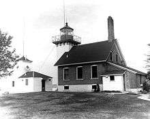 |
(#84003663) |
Sherwood Point Road on Green Bay 44°53′34″N 87°25′59″W / 44.892778°N 87.433056°W |
Sturgeon Bay | Red brick lightkeeper's dwelling with light tower built in 1883 on a 30-foot bluff at the west entrance to the Sturgeon Bay Ship Canal. A 600-pound fog bell was added in 1892.[68] |
| 56 | Sturgeon Bay Bridge | 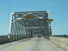 |
(#07001420) |
Michigan St. 44°49′55″N 87°22′52″W / 44.831944°N 87.381111°W |
Sturgeon Bay | Iron overhead-truss bridge with drawbridge section built in 1931 over Sturgeon Bay to connect the two halves of Door County.[69] |
| 57 | Sturgeon Bay Canal Light | 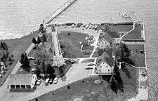 |
(#84003666) |
Sturgeon Bay Canal 44°47′42″N 87°18′46″W / 44.795°N 87.312778°W |
Sturgeon Bay | Light on a 98-foot steel tower, initially built in 1898 and finally stabilized in 1903.[70][71] |
| 58 | Sturgeon Bay Post Office | 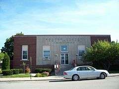 |
(#00001237) |
359 Louisiana Ave. 44°50′07″N 87°22′33″W / 44.835278°N 87.375833°W |
Sturgeon Bay | Brick and limestone building designed in Art Moderne style under Louis A. Simon and built in 1937, with mural inside.[72][73] |
| 59 | SUCCESS (scow schooner) Shipwreck | Upload image | (#15000711) |
.13 mi. SW. of Whitefish Dunes State Park Coordinates missing |
Sevastopol vicinity | 151-ton 2-masted scow schooner built in 1875 in Manitowoc. Hauled lumber on Lake Michigan until November 1896, when she was pushed aground by a storm while loading in Whitefish Bay. Still quite intact, with wire rigging, deadeyes, bilge pump and centerboard present.[74][75] |
| 60 | Third Avenue Historic District | 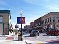 |
(#83004282) |
Roughly bounded by Kentucky St., N. 2nd, N. 3rd, and S. 3rd Aves. 44°50′05″N 87°22′36″W / 44.834722°N 87.376667°W |
Sturgeon Bay | Mixed business and residential district including the 1872 John Masse Hardware-Tin Shop, the Queen Anne Wegener Business Block built in the 1880s and 1890s, the 1906 Neoclassical Merchant's Exchange Bank, and the 1935 Art Moderne George Draeb Jewelry Store.[76] |
| 61 | Thordarson Estate Historic District |  |
(#85000641) |
Rock Island State Park 45°24′39″N 86°49′43″W / 45.410833°N 86.828611°W |
Rock Island | Island estate of Chester Thordarson, Icelandic immigrant, Chicago electrical inventor, businessman, and book collector. Remaining buildings are rustic limestone and wood-frame, built from 1910 to 1935, some designed by Frederick Dinkelberg.[77][78] |
| 62 | Freeman and Jesse Thorp House and Cottages |  |
(#97000887) |
4135 Bluff Street 45°07′36″N 87°14′40″W / 45.126667°N 87.244444°W |
Fish Creek | Queen Anne-style house started in 1902 by boat-builder Freeman Thorpe. After he drowned in Green Bay in 1903, his wife Jesse finished the house and rented out rooms. Six tourist cottages were added in the 1940s.[79] Now a B&B.[80] |
| 63 | Louis Vangindertahlen House | 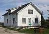 |
(#04000410) |
1514 Dump Rd. 44°44′38″N 87°34′47″W / 44.743889°N 87.579722°W |
Brussels | 1.5-story front-gabled house with concrete walls, built in 1921.[81] |
| 64 | Vorous General Store | 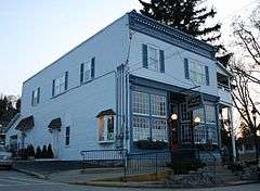 |
(#97000429) |
4153 WI 42 45°07′39″N 87°14′47″W / 45.1275°N 87.246389°W |
Fish Creek | Third general store in Fish Creek, built by Levi Vorous in Italianate commercial style in 1895. Later housed a garage and the town post office.[82] |
| 65 | Water Tower |  |
(#85000640) |
Rock Island State Park 45°24′44″N 86°48′23″W / 45.412222°N 86.806389°W |
Rock Island | Rustic limestone water tower of the Thordarson Estate, built in 1929 and probably designed by Puckey and Jenkins.[77][78] |
| 66 | Welcker's Resort Historic District | |
(#97000328) |
Roughly bounded by Cottage Row, Maple, Cedar, and Main Sts. 45°07′42″N 87°14′59″W / 45.128333°N 87.249722°W |
Gibraltar | Largely consists of buildings from the resort founded by German immigrant Dr. Herman Welcker in 1907 with a regimen influenced by European health spas of the time, catering initially to Germans from Milwaukee. District includes former cottages of the resort, the current White Gull Inn, and the current Whistling Swan, which was the Lumberman's Hotel in Marinette before Welcker had it hauled across Green Bay on the ice to become his "Casino."[83][84][85] |
| 67 | Whitefish Dunes-Bay View Site | 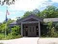 |
(#90001960) |
located at Whitefish Dunes State Park Coordinates missing |
Sevastopol | Artifacts found in the sand show successive occupations, beginning with the North Bay People around 100 BCE.[86] |
| 68 | William Zachow Farmstead | 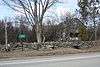 |
(#96001578) |
9533 WI 57 45°08′01″N 87°07′57″W / 45.133611°N 87.1325°W |
Bailey's Harbor | Barn and house built around 1896 by Zachow. Walls of the barn and part of the house are unusual stovewood construction. Now Alchemy Fields art gallery.[87][88] |
| 69 | Albert Zahn House |  |
(#00000492) |
8223 WI trunk Hwy. 57 45°04′15″N 87°07′24″W / 45.070833°N 87.123333°W |
Baileys Harbor | Retired farmer Zahn and his wife Louise built the concrete house in 1924, surrounded it with folk art carvings, and named it Bird's Park.[89] |
| 70 | August Zahn Blacksmith Shop and House | 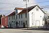 |
(#00000455) |
8152 WI trunk 57 45°04′00″N 87°07′26″W / 45.066667°N 87.123889°W |
Baileys Harbor | Blacksmith shop with stovewood walls built in 1905[90] and house built in 1912. Now the Blacksmith Inn.[91] |
Former listings
| [3] | Name on the Register | Image | Date listed | Date removed | Location | City or town | Summary |
|---|---|---|---|---|---|---|---|
| 1 | Frank and Clara Englebert House | 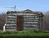 |
(#04000397) | 9390 Cemetery Rd. 44°44′51″N 87°35′59″W / 44.7475°N 87.5997°W |
Brussels | Gambrel-roofed Dutch Colonial Revival house built in 1924. Now demolished, following a lightning strike.[92] |
See also
| Wikimedia Commons has media related to National Register of Historic Places in Door County, Wisconsin. |
- List of National Historic Landmarks in Wisconsin
- National Register of Historic Places listings in Wisconsin
References
- ↑ The latitude and longitude information provided is primarily from the National Register Information System, and has been found to be fairly accurate for about 99% of listings. For 1%, the location info may be way off. We seek to correct the coordinate information wherever it is found to be erroneous. Please leave a note in the Discussion page for this article if you believe any specific location is incorrect.
- ↑ "National Register of Historic Places: Weekly List Actions". National Park Service, United States Department of the Interior. Retrieved on December 2, 2016.
- 1 2 Numbers represent an ordering by significant words. Various colorings, defined here, differentiate National Historic Landmarks and historic districts from other NRHP buildings, structures, sites or objects.
- ↑ National Park Service (2008-04-24). "National Register Information System". National Register of Historic Places. National Park Service.
- ↑ The eight-digit number below each date is the number assigned to each location in the National Register Information System database, which can be viewed by clicking the number.
- ↑ "Anderson Barn and Archival Resource Center". Ephraim Historical Foundation. Retrieved 2013-11-16.
- ↑ "List of structures in Anderson Dock Historic District". Architecture and History Inventory. Wisconsin Historical Society. Retrieved 2013-11-16.
- ↑ "Australasia Shipwreck (Wooden Bulk Carrier)". Features. National Park Service - U.S. Department of the Interior. Retrieved 2013-11-16. Includes a great photo of the wreck.
- ↑ Thomsen, Tamara; Keith Meverden. "Australasia Shipwreck (Wooden Bulk Carrier)" (PDF). National Register of Historic Places Registration Form. National Park Service - U.S. Department of the Interior. Retrieved 2013-11-16.
- ↑ Pepper, Terry. "Baileys Harbor Range Lights". Seeing the Light. Terry Pepper. Retrieved 2013-11-17.
- ↑ "Bailey's Harbor Town Hall / Mc Ardle Library". National Register or State Register. Wisconsin Historical Society. Retrieved 2013-11-17.
- ↑ "J.B. Bouche House". Architecture and History Inventory. Wisconsin Historical Society. Retrieved 2013-11-17.
- ↑ "Bullhead Point - Today". Wisconsin's Great Lakes Shipwrecks. Wisconsin Historical Society / UW - Sea Grant. Retrieved 2013-11-17.
- ↑ Pepper, Terry. "Cana Island Lighthouse". Seeing the Light. Terry Pepper. Retrieved 2013-11-19.
- ↑ Gardner, Paul; David Overstreet (Fall 2010). "Life During the End of the Ice Age". American Archaeology. 14 (3): 46–47.
- ↑ "Carnegie Free Library". National Register or State Register. Wisconsin Historical Society. Retrieved 2013-11-19.
- ↑ Pepper, Terry. "Chambers Island Light". Seeing the Light. Terry Pepper. Retrieved 2013-11-19.
- ↑ "Christina Nilsson". Wisconsin's Great Lakes Shipwrecks. Wisconsin Historical Society & University of Wisconsin Sea Grant. Retrieved 2013-11-23.
- ↑ "Church of the Atonement". Architecture and History Inventory. Wisconsin Historical Society. Retrieved 2013-11-23.
- ↑ Rodgers, Bradley A. "The 1995 Pre-Disturbance Wreck Site Investigation at Claflin Point, Sturgeon Bay Wisconsin" (PDF). Research Report No. 10. East Carolina University. Retrieved 2013-11-23.
- ↑ "The Clearing Folk School - History". The Clearing Folk School. Retrieved 2013-11-26.
- ↑ "Cupola House Shops - About". Retrieved 2013-11-26.
- ↑ "Cupola House (Levi Thorp House)". Architecture and History Inventory. Wisconsin Historical Society. Retrieved 2013-11-26.
- ↑ "August Draize Farmstead". Architecture and History Inventory. Wisconsin Historical Society. Retrieved 2013-11-26.
- ↑ "Draize, August, Farmstead". National Or State Register. Wisconsin Historical Society. Retrieved 2013-11-26.
- ↑ Pepper, Terry. "Eagle Bluff Light". Seeing the Light. Terry Pepper. Retrieved 2013-11-26.
- ↑ "History of the Ephraim Moravian Church". Ephraim Moravian Church. Retrieved 2013-11-29.
- ↑ "Ephraim Village Hall". Architecture and History Inventory. Wisconsin Historical Society. Retrieved 2013-11-29.
- ↑ "Joachine J. Falque House". Architecture and History Inventory. Wisconsin Historical Society. Retrieved 2013-11-29.
- 1 2 3 4 Location given in Kohl, Cris (2001). The Great Lakes Diving Guide. West Chicago, Ill.: Seawolf Communications, Inc. NRIS lists site as "address restricted".
- ↑ "Fleetwing". Wisconsin's Great Lakes Shipwrecks. University of Wisconsin Sea Grant and Wisconsin Historical Society. Retrieved 2013-11-29.
- ↑ "Frank O'Connor". Wisconsin's Great Lakes Shipwrecks. University of Wisconsin Sea Grant and Wisconsin Historical Society. Retrieved 2013-11-29.
- ↑ "Free Evangelical Lutheran Church-Bethania Scandinavian ELC". Architecture and History Inventory. Wisconsin Historical Society. Retrieved 2013-12-03.
- ↑ "Bethany Lutheran Church". Bethany Lutheran Church. Retrieved 2013-12-03.
- ↑ "Gibraltar District School #2". Architecture and History Inventory. Wisconsin Historical Society. Retrieved 2013-12-03.
- ↑ "Globe Hotel". Architecture and History Inventory. Wisconsin Historical Society. Retrieved 2013-12-03.
- ↑ "Green Bay Sloop Shipwreck". Wisconsin National Register of Historic Places. Wisconsin Historical Society. Retrieved 2013-12-03.
- ↑ "Current Research". Wisconsin Shipwrecks. Wisconsin Sea Grant/Wisconsin Historical Society. Retrieved 2015-10-17.
- ↑ "Hanover Shipwreck". Wisconsin National Register of Historic Places. Wisconsin Historical Society. Retrieved 2015-10-17.
- ↑ "Hillside Hotel / Hillside Cottages". Architecture and History Inventory. Wisconsin Historical Society. Retrieved 2013-12-07.
- ↑ "Iris Shipwreck". Wisconsin National Register of Historic Places. Wisconsin Historical Society. Retrieved 2013-12-07.
- ↑ "Jacksonport Wharf Archaeological District". National Register or State Register. Wisconsin Historical Society. Retrieved 2013-12-07.
- ↑ "Jischke's Meat Market". Architecture and History Inventory. Wisconsin Historical Society. Retrieved 2013-12-07.
- ↑ "Inn on Maple - Amenities". Inn on Maple. Retrieved 2013-12-07.
- ↑ "Joint Brussels and Gardner District School Number One". Architecture and History Inventory. Wisconsin Historical Society. Retrieved 2013-12-11.
- ↑ "Shipwrecks". Wisconsin's Schooner Coast. Wisconsin's Schooner Coast. Retrieved 2013-12-10.
- ↑ "Detailed Information for Joys (1884)". Wisconsin Historical Society Shipwreck Database. Wisconsin Historical Society. Retrieved 2013-12-11.
- ↑ "Lakeland Shipwreck (Steam Screw)". Architecture and History Inventory. Wisconsin Historical Society. Retrieved 2015-10-17.
- ↑ "L.A. Larson and Company Store". Architecture and History Inventory. Wisconsin Historical Society. Retrieved 2013-12-11.
- ↑ "Recent Projects". Door County Land Trust. Retrieved 2013-12-11.
- ↑ "Louisiana Service History". Wisconsin's Great Lakes Shipwrecks. Wisconsin Historical Society and UW Sea Grant Institute. Retrieved 2013-12-19.
- ↑ "List for Louisiana St./Seventh Ave Historic District". Architecture and History Inventory. Wisconsin Historical Society. Retrieved 2013-12-19.
- ↑ "Meridian". Wisconsin's Great Lakes Shipwrecks. Wisconsin Historical Society and UW Sea Grant Institute. Retrieved 2013-12-19.
- ↑ "Joseph Monfils Farmstead". Architecture and History Inventory. Wisconsin Historical Society. Retrieved 2013-12-22.
- ↑ "Murphy Farms Number 1". National Register or State Register. Wisconsin Historical Society. Retrieved 2013-12-22.
- ↑ "Namur Belgian-American District". National Register or State Register. Wisconsin Historical Society. Retrieved 2013-12-22.
- ↑ "List of Sites in the Namur Belgian-American Rural Historic District". Architecture and History Inventory. Wisconsin Historical Society. Retrieved 2013-12-27.
- ↑ "History of Alexander Noble". Gibraltar History Association. Retrieved 2013-12-27.
- ↑ "Alexander Noble House". Architecture and History Inventory. Wisconsin Historical Society. Retrieved 2013-12-27.
- ↑ "Ocean Wave Shipwreck". Wisconsin National Register of Historic Places. Wisconsin Historical Society. Retrieved 2013-12-27.
- ↑ "Peterson, Peter, House". Architecture and History Inventory. Wisconsin Historical Society. Retrieved 2013-12-27.
- ↑ Pepper, Terry. "Pilot Island". Seeing the Light. Terry Pepper. Retrieved 2013-12-31.
- ↑ "Pilot Island". Wisconsin's Great Lakes Shipwrecks. Wisconsin Historical Society and UW-Sea Grant. Retrieved 2013-12-31.
- 1 2 Pepper, Terry. "Plum Island Range Lights". Seeing the Light. Terry Pepper. Retrieved 2013-12-31.
- ↑ Mason, Ronald J. (December 1967). "The North Bay Component at the Porte des Morts Site, Door County Wisconsin". The Wisconsin Archeologist. 48 (4): 267–345. Retrieved 2013-12-31.
- ↑ Pepper, Terry. "Pottawotamie Lighthouse". Seeing the Light. Terry Pepper. Retrieved 2014-01-03.
- ↑ Mason, Ronald J. (Summer 1991). "Biography of an Island". Wisconsin Academic Review. Wisconsin Academy of Sciences, Arts and Letters: 35–39.
- ↑ Pepper, Terry. "Sherwood Point Lighthouse". Seeing the Light. Terry Pepper. Retrieved 2014-01-03.
- ↑ "Sturgeon Bay Bridge". Wisconsin Historical Society. Retrieved 2014-01-03.
- ↑ Pepper, Terry. "Sturgeon Bay Canal Light Station". Seeing the Light. Terry Pepper. Retrieved 2014-01-06.
- ↑ Pepper, Terry. "Tower Heights". Seeing the Light. Terry Pepper. Retrieved 2014-01-06.
- ↑ "U. S. Post Office". Architecture and History Inventory. Wisconsin Historical Society. Retrieved 2014-01-06.
- ↑ "Post Office Mural - Sturgeon Bay WI". The Living New Deal. Retrieved 2014-01-06.
- ↑ "Current Research". Wisconsin Shipwrecks. Sea Grant Foundation/Wisconsin Historical Society. Retrieved 2015-10-17.
- ↑ "Success Shipwreck (Scow Schooner)". Wisconsin Historical Society. Retrieved 2014-01-06.
- ↑ "List of Buildings in the Third Avenue/Downtown Historic District". Architecture and History Inventory. Wisconsin Historical Society. Retrieved 2014-01-06.
- 1 2 Cartwright, Carol Lohry (1984-12-17). "Historic Chester H. Thordarson Estate" (PDF). National Register of Historic Places - Inventory Nomination Form. U.S. Department of the Interior - National Park Service. Retrieved 2014-01-10.
- 1 2 "List of Structures in the Thordarson District". Architecture and History Inventory. Wisconsin Historical Society. Retrieved 2014-01-10.
- ↑ "Thorpe House Cottages". Architecture and History Inventory. Wisconsin Historical Society. Retrieved 2014-01-10.
- ↑ "Thorp House History". Thorp House Inn and Cottages. Retrieved 2014-01-10.
- ↑ "Louis Vangindertahlen House". Architecture and History Inventory. Wisconsin Historical Society. Retrieved 2014-01-10.
- ↑ "Vorous General Store". Architecture and History Inventory. Wisconsin Historical Society. Retrieved 2014-01-10.
- ↑ "White Gull Inn History". White Gull Inn. Retrieved 2014-01-18. Includes reminiscences of Welcker's era.
- ↑ "Henriette". Architecture and History Inventory. Wisconsin Historical Society. Retrieved 2014-01-18.
- ↑ "List of Properties in Welcker's Resort Historic District". Architecture and History Inventory. Wisconsin Historic Society. Retrieved 2014-01-18.
- ↑ "Whitefish Dunes State Park - History". Wisconsin Department of Natural Resources. Retrieved 2014-01-18.
- ↑ "William Zachow Farmstead". Architecture and History Inventory. Wisconsin Historical Society. Retrieved 2014-01-18.
- ↑ "Alchemy Fields - About". Alchemy Fields. Retrieved 2014-01-18.
- ↑ "Zahn, Albert, House". National Register or State Register. Wisconsin Historical Society. Retrieved 2014-01-18.
- ↑ "August Zahn Blacksmith Shop and Residence - Shop". Architecture and History Inventory. Wisconsin Historical Society. Retrieved 2014-01-18.
- ↑ "August Zahn Blacksmith Shop and Residence - House". Architecture and History Inventory. Wisconsin Historical Society. Retrieved 2014-01-18.
- ↑ "Frank and Clara Englebert House". Architecture and History Inventory. Wisconsin Historical Society. Retrieved 2014-01-18.
| Topics | |
|---|---|
| Lists by states |
|
| Lists by insular areas | |
| Lists by associated states | |
| Other areas | |
| |
Municipalities and communities of Door County, Wisconsin, United States | ||
|---|---|---|
| City | | |
| Villages | ||
| Towns | ||
| CDPs | ||
| Unincorporated communities | ||
| Footnotes | ‡This populated place also has portions in an adjacent county or counties | |
This article is issued from Wikipedia - version of the 9/1/2016. The text is available under the Creative Commons Attribution/Share Alike but additional terms may apply for the media files.