National Register of Historic Places listings in Kearney County, Nebraska
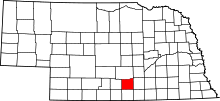
Location of Kearney County in Nebraska
This is a list of the National Register of Historic Places listings in Kearney County, Nebraska. It is intended to be a complete list of the properties and districts on the National Register of Historic Places in Kearney County, Nebraska, United States. The locations of National Register properties and districts for which the latitude and longitude coordinates are included below, may be seen in an online map.
There are 8 properties and districts listed on the National Register in the county.
- This National Park Service list is complete through NPS recent listings posted December 16, 2016.[1]
Current listings
| [2] | Name on the Register[3] | Image | Date listed[4] | Location | City or town | Description |
|---|---|---|---|---|---|---|
| 1 | Bethphage Mission | _Zion_Chapel_from_SW_1.JPG) |
(#13000199) |
1044 23rd Road 40°29′13″N 99°07′16″W / 40.486829°N 99.121231°W |
Axtell vicinity | |
| 2 | Eddie Eugene and Harriet Cotton Carpenter Farmstead | 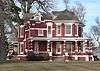 |
(#93000059) |
Approximately 0.5 miles west of Lowell 40°38′54″N 98°51′31″W / 40.648333°N 98.858611°W |
Lowell | |
| 3 | Dobytown | 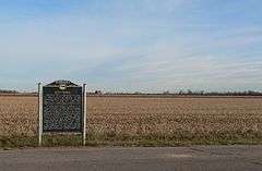 |
(#74001125) |
Southwest of Kearney[5] 40°38′30″N 99°02′51″W / 40.641667°N 99.047500°W |
Kearney | |
| 4 | Fort Kearney | 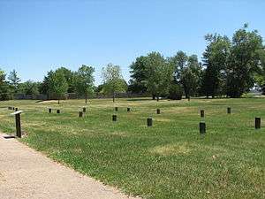 |
(#71000485) |
2 miles west of Newark on Nebraska Highway 10 40°38′36″N 99°00′25″W / 40.643333°N 99.006944°W |
Newark | |
| 5 | Kearney County Courthouse | 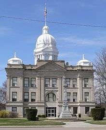 |
(#89002234) |
5th St. between Colorado and Minden Aves. 40°29′56″N 98°56′53″W / 40.498889°N 98.948056°W |
Minden | |
| 6 | Salem Swedish Methodist Episcopal Church |  |
(#82003192) |
Southwest of Axtell 40°27′11″N 99°10′42″W / 40.453056°N 99.178333°W |
Axtell | |
| 7 | W. T. Thorne Building | 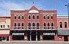 |
(#85002139) |
5th St. 40°29′59″N 98°56′54″W / 40.499722°N 98.948333°W |
Minden | |
| 8 | US Post Office-Minden | |
(#92000471) |
410 N. Minden St. 40°29′55″N 98°56′50″W / 40.498732°N 98.947358°W |
Minden | One of 12 Nebraska post offices featuring a Section of Fine Arts mural, "1848-Fort Kearney, Protectorate on the Overland Trail-1871" (1939) by William E. L. Bunn.[6] |
See also
- List of National Historic Landmarks in Nebraska
- National Register of Historic Places listings in Nebraska
References
- ↑ "National Register of Historic Places: Weekly List Actions". National Park Service, United States Department of the Interior. Retrieved on December 16, 2016.
- ↑ Numbers represent an ordering by significant words. Various colorings, defined here, differentiate National Historic Landmarks and historic districts from other NRHP buildings, structures, sites or objects.
- ↑ National Park Service (2009-03-13). "National Register Information System". National Register of Historic Places. National Park Service.
- ↑ The eight-digit number below each date is the number assigned to each location in the National Register Information System database, which can be viewed by clicking the number.
- ↑ Location derived from its GNIS feature record; the NRIS lists it as "Address Restricted"
- ↑ Ahlgren, Carol (August 1991). "National Register of Historic Places Multiple Property Documentation Form: Nebraska Post Offices Which Contain Section Artwork (1938-1942)" (PDF). Retrieved 2013-01-28.
External links
| Wikimedia Commons has media related to National Register of Historic Places in Kearney County, Nebraska. |
| Topics | |
|---|---|
| Lists by states |
|
| Lists by insular areas | |
| Lists by associated states | |
| Other areas | |
| |
Municipalities and communities of Kearney County, Nebraska, United States | ||
|---|---|---|
| City | ||
| Villages | ||
| Townships | ||
| Unincorporated communities | ||
| Ghost town | ||
This article is issued from Wikipedia - version of the 6/5/2016. The text is available under the Creative Commons Attribution/Share Alike but additional terms may apply for the media files.