| [3] |
Name on the Register |
Image |
Date listed[4] |
Location |
Municipality |
Description |
|---|
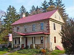
| 1 |
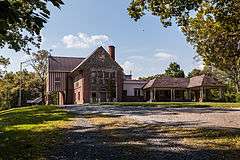
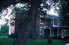
Alden Villa |
|
000000002011-04-20-0000April 20, 2011
(#11000203) |
1012 Alden Way
40°16′25″N 76°25′48″W / 40.273611°N 76.43°W / 40.273611; -76.43 (Alden Villa) |
Cornwall |
|
| 2 |
Annville Historic District |
|
000000001979-04-30-0000April 30, 1979
(#79002285) |
Roughly bounded by the Quittapahilla Creek and Lebanon, Saylor, and Marshall Streets in Annville
40°19′42″N 76°30′58″W / 40.328333°N 76.516111°W / 40.328333; -76.516111 (Annville Historic District) |
Annville Township |
|
| 3 |
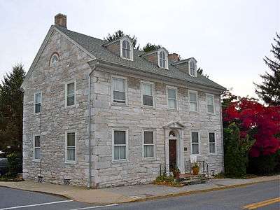
Biever House |
|
000000001978-02-14-0000February 14, 1978
(#78002423) |
49 South White Oak Street in Annville
40°19′41″N 76°30′56″W / 40.328056°N 76.515556°W / 40.328056; -76.515556 (Biever House) |
Annville Township |
|
| 4 |
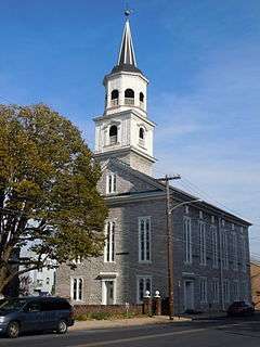
Bindnagles Evangelical Lutheran Church |
|
000000001975-07-07-0000July 7, 1975
(#75001651) |
North of Palmyra at the junction of Legislative Route 38003 and Township 330
40°20′38″N 76°37′01″W / 40.343889°N 76.616944°W / 40.343889; -76.616944 (Bindnagles Evangelical Lutheran Church) |
North Londonderry Township |
|
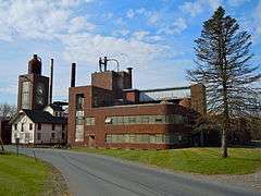
| 5 |
Bomberger's Distillery |
|
000000001975-06-26-0000June 26, 1975
(#75001649) |
7 miles (11 km) southwest of Newmanstown off Pennsylvania Route 501
40°16′37″N 76°19′13″W / 40.276944°N 76.320278°W / 40.276944; -76.320278 (Bomberger's Distillery) |
Heidelberg Township |
|
| 6 |
Brendle Farms |
|
000000001972-07-24-0000July 24, 1972
(#72001130) |
Junction of Pennsylvania Routes 501 and 897
40°17′45″N 76°18′12″W / 40.295833°N 76.303333°W / 40.295833; -76.303333 (Brendle Farms) |
Schaefferstown |
|
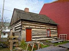
| 7 |
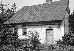
Chestnut Street Log House |
|
000000001978-11-20-0000November 20, 1978
(#78002424) |
1110 Chestnut Street
40°20′15″N 76°25′46″W / 40.3375°N 76.429444°W / 40.3375; -76.429444 (Chestnut Street Log House) |
Lebanon |
|
| 8 |
Colebrook Iron Master's House |
|
000000002010-06-28-0000June 28, 2010
(#10000405) |
5200 Elizabethtown Rd.
40°14′21″N 76°30′46″W / 40.239167°N 76.512778°W / 40.239167; -76.512778 (Colebrook Iron Master's House) |
South Londonderry Township |
|
| 9 |
Cornwall & Lebanon Railroad Station |
|
000000001974-12-04-0000December 4, 1974
(#74001790) |
161 North 8th Street
40°20′32″N 76°25′32″W / 40.342222°N 76.425556°W / 40.342222; -76.425556 (Cornwall & Lebanon Railroad Station) |
Lebanon |
|
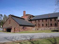
| 10 |
Cornwall Iron Furnace |
|
000000001966-11-13-0000November 13, 1966
(#66000671) |
Rexmont Road and Boyd Street
40°16′07″N 76°24′27″W / 40.268611°N 76.4075°W / 40.268611; -76.4075 (Cornwall Iron Furnace) |
Cornwall |
|
| 11 |
Philip Erpff House |
|
000000001979-11-20-0000November 20, 1979
(#79002287) |
South Market Street
40°17′47″N 76°17′37″W / 40.296389°N 76.293611°W / 40.296389; -76.293611 (Philip Erpff House) |
Schaefferstown |
|
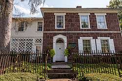
| 12 |
Josiah Funck Mansion |
|
000000001980-01-31-0000January 31, 1980
(#80003545) |
450 Cumberland Street
40°20′22″N 76°25′10″W / 40.339444°N 76.419444°W / 40.339444; -76.419444 (Josiah Funck Mansion) |
Lebanon |
|
| 13 |
Gloninger Estate |
|
000000001980-12-10-0000December 10, 1980
(#80003546) |
2511 West Oak Street, southwest of Lebanon
40°19′25″N 76°27′12″W / 40.323611°N 76.453333°W / 40.323611; -76.453333 (Gloninger Estate) |
North Cornwall Township |
|
| 14 |
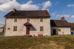
House of Miller at Millbach |
|
000000001973-04-23-0000April 23, 1973
(#73001640) |
Southwest of Newmanstown off Pennsylvania Route 419
40°19′49″N 76°14′19″W / 40.330278°N 76.238611°W / 40.330278; -76.238611 (House of Miller at Millbach) |
Millcreek Township |
|
| 15 |
John Immel House |
Upload image |
000000001980-04-17-0000April 17, 1980
(#80003548) |
East of Myerstown on Flanagan Road
40°22′08″N 76°16′21″W / 40.368889°N 76.2725°W / 40.368889; -76.2725 (John Immel House) |
Jackson Township |
|
| 16 |
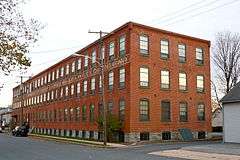
Landis Shoe Company Building |
|
000000001980-08-29-0000August 29, 1980
(#80003550) |
North Chestnut and East Broad Streets
40°18′37″N 76°35′50″W / 40.310278°N 76.597222°W / 40.310278; -76.597222 (Landis Shoe Company Building) |
Palmyra |
|
| 17 |
Lebanon Veterans Administration Hospital Historic District |
|
000000002013-07-23-0000July 23, 2013
(#13000539) |
1700 South Lincoln Avenue
40°19′04″N 76°23′52″W / 40.317717°N 76.397816°W / 40.317717; -76.397816 (Lebanon Veterans Administration Hospital Historic District) |
South Lebanon Township |
|
| 18 |
Isaac Meier Homestead |
|
000000001973-04-02-0000April 2, 1973
(#73001639) |
5200 South College Street
40°22′09″N 76°18′19″W / 40.369167°N 76.305278°W / 40.369167; -76.305278 (Isaac Meier Homestead) |
Myerstown |
|
| 19 |
Pennsylvania Chautauqua Historic District |
|
000000002015-08-18-0000August 18, 2015
(#15000535) |
Roughly bounded by State Game Lands, Pennsylvania Route 117, Pinch Rd., and Lancaster and Pennsylvania Aves.
40°14′50″N 76°28′18″W / 40.247222°N 76.471667°W / 40.247222; -76.471667 (Pennsylvania Chautauqua Historic District) |
Mount Gretna |
|
| 20 |
Mt. Gretna Campmeeting Historic District |
|
000000002012-09-04-0000September 4, 2012
(#12000608) |
Roughly bounded by PA 117, Pinch Rd., Bell Ave., & 1st St. (West Cornwall Township)
40°14′56″N 76°28′05″W / 40.248866°N 76.468053°W / 40.248866; -76.468053 (Mt. Gretna Campmeeting Historic District) |
Mount Gretna Heights |
|
| 21 |
Reading Railroad Station |
|
000000001975-07-17-0000July 17, 1975
(#75001647) |
North 8th Street
40°20′35″N 76°25′29″W / 40.343056°N 76.424722°W / 40.343056; -76.424722 (Reading Railroad Station) |
Lebanon |
|
| 22 |
Rex House |
|
000000001980-08-11-0000August 11, 1980
(#80003551) |
North Market Street
40°17′53″N 76°17′36″W / 40.298056°N 76.293333°W / 40.298056; -76.293333 (Rex House) |
Schaefferstown |
|
| 23 |
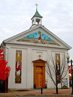
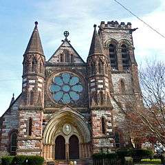
St. Lukes Episcopal Church |
|
000000001974-09-04-0000September 4, 1974
(#74001791) |
6th and Chestnut Streets
40°20′17″N 76°25′16″W / 40.338056°N 76.421111°W / 40.338056; -76.421111 (St. Lukes Episcopal Church) |
Lebanon |
|
| 24 |
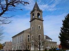
Salem Evangelical Lutheran Church |
|
000000002010-06-28-0000June 28, 2010
(#10000402) |
119 N Eighth St.
40°20′28″N 76°25′31″W / 40.341111°N 76.425278°W / 40.341111; -76.425278 (Salem Evangelical Lutheran Church) |
Lebanon |
|
| 25 |
Schaeffer House |
|
000000002011-07-25-0000July 25, 2011
(#11000630) |
Intersection of PA 501 and PA 897
40°17′57″N 76°17′42″W / 40.299167°N 76.295°W / 40.299167; -76.295 (Schaeffer House) |
Schaefferstown |
|
| 26 |
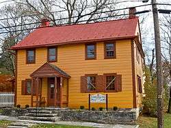
Dr. B. Stauffer House |
|
000000001979-06-22-0000June 22, 1979
(#79002286) |
192 West Main Street in Campbelltown
40°16′37″N 76°35′28″W / 40.276944°N 76.591111°W / 40.276944; -76.591111 (Dr. B. Stauffer House) |
South Londonderry Township |
|
| 27 |
Tabor Reformed Church |
|
000000001980-06-27-0000June 27, 1980
(#80003547) |
10th and Walnut Streets
40°20′13″N 76°25′39″W / 40.336944°N 76.4275°W / 40.336944; -76.4275 (Tabor Reformed Church) |
Lebanon |
|
| 28 |
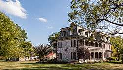
Tulpehocken Manor Plantation |
|
000000001975-05-12-0000May 12, 1975
(#75001648) |
2 miles (3.2 km) west of Myerstown on U.S. Route 422
40°21′48″N 76°20′25″W / 40.363333°N 76.340278°W / 40.363333; -76.340278 (Tulpehocken Manor Plantation) |
Jackson Township |
|
| 29 |
Union Canal Tunnel |
|
000000001974-10-01-0000October 1, 1974
(#74001792) |
West of Lebanon off Pennsylvania Route 72
40°20′58″N 76°27′42″W / 40.349444°N 76.461667°W / 40.349444; -76.461667 (Union Canal Tunnel) |
North Lebanon Township |
|
| 30 |
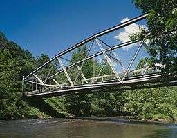
Waterville Bridge |
|
000000001988-11-14-0000November 14, 1988
(#88002171) |
Appalachian Trail over Swatara Creek in Swatara Gap State Park
40°28′49″N 76°31′55″W / 40.480278°N 76.531944°W / 40.480278; -76.531944 (Waterville Bridge) |
Union Township |
|
| 31 |
Heinrich Zeller House |
|
000000001975-05-12-0000May 12, 1975
(#75001650) |
West of Newmanstown off Pennsylvania Route 419
40°20′57″N 76°13′33″W / 40.349167°N 76.225833°W / 40.349167; -76.225833 (Heinrich Zeller House) |
Millcreek Township |
|
