| [3] |
Name on the Register |
Image |
Date listed[4] |
Location |
Municipality |
Description |
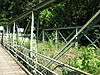
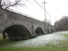
|---|
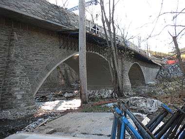
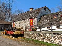
| 1 |
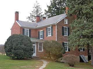
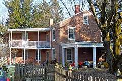
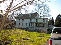
John Bailey Farm |
|
000000001985-05-20-0000May 20, 1985
(#85001143) |
Springdell Road near Coatesville
39°55′41″N 75°50′28″W / 39.928056°N 75.841111°W / 39.928056; -75.841111 (John Bailey Farm) |
East Fallowfield Township |
|
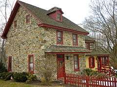
| 2 |
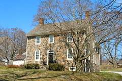
Baily Farm |
|
000000001985-09-16-0000September 16, 1985
(#85002347) |
Strasburg and Broad Run Roads
39°56′55″N 75°42′11″W / 39.948611°N 75.703056°W / 39.948611; -75.703056 (Baily Farm) |
West Bradford Township |
|
| 3 |
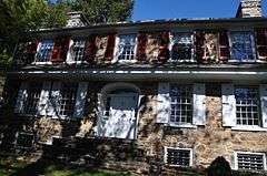
Barns-Brinton House |
|
000000001971-05-27-0000May 27, 1971
(#71000692) |
East of Hamorton on U.S. Route 1
39°52′24″N 75°37′35″W / 39.873333°N 75.626389°W / 39.873333; -75.626389 (Barns-Brinton House) |
Pennsbury Township |
|
| 4 |
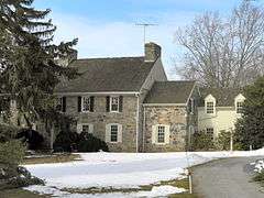
Birmingham Friends Meetinghouse and School |
|
000000001971-07-27-0000July 27, 1971
(#71000688) |
1245 Birmingham Road
39°54′20″N 75°35′42″W / 39.905556°N 75.595°W / 39.905556; -75.595 (Birmingham Friends Meetinghouse and School) |
Birmingham Township |
|
| 5 |
Bradford Friends Meetinghouse |
|
000000001971-07-27-0000July 27, 1971
(#71000694) |
Eastern side of Northbrook Road in Marshallton
39°56′54″N 75°40′47″W / 39.948333°N 75.679722°W / 39.948333; -75.679722 (Bradford Friends Meetinghouse) |
West Bradford Township |
|
| 6 |
Brandywine Building and Loan Assoc. Rowhouses |
|
000000001985-05-20-0000May 20, 1985
(#85001144) |
Hephzibah Hill Road near Coatesville
39°57′13″N 75°48′24″W / 39.953611°N 75.806667°W / 39.953611; -75.806667 (Brandywine Building and Loan Assoc. Rowhouses) |
East Fallowfield Township |
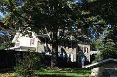
|
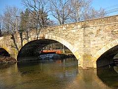
| 7 |
Bridge in East Fallowfield Township |
|
000000001988-06-22-0000June 22, 1988
(#88000878) |
Strasburg Road over Mill Race near Mortonville
39°56′46″N 75°46′43″W / 39.946111°N 75.778611°W / 39.946111; -75.778611 (Bridge in East Fallowfield Township) |
East Fallowfield Township |
|
| 8 |
Bridge in West Fallowfield Township |
|
000000001988-06-22-0000June 22, 1988
(#88000849) |
Ross Fording Road over Octoraro Creek, near Steelville
39°52′58″N 75°59′31″W / 39.882778°N 75.991944°W / 39.882778; -75.991944 (Bridge in West Fallowfield Township) |
West Fallowfield Township |
|
| 9 |
Brinton's Mill |
|
000000001971-05-27-0000May 27, 1971
(#71000689) |
North of Chadds Ford on Creek Road
39°53′07″N 75°36′13″W / 39.885278°N 75.603611°W / 39.885278; -75.603611 (Brinton's Mill) |
Birmingham Township |
|
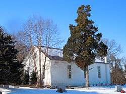
| 10 |
Edward Brinton House |
|
000000001973-06-19-0000June 19, 1973
(#73001599) |
Northwest of Chadds Ford at 1325 Creek Road
39°53′17″N 75°36′29″W / 39.888056°N 75.608056°W / 39.888056; -75.608056 (Edward Brinton House) |
Birmingham Township |
|
| 11 |
George Brinton House |
|
000000001990-10-25-0000October 25, 1990
(#90001608) |
Pennsylvania Route 100, 1 mile north of its junction with U.S. Route 1, near Chadds Ford
39°52′51″N 75°35′56″W / 39.880833°N 75.598889°W / 39.880833; -75.598889 (George Brinton House) |
Birmingham Township |
|
| 12 |
Brinton-King Farmstead |
|
000000002002-03-21-0000March 21, 2002
(#02000230) |
1301 Brinton's Bridge Road, 162 Baltimore Pike
39°52′29″N 75°37′13″W / 39.874597°N 75.620275°W / 39.874597; -75.620275 (Brinton-King Farmstead) |
Pennsbury Township |
|
| 13 |
Carter-Worth House and Farm |
|
000000001977-09-15-0000September 15, 1977
(#77001151) |
450 Lucky Hill Road near Marshallton
39°56′43″N 75°40′02″W / 39.945278°N 75.667222°W / 39.945278; -75.667222 (Carter-Worth House and Farm) |
East Bradford Township |
|
| 14 |
Cedarcroft |
|
000000001971-11-11-0000November 11, 1971
(#71000693) |
North of Kennett Square
39°51′35″N 75°43′09″W / 39.859722°N 75.719167°W / 39.859722; -75.719167 (Cedarcroft) |
East Marlborough Township |
|
| 15 |
Chandler Mill Bridge |
|
000000002010-01-11-0000January 11, 2010
(#09001213) |
Chandler Mill Road over West Branch Red Clay Creek
39°48′41″N 75°42′48″W / 39.811389°N 75.713417°W / 39.811389; -75.713417 (Chandler Mill Bridge) |
Kennett Township |
|
| 16 |
Como Farm |
|
000000001985-09-16-0000September 16, 1985
(#85002348) |
Broad Run Road
39°57′08″N 75°42′26″W / 39.952222°N 75.707222°W / 39.952222; -75.707222 (Como Farm) |
West Bradford Township |
|
| 17 |
Cope's Bridge |
|
000000001985-03-07-0000March 7, 1985
(#85000465) |
Strasburg Road (Pennsylvania Route 162) west of its junction with Creek Road and east of Marshallton[5]
39°57′32″N 75°39′19″W / 39.958861°N 75.655361°W / 39.958861; -75.655361 (Cope's Bridge) |
West Bradford Township |
|
| 18 |
Daniel Davis House and Barn |
|
000000001973-04-11-0000April 11, 1973
(#73001598) |
Birmingham and Street Road
39°54′47″N 75°36′00″W / 39.913056°N 75.6°W / 39.913056; -75.6 (Daniel Davis House and Barn) |
Birmingham Township |
|
| 19 |
Harry DeHaven House |
|
000000001985-09-18-0000September 18, 1985
(#85002386) |
Strasburg Road near Coatesville
39°57′21″N 75°50′53″W / 39.955891°N 75.847956°W / 39.955891; -75.847956 (Harry DeHaven House) |
East Fallowfield Township |
|
| 20 |
Derbydown Homestead |
|
000000001973-02-04-0000February 4, 1973
(#73001609) |
At the junction of CR 15077 and 15080
39°55′31″N 75°41′12″W / 39.925278°N 75.686667°W / 39.925278; -75.686667 (Derbydown Homestead) |
West Bradford Township |
|
| 21 |
Dilworthtown Historic District |
|
000000001973-01-18-0000January 18, 1973
(#73001601) |
Junction of CR 15199 and 15087
39°53′57″N 75°34′06″W / 39.899167°N 75.568333°W / 39.899167; -75.568333 (Dilworthtown Historic District) |
Birmingham Township |
|
| 22 |
Doe Run Village Historic District |
|
000000001985-09-16-0000September 16, 1985
(#85002349) |
Highland Dairy, DuPont & Chapel Roads, and Pennsylvania Routes 82 and 841
39°55′08″N 75°49′04″W / 39.918889°N 75.817778°W / 39.918889; -75.817778 (Doe Run Village Historic District) |
West Marlborough Township |
|
| 23 |
Edward Dougherty House |
|
000000001985-05-20-0000May 20, 1985
(#85001145) |
Mt. Carmel Road near Coatesville
39°57′45″N 75°51′43″W / 39.9625°N 75.861944°W / 39.9625; -75.861944 (Edward Dougherty House) |
East Fallowfield Township |
|
| 24 |
Philip Dougherty House |
|
000000001985-09-18-0000September 18, 1985
(#85002390) |
Strasburg Road near Coatesville
39°57′32″N 75°52′20″W / 39.958889°N 75.872222°W / 39.958889; -75.872222 (Philip Dougherty House) |
East Fallowfield Township |
|
| 25 |
Philip Dougherty Tavern |
|
000000001985-09-18-0000September 18, 1985
(#85002391) |
Strasburg Road near Coatesville
39°57′40″N 75°51′42″W / 39.961111°N 75.861667°W / 39.961111; -75.861667 (Philip Dougherty Tavern) |
East Fallowfield Township |
|
| 26 |
Drovers Inn |
|
000000001985-09-18-0000September 18, 1985
(#85002388) |
Strasburg Road near Coatesville
39°57′14″N 75°50′18″W / 39.953889°N 75.838333°W / 39.953889; -75.838333 (Drovers Inn) |
East Fallowfield Township |
|
| 27 |
East Bradford Boarding School for Boys |
|
000000001973-03-07-0000March 7, 1973
(#73001605) |
1 mile (1.6 km) east of Lenape at West Chester and Sconnelltown Roads
39°55′47″N 75°37′07″W / 39.929722°N 75.618611°W / 39.929722; -75.618611 (East Bradford Boarding School for Boys) |
East Bradford Township |
|
| 28 |
Edgewood |
|
000000001973-03-07-0000March 7, 1973
(#09000102) |
Southeast of the junction of County Roads 15087 and 15221, near West Chester
39°54′08″N 75°35′21″W / 39.902333°N 75.589167°W / 39.902333; -75.589167 (Edgewood) |
Birmingham Township |
|
| 29 |
Embreeville Historic District |
|
000000001985-09-16-0000September 16, 1985
(#85002350) |
Pennsylvania Route 162
39°55′35″N 75°43′55″W / 39.926389°N 75.731944°W / 39.926389; -75.731944 (Embreeville Historic District) |
Newlin Township |
|
| 30 |
Ercildoun Historic District |
|
000000001985-05-20-0000May 20, 1985
(#85001157) |
Pennsylvania Route 82, Township 368, Legislative Route 15236, and Township 371 and 182
39°56′35″N 75°50′31″W / 39.943056°N 75.841944°W / 39.943056; -75.841944 (Ercildoun Historic District) |
East Fallowfield Township |
|
| 31 |
Fairville Historic District |
|
000000001996-11-07-0000November 7, 1996
(#96001200) |
Kennett Pike between Fairville Road and Hickory Hill Road
39°50′52″N 75°38′00″W / 39.847778°N 75.633333°W / 39.847778; -75.633333 (Fairville Historic District) |
Pennsbury Township |
|
| 32 |
John Ferron House |
|
000000001985-11-26-0000November 26, 1985
(#85003049) |
Saint Malachi Road
39°53′57″N 75°51′06″W / 39.899167°N 75.851667°W / 39.899167; -75.851667 (John Ferron House) |
Londonderry Township |
|
| 33 |
Gibson's Covered Bridge |
|
000000001980-12-10-0000December 10, 1980
(#80003456) |
Southeast of Downingtown on Township 391
39°58′34″N 75°41′00″W / 39.976111°N 75.683333°W / 39.976111; -75.683333 (Gibson's Covered Bridge) |
East and West Bradford Townships |
|
| 34 |
Joseph Gladden House |
|
000000001985-05-20-0000May 20, 1985
(#85001146) |
West Chester Road near Coatesville
39°58′45″N 75°47′29″W / 39.979167°N 75.791389°W / 39.979167; -75.791389 (Joseph Gladden House) |
East Fallowfield Township |
|
| 35 |
Glen Hope Covered Bridge |
|
000000001980-12-10-0000December 10, 1980
(#80003472) |
West of Lewisville on Township 344, near West Grove
39°43′37″N 75°54′28″W / 39.726944°N 75.907778°W / 39.726944; -75.907778 (Glen Hope Covered Bridge) |
Elk Township |
|
| 36 |
Glen Rose Historic District |
|
000000001985-09-18-0000September 18, 1985
(#85002384) |
Legislative Route 15178 and Township 371
39°56′37″N 75°51′33″W / 39.943611°N 75.859167°W / 39.943611; -75.859167 (Glen Rose Historic District) |
East Fallowfield Township |
|
| 37 |
Green Valley Historic District |
|
000000001985-09-16-0000September 16, 1985
(#85002352) |
Green Valley Road
39°55′18″N 75°45′40″W / 39.921667°N 75.761111°W / 39.921667; -75.761111 (Green Valley Historic District) |
East Marlborough and Newlin Townships |
|
| 38 |
Joseph Gregg House |
|
000000001994-02-04-0000February 4, 1994
(#94000007) |
500 Chandler Mill Road
39°49′05″N 75°43′07″W / 39.818056°N 75.718611°W / 39.818056; -75.718611 (Joseph Gregg House) |
Kennett Township |
|
| 39 |
Hamorton Historic District |
|
000000001990-04-26-0000April 26, 1990
(#90000704) |
Junction of U.S. Route 1 and Pennsylvania Route 52
39°52′08″N 75°39′18″W / 39.868889°N 75.655°W / 39.868889; -75.655 (Hamorton Historic District) |
Kennett Township |
|
| 40 |
Hance House and Barn |
|
000000001985-09-16-0000September 16, 1985
(#85002354) |
15 S Bridge Rd. (Pennsylvania Route 842)
39°55′39″N 75°39′12″W / 39.9275°N 75.653333°W / 39.9275; -75.653333 (Hance House and Barn) |
East Bradford Township |
|
| 41 |
John Hanna Farm |
|
000000001985-05-20-0000May 20, 1985
(#85001147) |
Fairview Road near Coatesville
39°56′11″N 75°47′42″W / 39.936389°N 75.795°W / 39.936389; -75.795 (John Hanna Farm) |
East Fallowfield Township |
|
| 42 |
Col. John Hannum House |
|
000000001980-12-10-0000December 10, 1980
(#80003463) |
Northeast of Marshallton at 898 Frank Road
39°58′06″N 75°39′34″W / 39.968439°N 75.659461°W / 39.968439; -75.659461 (Col. John Hannum House) |
East Bradford Township |
|
| 43 |
Harlan House |
|
000000001985-05-09-0000May 9, 1985
(#85001004) |
Pennsylvania Route 162 and Star Gazer Road, near Embreeville
39°56′17″N 75°43′56″W / 39.938056°N 75.732222°W / 39.938056; -75.732222 (Harlan House) |
Newlin Township |
|
| 44 |
Harlan Log House |
|
000000001987-07-16-0000July 16, 1987
(#87001211) |
Fairville Road near Kennett Square
39°50′25″N 75°38′14″W / 39.840278°N 75.637222°W / 39.840278; -75.637222 (Harlan Log House) |
Kennett Township |
|
| 45 |
Peter Harvey House and Barn |
|
000000001978-04-20-0000April 20, 1978
(#78002371) |
East of Kennett Square on Hillendale Road near Mendenhall
39°51′54″N 75°37′26″W / 39.865°N 75.623889°W / 39.865; -75.623889 (Peter Harvey House and Barn) |
Pennsbury Township |
|
| 46 |
William Harvey House |
|
000000001971-05-27-0000May 27, 1971
(#71000690) |
Northwest of Chadds Ford on Brinton's Bridge Road off U.S. Route 1
39°52′35″N 75°37′04″W / 39.876389°N 75.617778°W / 39.876389; -75.617778 (William Harvey House) |
Pennsbury Township |
|
| 47 |
Hayes Homestead |
|
000000001985-09-16-0000September 16, 1985
(#85002355) |
Pennsylvania Route 162 and Harvey's Bridge Road
39°56′09″N 75°44′10″W / 39.935833°N 75.736111°W / 39.935833; -75.736111 (Hayes Homestead) |
Newlin Township |
|
| 48 |
Hayes Mill House |
|
000000001985-09-16-0000September 16, 1985
(#85002358) |
Star Gazer Road
39°56′23″N 75°44′01″W / 39.939722°N 75.733611°W / 39.939722; -75.733611 (Hayes Mill House) |
Newlin Township |
|
| 49 |
Jacob Hayes House |
|
000000001985-09-16-0000September 16, 1985
(#85002356) |
Pennsylvania Route 162
39°56′09″N 75°44′07″W / 39.935833°N 75.735278°W / 39.935833; -75.735278 (Jacob Hayes House) |
Newlin Township |
|
| 50 |
Cyrus Hoopes House and Barn |
|
000000001985-11-26-0000November 26, 1985
(#85003050) |
Springdell Road
39°54′33″N 75°49′59″W / 39.909167°N 75.833056°W / 39.909167; -75.833056 (Cyrus Hoopes House and Barn) |
West Marlborough Township |
|
| 51 |
Hopewell Historic District |
|
000000001991-02-28-0000February 28, 1991
(#91000226) |
Roughly Hopewell Road from Lower Hopewell Road to Roneys Corner Road and area south, and Lower Hopewell Road north past Calvery Road
39°46′46″N 76°01′01″W / 39.779444°N 76.016944°W / 39.779444; -76.016944 (Hopewell Historic District) |
East Nottingham and Lower Oxford Townships |
|
| 52 |
House at Springdell |
|
000000001985-09-16-0000September 16, 1985
(#85002360) |
Pennsylvania Route 841
39°54′25″N 75°50′09″W / 39.906944°N 75.835833°W / 39.906944; -75.835833 (House at Springdell) |
West Marlborough Township |
|
| 53 |
House at Upper Laurel Iron Works |
|
000000001985-09-16-0000September 16, 1985
(#85002371) |
McCorkel's Rock Road
39°56′00″N 75°46′47″W / 39.933333°N 75.779722°W / 39.933333; -75.779722 (House at Upper Laurel Iron Works) |
Newlin Township |
|
| 54 |
Indian Deep Farm |
|
000000001985-09-16-0000September 16, 1985
(#85002372) |
Glenhall and Groundhog College Roads
39°55′34″N 75°41′59″W / 39.926111°N 75.699722°W / 39.926111; -75.699722 (Indian Deep Farm) |
Newlin Township |
|
| 55 |
Kennett Square Historic District |
|
000000001989-08-18-0000August 18, 1989
(#89001052) |
Roughly bounded by Sickles, Willow, Mulberry, Broad, South, Union, Cedar, Lafayette, State, and Washington
39°50′41″N 75°42′44″W / 39.844722°N 75.712222°W / 39.844722; -75.712222 (Kennett Square Historic District) |
Kennett Square |
|
| 56 |
Lenape Bridge |
|
000000001988-06-22-0000June 22, 1988
(#88000781) |
Pennsylvania Route 52 over parking lot
39°54′54″N 75°37′47″W / 39.915°N 75.629722°W / 39.915; -75.629722 (Lenape Bridge) |
Birmingham and Pocopson Townships |
|
| 57 |
Longwood Gardens District |
|
000000001972-12-10-0000December 10, 1972
(#72001105) |
On U.S. Route 1 near Hamorton
39°52′11″N 75°40′43″W / 39.869722°N 75.678611°W / 39.869722; -75.678611 (Longwood Gardens District) |
East Marlborough Township |
|
| 58 |
Lunn's Tavern |
|
000000001979-10-25-0000October 25, 1979
(#79002204) |
Pennsylvania Route 896 at Strickersville
39°44′06″N 75°47′38″W / 39.735°N 75.793889°W / 39.735; -75.793889 (Lunn's Tavern) |
London Britain Township |
|
| 59 |
Marlborough Village Historic District |
|
000000001995-03-08-0000March 8, 1995
(#95000130) |
354–418 Marlborough Road and 901 and 940 Marlborough Springs Road, near Kennett Square
39°54′00″N 75°42′11″W / 39.9°N 75.703056°W / 39.9; -75.703056 (Marlborough Village Historic District) |
East Marlborough and Newlin Townships |
|
| 60 |
Humphry Marshall House |
|
000000001971-05-27-0000May 27, 1971
(#71000695) |
Strasburg Road / Pennsylvania Route 162 at the junction with Northbrook Road, near Marshallton
39°57′02″N 75°40′54″W / 39.950556°N 75.681667°W / 39.950556; -75.681667 (Humphry Marshall House) |
West Bradford Township |
|
| 61 |
Marshallton Historic District |
|
000000001986-01-08-0000January 8, 1986
(#86000056) |
Strasburg Road in Marshallton
39°57′00″N 75°40′35″W / 39.95°N 75.676389°W / 39.95; -75.676389 (Marshallton Historic District) |
West Bradford Township |
|
| 62 |
Marshallton Inn |
|
000000001977-07-29-0000July 29, 1977
(#77001152) |
West Strasburg Road in Marshallton
39°57′01″N 75°40′43″W / 39.950278°N 75.678611°W / 39.950278; -75.678611 (Marshallton Inn) |
West Bradford Township |
|
| 63 |
Mercer's Mill Covered Bridge |
|
000000001980-12-11-0000December 11, 1980
(#80003509) |
Northeast of Christiana and south of Atglen
39°55′53″N 75°58′54″W / 39.931389°N 75.981667°W / 39.931389; -75.981667 (Mercer's Mill Covered Bridge) |
West Fallowfield Township |
Extends into Lancaster County
|
| 64 |
Merestone |
|
000000001995-03-02-0000March 2, 1995
(#95000093) |
Yeatman's Station Rd.
39°45′45″N 75°44′57″W / 39.7625°N 75.749167°W / 39.7625; -75.749167 (Merestone) |
New Garden Township |
Extends into northern New Castle County, Delaware
|
| 65 |
Mortonville Hotel |
|
000000001985-09-18-0000September 18, 1985
(#85002393) |
Strasburg Road near Coatesville
39°56′49″N 75°46′41″W / 39.946944°N 75.778056°W / 39.946944; -75.778056 (Mortonville Hotel) |
East Fallowfield Township |
|
| 66 |
Mountain Meadow Farm |
|
000000001985-09-16-0000September 16, 1985
(#85002373) |
Harvey's Bridge Road
39°56′00″N 75°44′48″W / 39.933333°N 75.746667°W / 39.933333; -75.746667 (Mountain Meadow Farm) |
Newlin Township |
|
| 67 |
Northbrook Historic District |
|
000000001985-09-16-0000September 16, 1985
(#85002374) |
Northbrook, Indian Hannah, and Bragg Hill Roads
39°55′19″N 75°41′29″W / 39.921944°N 75.691389°W / 39.921944; -75.691389 (Northbrook Historic District) |
Newlin, Pocopson, and West Bradford Townships |
|
| 68 |
Oakdale |
|
000000001972-01-13-0000January 13, 1972
(#72001103) |
Hillendale Road near Chadds Ford
39°51′39″N 75°37′18″W / 39.860833°N 75.621667°W / 39.860833; -75.621667 (Oakdale) |
Pennsbury Township |
|
| 69 |
Old Kennett Meetinghouse |
|
000000001974-07-15-0000July 15, 1974
(#74001776) |
South of West Chester on U.S. Route 1, east of its junction with Pennsylvania Route 52
39°52′16″N 75°38′54″W / 39.871111°N 75.648333°W / 39.871111; -75.648333 (Old Kennett Meetinghouse) |
Kennett Township |
|
| 70 |
Orthodox Meetinghouse |
|
000000001972-04-26-0000April 26, 1972
(#72001112) |
Southwest of West Chester on Birmingham Road
39°54′16″N 75°35′38″W / 39.904444°N 75.593889°W / 39.904444; -75.593889 (Orthodox Meetinghouse) |
Birmingham Township |
|
| 71 |
Oxford Historic District |
|
000000002007-02-01-0000February 1, 2007
(#06001336) |
Roughly bounded by Church Road, Chase Street, Hodgson Street
39°47′07″N 75°58′44″W / 39.785386°N 75.978836°W / 39.785386; -75.978836 (Oxford Historic District) |
Oxford |
|
| 72 |
Oxford Hotel |
|
000000001994-08-26-0000August 26, 1994
(#94001055) |
Junction of Market and North 3rd Streets
39°47′07″N 75°58′44″W / 39.785278°N 75.978889°W / 39.785278; -75.978889 (Oxford Hotel) |
Oxford |
|
| 73 |
Paradise Valley Historic District |
|
000000001992-12-24-0000December 24, 1992
(#92001724) |
Roughly Valley Creek Road from U.S. Route 322 to Ravine Road, near Marshallton
39°59′04″N 75°39′55″W / 39.984444°N 75.665278°W / 39.984444; -75.665278 (Paradise Valley Historic District) |
East Bradford Township |
|
| 74 |
Parkersville Friends Meetinghouse |
|
000000001973-03-20-0000March 20, 1973
(#73001610) |
South of Parkersville off Pennsylvania Route 926
39°53′10″N 75°38′44″W / 39.886111°N 75.645556°W / 39.886111; -75.645556 (Parkersville Friends Meetinghouse) |
Pennsbury Township |
|
| 75 |
Mansel Passmore House |
|
000000001985-05-20-0000May 20, 1985
(#85001148) |
Glen Rose Road near Coatesville
39°56′25″N 75°51′06″W / 39.940278°N 75.851667°W / 39.940278; -75.851667 (Mansel Passmore House) |
East Fallowfield Township |
|
| 76 |
Isaac Pawling House |
|
000000001985-09-18-0000September 18, 1985
(#85002394) |
Strasburg Road near Coatesville
39°57′18″N 75°50′53″W / 39.955128°N 75.848017°W / 39.955128; -75.848017 (Isaac Pawling House) |
East Fallowfield Township |
|
| 77 |
Martha Pennock House |
|
000000001985-05-20-0000May 20, 1985
(#85001149) |
Pennsylvania Route 82 near Coatesville
39°55′59″N 75°49′57″W / 39.933056°N 75.8325°W / 39.933056; -75.8325 (Martha Pennock House) |
East Fallowfield Township |
|
| 78 |
Pennsbury Inn |
|
000000001972-03-16-0000March 16, 1972
(#72001104) |
On U.S. Route 1 at its junction with Hickory Hill Road, near Chadds Ford
39°52′29″N 75°38′13″W / 39.874722°N 75.636944°W / 39.874722; -75.636944 (Pennsbury Inn) |
Pennsbury Township |
|
| 79 |
William Peters House |
|
000000001971-05-27-0000May 27, 1971
(#71000696) |
Hillendale Road near Mendenhall
39°51′50″N 75°37′36″W / 39.863889°N 75.626667°W / 39.863889; -75.626667 (William Peters House) |
Pennsbury Township |
|
| 80 |
Joseph and Esther Phillips Plantation |
|
000000001990-09-05-0000September 5, 1990
(#90001414) |
Bailey's Crossroads, south of Glen Run Road and south of Atglen
39°55′36″N 75°58′25″W / 39.926667°N 75.973611°W / 39.926667; -75.973611 (Joseph and Esther Phillips Plantation) |
West Fallowfield Township |
|
| 81 |
Lukens Pierce House |
|
000000001973-03-14-0000March 14, 1973
(#73001604) |
Northwest of Ercildoun on Wilmington Road
39°57′09″N 75°51′00″W / 39.9525°N 75.85°W / 39.9525; -75.85 (Lukens Pierce House) |
East Fallowfield Township |
|
| 82 |
Pine Grove Covered Bridge |
|
000000001980-12-11-0000December 11, 1980
(#80003521) |
Southeast of Kirkwood on Legislative Route 36018
39°47′37″N 76°02′41″W / 39.793611°N 76.044722°W / 39.793611; -76.044722 (Pine Grove Covered Bridge) |
East Nottingham Township |
Extends into Lancaster County
|
| 83 |
Powell Farm |
|
000000001985-08-20-0000August 20, 1985
(#85001150) |
Dupont Road near Coatesville
39°56′13″N 75°48′29″W / 39.936944°N 75.808056°W / 39.936944; -75.808056 (Powell Farm) |
East Fallowfield Township |
|
| 84 |
John Powell House |
|
000000001985-05-20-0000May 20, 1985
(#85001151) |
Hephzibah Hill Road near Coatesville
39°56′16″N 75°48′50″W / 39.937778°N 75.813889°W / 39.937778; -75.813889 (John Powell House) |
East Fallowfield Township |
|
| 85 |
Primitive Hall |
|
000000001975-03-19-0000March 19, 1975
(#75001629) |
2 miles (3.2 km) northwest of Chatham on Pennsylvania Route 841
39°52′33″N 75°50′02″W / 39.875833°N 75.833889°W / 39.875833; -75.833889 (Primitive Hall) |
West Marlborough Township |
|
| 86 |
Joshua Pusey House |
|
000000001985-05-20-0000May 20, 1985
(#85001152) |
Saw Mill Road near Coatesville
39°57′24″N 75°46′47″W / 39.956667°N 75.779722°W / 39.956667; -75.779722 (Joshua Pusey House) |
East Fallowfield Township |
|
| 87 |
Moses Ross House |
|
000000001985-09-16-0000September 16, 1985
(#85002375) |
Off Creek Road north of Daleville
39°53′45″N 75°52′21″W / 39.895833°N 75.8725°W / 39.895833; -75.8725 (Moses Ross House) |
Londonderry Township |
|
| 88 |
Rudolph and Arthur Covered Bridge |
|
000000001980-12-10-0000December 10, 1980
(#80003473) |
North of Lewisville on Township 307 near West Grove
39°44′45″N 75°52′57″W / 39.745833°N 75.8825°W / 39.745833; -75.8825 (Rudolph and Arthur Covered Bridge) |
Elk and New London Townships |
|
| 89 |
St. Milachi Church |
|
000000001985-09-16-0000September 16, 1985
(#85002376) |
St. Milachi Road
39°53′48″N 75°50′57″W / 39.896667°N 75.849167°W / 39.896667; -75.849167 (St. Milachi Church) |
Londonderry Township |
|
| 90 |
David Scott House |
|
000000001985-05-20-0000May 20, 1985
(#85001153) |
Mt. Carmel Road near Coatesville
39°57′35″N 75°51′41″W / 39.959722°N 75.861389°W / 39.959722; -75.861389 (David Scott House) |
East Fallowfield Township |
|
| 91 |
Thomas Scott House |
|
000000001985-05-20-0000May 20, 1985
(#85001154) |
Park Avenue near Coatesville
39°57′55″N 75°51′09″W / 39.965278°N 75.8525°W / 39.965278; -75.8525 (Thomas Scott House) |
East Fallowfield Township |
|
| 92 |
Sharpless Homestead |
|
000000002011-12-15-0000December 15, 2011
(#11000924) |
1045 Birmingham Rd.
39°55′08″N 75°36′22″W / 39.918861°N 75.605995°W / 39.918861; -75.605995 (Sharpless Homestead) |
Birmingham Township |
|
| 93 |
South Brook Farm |
|
000000001991-11-14-0000November 14, 1991
(#91001710) |
Junction of Street Road and Bird Road
39°52′00″N 75°45′13″W / 39.866667°N 75.753611°W / 39.866667; -75.753611 (South Brook Farm) |
East Marlborough Township |
|
| 94 |
Speakman No. 1 |
|
000000001980-12-10-0000December 10, 1980
(#80003464) |
South of Coatesville on Legislative Route 15068, near Modena
39°55′46″N 75°49′23″W / 39.929444°N 75.823056°W / 39.929444; -75.823056 (Speakman No. 1) |
East Fallowfield Township |
|
| 95 |
Speakman No. 2, Mary Ann Pyle Bridge |
|
000000001980-12-10-0000December 10, 1980
(#80003465) |
South of Coatesville on Township 371, near Modena
39°55′19″N 75°48′01″W / 39.921944°N 75.800278°W / 39.921944; -75.800278 (Speakman No. 2, Mary Ann Pyle Bridge) |
East Fallowfield Township |
|
| 96 |
Springdale Farm |
|
000000001973-03-07-0000March 7, 1973
(#73001607) |
Northeast of Mendenhall on Hillendale Road
39°51′39″N 75°37′45″W / 39.860833°N 75.629167°W / 39.860833; -75.629167 (Springdale Farm) |
Pennsbury Township |
|
| 97 |
Spruce Grove School |
|
000000001985-09-16-0000September 16, 1985
(#85002378) |
Brandywine Creek Road
39°56′07″N 75°46′08″W / 39.935278°N 75.768889°W / 39.935278; -75.768889 (Spruce Grove School) |
Newlin Township |
|
| 98 |
Robert Steen House |
|
000000001985-05-20-0000May 20, 1985
(#85001155) |
Fairview Road near Coatesville
39°56′28″N 75°47′16″W / 39.941111°N 75.787778°W / 39.941111; -75.787778 (Robert Steen House) |
East Fallowfield Township |
|
| 99 |
Linton Stephens Covered Bridge |
|
000000001980-12-10-0000December 10, 1980
(#80003466) |
Southwest of New London on Township 344
39°45′23″N 75°54′46″W / 39.756389°N 75.912778°W / 39.756389; -75.912778 (Linton Stephens Covered Bridge) |
Elk and New London Townships |
|
| 100 |
Strode's Mill |
|
000000001971-05-27-0000May 27, 1971
(#71000697) |
Junction of Pennsylvania Route 52 and Birmingham Road
39°55′43″N 75°37′04″W / 39.928611°N 75.617778°W / 39.928611; -75.617778 (Strode's Mill) |
East Bradford Township |
|
| 101 |
Strode's Mill Historic District |
|
000000001989-05-05-0000May 5, 1989
(#89000354) |
Junction of Pennsylvania Route 52 and Birmingham Road
39°55′42″N 75°37′03″W / 39.928333°N 75.6175°W / 39.928333; -75.6175 (Strode's Mill Historic District) |
East Bradford Township |
|
| 102 |
Taylor House |
|
000000001979-08-01-0000August 1, 1979
(#79002202) |
East of Marshallton on West Strasburg Road
39°57′27″N 75°39′40″W / 39.9575°N 75.661111°W / 39.9575; -75.661111 (Taylor House) |
East Bradford Township |
|
| 103 |
Taylor-Cope Historic District |
|
000000001987-07-16-0000July 16, 1987
(#87001250) |
890–1100 blocks of Strasburg Road/Pennsylvania Route 162 in Marshallton
39°57′32″N 75°38′50″W / 39.958889°N 75.647222°W / 39.958889; -75.647222 (Taylor-Cope Historic District) |
West Bradford Township |
|
| 104 |
Temple-Webster-Stoner House |
|
000000001973-03-07-0000March 7, 1973
(#72133612) |
East of Romansville off Pennsylvania Route 162
39°56′42″N 75°42′05″W / 39.945°N 75.701389°W / 39.945; -75.701389 (Temple-Webster-Stoner House) |
West Bradford Township |
|
| 105 |
Thompson Farm |
|
000000001983-07-14-0000July 14, 1983
(#83002228) |
632 Chambers Rock Road near New London
39°43′54″N 75°46′57″W / 39.731667°N 75.7825°W / 39.731667; -75.7825 (Thompson Farm) |
London Britain Township |
|
| 106 |
Trimbleville Historic District |
|
000000001985-09-16-0000September 16, 1985
(#85002377) |
Northbrook, Broad Run, and Camp Linden Roads
39°55′55″N 75°40′56″W / 39.931944°N 75.682222°W / 39.931944; -75.682222 (Trimbleville Historic District) |
Pocopson and West Bradford Townships |
|
| 107 |
Unionville Village Historic District |
|
000000001979-06-06-0000June 6, 1979
(#79002205) |
Pennsylvania Routes 82 and 162, at Unionville
39°53′42″N 75°44′09″W / 39.895°N 75.735833°W / 39.895; -75.735833 (Unionville Village Historic District) |
East Marlborough Township |
|
| 108 |
Rev. Joshua Vaughan House |
|
000000001985-09-18-0000September 18, 1985
(#85002395) |
Strasburg Road near Coatesville
39°57′03″N 75°48′54″W / 39.950833°N 75.815°W / 39.950833; -75.815 (Rev. Joshua Vaughan House) |
East Fallowfield Township |
|
| 109 |
Asa Walton House |
|
000000001985-09-18-0000September 18, 1985
(#85002396) |
Strasburg and Old Wilmington Roads, near Coatesville
39°57′20″N 75°51′16″W / 39.955556°N 75.854444°W / 39.955556; -75.854444 (Asa Walton House) |
East Fallowfield Township |
|
| 110 |
John Wentz House |
|
000000001985-05-20-0000May 20, 1985
(#85001156) |
Pennsylvania Route 82 near Coatesville
39°56′40″N 75°49′59″W / 39.944444°N 75.833056°W / 39.944444; -75.833056 (John Wentz House) |
East Fallowfield Township |
|
| 111 |
White Horse Tavern |
|
000000001985-09-18-0000September 18, 1985
(#85002397) |
Strasburg Road near Coatesville
39°57′02″N 75°49′11″W / 39.950556°N 75.819722°W / 39.950556; -75.819722 (White Horse Tavern) |
East Fallowfield Township |
|
| 112 |
Gideon Wickersham Farmstead |
|
000000001988-01-30-0000January 30, 1988
(#87001992) |
750 Northbrook Road near Kennett Square
39°53′19″N 75°41′23″W / 39.888611°N 75.689722°W / 39.888611; -75.689722 (Gideon Wickersham Farmstead) |
East Marlborough Township |
|
| 113 |
Wiley-Cloud House |
|
000000002012-09-04-0000September 4, 2012
(#12000606) |
107 Ironstone Ln.
39°49′51″N 75°40′19″W / 39.830879°N 75.671867°W / 39.830879; -75.671867 (Wiley-Cloud House) |
Kennett Township |
|
| 114 |
Wilkinson House |
|
000000001985-09-16-0000September 16, 1985
(#85002379) |
Pennsylvania Route 842
39°55′33″N 75°39′57″W / 39.925833°N 75.665833°W / 39.925833; -75.665833 (Wilkinson House) |
Pocopson Township |
|
| 115 |
Robert Wilson House |
|
000000001985-09-18-0000September 18, 1985
(#85002398) |
Strasburg Road near Coatesville
39°57′09″N 75°50′32″W / 39.9525°N 75.842222°W / 39.9525; -75.842222 (Robert Wilson House) |
East Fallowfield Township |
|
| 116 |
Worker's House at Lower Laurel Iron Works |
|
000000001985-09-16-0000September 16, 1985
(#85002381) |
Creek Road
39°56′14″N 75°46′08″W / 39.937222°N 75.768889°W / 39.937222; -75.768889 (Worker's House at Lower Laurel Iron Works) |
Newlin Township |
|
| 117 |
Worth-Jefferis Rural Historic District |
|
000000001995-04-27-0000April 27, 1995
(#95000523) |
Roughly along Lucky Hill, North Wawaset, Allerton, and Creek Roads, near Marshallton
39°56′15″N 75°39′13″W / 39.9375°N 75.653611°W / 39.9375; -75.653611 (Worth-Jefferis Rural Historic District) |
East and West Bradford Townships |
|
| 118 |
Joseph Young House |
|
000000001985-09-16-0000September 16, 1985
(#85002383) |
Creek Road
39°56′12″N 75°45′39″W / 39.936667°N 75.760833°W / 39.936667; -75.760833 (Joseph Young House) |
Newlin Township |
|
| 119 |
Robert Young House |
|
000000001985-09-18-0000September 18, 1985
(#85002399) |
Strasburg Road near Coatesville
39°57′02″N 75°49′13″W / 39.950556°N 75.820278°W / 39.950556; -75.820278 (Robert Young House) |
East Fallowfield Township |
|


%2C_Kennett_Square_vicinity_(Chester_County%2C_Pennsylvania).jpg)


_(West_Bradford_Township)%2C_Marshallton_(Chester_County%2C_Pennsylvania).jpg)