| [3] |
Name on the Register |
Image |
Date listed[4] |
Location |
Municipality |
Description |
|---|
| 1 |
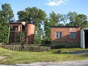
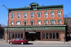
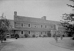
Clement Atkinson Memorial Hospital |
|
000000002011-09-08-0000September 8, 2011
(#11000642) |
822–824 East Chestnut Street
39°59′13″N 75°48′29″W / 39.986861°N 75.808°W / 39.986861; -75.808 (Clement Atkinson Memorial Hospital) |
Coatesville |
|
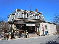
| 2 |
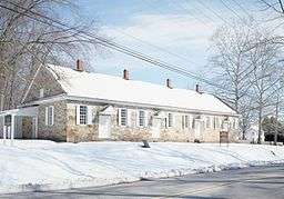
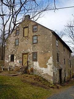
Birchrunville General Store |
|
000000001978-03-21-0000March 21, 1978
(#78002368) |
Hollow and Flowing Springs Roads, at Birchrunville
40°07′51″N 75°38′26″W / 40.130833°N 75.640556°W / 40.130833; -75.640556 (Birchrunville General Store) |
West Vincent Township |
|
| 3 |
Birchrunville Historic District |
|
000000001992-04-28-0000April 28, 1992
(#92000401) |
Junction of Flowing Springs Road and Schoolhouse Ln. near Birchrunville
40°07′56″N 75°38′19″W / 40.132222°N 75.638611°W / 40.132222; -75.638611 (Birchrunville Historic District) |
West Vincent Township |
|
| 4 |
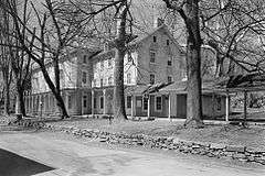
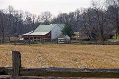
Bridge Mill Farm |
|
000000001983-03-09-0000March 9, 1983
(#83002221) |
Marshall Road near Downingtown
40°03′22″N 75°45′35″W / 40.056111°N 75.759722°W / 40.056111; -75.759722 (Bridge Mill Farm) |
East Brandywine Township |
|
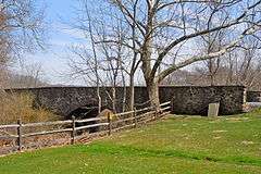
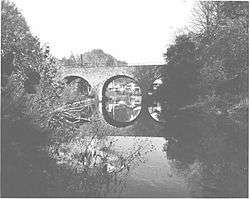
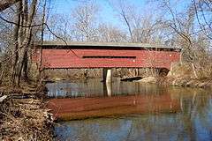
| 5 |
Brower's Bridge |
|
000000001988-06-22-0000June 22, 1988
(#88000754) |
Mansion Road over French Creek
40°08′51″N 75°46′10″W / 40.1475°N 75.769444°W / 40.1475; -75.769444 (Brower's Bridge) |
East Nantmeal Township and Warwick Township |
|
| 6 |
Thomas Bull House |
|
000000001979-08-03-0000August 3, 1979
(#79002198) |
East of Elverson on Bulltown Road
40°09′03″N 75°47′34″W / 40.150833°N 75.792778°W / 40.150833; -75.792778 (Thomas Bull House) |
East Nantmeal Township |
|
| 7 |
Byers Station Historic District |
|
000000002002-02-20-0000February 20, 2002
(#02000062) |
Junction of Byers and Eagle Farm Roads
40°04′48″N 75°40′30″W / 40.08°N 75.675°W / 40.08; -75.675 (Byers Station Historic District) |
Upper Uwchlan Township |
|
| 8 |
Caln Meeting House |
|
000000001984-05-03-0000May 3, 1984
(#84003182) |
901 Caln Meeting House Road near Coatesville
40°00′26″N 75°45′55″W / 40.007222°N 75.765278°W / 40.007222; -75.765278 (Caln Meeting House) |
Caln Township |
|
| 9 |
Carver Court |
|
000000002016-05-31-0000May 31, 2016
(#16000310) |
Foundry Street and Brooks Lane
39°59′27″N 75°48′06″W / 39.990930°N 75.801572°W / 39.990930; -75.801572 (Carver Court) |
Caln Township |
Public housing, just east of Coatesville, designed by Louis Kahn and Oscar Stonorov
|
| 10 |
Chester Springs Historic District |
|
000000001971-05-17-0000May 17, 1971
(#71000691) |
North of Chester Springs on Art School Road
40°05′45″N 75°37′24″W / 40.095833°N 75.623333°W / 40.095833; -75.623333 (Chester Springs Historic District) |
West Pikeland Township |
|
| 11 |
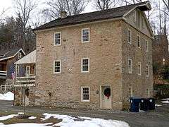
Clinger-Moses Mill Complex |
|
000000001980-07-17-0000July 17, 1980
(#80003454) |
South of Chester Springs on Pine Creek Lane
40°04′58″N 75°36′49″W / 40.082778°N 75.613611°W / 40.082778; -75.613611 (Clinger-Moses Mill Complex) |
West Pikeland Township |
|
| 12 |
Coatesville Historic District |
|
000000001987-05-14-0000May 14, 1987
(#87000667) |
Roughly bounded by Chestnut Street, 6th Avenue, Oak Street, 5th Avenue, Harmony Street, and 1st Avenue
39°58′57″N 75°49′04″W / 39.9825°N 75.817778°W / 39.9825; -75.817778 (Coatesville Historic District) |
Coatesville |
|
| 13 |
Coatesville Veterans Administration Hospital Historic District |
|
000000002013-03-06-0000March 6, 2013
(#13000059) |
1400 Blackhorse Hill Rd.
39°59′53″N 75°47′47″W / 39.998032°N 75.796334°W / 39.998032; -75.796334 (Coatesville Veterans Administration Hospital Historic District) |
Coatesville |
|
| 14 |
Continental Powder Works at French Creek |
|
000000002015-11-24-0000November 24, 2015
(#15000827) |
General area of Rapps Dam Rd. near Rapps Covered Bridge
40°08′17″N 75°33′11″W / 40.138103°N 75.553150°W / 40.138103; -75.553150 (Continental Powder Works at French Creek) |
East Pikeland Township |
|
| 15 |
County Bridge No. 101 |
|
000000001988-06-22-0000June 22, 1988
(#88000780) |
Wagontown Road over Brandywine Creek, near Rock Run
39°59′29″N 75°49′52″W / 39.991389°N 75.831111°W / 39.991389; -75.831111 (County Bridge No. 101) |
Valley Township |
|
| 16 |
County Bridge No. 124 |
|
000000001988-06-22-0000June 22, 1988
(#88000760) |
Edge Hill Road over Beaver Creek
40°00′38″N 75°44′39″W / 40.010556°N 75.744167°W / 40.010556; -75.744167 (County Bridge No. 124) |
Downingtown |
|
| 17 |
Coventry Hall |
|
000000001974-12-16-0000December 16, 1974
(#74001767) |
Off Pennsylvania Route 23
40°10′30″N 75°41′14″W / 40.175°N 75.687222°W / 40.175; -75.687222 (Coventry Hall) |
South Coventry Township |
|
| 18 |
Coventryville Historic District |
|
000000001978-01-31-0000January 31, 1978
(#78002378) |
South of Pottstown on Pennsylvania Route 23
40°10′12″N 75°41′32″W / 40.17°N 75.692222°W / 40.17; -75.692222 (Coventryville Historic District) |
South Coventry Township |
|
| 19 |
Deery Family Homestead |
|
000000001977-12-23-0000December 23, 1977
(#77001153) |
West of Phoenixville
40°06′47″N 75°36′32″W / 40.113056°N 75.608889°W / 40.113056; -75.608889 (Deery Family Homestead) |
West Vincent Township |
|
| 20 |
Downingtown Log House |
|
000000001979-05-24-0000May 24, 1979
(#79002195) |
15 East Lancaster Avenue
40°00′23″N 75°42′18″W / 40.006389°N 75.705°W / 40.006389; -75.705 (Downingtown Log House) |
Downingtown |
|
| 21 |
East Lancaster Avenue Historic District |
|
000000001979-12-11-0000December 11, 1979
(#79002196) |
An irregular pattern along East Lancaster Avenue
40°00′36″N 75°41′47″W / 40.01°N 75.696389°W / 40.01; -75.696389 (East Lancaster Avenue Historic District) |
Downingtown |
|
| 22 |
Nicholas East House |
|
000000001973-04-02-0000April 2, 1973
(#73001614) |
West of Valley Forge on Kimberton Road
40°06′49″N 75°39′16″W / 40.113611°N 75.654444°W / 40.113611; -75.654444 (Nicholas East House) |
West Vincent Township |
|
| 23 |
Elverson Historic District |
|
000000001993-04-29-0000April 29, 1993
(#93000354) |
Main, Chestnut and Hall Streets and Park Avenue
40°09′24″N 75°49′56″W / 40.156667°N 75.832222°W / 40.156667; -75.832222 (Elverson Historic District) |
Elverson |
|
| 24 |
Fagley House |
|
000000001976-05-03-0000May 3, 1976
(#76001628) |
West of Phoenixville on Art School Road
40°06′30″N 75°36′45″W / 40.108333°N 75.6125°W / 40.108333; -75.6125 (Fagley House) |
West Pikeland Township |
|
| 25 |
William Ferguson Farm |
|
000000001980-04-10-0000April 10, 1980
(#80003460) |
East of Glen Moore on Marshall Road
40°04′57″N 75°44′58″W / 40.0825°N 75.749444°W / 40.0825; -75.749444 (William Ferguson Farm) |
Wallace Township |
|
| 26 |
French Creek Farm |
|
000000001988-11-03-0000November 3, 1988
(#88002372) |
Kimberton Road near Kimberton
40°08′12″N 75°35′14″W / 40.136667°N 75.587222°W / 40.136667; -75.587222 (French Creek Farm) |
West Vincent Township |
|
| 27 |
Fricks Locks Historic District |
|
000000002003-11-21-0000November 21, 2003
(#03001188) |
End of Fricks Lock Road, approximately 1000 feet east of Sanatoga Road
40°13′21″N 75°35′47″W / 40.2225°N 75.596389°W / 40.2225; -75.596389 (Fricks Locks Historic District) |
East Coventry Township |
|
| 28 |
General Washington Inn |
|
000000001979-08-22-0000August 22, 1979
(#79002197) |
Uwchlan and East Lancaster Avenues
40°00′41″N 75°41′45″W / 40.011389°N 75.695833°W / 40.011389; -75.695833 (General Washington Inn) |
Downingtown |
|
| 29 |
Glenmoore Historic District |
|
000000002011-03-18-0000March 18, 2011
(#11000107) |
Junction of Fairview and Creek Roads; roughly bounded by Park Lane, Indiantown Road, and Howson Lane
40°05′31″N 75°46′31″W / 40.092083°N 75.775389°W / 40.092083; -75.775389 (Glenmoore Historic District) |
Wallace Township |
|
| 30 |
Hall's Bridge |
|
000000001973-04-23-0000April 23, 1973
(#73001600) |
About 3 miles (4.8 km) north of Chester Springs at Sheeder Road and Birch Run
40°08′51″N 75°37′15″W / 40.1475°N 75.620833°W / 40.1475; -75.620833 (Hall's Bridge) |
East and West Vincent Townships |
|
| 31 |
Hare's Hill Road Bridge |
|
000000001978-03-28-0000March 28, 1978
(#78002375) |
West of Phoenixville on Hare's Hill Road
40°08′27″N 75°34′06″W / 40.140833°N 75.568333°W / 40.140833; -75.568333 (Hare's Hill Road Bridge) |
East Pikeland Township |
|
| 32 |
George Hartman House |
|
000000001976-03-26-0000March 26, 1976
(#76001629) |
West of Phoenixville on Church Road
40°06′13″N 75°35′32″W / 40.103611°N 75.592222°W / 40.103611; -75.592222 (George Hartman House) |
East Pikeland Township |
|
| 33 |
Hatfield-Hibernia Historic District |
|
000000001984-06-20-0000June 20, 1984
(#84003205) |
North of Wagontown
40°01′24″N 75°50′46″W / 40.023333°N 75.846111°W / 40.023333; -75.846111 (Hatfield-Hibernia Historic District) |
West Brandywine Township and West Caln Township |
|
| 34 |
Hibernia House |
|
000000001975-11-20-0000November 20, 1975
(#75001632) |
North of Wagontown off Pennsylvania Route 340
40°01′45″N 75°50′33″W / 40.029167°N 75.8425°W / 40.029167; -75.8425 (Hibernia House) |
West Caln Township |
|
| 35 |
High Bridge |
|
000000001976-03-26-0000March 26, 1976
(#76001623) |
Spans west branch of the Brandywine
39°59′02″N 75°49′39″W / 39.983889°N 75.8275°W / 39.983889; -75.8275 (High Bridge) |
Coatesville |
|
| 36 |
Hockley Mill Farm |
|
000000001990-12-18-0000December 18, 1990
(#90001921) |
Warwick Furnace Road, southeast of Knauertown
40°09′15″N 75°42′59″W / 40.154167°N 75.716389°W / 40.154167; -75.716389 (Hockley Mill Farm) |
Warwick Township |
|
| 37 |
Hopewell Farm |
|
000000002010-01-11-0000January 11, 2010
(#09001215) |
1751 Valley Road
39°58′01″N 75°52′09″W / 39.966944°N 75.869167°W / 39.966944; -75.869167 (Hopewell Farm) |
Valley Township |
|
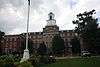
| 38 |
Hopewell Furnace National Historic Site |
|
000000001966-10-15-0000October 15, 1966
(#66000645) |
5 miles (8.0 km) south of Birdsboro, near Pine Swamp
40°12′20″N 75°46′06″W / 40.205556°N 75.768333°W / 40.205556; -75.768333 (Hopewell Furnace National Historic Site) |
Warwick Township |
Extends into Berks County
|
| 39 |
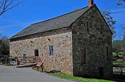
Roger Hunt Mill |
|
000000001980-01-04-0000January 4, 1980
(#80003457) |
Race Street
40°00′29″N 75°42′41″W / 40.008056°N 75.711389°W / 40.008056; -75.711389 (Roger Hunt Mill) |
Downingtown |
|
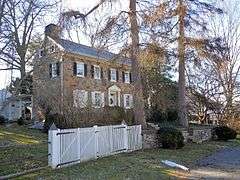
| 40 |
Abram Huston House and Carriage House |
|
000000001977-09-15-0000September 15, 1977
(#77001149) |
53 South 1st Avenue
39°58′54″N 75°49′21″W / 39.981667°N 75.8225°W / 39.981667; -75.8225 (Abram Huston House and Carriage House) |
Coatesville |
|
| 41 |
Isabella Furnace |
|
000000001991-09-06-0000September 6, 1991
(#91001135) |
Bollinger Drive just north of Creek Road, near Brandywine Manor
40°06′48″N 75°49′23″W / 40.113333°N 75.823056°W / 40.113333; -75.823056 (Isabella Furnace) |
West Nantmeal Township |
|
| 42 |
Kennedy Bridge |
|
000000001974-01-21-0000January 21, 1974
(#74001770) |
North of Kimberton off Pennsylvania Route 23 on Seven Stars Road over French Creek
40°08′25″N 75°34′36″W / 40.140278°N 75.576667°W / 40.140278; -75.576667 (Kennedy Bridge) |
East Vincent Township |
|
| 43 |
Ker-Feal |
|
000000002003-11-07-0000November 7, 2003
(#03001125) |
1081 Bodine Road, Chester Springs
40°04′38″N 75°36′33″W / 40.077222°N 75.609167°W / 40.077222; -75.609167 (Ker-Feal) |
West Pikeland Township |
|
| 44 |
Kimberton Village Historic District |
|
000000001976-05-06-0000May 6, 1976
(#76001626) |
Both sides of Hares Hill Road between Kimberton and Cold Stream
40°07′47″N 75°34′36″W / 40.129722°N 75.576667°W / 40.129722; -75.576667 (Kimberton Village Historic District) |
East Pikeland Township |
Originally listed in 1976, with a boundary increase in 1987.
|
| 45 |
John Knauer House and Mill |
|
000000001985-05-30-0000May 30, 1985
(#85001173) |
Pennsylvania Route 23 in Knauertown
40°10′14″N 75°43′53″W / 40.170556°N 75.731389°W / 40.170556; -75.731389 (John Knauer House and Mill) |
Warwick Township |
|
| 46 |
Lahr Farm |
|
000000001979-09-07-0000September 7, 1979
(#79002199) |
East of Elverson on Pennsylvania Route 23
40°09′39″N 75°46′10″W / 40.160833°N 75.769444°W / 40.160833; -75.769444 (Lahr Farm) |
Warwick Township |
|
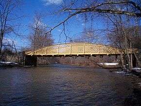
| 47 |
Larkin Covered Bridge |
|
000000001980-12-10-0000December 10, 1980
(#80003458) |
North of Downingtown in Marsh Creek State Park
40°04′15″N 75°43′15″W / 40.070833°N 75.720833°W / 40.070833; -75.720833 (Larkin Covered Bridge) |
Upper Uwchlan Township |
|
| 48 |
Lightfoot Mill |
|
000000001973-04-13-0000April 13, 1973
(#73001616) |
1703 Conestoga Road in Chester Springs
40°04′53″N 75°38′40″W / 40.081389°N 75.644444°W / 40.081389; -75.644444 (Lightfoot Mill) |
West Pikeland Township |
|
| 49 |
Lionville Historic District |
|
000000001980-12-01-0000December 1, 1980
(#80003459) |
Roughly along Pennsylvania Route 100 and South Village Avenue in Lionville
40°03′16″N 75°39′33″W / 40.054444°N 75.659167°W / 40.054444; -75.659167 (Lionville Historic District) |
Uwchlan Township |
|
| 50 |
Lukens Historic District |
|
000000001994-04-19-0000April 19, 1994
(#94001186) |
50, 53, 76, and 102 South 1st Street
39°58′52″N 75°49′21″W / 39.981111°N 75.8225°W / 39.981111; -75.8225 (Lukens Historic District) |
Coatesville |
|
| 51 |
Lukens Main Office Building |
|
000000001976-05-24-0000May 24, 1976
(#76001624) |
50 South 1st Avenue
39°58′54″N 75°49′25″W / 39.981667°N 75.823611°W / 39.981667; -75.823611 (Lukens Main Office Building) |
Coatesville |
|
| 52 |
Marshall's Bridge |
|
000000001988-06-22-0000June 22, 1988
(#88000880) |
Marshall Road over Culbertson Run
40°03′23″N 75°45′31″W / 40.056389°N 75.758611°W / 40.056389; -75.758611 (Marshall's Bridge) |
East Brandywine Township |
|
| 53 |
Simon Meredith House |
|
000000001974-12-16-0000December 16, 1974
(#74001772) |
0.5 miles (0.80 km) west of Pughtown on Pughtown Road
40°10′12″N 75°40′39″W / 40.17°N 75.6775°W / 40.17; -75.6775 (Simon Meredith House) |
South Coventry Township |
|
| 54 |
Stephen Meredith House |
|
000000001993-04-29-0000April 29, 1993
(#93000355) |
Pennsylvania Route 100 halfway between Bucktown and Pughtown
40°10′17″N 75°39′41″W / 40.171389°N 75.661389°W / 40.171389; -75.661389 (Stephen Meredith House) |
South Coventry Township |
|
| 55 |
Nathan Michener House |
|
000000001976-04-03-0000April 3, 1976
(#76001622) |
West of Bucktown on Ridge Road
40°10′25″N 75°40′30″W / 40.173611°N 75.675°W / 40.173611; -75.675 (Nathan Michener House) |
South Coventry Township |
|
| 56 |
Middle Pickering Rural Historic District |
|
000000001991-09-06-0000September 6, 1991
(#91001125) |
Pikeland, Yellow Springs, Merlin, Church, and Pickering Roads
40°05′40″N 75°34′38″W / 40.094444°N 75.577222°W / 40.094444; -75.577222 (Middle Pickering Rural Historic District) |
East and West Pikeland Townships |
Extends into Charlestown Township in Eastern Chester County
|
| 57 |
Nantmeal Village Historic District |
|
000000002014-08-01-0000August 1, 2014
(#14000466) |
Extending from jct. of Nantmeal, Fairview, Horseshoe Trail & Coventryville Rds.
40°08′30″N 75°42′18″W / 40.1417°N 75.70498°W / 40.1417; -75.70498 (Nantmeal Village Historic District) |
East Nantmeal Township |
|
| 58 |
National Bank of Coatesville Building |
|
000000001977-09-14-0000September 14, 1977
(#77001150) |
235 East Lincoln Highway
39°59′01″N 75°49′19″W / 39.983611°N 75.821944°W / 39.983611; -75.821944 (National Bank of Coatesville Building) |
Coatesville |
|
| 59 |
North Warwick Historic and Archeological District |
|
000000001995-02-24-0000February 24, 1995
(#95000135) |
Pennsylvania Route 345 and Harmonyville, Bethesda, Hopewell, Piersol, Trythall, and Northside Roads[5]
40°11′18″N 75°46′08″W / 40.188333°N 75.768889°W / 40.188333; -75.768889 (North Warwick Historic and Archeological District) |
Warwick Township |
|
| 60 |
Parker's Ford |
|
000000001983-03-17-0000March 17, 1983
(#83002226) |
Old Schuylkill Road near Parkerford
40°11′56″N 75°34′52″W / 40.198889°N 75.581111°W / 40.198889; -75.581111 (Parker's Ford) |
East Coventry and East Vincent Townships |
|
| 61 |
Parkesburg National Bank |
|
000000001980-08-29-0000August 29, 1980
(#80003467) |
Gay and Main Streets
39°57′35″N 75°55′22″W / 39.959722°N 75.922778°W / 39.959722; -75.922778 (Parkesburg National Bank) |
Parkesburg |
|
| 62 |
Parkesburg School |
|
000000001995-04-27-0000April 27, 1995
(#95000524) |
360 Strasburg Avenue
39°57′40″N 75°55′14″W / 39.961111°N 75.920556°W / 39.961111; -75.920556 (Parkesburg School) |
Parkesburg |
|
| 63 |
Pleasant Hill Plantation |
|
000000001983-02-24-0000February 24, 1983
(#83002227) |
Little Conestoga Road near Glen Moore
40°07′02″N 75°47′00″W / 40.117222°N 75.783333°W / 40.117222; -75.783333 (Pleasant Hill Plantation) |
West Nantmeal Township |
|
| 64 |
Pottstown Landing Historic District |
|
000000002001-08-31-0000August 31, 2001
(#01000927) |
Roughly bounded by U.S. Route 422 bypass, Whartnaby Street 633 Laurelwood Road and Reiff Street
40°14′17″N 75°39′51″W / 40.238056°N 75.664167°W / 40.238056; -75.664167 (Pottstown Landing Historic District) |
North Coventry Township |
|
| 65 |
Prizer's Mill Complex |
|
000000001978-09-06-0000September 6, 1978
(#78002376) |
West of Phoenixville on Seven Stars Road
40°08′16″N 75°34′27″W / 40.137778°N 75.574167°W / 40.137778; -75.574167 (Prizer's Mill Complex) |
East Pikeland Township |
|
| 66 |
Rapps Bridge |
|
000000001973-06-18-0000June 18, 1973
(#73001608) |
Rapps Dam Road off of Route 23
40°08′22″N 75°32′34″W / 40.139444°N 75.542778°W / 40.139444; -75.542778 (Rapps Bridge) |
East Pikeland Township |
|
| 67 |
Reading Furnace Historic District |
|
000000001987-07-30-0000July 30, 1987
(#87000797) |
Mansion Road
40°08′49″N 75°46′08″W / 40.146944°N 75.768889°W / 40.146944; -75.768889 (Reading Furnace Historic District) |
Warwick Township |
|
| 68 |
Rice-Pennebecker Farm |
|
000000001986-08-21-0000August 21, 1986
(#86001765) |
Clover Mill Road near Chester Springs
40°06′07″N 75°35′59″W / 40.101944°N 75.599722°W / 40.101944; -75.599722 (Rice-Pennebecker Farm) |
West Pikeland Township |
|
| 69 |
River Bend Farm |
|
000000001980-08-29-0000August 29, 1980
(#80003468) |
North of Spring City on Sanatoga Road
40°13′47″N 75°35′53″W / 40.229833°N 75.598056°W / 40.229833; -75.598056 (River Bend Farm) |
East Coventry Township |
|
| 70 |
Philip Rogers House |
|
000000001973-05-25-0000May 25, 1973
(#73001617) |
Ridge Road
40°10′29″N 75°43′11″W / 40.174722°N 75.719722°W / 40.174722; -75.719722 (Philip Rogers House) |
Warwick Township |
|
| 71 |
Robert Rooke House |
|
000000001973-09-19-0000September 19, 1973
(#73001602) |
North of Downingtown on Horseshoe Trail at Fellowship Road
40°07′19″N 75°39′42″W / 40.121944°N 75.661667°W / 40.121944; -75.661667 (Robert Rooke House) |
West Vincent Township |
|
| 72 |
St. Mary's Episcopal Church |
|
000000001996-02-16-0000February 16, 1996
(#96000082) |
Warwick Road near Elverson
40°09′57″N 75°46′52″W / 40.165833°N 75.781111°W / 40.165833; -75.781111 (St. Mary's Episcopal Church) |
Warwick Township |
|
| 73 |
St. Paul African Methodist Episcopal Church |
|
000000002012-12-12-0000December 12, 2012
(#12001042) |
703 Merchant St.
39°59′15″N 75°48′41″W / 39.98759°N 75.81134°W / 39.98759; -75.81134 (St. Paul African Methodist Episcopal Church) |
Coatesville |
|
| 74 |
St. Peters Village Historic District |
|
000000002003-11-23-0000November 23, 2003
(#03001189) |
Eastern and western sides of St. Peters Road between School Road and Rock Run Road
40°10′51″N 75°43′46″W / 40.180833°N 75.729444°W / 40.180833; -75.729444 (St. Peters Village Historic District) |
Warwick Township |
|
| 75 |
Sandy Hill Tavern |
|
000000001980-12-10-0000December 10, 1980
(#80003461) |
Southeast of Honey Brook on Pennsylvania Route 340
40°01′00″N 75°53′46″W / 40.016667°N 75.896111°W / 40.016667; -75.896111 (Sandy Hill Tavern) |
West Caln Township |
|
| 76 |
Springton Manor Farm |
|
000000001979-08-07-0000August 7, 1979
(#79002200) |
South of Glenmoore at Springton and Creek Roads
40°04′18″N 75°46′40″W / 40.071667°N 75.777778°W / 40.071667; -75.777778 (Springton Manor Farm) |
Wallace Township |
|
| 77 |
Strickland-Roberts Homestead |
|
000000001978-01-30-0000January 30, 1978
(#78002372) |
3 miles (4.8 km) south of Kimberton on St. Matthews Road
40°07′20″N 75°38′06″W / 40.122222°N 75.635°W / 40.122222; -75.635 (Strickland-Roberts Homestead) |
West Vincent Township |
|
| 78 |
Terracina |
|
000000001978-12-13-0000December 13, 1978
(#78002369) |
76 South 1st Avenue
39°58′52″N 75°49′21″W / 39.981111°N 75.8225°W / 39.981111; -75.8225 (Terracina) |
Coatesville |
|
| 79 |
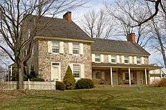
Townsend House |
|
000000001974-12-16-0000December 16, 1974
(#74001773) |
Southwest of Pughtown off Pennsylvania Route 100
40°09′51″N 75°40′21″W / 40.164167°N 75.6725°W / 40.164167; -75.6725 (Townsend House) |
South Coventry Township |
|
| 80 |
Uwchlan Meetinghouse |
|
000000001973-09-20-0000September 20, 1973
(#73001606) |
North Village Avenue (Pennsylvania Route 113) in Lionville
40°03′16″N 75°39′37″W / 40.054444°N 75.660278°W / 40.054444; -75.660278 (Uwchlan Meetinghouse) |
Uwchlan Township |
|
| 81 |
Vincent Forge Mansion |
|
000000001985-05-09-0000May 9, 1985
(#85001003) |
Cook's Glen Road R.D.
40°09′26″N 75°38′29″W / 40.157222°N 75.641389°W / 40.157222; -75.641389 (Vincent Forge Mansion) |
East Vincent Township |
|
| 82 |
Warrenpoint |
|
000000001975-11-11-0000November 11, 1975
(#75001630) |
West of Knauertown off Pennsylvania Route 23
40°09′52″N 75°44′37″W / 40.164444°N 75.743611°W / 40.164444; -75.743611 (Warrenpoint) |
Warwick Township |
|
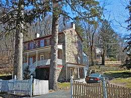
| 83 |
Warwick Furnace/Farms |
|
000000001976-09-13-0000September 13, 1976
(#76001627) |
South of Knauertown off Pennsylvania Route 23 on Warwick Furnace Road
40°09′03″N 75°44′28″W / 40.150833°N 75.741111°W / 40.150833; -75.741111 (Warwick Furnace/Farms) |
East Nantmeal Township |
|
| 84 |
Warwick Mills |
|
000000001974-12-30-0000December 30, 1974
(#74001769) |
East of Elverson off Pennsylvania Route 23 on James Mills Road
40°08′54″N 75°45′19″W / 40.148333°N 75.755278°W / 40.148333; -75.755278 (Warwick Mills) |
Warwick Township |
|
| 85 |
Welkinweir |
|
000000002001-09-07-0000September 7, 2001
(#01000953) |
1368 Prizer Road
40°09′13″N 75°40′55″W / 40.153611°N 75.681944°W / 40.153611; -75.681944 (Welkinweir) |
East Nantmeal Township |
|
| 86 |
West Vincent Highlands Historic District |
|
000000001998-05-07-0000May 7, 1998
(#98000400) |
Birchrun Road, Pennsylvania Route 401, Fellowship Road, Horshoe Tr., Hollow Road, and Davis, Jaine, Green, Bartlett, and Mill Lns.
40°07′37″N 75°40′17″W / 40.126944°N 75.671389°W / 40.126944; -75.671389 (West Vincent Highlands Historic District) |
Upper Uwchlan and West Vincent Townships |
|
| 87 |
Wheelen House |
|
000000001974-06-20-0000June 20, 1974
(#74001768) |
Northeast of Downingtown on Fellowship Road
40°06′21″N 75°40′35″W / 40.105833°N 75.676389°W / 40.105833; -75.676389 (Wheelen House) |
Upper Uwchlan Township |
|
| 88 |
Jacob Winings House and Clover Mill |
|
000000001979-08-17-0000August 17, 1979
(#79002203) |
Southwest of Phoenixville on James Mill Road
40°09′01″N 75°45′52″W / 40.150278°N 75.764444°W / 40.150278; -75.764444 (Jacob Winings House and Clover Mill) |
Warwick Township |
|


%2C_Pughtown%2C_Chester_County%2C_PA.jpg)