| [3] |
Name on the Register |
Image |
Date listed[4] |
Location |
Municipality |
Description |
|---|
| 1 |
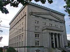
Allentown Masonic Temple |
|
000000002004-05-05-0000May 5, 2004
(#04000402) |
1524 West Linden Street
40°35′55″N 75°29′25″W / 40.598611°N 75.490278°W / 40.598611; -75.490278 (Allentown Masonic Temple) |
Allentown |
|
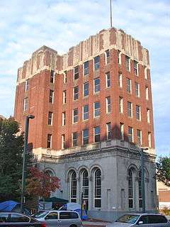
| 2 |
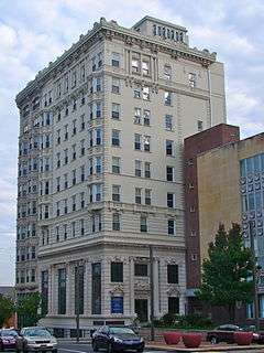
Allentown National Bank |
|
000000002005-12-28-0000December 28, 2005
(#05001490) |
13–17 N. 7th Street
40°36′17″N 75°28′17″W / 40.604722°N 75.471389°W / 40.604722; -75.471389 (Allentown National Bank) |
Allentown |
|
| 3 |
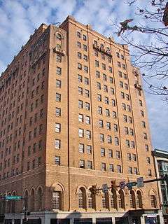
Americus Hotel |
|
000000001984-08-23-0000August 23, 1984
(#84003454) |
541 Hamilton Street
40°36′10″N 75°28′12″W / 40.602778°N 75.47°W / 40.602778; -75.47 (Americus Hotel) |
Allentown |
|
| 4 |
Bethlehem Armory |
|
000000001991-11-14-0000November 14, 1991
(#91001693) |
301 Prospect Street
40°37′09″N 75°23′16″W / 40.619167°N 75.387778°W / 40.619167; -75.387778 (Bethlehem Armory) |
Bethlehem |
|
| 5 |
Biery's Port Historic District |
|
000000001984-08-09-0000August 9, 1984
(#84003457) |
Roughly bounded by Pineapple, Front, Race, and Mulberry Streets
40°38′57″N 75°28′04″W / 40.649167°N 75.467778°W / 40.649167; -75.467778 (Biery's Port Historic District) |
Catasauqua |
|
| 6 |
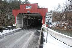
Bogert Covered Bridge |
|
000000001980-12-01-0000December 1, 1980
(#80003552) |
South of Allentown on Legislative Route 39016 in Little Lehigh Park
40°34′08″N 75°30′17″W / 40.568889°N 75.504722°W / 40.568889; -75.504722 (Bogert Covered Bridge) |
Allentown |
|
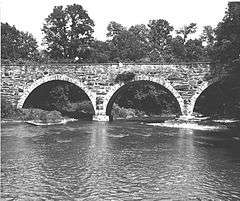
| 7 |
Bridge in Heidelberg Township |
|
000000001988-06-22-0000June 22, 1988
(#88000765) |
Legislative Route 39110 over a branch of Jordan Creek
40°42′03″N 75°42′37″W / 40.700833°N 75.710278°W / 40.700833; -75.710278 (Bridge in Heidelberg Township) |
Heidelberg Township |
|
| 8 |
Burnside Plantation |
|
000000001990-05-02-0000May 2, 1990
(#90000705) |
Schoenersville Road 2 miles (3.2 km) southeast of its junction with Easton Avenue
40°37′51″N 75°23′22″W / 40.630833°N 75.389444°W / 40.630833; -75.389444 (Burnside Plantation) |
Bethlehem |
|
| 9 |
Catasauqua Residential Historic District |
|
000000001984-05-10-0000May 10, 1984
(#84003465) |
Roughly bounded by Howertown Road, Railroad Avenue, Oak and Bridge Streets
40°39′19″N 75°28′25″W / 40.655278°N 75.473611°W / 40.655278; -75.473611 (Catasauqua Residential Historic District) |
Catasauqua |
|
| 10 |
Centennial Bridge |
|
000000001988-06-22-0000June 22, 1988
(#88000772) |
Station Avenue over Saucon Creek
40°31′43″N 75°23′31″W / 40.528611°N 75.391944°W / 40.528611; -75.391944 (Centennial Bridge) |
Center Valley |
|
| 11 |
Central Bethlehem Historic District |
|
000000001972-05-05-0000May 5, 1972
(#72001131) |
Bounded by Main, Nevada, and East Broad Streets, and the river
40°37′06″N 75°22′56″W / 40.618333°N 75.382222°W / 40.618333; -75.382222 (Central Bethlehem Historic District) |
Bethlehem |
Extends into Northampton County
|
| 12 |
Cold Spring Bridge |
|
000000001988-06-22-0000June 22, 1988
(#88000874) |
2nd Street over Spring Creek
40°42′03″N 75°31′01″W / 40.700833°N 75.516944°W / 40.700833; -75.516944 (Cold Spring Bridge) |
North Whitehall and Whitehall Townships |
|
| 13 |
Coopersburg Historic District |
|
000000001982-04-26-0000April 26, 1982
(#82003798) |
Main Street and Pennsylvania Route 309
40°30′32″N 75°23′23″W / 40.508889°N 75.389722°W / 40.508889; -75.389722 (Coopersburg Historic District) |
Coopersburg |
|
| 14 |
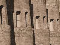
Coplay Cement Company Kilns |
|
000000001980-09-02-0000September 2, 1980
(#80003556) |
North 2nd Street
40°40′34″N 75°29′42″W / 40.676111°N 75.495°W / 40.676111; -75.495 (Coplay Cement Company Kilns) |
Coplay |
|
| 15 |
Dent Hardware Company Factory Complex |
|
000000001986-08-21-0000August 21, 1986
(#86001772) |
1101 3rd Street, Fullerton
40°38′24″N 75°28′30″W / 40.64°N 75.475°W / 40.64; -75.475 (Dent Hardware Company Factory Complex) |
Whitehall Township |
|
| 16 |
Dillingersville Union School and Church |
|
000000001979-10-25-0000October 25, 1979
(#79002290) |
East of Zionsville on Zionsville Road
40°28′26″N 75°29′17″W / 40.473889°N 75.488056°W / 40.473889; -75.488056 (Dillingersville Union School and Church) |
Lower Milford Township |
|
| 17 |
Dime Savings and Trust Company |
|
000000001985-01-03-0000January 3, 1985
(#85000036) |
12 North 7th Street
40°36′08″N 75°28′22″W / 40.602222°N 75.472778°W / 40.602222; -75.472778 (Dime Savings and Trust Company) |
Allentown |
|
| 18 |
Dorneyville Crossroad Settlement |
|
000000001977-12-07-0000December 7, 1977
(#77001172) |
South of Allentown at the junction of U.S. Route 222 and Pennsylvania Route 29
40°34′48″N 75°31′19″W / 40.58°N 75.521944°W / 40.58; -75.521944 (Dorneyville Crossroad Settlement) |
South Whitehall Township |
|
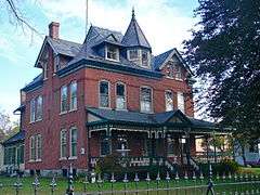
| 19 |
Jacob Jr. Ehrenhardt House |
|
000000002003-11-07-0000November 7, 2003
(#03001123) |
55 South Keystone Avenue
40°32′23″N 75°29′11″W / 40.539722°N 75.486389°W / 40.539722; -75.486389 (Jacob Jr. Ehrenhardt House) |
Emmaus |
|
| 20 |
Fireman's Drinking Fountain |
|
000000001981-11-09-0000November 9, 1981
(#81000551) |
Main Street
40°45′06″N 75°36′48″W / 40.751667°N 75.613333°W / 40.751667; -75.613333 (Fireman's Drinking Fountain) |
Slatington |
|
| 21 |
Fountain Hill Historic District |
|
000000001988-04-21-0000April 21, 1988
(#88000450) |
Roughly bounded by Brighton, Wyandotte, W. 4th, and Seminole Streets, and Delaware Avenue
40°36′40″N 75°23′10″W / 40.611111°N 75.386111°W / 40.611111; -75.386111 (Fountain Hill Historic District) |
Bethlehem |
Extends into Northampton County
|
| 22 |
Frantz's Bridge |
|
000000001988-06-22-0000June 22, 1988
(#88000771) |
Legislative Route 39060 over Jordan Creek
40°39′03″N 75°39′02″W / 40.650833°N 75.650556°W / 40.650833; -75.650556 (Frantz's Bridge) |
Lowhill Township |
Replaced with a concrete bridge in 2011
|
| 23 |
Gauff-Roth House |
|
000000001985-09-05-0000September 5, 1985
(#85001966) |
427–443 Auburn Street
40°35′46″N 75°27′52″W / 40.596111°N 75.464444°W / 40.596111; -75.464444 (Gauff-Roth House) |
Allentown |
|
| 24 |
Geiger Covered Bridge |
|
000000001980-12-01-0000December 1, 1980
(#80003558) |
Southeast of Schencksville on Township 681
40°38′46″N 75°37′00″W / 40.646111°N 75.616667°W / 40.646111; -75.616667 (Geiger Covered Bridge) |
North Whitehall Township |
|
| 25 |
Haines Mill |
|
000000001981-09-11-0000September 11, 1981
(#81000548) |
Walnut Street and Main Boulevard
40°35′06″N 75°31′56″W / 40.585°N 75.532222°W / 40.585; -75.532222 (Haines Mill) |
South Whitehall Township |
|
| 26 |
Helfrich's Springs Grist Mill |
|
000000001977-10-14-0000October 14, 1977
(#77001174) |
West of Fullerton on Mickley Road
40°37′31″N 75°29′29″W / 40.625278°N 75.491389°W / 40.625278; -75.491389 (Helfrich's Springs Grist Mill) |
Whitehall Township |
|
| 27 |
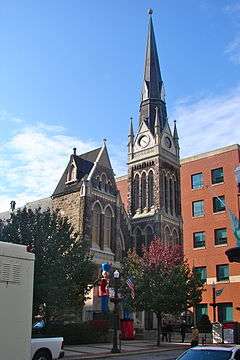
High German Evangelical Reformed Church |
|
000000001983-07-28-0000July 28, 1983
(#83002259) |
620 Hamilton Street
40°36′08″N 75°27′31″W / 40.602222°N 75.458611°W / 40.602222; -75.458611 (High German Evangelical Reformed Church) |
Allentown |
|
| 28 |
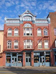
Hotel Sterling |
|
000000001984-05-03-0000May 3, 1984
(#84003469) |
343–345 Hamilton Street
40°36′19″N 75°27′43″W / 40.605278°N 75.461944°W / 40.605278; -75.461944 (Hotel Sterling) |
Allentown |
|
| 29 |
Kemmerer House |
|
000000001977-09-14-0000September 14, 1977
(#77001173) |
3 Iroquois Street
40°32′54″N 75°29′57″W / 40.548444°N 75.49925°W / 40.548444; -75.49925 (Kemmerer House) |
Emmaus |
|
| 30 |
Frederick and Catherine Leaser Farm |
|
000000002004-01-14-0000January 14, 2004
(#03001420) |
7654 Leaser Road
40°40′32″N 75°50′47″W / 40.675556°N 75.846389°W / 40.675556; -75.846389 (Frederick and Catherine Leaser Farm) |
Lynn Township |
|
| 31 |
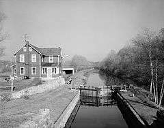
Lehigh Canal |
|
000000001980-08-15-0000August 15, 1980
(#80003553) |
Walnutport to Allentown Section
40°42′08″N 75°31′52″W / 40.702222°N 75.531111°W / 40.702222; -75.531111 (Lehigh Canal) |
Allentown |
Extends into Northampton County
|
| 32 |
Lehigh Canal; Allentown to Hopeville Section |
|
000000001979-12-17-0000December 17, 1979
(#79002307) |
Along the Lehigh River
40°36′55″N 75°24′52″W / 40.615278°N 75.414444°W / 40.615278; -75.414444 (Lehigh Canal; Allentown to Hopeville Section) |
Allentown |
|
| 33 |
Linden Grove Pavilion |
|
000000001979-11-30-0000November 30, 1979
(#79002289) |
Linden and South Main Streets
40°30′18″N 75°23′35″W / 40.505°N 75.393056°W / 40.505; -75.393056 (Linden Grove Pavilion) |
Coopersburg |
|
| 34 |
Lock Ridge Furnace Complex |
|
000000001981-09-11-0000September 11, 1981
(#81000547) |
Franklin and Church Streets
40°30′32″N 75°35′39″W / 40.508889°N 75.594167°W / 40.508889; -75.594167 (Lock Ridge Furnace Complex) |
Alburtis |
|
| 35 |
Manasses Guth Covered Bridge |
|
000000001980-12-01-0000December 1, 1980
(#80003559) |
West of Greenawalds on Township 602
40°37′42″N 75°33′13″W / 40.628333°N 75.553611°W / 40.628333; -75.553611 (Manasses Guth Covered Bridge) |
South Whitehall Township |
|
| 36 |
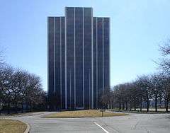
Martin Tower |
|
000000002010-06-28-0000June 28, 2010
(#10000401) |
1170 8th Ave.
40°37′54″N 75°23′40″W / 40.631667°N 75.394444°W / 40.631667; -75.394444 (Martin Tower) |
Bethlehem |
|
| 37 |
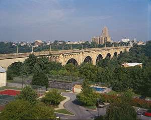
Albertus L. Meyers Bridge |
|
000000001988-06-22-0000June 22, 1988
(#88000870) |
8th Street over Little Lehigh and Railroad Streets
40°35′45″N 75°28′16″W / 40.595833°N 75.471111°W / 40.595833; -75.471111 (Albertus L. Meyers Bridge) |
Allentown |
|
| 38 |
Mount Airy Historic District |
|
000000001988-05-09-0000May 9, 1988
(#88000453) |
Roughly Prospect Avenue between 15th and 8th Avenues
40°37′12″N 75°24′09″W / 40.62°N 75.4025°W / 40.62; -75.4025 (Mount Airy Historic District) |
Bethlehem |
|
| 39 |
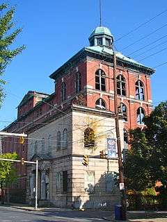
Neuweiler Brewery |
|
000000001980-06-27-0000June 27, 1980
(#80003554) |
401 North Front Street
40°36′40″N 75°27′29″W / 40.611111°N 75.458056°W / 40.611111; -75.458056 (Neuweiler Brewery) |
Allentown |
|
| 40 |
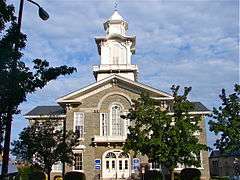
Old Lehigh County Courthouse |
|
000000001981-09-11-0000September 11, 1981
(#81000550) |
5th and Hamilton Streets
40°36′13″N 75°28′04″W / 40.603611°N 75.467778°W / 40.603611; -75.467778 (Old Lehigh County Courthouse) |
Allentown |
|
| 41 |
Rex Covered Bridge |
|
000000001980-12-01-0000December 1, 1980
(#80003560) |
South of Schencksville on Township 593
40°38′05″N 75°36′47″W / 40.634722°N 75.613056°W / 40.634722; -75.613056 (Rex Covered Bridge) |
North Whitehall Township |
|
| 42 |
Rodale Organic Gardening Experimental Farm |
|
000000001999-05-12-0000May 12, 1999
(#99000515) |
2056 Minesite Road
40°33′17″N 75°31′20″W / 40.554722°N 75.522222°W / 40.554722; -75.522222 (Rodale Organic Gardening Experimental Farm) |
Lower Macungie Township |
|
| 43 |
Schlicher Covered Bridge |
|
000000001980-12-01-0000December 1, 1980
(#80003555) |
Legislative Route 39058 near Allentown
40°39′42″N 75°37′38″W / 40.661667°N 75.627222°W / 40.661667; -75.627222 (Schlicher Covered Bridge) |
North Whitehall Township |
|
| 44 |
George F. Schlicher Hotel |
|
000000001992-05-07-0000May 7, 1992
(#92000396) |
105–107 South Main Street
40°30′43″N 75°36′12″W / 40.511944°N 75.603333°W / 40.511944; -75.603333 (George F. Schlicher Hotel) |
Alburtis |
|
| 45 |
Shelter House |
|
000000001978-02-17-0000February 17, 1978
(#78002426) |
South 4th Street
40°31′50″N 75°29′06″W / 40.530556°N 75.485°W / 40.530556; -75.485 (Shelter House) |
Emmaus |
|
| 46 |
Slatington Historic District |
|
000000002004-08-11-0000August 11, 2004
(#04000839) |
Roughly bounded by Ridge Alley, Chesnut Street, Railroad Street, Kern Street, Hill Alley, 5th Street, and Dowell
40°44′54″N 75°36′43″W / 40.748333°N 75.611944°W / 40.748333; -75.611944 (Slatington Historic District) |
Slatington |
|
| 47 |
George Taylor House |
|
000000001971-07-17-0000July 17, 1971
(#71000709) |
Front Street
40°38′52″N 75°27′59″W / 40.647778°N 75.466389°W / 40.647778; -75.466389 (George Taylor House) |
Catasauqua |
|
| 48 |
Trout Hall |
|
000000001978-11-14-0000November 14, 1978
(#78002425) |
414 Walnut Street
40°36′09″N 75°27′50″W / 40.6025°N 75.463889°W / 40.6025; -75.463889 (Trout Hall) |
Allentown |
|
| 49 |
Troxell-Steckel House |
|
000000001980-06-27-0000June 27, 1980
(#80003557) |
4229 Reliance Street
40°40′32″N 75°32′08″W / 40.675556°N 75.535556°W / 40.675556; -75.535556 (Troxell-Steckel House) |
Egypt |
|
| 50 |
Vigilant Fire Company Firemen's Monument |
|
000000002004-08-11-0000August 11, 2004
(#04000838) |
Union Cemetery, west side of Pennsylvania Route 873, approximately 1⁄3 mile (0.5 km) south of Slatington
40°44′23″N 75°36′49″W / 40.739722°N 75.613611°W / 40.739722; -75.613611 (Vigilant Fire Company Firemen's Monument) |
Washington Township |
|
| 51 |
Valentine Weaver House |
|
000000001984-06-28-0000June 28, 1984
(#84003482) |
146 South Church Street
40°30′40″N 75°33′21″W / 40.511111°N 75.555833°W / 40.511111; -75.555833 (Valentine Weaver House) |
Macungie |
|
| 52 |
Wehr Covered Bridge |
|
000000001980-12-01-0000December 1, 1980
(#80003561) |
West of Greenawald on Township 597
40°34′08″N 75°30′17″W / 40.568889°N 75.504722°W / 40.568889; -75.504722 (Wehr Covered Bridge) |
South Whitehall Township |
|
| 53 |
Zollinger-Harned Company Building |
|
000000001979-12-17-0000December 17, 1979
(#79002288) |
605–613 Hamilton Mall and 14016 North 6th Street
40°36′10″N 75°28′14″W / 40.602778°N 75.470556°W / 40.602778; -75.470556 (Zollinger-Harned Company Building) |
Allentown |
|


.jpg)



.png)
