| [2] |
Name on the Register |
Image |
Date listed[3] |
Location |
Neighborhood |
Description |
|---|
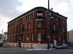
| 1 |
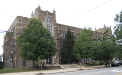
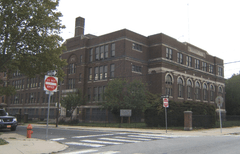
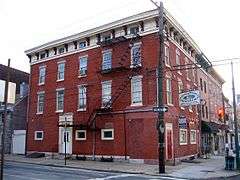
26th District Police and Patrol Station |
|
000000001984-07-12-0000July 12, 1984
(#84003550) |
2136–2142 East Dauphin Street
39°58′52″N 75°07′44″W / 39.981°N 75.129°W / 39.981; -75.129 (26th District Police and Patrol Station) |
Kensington |
|
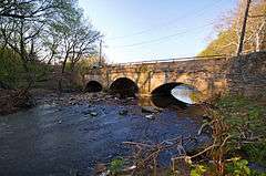
| 2 |
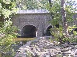
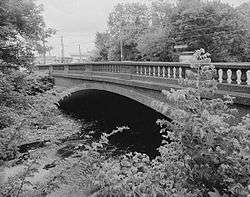
Adams Avenue Bridge in Philadelphia |
|
000000001988-06-22-0000June 22, 1988
(#88000851) |
Adams Avenue over Tacony Creek
40°02′31″N 75°06′48″W / 40.0419°N 75.1133°W / 40.0419; -75.1133 (Adams Avenue Bridge in Philadelphia) |
Olney |
Extends into North Philadelphia
|
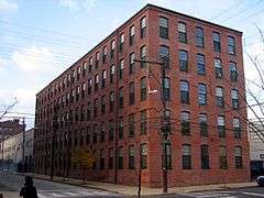
| 3 |
Albion Carpet Mill |
|
000000002016-01-12-0000January 12, 2016
(#15000973) |
1821-1845 E. Hagert St.
39°59′10″N 75°07′48″W / 39.986111°N 75.130000°W / 39.986111; -75.130000 (Albion Carpet Mill) |
Kensington |
|
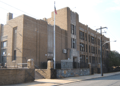
| 4 |
Ethan Allen School |
|
000000001988-11-18-0000November 18, 1988
(#88002227) |
3001 Robbins Avenue
40°01′47″N 75°03′44″W / 40.0297°N 75.0622°W / 40.0297; -75.0622 (Ethan Allen School) |
Mayfair |
|
| 5 |
William W. Axe School |
|
000000001988-11-18-0000November 18, 1988
(#88002240) |
1709–1733 Kinsey Street
40°00′44″N 75°05′02″W / 40.0122°N 75.0839°W / 40.0122; -75.0839 (William W. Axe School) |
Frankford |
|
| 6 |
Beatty's Mills Factory Building |
|
000000002004-08-18-0000August 18, 2004
(#04000881) |
2446–2468 Coral Street
39°59′04″N 75°07′43″W / 39.9844°N 75.1286°W / 39.9844; -75.1286 (Beatty's Mills Factory Building) |
Kensington |
|
| 7 |
Bridesburg School |
|
000000001989-04-10-0000April 10, 1989
(#88002285) |
2624 Haworth Street
40°00′10″N 75°04′05″W / 40.0028°N 75.0681°W / 40.0028; -75.0681 (Bridesburg School) |
Bridesburg |
|
| 8 |
Joseph H. Brown School |
|
000000001988-11-18-0000November 18, 1988
(#88002250) |
8118–8120 Frankford Avenue
40°02′36″N 75°01′29″W / 40.0433°N 75.0247°W / 40.0433; -75.0247 (Joseph H. Brown School) |
Holmesburg |
|
| 9 |
Brownhill & Kramer Hosiery Mill |
|
000000002014-03-31-0000March 31, 2014
(#14000096) |
406-426 Memphis St., 1421-1437 E. Columbia Ave.
39°58′27″N 75°07′56″W / 39.974029°N 75.132152°W / 39.974029; -75.132152 (Brownhill & Kramer Hosiery Mill) |
Fishtown |
|
| 10 |
H.W. Butterworth and Sons Company Building |
|
000000002010-06-28-0000June 28, 2010
(#10000406) |
2410 East York St.
39°58′39″N 75°07′29″W / 39.9775°N 75.1247°W / 39.9775; -75.1247 (H.W. Butterworth and Sons Company Building) |
Kensington |
|
| 11 |
Carl Mackley Houses |
|
000000001998-05-06-0000May 6, 1998
(#98000401) |
1401 East Bristol Street
40°00′44″N 75°05′55″W / 40.0122°N 75.0986°W / 40.0122; -75.0986 (Carl Mackley Houses) |
Juniata |
|
| 12 |
Laura H. Carnell School |
|
000000001988-11-18-0000November 18, 1988
(#88002251) |
6101 Summerdale Avenue
40°02′20″N 75°05′03″W / 40.0389°N 75.0842°W / 40.0389; -75.0842 (Laura H. Carnell School) |
Oxford Circle |
|
| 13 |
Watson Comly School |
|
000000001988-11-18-0000November 18, 1988
(#88002324) |
13250 Trevose Road
40°07′36″N 75°00′46″W / 40.1267°N 75.0128°W / 40.1267; -75.0128 (Watson Comly School) |
Somerton |
|
| 14 |
Russell H. Conwell School |
|
000000001988-11-18-0000November 18, 1988
(#88002258) |
1829–1951 East Clearfield Street
39°59′39″N 75°06′54″W / 39.9942°N 75.115°W / 39.9942; -75.115 (Russell H. Conwell School) |
Port Richmond |
|
| 15 |
Thomas Creighton School |
|
000000001988-11-18-0000November 18, 1988
(#88002260) |
5401 Tabor Road
40°02′04″N 75°06′19″W / 40.0344°N 75.1053°W / 40.0344; -75.1053 (Thomas Creighton School) |
Crescentville |
|
| 16 |
Kennedy Crossan School |
|
000000001988-11-18-0000November 18, 1988
(#88002261) |
7341 Palmetto Street
40°03′43″N 75°04′54″W / 40.0619°N 75.0817°W / 40.0619; -75.0817 (Kennedy Crossan School) |
Burholme |
|
| 17 |
The Delaware Station of the Philadelphia Electric Company |
|
000000002016-08-10-0000August 10, 2016
(#16000427) |
1325 Beach St.
39°58′03″N 75°07′40″W / 39.967422°N 75.127785°W / 39.967422; -75.127785 (The Delaware Station of the Philadelphia Electric Company) |
Fishtown |
|
| 18 |
Hamilton Disston School |
|
000000001988-11-18-0000November 18, 1988
(#88002262) |
6801 Cottage Street
40°01′42″N 75°02′50″W / 40.0283°N 75.0472°W / 40.0283; -75.0472 (Hamilton Disston School) |
Tacony |
|
| 19 |
Mary Disston School |
|
000000001988-11-18-0000November 18, 1988
(#88002319) |
4521 Longshore Avenue
40°01′42″N 75°02′40″W / 40.0283°N 75.0444°W / 40.0283; -75.0444 (Mary Disston School) |
Tacony |
|
| 20 |
Henry R. Edmunds School |
|
000000001988-11-18-0000November 18, 1988
(#88002266) |
1101–1197 Haworth Street
40°01′30″N 75°05′12″W / 40.025°N 75.0867°W / 40.025; -75.0867 (Henry R. Edmunds School) |
Northwood |
|
| 21 |
Fayette School |
|
000000001986-12-04-0000December 4, 1986
(#86003295) |
Old Bustleton and Welsh Roads
40°04′56″N 75°02′20″W / 40.0822°N 75.0389°W / 40.0822; -75.0389 (Fayette School) |
Bustleton |
|
| 22 |
Edwin Forrest School |
|
000000001988-11-18-0000November 18, 1988
(#88002273) |
4300 Bleigh Street
40°02′04″N 75°02′10″W / 40.0344°N 75.036°W / 40.0344; -75.036 (Edwin Forrest School) |
Mayfair |
|
| 23 |
Frankford Arsenal |
|
000000001972-03-16-0000March 16, 1972
(#72001153) |
Tacony and Bridge Streets
40°00′28″N 75°04′00″W / 40.0078°N 75.0667°W / 40.0078; -75.0667 (Frankford Arsenal) |
Frankford |
|
| 24 |
Frankford Avenue Bridge |
|
000000001988-06-22-0000June 22, 1988
(#88000803) |
Frankford Avenue over the Pennypack Creek
40°02′37″N 75°01′14″W / 40.0436°N 75.0205°W / 40.0436; -75.0205 (Frankford Avenue Bridge) |
Holmesburg |
|
| 25 |
Frankford Avenue Bridge |
|
000000001988-06-22-0000June 22, 1988
(#88000850) |
Frankford Avenue over Poquessing Creek
40°03′53″N 74°58′53″W / 40.0646°N 74.9814°W / 40.0646; -74.9814 (Frankford Avenue Bridge) |
Torresdale |
Extends into Bucks County
|
| 26 |
Benjamin Franklin School |
|
000000001988-11-18-0000November 18, 1988
(#88002274) |
5737–5741 Rising Sun Avenue
40°02′33″N 75°06′15″W / 40.0425°N 75.1042°W / 40.0425; -75.1042 (Benjamin Franklin School) |
Crescentville |
|
| 27 |
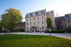
Friends Hospital |
|
000000001999-01-20-0000January 20, 1999
(#99000629) |
4641 Roosevelt Boulevard
40°01′36″N 75°06′07″W / 40.0267°N 75.1019°W / 40.0267; -75.1019 (Friends Hospital) |
Northwood |
First private psychiatric hospital in the U.S., founded 1813
|
| 28 |
Glen Foerd on the Delaware |
|
000000001979-11-20-0000November 20, 1979
(#79002320) |
5001 Grant Avenue
40°03′05″N 74°58′44″W / 40.0514°N 74.9789°W / 40.0514; -74.9789 (Glen Foerd on the Delaware) |
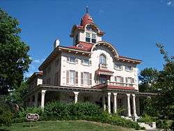
Torresdale |
Glen Foerd on the Delaware is a historic estate located at the confluence of the Poquessing Creek and Delaware River. It is listed on the National Register of Historic Places and the Historic American Landscape Survey. www.glenfoerd.org
|
| 29 |
Greenbelt Knoll Historic District |
|
000000002010-12-14-0000December 14, 2010
(#10001030) |
1–19 Longford St., roughly bounded by Holme Ave. and Pennypack Park Greenway
40°03′23″N 75°01′20″W / 40.0564°N 75.0222°W / 40.0564; -75.0222 (Greenbelt Knoll Historic District) |
Pennypack |
|
| 30 |
Green Tree Tavern |
|
000000001980-06-27-0000June 27, 1980
(#80003612) |
260–262 East Girard Avenue
39°58′11″N 75°07′54″W / 39.9696°N 75.1318°W / 39.9696; -75.1318 (Green Tree Tavern) |
Fishtown |
|
| 31 |
Warren G. Harding Junior High School |
|
000000001988-11-18-0000November 18, 1988
(#88002277) |
2000 Wakeling Street
40°00′47″N 75°04′28″W / 40.0131°N 75.0744°W / 40.0131; -75.0744 (Warren G. Harding Junior High School) |
Frankford |
|
| 32 |
Holme Avenue Bridge |
|
000000001988-06-22-0000June 22, 1988
(#88000806) |
Holme Avenue over Wooden Bridge Run
40°03′23″N 75°01′27″W / 40.0565°N 75.0243°W / 40.0565; -75.0243 (Holme Avenue Bridge) |
Pennypack |
|
| 33 |
Francis Hopkinson School |
|
000000001988-11-18-0000November 18, 1988
(#88002282) |
1301–1331 East Luzerne Avenue
40°00′30″N 75°06′09″W / 40.0083°N 75.1024°W / 40.0083; -75.1024 (Francis Hopkinson School) |
Juniata |
|
| 34 |
George L. Horn School |
|
000000001986-12-04-0000December 4, 1986
(#86003292) |
Frankford and Castor Avenues
39°59′58″N 75°05′55″W / 39.9994°N 75.0985°W / 39.9994; -75.0985 (George L. Horn School) |
Port Richmond |
|
| 35 |
John Paul Jones Junior High School |
|
000000001988-11-18-0000November 18, 1988
(#88002287) |
2922 Memphis Street
39°59′10″N 75°06′46″W / 39.9861°N 75.1128°W / 39.9861; -75.1128 (John Paul Jones Junior High School) |
Port Richmond |
|
| 36 |
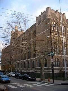
Kensington High School for Girls |
|
000000001988-11-18-0000November 18, 1988
(#88002288) |
2075 East Cumberland Street
39°59′03″N 75°07′35″W / 39.9842°N 75.1264°W / 39.9842; -75.1264 (Kensington High School for Girls) |
Kensington |
|
| 37 |
Knowlton |
|
000000001974-10-01-0000October 1, 1974
(#74001803) |
8001 Verree Road
40°04′24″N 75°04′28″W / 40.0732°N 75.0744°W / 40.0732; -75.0744 (Knowlton) |
Fox Chase |
|
| 38 |
Lawndale School |
|
000000001988-11-18-0000November 18, 1988
(#88002254) |
600 Hellerman Street
40°02′59″N 75°05′31″W / 40.0496°N 75.0919°W / 40.0496; -75.0919 (Lawndale School) |
Lawndale |
|
| 39 |
Henry Longfellow School |
|
000000001988-11-18-0000November 18, 1988
(#88002294) |
5004–5098 Tacony Street
40°00′31″N 75°04′17″W / 40.0085°N 75.0714°W / 40.0085; -75.0714 (Henry Longfellow School) |
Frankford |
|
| 40 |
John Marshall School |
|
000000001988-11-18-0000November 18, 1988
(#88002298) |
1501–1527 Sellers Street
40°00′53″N 75°05′15″W / 40.0146°N 75.0875°W / 40.0146; -75.0875 (John Marshall School) |
Frankford |
|
| 41 |
James Martin School |
|
000000001988-11-18-0000November 18, 1988
(#88002299) |
3340 Richmond Street
39°59′08″N 75°05′50″W / 39.9856°N 75.0971°W / 39.9856; -75.0971 (James Martin School) |
Port Richmond |
|
| 42 |
Mechanicsville School |
|
000000001986-12-01-0000December 1, 1986
(#86003306) |
Mechanicsville Road
40°06′27″N 74°58′02″W / 40.1074°N 74.9671°W / 40.1074; -74.9671 (Mechanicsville School) |
Parkwood |
|
| 43 |
Penn Treaty Junior High School |
|
000000001988-11-18-0000November 18, 1988
(#88002311) |
600 East Thompson Street
39°58′22″N 75°07′38″W / 39.9728°N 75.1272°W / 39.9728; -75.1272 (Penn Treaty Junior High School) |
Fishtown |
|
| 44 |
Thomas Powers School |
|
000000001986-12-04-0000December 4, 1986
(#86003319) |
Frankford Avenue and Somerset Street
39°59′20″N 75°07′11″W / 39.9888°N 75.1197°W / 39.9888; -75.1197 (Thomas Powers School) |
Port Richmond |
|
| 45 |
Richmond School |
|
000000001988-11-18-0000November 18, 1988
(#88002316) |
2942 Belgrade Street
39°59′00″N 75°06′38″W / 39.9833°N 75.1106°W / 39.9833; -75.1106 (Richmond School) |
Port Richmond |
|
| 46 |
John Ruan House |
|
000000001985-10-31-0000October 31, 1985
(#85003410) |
4278–4280 Griscom Street
40°00′40″N 75°05′25″W / 40.0111°N 75.0903°W / 40.0111; -75.0903 (John Ruan House) |
Frankford |
|
| 47 |
Ryerss Mansion |
|
000000001976-11-21-0000November 21, 1976
(#76001669) |
Central and Cottman Avenues
40°04′07″N 75°05′19″W / 40.0686°N 75.0886°W / 40.0686; -75.0886 (Ryerss Mansion) |
Fox Chase |
|
| 48 |
Philip H. Sheridan School |
|
000000001988-11-18-0000November 18, 1988
(#88002322) |
800–818 East Ontario Street
39°59′59″N 75°06′51″W / 39.9996°N 75.1142°W / 39.9996; -75.1142 (Philip H. Sheridan School) |
Kensington |
|
| 49 |
Franklin Smedley School |
|
000000001988-11-18-0000November 18, 1988
(#88002323) |
5199 Mulberry Street
40°01′11″N 75°04′26″W / 40.0197°N 75.0739°W / 40.0197; -75.0739 (Franklin Smedley School) |
Frankford |
|
| 50 |
Stanley |
|
000000002005-05-10-0000May 10, 2005
(#05000415) |
8500 Pine Road
40°05′25″N 75°04′29″W / 40.0903°N 75.0747°W / 40.0903; -75.0747 (Stanley) |
Fox Chase |
Extends into Montgomery County
|
| 51 |
James J. Sullivan School |
|
000000001988-11-18-0000November 18, 1988
(#88002327) |
5300 Ditman Street
40°00′58″N 75°04′00″W / 40.016°N 75.0667°W / 40.016; -75.0667 (James J. Sullivan School) |
Frankford |
|
| 52 |
Tacony Disston Community Development Historic District |
|
000000002016-05-16-0000May 16, 2016
(#16000257) |
Roughly bounded by 4500-4900 blks. of Magee St., Princeton & Tyson Aves., 6900 blk. of Cottage St.
40°02′07″N 75°03′26″W / 40.035218°N 75.057174°W / 40.035218; -75.057174 (Tacony Disston Community Development Historic District) |
Tacony |
|
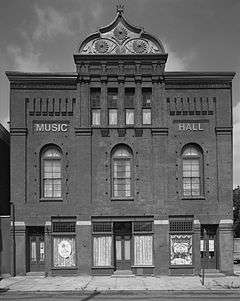
| 53 |
Tacony Music Hall |
|
000000001990-03-09-0000March 9, 1990
(#90000413) |
4815–4819 Longshore Avenue
40°01′29″N 75°02′32″W / 40.0246°N 75.0421°W / 40.0246; -75.0421 (Tacony Music Hall) |
Tacony |
|
| 54 |
Times Finishing Works |
|
000000002016-07-05-0000July 5, 2016
(#16000428) |
1136-1148 N. American St.
39°58′07″N 75°08′27″W / 39.968700°N 75.140696°W / 39.968700; -75.140696 (Times Finishing Works) |
|
|
| 55 |
Francis E. Willard School |
|
000000001986-12-04-0000December 4, 1986
(#86003346) |
Emerald and Orleans Streets
39°59′30″N 75°07′01″W / 39.9917°N 75.1169°W / 39.9917; -75.1169 (Francis E. Willard School) |
Port Richmond |
|
| 56 |
David Wilmot School |
|
000000001988-11-18-0000November 18, 1988
(#88002289) |
1734 Meadow Street
40°00′50″N 75°04′51″W / 40.0138°N 75.0808°W / 40.0138; -75.0808 (David Wilmot School) |
Frankford |
|
| 57 |
Woodrow Wilson Junior High School |
|
000000001986-12-04-0000December 4, 1986
(#86003347) |
Cottman Avenue and Loretto Street
40°03′09″N 75°04′08″W / 40.0524°N 75.069°W / 40.0524; -75.069 (Woodrow Wilson Junior High School) |
Castor Gardens[4] |
|
