National Register of Historic Places listings in Orleans Parish, Louisiana
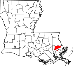
Location of Orleans Parish in Louisiana
This is a list of the National Register of Historic Places listings in Orleans Parish, Louisiana.
This is intended to be a complete list of the properties and districts on the National Register of Historic Places in Orleans Parish, Louisiana, United States, which is consolidated with the city of New Orleans. The locations of National Register properties and districts for which the latitude and longitude coordinates are included below, may be seen in a map.[1]
There are 167 properties and districts listed on the National Register in the parish, including 25 National Historic Landmarks. Three properties were once listed, but have since been removed.
- This National Park Service list is complete through NPS recent listings posted December 16, 2016.[2]
Current listings
| [3] | Name on the Register[4] | Image | Date listed[5] | Location | Description |
|---|---|---|---|---|---|
| 1 | Aldrich-Genella House |  |
(#80001742) |
4801 St. Charles Avenue 29°55′35″N 90°06′24″W / 29.926389°N 90.106667°W |
|
| 2 | Algiers Point |  |
(#78001428) |
Bounded by the Mississippi River, Slidell St., and Atlantic Ave.; also roughly bounded by Slidell, Brooklyn, Atlantic, Newton, and Homer Sts. 29°57′05″N 90°03′02″W / 29.951389°N 90.050556°W |
Second set of boundaries represents a boundary increase of March 17, 2011 |
| 3 | American Chicle Company Building |  |
(#98001176) |
8311 Fig St. 29°57′43″N 90°07′03″W / 29.961944°N 90.1175°W |
|
| 4 | Arabella Station |  |
(#95001484) |
5600 Magazine Street 29°55′14″N 90°07′03″W / 29.920556°N 90.1175°W |
Formerly a 19th-century streetcar barn; now redeveloped and housing a grocery market. |
| 5 | Bank of Louisiana | 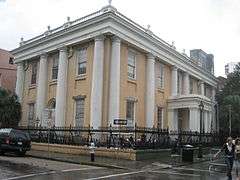 |
(#73000870) |
334 Royal Street 29°57′21″N 90°04′00″W / 29.955833°N 90.066667°W |
|
| 6 | Bank of New Orleans (BNO) Building | Upload image | (#16000712) |
1010 Common St. 29°57′14″N 90°04′24″W / 29.953895°N 90.073461°W |
|
| 7 | Gen. Beauregard Equestrian Statue | 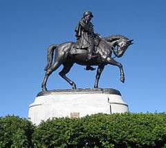 |
(#99000233) |
Junction of Esplanade Ave. and Wisner Boulevard 29°59′02″N 90°05′23″W / 29.983889°N 90.089722°W |
Equestrian statue of P. G. T. Beauregard by Alexander Doyle |
| 8 | Big Oak-Little Oak Islands | Upload image | (#71000357) |
Within marshes along the shoreline of Lake Pontchartrain, northeast of central New Orleans[6] 30°04′28″N 89°53′49″W / 30.074444°N 89.896944°W |
Pre-Columbian habitation sites |
| 9 | Blue Plate Building | 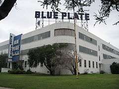 |
(#08000989) |
1315 S. Jefferson Davis Parkway 29°57′27″N 90°06′20″W / 29.957444°N 90.1055°W |
Art Deco factory building |
| 10 | Bohn Motor Company Automobile Dealership |  |
(#10001193) |
2700 South Broad 29°57′03″N 90°05′59″W / 29.950833°N 90.099722°W |
|
| 11 | Bristow Tower | Upload image | (#15001001) |
4537 Magnolia St. 29°56′14″N 90°06′16″W / 29.937094°N 90.104383°W |
|
| 12 | Broadmoor Historic District |  |
(#03000519) |
Roughly bounded by South Broad/Fountainebleau, Milan, S. Claiborne, and Octavia; also roughly bounded by Walmsley, S. White, Eden, and S. Jefferson Davis Parkway 29°56′48″N 90°06′22″W / 29.946667°N 90.106111°W |
Second set of boundaries represents a boundary increase of September 13, 2007 |
| 13 | Building at 225 Baronne Street |  |
(#13000694) |
225 Baronne St. 29°57′10″N 90°04′20″W / 29.952742°N 90.072312°W |
|
| 14 | Buildings at 445-447-449 South Rampart |  |
(#07000857) |
445-447-449 S. Rampart Street 29°57′02″N 90°04′30″W / 29.950556°N 90.075°W |
|
| 15 | Bullitt-Longenecker House |  |
(#81000296) |
3627 Carondelet Street 29°55′42″N 90°05′42″W / 29.928333°N 90.095°W |
|
| 16 | Bywater Historic District |  |
(#86000113) |
Roughly bounded by N. Claiborne Avenue and Urquhart St., Kentucky St., the Mississippi River, and Montegut and Press Sts. 29°58′00″N 90°02′17″W / 29.966667°N 90.038056°W |
|
| 17 | The Cabildo | 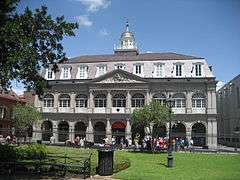 |
(#66000373) |
701 Chartres St. 29°57′26″N 90°03′51″W / 29.957222°N 90.064167°W |
Late 18th-century building on Jackson Square; city hall from the colonial era through early 19th century; now one of the properties of the Louisiana State Museum. |
| 18 | George Washington Cable House | 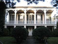 |
(#66000374) |
1313 8th St. 29°55′35″N 90°05′14″W / 29.926389°N 90.087222°W |
Garden District cottage, the home of writer George Washington Cable between 1874 and 1884 |
| 19 | Carrollton Historic District | 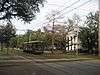 |
(#87001893) |
Roughly bounded by Lowerline St., the Mississippi River, Monticello Ave., and Earhart Boulevard; also bounded by Claiborne, National Octavia, Grape, and Lowerline 29°57′08″N 90°07′38″W / 29.952222°N 90.127222°W |
Second set of boundaries represents a boundary increase of September 6, 2007 |
| 20 | Carver Theater | 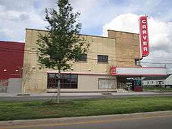 |
(#98001078) |
2101 Orleans Avenue 29°58′00″N 90°04′36″W / 29.966667°N 90.076667°W |
|
| 21 | Central City Historic District | 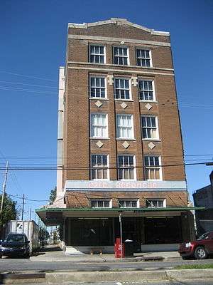 |
(#82002783) |
Roughly bounded by Pontchartrain Expressway and Louisiana, St. Charles, and Claiborne Aves. 29°56′20″N 90°05′10″W / 29.938889°N 90.086111°W |
|
| 22 | Charity Hospital of New Orleans | 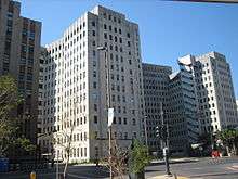 |
(#10001173) |
1532 Tulane Ave. 29°57′19″N 90°04′41″W / 29.955278°N 90.078056°W |
|
| 23 | Confederate Memorial Hall | 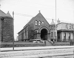 |
(#75000852) |
929 Camp St. 29°56′36″N 90°04′53″W / 29.943333°N 90.081389°W |
|
| 24 | Congo Square | 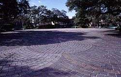 |
(#92001763) |
Junction of Rampart and St. Peter Streets 29°57′39″N 90°04′06″W / 29.960833°N 90.068333°W |
Gathering place for African-American music and dance since colonial era; now within Louis Armstrong Park |
| 25 | Criminal Courts Building | 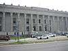 |
(#84001337) |
2700 Tulane Ave. 29°57′41″N 90°05′37″W / 29.961389°N 90.093611°W |
|
| 26 | Nathaniel C. & Frances Curtis, Jr., House |  |
(#14000311) |
6161 Marquette Pl. 29°56′00″N 90°07′06″W / 29.9332°N 90.1184°W |
|
| 27 | Guy J. and Rose Caruso D'Antonio House | Upload image | (#16000710) |
2621 O'Reilly St. 29°58′58″N 90°04′23″W / 29.982912°N 90.073002°W |
|
| 28 | DELTA QUEEN (Steamboat) | 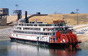 |
(#70000495) |
30 Robin Street Wharf 29°56′03″N 90°03′39″W / 29.934167°N 90.060833°W |
|
| 29 | DELUGE | 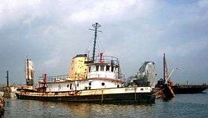 |
(#89001427) |
Mississippi River north of Canal St. Algiers Ferry 29°57′20″N 90°03′18″W / 29.955556°N 90.055°W |
|
| 30 | Dillard University | 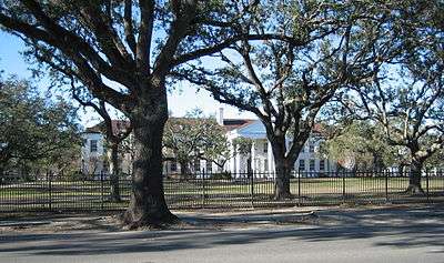 |
(#03000202) |
2601 Gentilly Boulevard 29°59′50″N 90°03′56″W / 29.997222°N 90.065556°W |
Historically black university, named for James Hardy Dillard |
| 31 | James H. Dillard House |  |
(#74000929) |
571 Audubon St. 29°56′07″N 90°07′34″W / 29.935278°N 90.126111°W |
|
| 32 | Eagle Saloon Building |  |
(#02001160) |
401-403 South Rampart Street 29°57′05″N 90°04′30″W / 29.951389°N 90.075°W |
Key venue in the early development of jazz in the late 19th and early 20th centuries |
| 33 | Edgewood Park Historic District |  |
(#14000690) |
Roughly bounded by Peoples & Humanity Sts., Gentilly Blvd., Peoples Ave. & Fairmont Dr. 29°59′48″N 90°03′10″W / 29.9968°N 90.0529°W |
|
| 34 | Esplanade Ridge Historic District |  |
(#80001743) |
U.S. Route 90 29°58′34″N 90°04′42″W / 29.976111°N 90.078333°W |
The Faubourg St. John area was settled in 1708 as Port Bayou Saint-Jean ten years before the city of New Orleans was founded. |
| 35 | Factors Row and Thiberge Buildings |  |
(#83000529) |
401-405 Carondelet and 802-830 Perdido St. 29°57′02″N 90°04′19″W / 29.950556°N 90.071944°W |
|
| 36 | Faubourg Marigny |  |
(#74000930) |
Roughly bounded by the Mississippi River, Esplanade Avenue, Marias St., and Montegut St. 29°57′55″N 90°03′20″W / 29.965278°N 90.055556°W |
Neighborhood established by Bernard de Marigny in the early 1800s, site of the former Marigny plantation just below the Vieux Carré |
| 37 | Federal Fibre Mills Building | 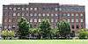 |
(#83004190) |
1101 S. Peters St. 29°56′25″N 90°03′58″W / 29.940278°N 90.066111°W |
|
| 38 | Flint-Goodridge Hospital of Dillard University |  |
(#88003139) |
Louisiana Ave. and LaSalle St. 29°56′10″N 90°05′41″W / 29.936111°N 90.094722°W |
African-American hospital in Jim Crow Law era |
| 39 | Fort Macomb |  |
(#78001429) |
East of central New Orleans at Chef Menteur Pass on U.S. Route 90 30°03′51″N 89°48′15″W / 30.064167°N 89.804167°W |
Early 19th-century brick fortress |
| 40 | Fort Pike | 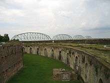 |
(#72000557) |
North of central New Orleans off U.S. Route 90, E. 30°09′58″N 89°44′13″W / 30.166111°N 89.736944°W |
Early 19th-century brick fortress |
| 41 | Fort St. John | 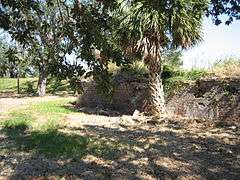 |
(#83000530) |
Bayou St. John off Robert E. Lee Boulevard 30°01′20″N 90°05′00″W / 30.022222°N 90.083333°W |
Colonial-era fort, later amusement park; also known as "Old Spanish Fort" |
| 42 | Fourth Church of Christ, Scientist | 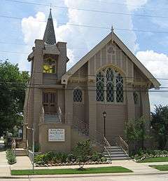 |
(#02000782) |
134 Polk Ave. 30°00′05″N 90°06′51″W / 30.001389°N 90.114167°W |
|
| 43 | William Frantz Elementary School | 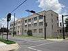 |
(#05000557) |
3811 N. Galvez St. 29°58′35″N 90°01′59″W / 29.976389°N 90.033056°W |
1937 public school building which was the site of racial desegregation protests in 1960, when Ruby Bridges was enrolled here |
| 44 | French Market-Old Vegetable Market | 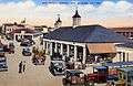 |
(#72000558) |
1000 Decatur Street 29°57′33″N 90°03′37″W / 29.959167°N 90.060278°W |
Historic building of the French Market complex |
| 45 | Gallier Hall | 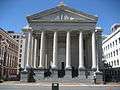 |
(#74002250) |
545 St. Charles Ave. 29°56′47″N 90°04′17″W / 29.946389°N 90.071389°W |
Former City Hall |
| 46 | Gallier House | 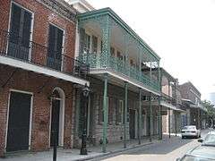 |
(#74000932) |
1132 Royal Street 29°57′41″N 90°03′41″W / 29.961389°N 90.061389°W |
Built by architect James Gallier, Jr., in 1857 for his own family residence, now operated as a historic house museum. |
| 47 | Garden District |  |
(#71000358) |
Bounded by Carondelet, Josephine, and Magazine Streets, and Louisiana Ave. 29°55′45″N 90°05′02″W / 29.929167°N 90.083889°W |
|
| 48 | Gem Theater | Upload image | (#15001002) |
3940 Thalia St. 29°57′08″N 90°05′51″W / 29.952325°N 90.097388°W |
|
| 49 | Mary Louise Kennedy Genella House |  |
(#82000446) |
5022-5028 Prytania St. 29°55′28″N 90°06′34″W / 29.924444°N 90.109444°W |
|
| 50 | General Laundry Building | 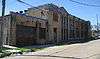 |
(#74000933) |
2512 St. Peter St. 29°58′05″N 90°04′53″W / 29.968056°N 90.081389°W |
Aztec Revival Deco commercial building |
| 51 | Gentilly Terrace Historic District | 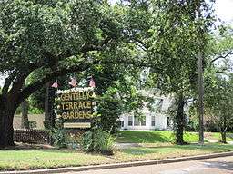 |
(#99001358) |
Roughly bounded by Spain, Mirabeau, Eastern, and Gentilly Boulevard 30°00′18″N 90°03′05″W / 30.005°N 90.051389°W |
|
| 52 | Nicholas Girod House | 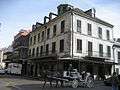 |
(#70000254) |
500 Chartres St. 29°57′21″N 90°03′54″W / 29.955833°N 90.065°W |
Originally constructed in 1797, by 1821 it was owned by former Mayor Nicolas Girod, a wealthy French American who refurbished it in preparation for a rescue of Napoleon from his exile. Word was received of Napoleon's death — the building is commonly known as the Napoleon House. Since 1914 has functioned as the Napoleon House Restaurant. |
| 53 | The Governor House Motor Hotel | Upload image | (#16000298) |
1630 Canal St. 29°57′31″N 90°04′39″W / 29.958664°N 90.077373°W |
|
| 54 | Grant-Black House |  |
(#79001074) |
3932 St. Charles Ave. 29°55′35″N 90°05′50″W / 29.926389°N 90.097222°W |
|
| 55 | Greenville Hall |  |
(#77000673) |
7214 St. Charles Ave. 29°56′13″N 90°07′39″W / 29.936944°N 90.1275°W |
Formerly part of Dominican College campus, now part of Loyola University New Orleans |
| 56 | Hart House | 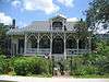 |
(#84001339) |
2108 Palmer Ave. 29°56′13″N 90°07′06″W / 29.936944°N 90.118333°W |
|
| 57 | Lafcadio Hearn House |  |
(#06000324) |
1565-67 Cleveland Ave. 29°57′34″N 90°04′39″W / 29.959444°N 90.0775°W |
Former residence of writer Lafcadio Hearn |
| 58 | Hennen Building | 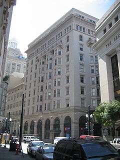 |
(#86002104) |
203 Carondelet 29°57′09″N 90°04′17″W / 29.9525°N 90.071389°W |
Hennen Building, also known as Latter & Blum Building, Maritime Building; early high-rise from 1895 |
| 59 | Hermann-Grima House | 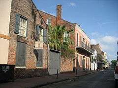 |
(#71000359) |
818-820 St. Louis St. 29°57′26″N 90°04′04″W / 29.957222°N 90.067778°W |
Early example (1831) of American architecture in the French Quarter, operated as an historic house museum. Has the only extant horse stable and open-hearth kitchen. |
| 60 | Simon Hernsheim House | 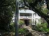 |
(#82002784) |
3811 St. Charles Ave. 29°55′38″N 90°05′46″W / 29.927222°N 90.096111°W |
Now houses the Columns Hotel |
| 61 | Holy Cross Historic District | 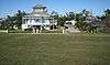 |
(#86002105) |
Roughly bounded by Burgundy and Dauphine Sts., Delery St., the Mississippi River, and the Industrial Canal 29°57′26″N 90°01′08″W / 29.957222°N 90.018889°W |
|
| 62 | Howard Memorial Library | 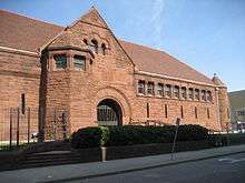 |
(#91000343) |
615 Howard Ave. 29°56′34″N 90°04′17″W / 29.942778°N 90.071389°W |
|
| 63 | Iberville Public Housing Development Historic District | 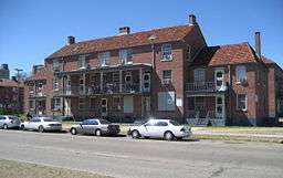 |
(#14000692) |
401 Treme St. 29°57′34″N 90°04′25″W / 29.959444°N 90.073611°W |
|
| 64 | International Trade Mart | 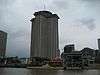 |
(#13001127) |
2 Canal Street 29°56′56″N 90°03′48″W / 29.948976°N 90.063355°W |
|
| 65 | Irish Channel Area Architectural District | 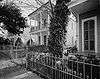 |
(#76000967) |
Roughly bounded by Jackson Ave., Aline and Magazine Sts., and the Mississippi River 29°55′20″N 90°04′51″W / 29.922222°N 90.080833°W |
|
| 66 | Iroquois Theater |  |
(#02001161) |
413-415 S. Rampart St. 29°57′09″N 90°04′30″W / 29.9525°N 90.075°W |
|
| 67 | Isaacs-Williams Mansion |  |
(#76000968) |
5120 St. Charles Ave. 29°55′35″N 90°06′38″W / 29.926389°N 90.110556°W |
Milton Latter Memorial Library |
| 68 | Jackson Barracks |  |
(#76000969) |
6400 St. Claude Avenue 29°57′04″N 90°00′37″W / 29.951111°N 90.010278°W |
|
| 69 | Jackson Square | 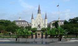 |
(#66000375) |
Bounded by Decatur, St. Peter, St. Ann, and Chartres Sts. 29°57′26″N 90°03′47″W / 29.957222°N 90.063056°W |
Central square of the Vieux Carré, historically called the Place d'Armes (Plaza de Armas). Redesigned as a public park and renamed in the mid-19th century, by Micaela Almonester, Baroness de Pontalba. |
| 70 | Henry Jones Cottage | Upload image | (#15000696) |
2409-2411 D'Abadie St. 29°58′45″N 90°04′18″W / 29.9793°N 90.0716°W |
|
| 71 | Julia Street Row | 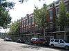 |
(#77000674) |
602-646 Julia St. 29°56′43″N 90°04′16″W / 29.945278°N 90.071111°W |
Intact block-long row of matching, early 19th-century brick townhouses |
| 72 | Jung Hotel | 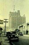 |
(#82002785) |
1500 Canal St. 29°57′25″N 90°04′34″W / 29.956944°N 90.076111°W |
|
| 73 | Karnofsky Tailor Shop-House | 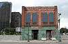 |
(#02001162) |
427-431 S. Rampart St. 29°57′02″N 90°04′30″W / 29.950556°N 90.075°W |
Karnofsky family active in early promotion of jazz; location of early employment of young Louis Armstrong |
| 74 | Lafayette Cemetery No. 1 | 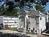 |
(#72000559) |
1400 Washington Ave. 29°55′43″N 90°05′07″W / 29.928611°N 90.085278°W |
|
| 75 | Lafitte Avenue Project Buildings C-47, E-45 and No. 46 | Upload image | (#15001003) |
Corner of Lafitte Ave. & N. Johnson St. 29°57′56″N 90°04′40″W / 29.965510°N 90.077743°W |
|
| 76 | Lafitte's Blacksmith Shop | 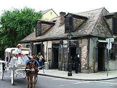 |
(#70000255) |
941 Bourbon Street 29°57′39″N 90°03′50″W / 29.960833°N 90.063889°W |
Late 18th-century Creole cottage, became a bar in the 20th century. |
| 77 | LeBeuf Plantation House | Upload image | (#93000694) |
101 Carmick, US Naval Support Activity 29°56′56″N 90°01′50″W / 29.948889°N 90.030556°W |
|
| 78 | LeCarpentier-Beauregard-Keyes House | 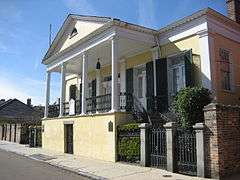 |
(#75000853) |
1113 Chartres St. 29°57′39″N 90°03′40″W / 29.960833°N 90.061111°W |
Former residence of General P.G.T. Beauregard and author Frances Parkinson Keyes |
| 79 | Robert E. Lee Monument | 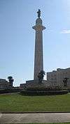 |
(#91000254) |
Lee Cir., in the 900-1000 blocks of St. Charles Ave. 29°56′35″N 90°04′20″W / 29.943056°N 90.072222°W |
Monument in Lee Circle commemorates Robert E. Lee. Erected in 1884; statue by Alexander Doyle. |
| 80 | Leeds Iron Foundry | 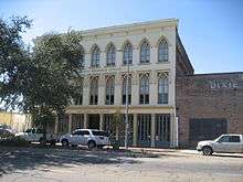 |
(#76000970) |
923 Tchoupitoulas Street 29°56′33″N 90°04′05″W / 29.9425°N 90.068056°W |
Gothic revival commercial building with many links to New Orleans history; now houses the Preservation Resource Center. |
| 81 | Huey P. Long Mansion | 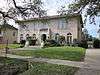 |
(#80001744) |
14 Audubon Boulevard 29°56′35″N 90°07′11″W / 29.943056°N 90.119722°W |
Former residence of Governor Huey P. Long |
| 82 | Longue Vue House and Gardens | 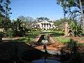 |
(#91001419) |
7 Bamboo Road 29°58′36″N 90°07′23″W / 29.976667°N 90.123056°W |
Early 20th-century city estate and gardens, open to the public |
| 83 | Louisiana State Bank Building | .jpg) |
(#83004387) |
403-409 Royal Street 29°57′20″N 90°04′01″W / 29.955556°N 90.066944°W |
|
| 84 | Louisiana Superdome | 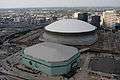 |
(#15001004) |
1500 Sugar Bowl Dr. 29°57′03″N 90°04′54″W / 29.950888°N 90.081763°W |
|
| 85 | Lowe-Forman House | 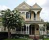 |
(#82002786) |
5301 Camp St. 29°55′18″N 90°06′47″W / 29.921667°N 90.113056°W |
|
| 86 | Lower Garden District |  |
(#72000560) |
Roughly bounded by St. Charles Ave., Jackson St., the Mississippi River, and Annunciation and Race Sts.; also roughly the southern side of St. Charles Ave. between U.S. Route 90 and Josephine St. and two parcels on the southern side of Annunciation St. 29°55′55″N 90°04′15″W / 29.931944°N 90.070833°W |
Second set of boundaries represents a boundary increase of July 26, 1990 |
| 87 | Lykes Brothers Steamship Company Historic District | |
(#11000804) |
1770, 1744-46 Tchoupitoulas Street 29°55′39″N 90°04′00″W / 29.9275°N 90.066667°W |
|
| 88 | Macheca Building |  |
(#83000531) |
828 Canal St. 29°57′14″N 90°04′15″W / 29.953889°N 90.070833°W |
|
| 89 | Madame John's Legacy |  |
(#70000256) |
632 Dumaine St. 29°57′32″N 90°03′46″W / 29.958889°N 90.062778°W |
Late 18th-century French Colonial house, rare architectural example which escaped the Great Fires of 1788 and 1794; operated by the Louisiana State Museum. Name is from a story by George Washington Cable. |
| 90 | Magnolia Street Housing Project |  |
(#99001038) |
Roughly bounded by Washington Ave., La Salle St., Louisiana Ave., and Magnolia St. 29°56′16″N 90°05′34″W / 29.937778°N 90.092778°W |
|
| 91 | Maylie's Restaurant |  |
(#98000577) |
1007-09 Poydras St. 29°57′02″N 90°04′28″W / 29.950556°N 90.074444°W |
|
| 92 | McDonogh School No. 6 | 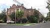 |
(#82000447) |
4849 Chestnut St. 29°55′22″N 90°06′27″W / 29.922778°N 90.1075°W |
|
| 93 | McDonogh 19 Elementary School | Upload image | (#16000672) |
5909 St. Claude Ave. 29°57′38″N 90°00′46″W / 29.960521°N 90.012640°W |
|
| 94 | Merieult House | 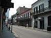 |
(#72000561) |
533 Royal Street 29°57′24″N 90°03′57″W / 29.956667°N 90.065833°W |
|
| 95 | Metairie Cemetery |  |
(#91001780) |
Junction of Interstate 10 and Metairie Road 29°58′54″N 90°07′05″W / 29.981667°N 90.118056°W |
|
| 96 | Adolph Meyer School |  |
(#15001013) |
2013 General Meyer Ave. 29°56′41″N 90°02′10″W / 29.944692°N 90.036204°W |
|
| 97 | Mid-City Historic District | 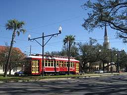 |
(#93001394) |
Roughly bounded by Derbigny St., Conti St., City Park Ave., and Interstate 10; also roughly bounded by City Park Ave., St. Louis St., Claiborne Ave., and Interstate 10 29°58′08″N 90°05′45″W / 29.968889°N 90.095833°W |
Second set of boundaries represents a significant boundary adjustment of December 15, 2011 |
| 98 | Napoleon Street Branch Library | 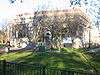 |
(#79001075) |
Napoleon St. 29°55′16″N 90°06′04″W / 29.921111°N 90.101111°W |
|
| 99 | National American Bank Building | 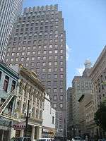 |
(#86001048) |
200 Carondelet Street 29°57′08″N 90°04′14″W / 29.952222°N 90.070556°W |
|
| 100 | New Marigny Historic District | 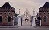 |
(#94001170) |
Roughly bounded by St. Claude, St. Bernard, Tonti, and St. Ferdinand Sts. and Interstate 10 29°58′27″N 90°03′17″W / 29.974167°N 90.054722°W |
|
| 101 | New Orleans City Park Carousel and Pavilion | 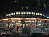 |
(#86000254) |
City Park, off City Park Ave. 29°59′15″N 90°05′57″W / 29.9875°N 90.099167°W |
|
| 102 | New Orleans Cotton Exchange Building | 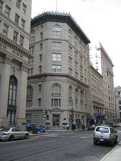 |
(#77000675) |
231 Carondelet Street 29°57′07″N 90°04′17″W / 29.951944°N 90.071389°W |
|
| 103 | New Orleans Federal Savings and Loan Building | Upload image | (#15000346) |
4948 Chef Menteur Hwy. 30°00′14″N 90°02′20″W / 30.0040°N 90.039°W |
|
| 104 | New Orleans Jazz National Historical Park | 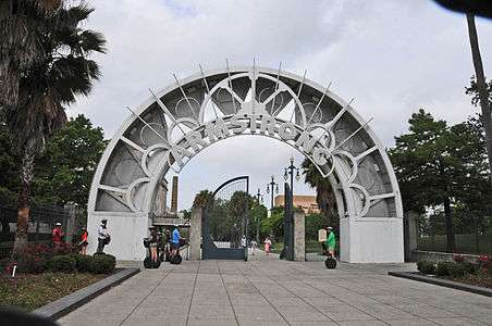 |
(#01000277) |
365 Canal St. 29°57′45″N 90°04′02″W / 29.962389°N 90.067222°W |
|
| 105 | New Orleans Lower Central Business District |  |
(#91000825) |
Roughly bounded by Canal, Tchoupitoulas, Poydras, O'Keefe, Common, and S. Saratoga; also approximately Rampart, Tulane, Loyola, Gravier, O'Keefe, and Common; also 234 and 222 Loyola and 1100 Tulane Aves., 300, 306, 308, 310, and 314 Rampart, 1111 and 935 Gravier, and 1010 Common Sts. 29°57′08″N 90°04′17″W / 29.952222°N 90.071389°W |
Second and third sets of boundaries represent boundary increases of February 9, 2006 and January 20, 2015 respectively |
| 106 | Newberger House |  |
(#84001340) |
1640 Palmer Ave. 29°55′58″N 90°07′11″W / 29.932778°N 90.119722°W |
|
| 107 | Odd Fellows Rest Cemetery | 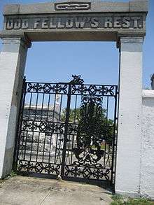 |
(#80001745) |
Canal St. and City Park Ave. 29°58′53″N 90°06′39″W / 29.981389°N 90.110833°W |
|
| 108 | ODECO Building | Upload image | (#16000300) |
1600 Canal St. 29°57′30″N 90°04′38″W / 29.958427°N 90.077109°W |
|
| 109 | Oil and Gas Building | 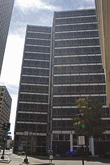 |
(#13001143) |
1100 Tulane Ave. 29°57′14″N 90°04′27″W / 29.953893°N 90.074256°W |
|
| 110 | Old Handleman Building |  |
(#80001746) |
1824-1832 Dryades St. (Oretha Castle Haley Boulevard) 29°56′18″N 90°04′51″W / 29.938333°N 90.080833°W |
|
| 111 | Old Meat Market-Halle des Boucheries |  |
(#72000562) |
800 Decatur Street 29°56′22″N 90°03′44″W / 29.939444°N 90.062222°W |
Historic building of French Market complex |
| 112 | Old Ursuline Convent | 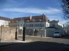 |
(#66000376) |
1114 Chartres St. 29°57′37″N 90°03′39″W / 29.960278°N 90.060833°W |
Colonial-era convent complex, later Archbishop's Palace |
| 113 | Orpheum Theatre |  |
(#82002787) |
125-129 University Pl. 29°57′16″N 90°04′21″W / 29.954444°N 90.0725°W |
|
| 114 | Pan-American Life Insurance Company Building | 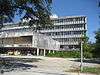 |
(#07000982) |
2400 Canal St. 29°57′52″N 90°05′06″W / 29.964444°N 90.085°W |
|
| 115 | Park View Guest House | 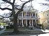 |
(#82000448) |
7004 St. Charles Avenue 29°56′08″N 90°07′33″W / 29.935556°N 90.125833°W |
|
| 116 | Parkview Historic District |  |
(#95000675) |
Roughly bounded by City Park Ave., Bayou St. John, Orleans, Rocheblave, Lafitte, and St. Louis 29°58′40″N 90°05′33″W / 29.977778°N 90.0925°W |
|
| 117 | Perseverance Hall | 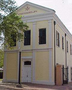 |
(#73000871) |
901 St. Claude Ave. 29°57′46″N 90°04′04″W / 29.962778°N 90.067778°W |
|
| 118 | Pessou House |  |
(#82002788) |
6018 Benjamin St. 29°55′47″N 90°07′09″W / 29.929722°N 90.119167°W |
|
| 119 | Pitot House |  |
(#71000360) |
1440 Moss St. 29°58′54″N 90°05′21″W / 29.981667°N 90.089167°W |
Late 18th-century house; one of the owners was Mayor James Pitot. Open to the public and home to the Louisiana Landmarks Society. |
| 120 | Plaza Tower | 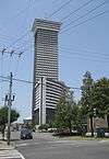 |
(#12001241) |
1001 Howard Ave. 29°56′47″N 90°04′34″W / 29.946373°N 90.076219°W |
|
| 121 | Pontalba Buildings | 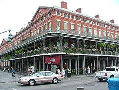 |
(#74000934) |
500 St. Ann St. and 500 St. Peter St. 29°57′27″N 90°03′46″W / 29.9575°N 90.062778°W |
c. 1850 matching townhouse buildings with first-floor retail shops; on either side of Jackson Square, constructed by New Orleans native Micaela Almonester, Baroness de Pontalba |
| 122 | The Presbytere |  |
(#70000257) |
751 Chartres St. 29°57′29″N 90°03′50″W / 29.958056°N 90.063889°W |
Colonial-era Roman Catholic headquarters for the Louisiana colony; now a property of the Louisiana State Museum, on Jackson Square |
| 123 | Jean Louis Rabassa House | 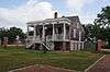 |
(#74000935) |
1125 St. Ann St. 29°57′42″N 90°04′04″W / 29.961667°N 90.067778°W |
|
| 124 | The Rault Center | Upload image | (#14001171) |
1111 Gravier St. 29°57′12″N 90°04′28″W / 29.9532°N 90.0744°W |
|
| 125 | Rice House |  |
(#78001430) |
3643 Camp St. 29°55′21″N 90°05′44″W / 29.9225°N 90.095556°W |
|
| 126 | Saenger Theatre | 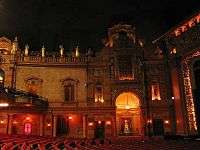 |
(#77000676) |
1111 Canal Street; also 1101-1111 Canal St. 29°57′21″N 90°04′22″W / 29.955833°N 90.072778°W |
Second set of boundaries represents a boundary increase of April 1, 1985 |
| 127 | St. Alphonsus Church | 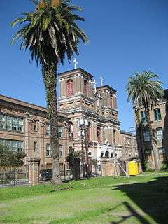 |
(#73000872) |
2029 Constance St. 29°55′50″N 90°04′25″W / 29.930556°N 90.073611°W |
|
| 128 | St. Bernard Market | 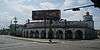 |
(#12000498) |
1522 St. Bernard Ave. 29°58′20″N 90°03′56″W / 29.972188°N 90.065535°W |
|
| 129 | St. Charles Streetcar Line | 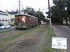 |
(#73000873) |
St. Charles Avenue route from downtown to Carrollton; also St. Charles Ave., Carondelet St., Canal St., Howard Ave., Lee Cir., Carrollton Ave., Willow St., and Jeanette St. 29°56′27″N 90°06′08″W / 29.940833°N 90.102222°W |
Second set of boundaries represent National Historic Landmark designation and boundary increase of August 25, 2014, "The St. Charles Line" |
| 130 | St. James AME Church |  |
(#82000449) |
222 N. Roman St. 29°57′39″N 90°04′43″W / 29.960833°N 90.078611°W |
|
| 131 | St. Louis Cemetery No. 1 | 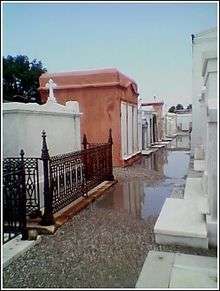 |
(#75000855) |
Bounded by Basin, St. Louis, Conti, and Tremé Sts. 29°57′25″N 90°04′34″W / 29.956944°N 90.076111°W |
|
| 132 | St. Louis Cemetery No. 2 | 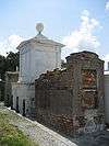 |
(#75000856) |
Bounded by Claiborne, Robertson, St. Louis, and Iberville St. 29°57′38″N 90°04′32″W / 29.960556°N 90.075556°W |
|
| 133 | St. Mary's Assumption Church | 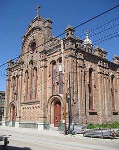 |
(#71000361) |
2030 Constance St. 29°55′45″N 90°04′29″W / 29.929167°N 90.074722°W |
|
| 134 | St. Patrick's Church | 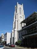 |
(#74000936) |
724 Camp St. 29°56′48″N 90°04′11″W / 29.946667°N 90.069722°W |
|
| 135 | St. Peter A.M.E. Church | 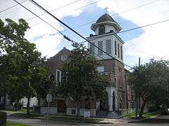 |
(#79001077) |
1201 Cadiz St. 29°55′24″N 90°06′14″W / 29.923333°N 90.103889°W |
|
| 136 | St. Vincent De Paul Roman Catholic Church | 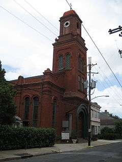 |
(#76000971) |
3051 Dauphine St. 29°57′52″N 90°02′46″W / 29.964444°N 90.046111°W |
|
| 137 | Jean Marie Saux Building | 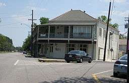 |
(#83000532) |
900 City Park Ave. 29°58′59″N 90°05′51″W / 29.983056°N 90.0975°W |
|
| 138 | Schwegmann Bros. Giant Supermarket No. 1 |  |
(#14000314) |
222 St. Claude Ave. 29°58′06″N 90°03′22″W / 29.968454°N 90.056001°W |
|
| 139 | Shell Building | 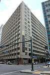 |
(#02000039) |
925 Common St. 29°57′20″N 90°04′23″W / 29.955556°N 90.073056°W |
|
| 140 | Louis Sincer House | 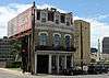 |
(#78001431) |
1061 Camp St. 29°56′30″N 90°04′19″W / 29.941667°N 90.071944°W |
|
| 141 | Sister Stanislaus Memorial Building |  |
(#03001233) |
450 S. Claiborne Ave. 29°57′18″N 90°04′50″W / 29.955°N 90.080556°W |
|
| 142 | Sommerville-Kearney House |  |
(#78003449) |
1401 Delachaise St. 29°55′31″N 90°05′28″W / 29.925278°N 90.091111°W |
|
| 143 | South Lakeview Historic District | 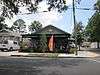 |
(#02000465) |
Bounded roughly by Navarre St., Gen. Diaz, Weiblen, and Hawthorne Pl. 29°59′23″N 90°06′33″W / 29.989722°N 90.109167°W |
|
| 144 | Southern Railway Freight Office | 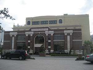 |
(#04001338) |
1201 St. Louis St. 29°57′34″N 90°04′14″W / 29.959444°N 90.070556°W |
Also known as "Basin Street Station" |
| 145 | Standard Coffee Company Warehouse and Factory | Upload image | (#15000697) |
450 Mandeville St. 29°57′45″N 90°03′14″W / 29.9624°N 90.0539°W |
|
| 146 | Straight University Boarding House and Dining Hall | 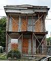 |
(#11000074) |
1423 N. Claiborne Avenue 29°58′12″N 90°04′07″W / 29.97°N 90.068611°W |
|
| 147 | TECUMSEH (towboat) | Upload image | (#96000202) |
Toulouse Street Wharf 29°57′16″N 90°03′43″W / 29.954444°N 90.061944°W |
|
| 148 | Tewell House |  |
(#78001432) |
1503 Valence St. 29°55′31″N 90°06′20″W / 29.925278°N 90.105556°W |
|
| 149 | Texaco Building | 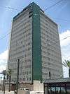 |
(#06000715) |
1501 Canal Street 29°57′35″N 90°04′30″W / 29.959722°N 90.075°W |
|
| 150 | Treme Market | Upload image | (#16000711) |
1508 Orleans Ave. 29°57′51″N 90°04′22″W / 29.964194°N 90.072834°W |
|
| 151 | Tulane University of Louisiana | 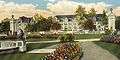 |
(#78001433) |
St. Charles Avenue, South Claiborne, Broadway, and Calhoun Sts. 29°56′19″N 90°07′18″W / 29.938611°N 90.121667°W |
Private, nonsectarian research university; founded in 1834 as a medical college and later renamed for Paul Tulane, merged with Sophie Newcomb College. |
| 152 | A.P. Tureaud, Sr. House | 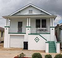 |
(#06000742) |
3121 Pauger St. 29°59′01″N 90°03′41″W / 29.983611°N 90.061389°W |
|
| 153 | Turner's Hall | 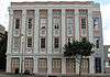 |
(#82000450) |
606 O'Keefe St. 29°56′55″N 90°04′28″W / 29.948611°N 90.074444°W |
|
| 154 | Turpin-Kofler-Buja House | 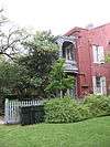 |
(#73000874) |
2319 Magazine St. 29°55′43″N 90°04′42″W / 29.928611°N 90.078333°W |
|
| 155 | U.S. Court of Appeals-Fifth Circuit | 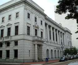 |
(#74000937) |
600 Camp St. 29°56′52″N 90°04′45″W / 29.947778°N 90.079167°W |
1909 Art Nouveau courthouse and former post office; many key civil rights cases heard and decided here in mid-20th century |
| 156 | U.S. Customhouse | 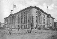 |
(#74000938) |
423 Canal Street 29°57′06″N 90°03′58″W / 29.951667°N 90.066111°W |
Egyptian Revival Federal Building, now houses the Audubon Insectorium. Constructed between 1848 and 1881, due to design changes and the interruption of the Civil War. |
| 157 | U.S. Mint, New Orleans Branch | 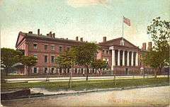 |
(#73000875) |
420 Esplanade Avenue 29°57′40″N 90°03′29″W / 29.961111°N 90.058056°W |
Built in 1835, former branch U.S. Mint and briefly a C.S.A. mint. Decommissioned in 1911, the building is now one of the Louisiana State Museum's French Quarter properties. |
| 158 | U.S. Naval Station Algiers Historic District | Upload image | (#13000695) |
Roughly bounded by Mississippi R. levee, Heerman, Constitution & Carmick Sts. 29°56′57″N 90°01′58″W / 29.949208°N 90.032916°W |
|
| 159 | Union Bethel A.M.E. Church | 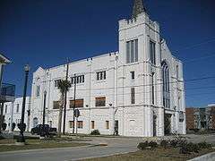 |
(#07001003) |
2321 Thalia 29°56′38″N 90°04′57″W / 29.943889°N 90.0825°W |
|
| 160 | Upper Central Business District | 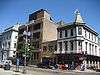 |
(#90001231) |
Roughly bounded by O'Keefe, Poydras, Convention Center Boulevard, the Expressway (U.S. Route 90 Business), and Howard Ave; also the junction of Howard and St. Charles Aves. and along O'Keefe Ave. and Poydras St.; also roughly bounded by O'Keefe, Poydras, Convention Center Boulevard, U.S. Route 90, and Howard Ave. 29°56′40″N 90°04′09″W / 29.944444°N 90.069167°W |
Second and third sets of boundaries represent boundary increases of August 12, 1993 and August 6, 2008 respectively |
| 161 | Uptown New Orleans Historic District | 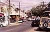 |
(#85001417) |
Roughly bounded by Louisiana, Claiborne, Lowerline, and the Mississippi River 29°55′42″N 90°06′49″W / 29.928333°N 90.113611°W |
|
| 162 | U.S. Army Supply Base New Orleans | 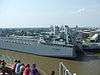 |
(#15001014) |
4400 Dauphine St. 29°57′41″N 90°01′55″W / 29.961432°N 90.031822°W |
|
| 163 | Vieux Carre Historic District | 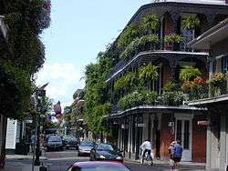 |
(#66000377) |
Bounded by the Mississippi River, Rampart and Canal Sts., and Esplanade Ave. 29°57′26″N 90°03′50″W / 29.957222°N 90.063889°W |
Original city as designed by French colonial officials in the early 18th century |
| 164 | Walker House |  |
(#86001057) |
1912 St. Charles Ave. 29°56′07″N 90°04′41″W / 29.935278°N 90.078056°W |
|
| 165 | Booker T. Washington High School and Auditorium |  |
(#02000803) |
1201 S. Roman 29°57′05″N 90°05′20″W / 29.951389°N 90.088889°W |
|
| 166 | Whitney National Bank (Poydras Branch) |  |
(#85000093) |
Poydras and Camp Sts. 29°56′59″N 90°04′11″W / 29.949722°N 90.069722°W |
|
| 167 | Xavier University Main Building, Convent and Library |  |
(#04000114) |
1 Drexel Dr. 29°57′57″N 90°06′26″W / 29.965833°N 90.107222°W |
Former listing
| [3] | Name on the Register | Image | Date listed | Date removed | Location | Summary |
|---|---|---|---|---|---|---|
| 1 | New Canal Lighthouse | 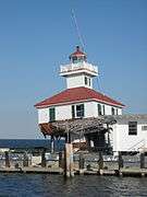 |
(#85003186) | West End Boulevard and Lakeshore Dr. 30°01′36″N 90°06′47″W / 30.0267°N 90.1131°W |
Built in 1890/1901, it was seriously damaged in 2005 by Hurricanes Katrina and Rita. However, the old lighthouse has been reconstructed, as of 2013. | |
| 2 | Canal Station |  |
(#92001873) | 2819 Canal St. 29°58′16″N 90°05′34″W / 29.971111°N 90.092778°W |
Streetcar and bus barn and repair facility | |
| 3 | USS CABOT (CVL-28) | .jpg) |
(#90000334) | Foot of Jackson St. 29°55′21″N 90°04′12″W / 29.9225°N 90.07°W |
Aircraft carrier which has been scrapped and no longer exists |
See also
| Wikimedia Commons has media related to National Register of Historic Places in Orleans Parish, Louisiana. |
- History of New Orleans
- Buildings and architecture of New Orleans
- List of National Historic Landmarks in Louisiana
- National Register of Historic Places listings in Louisiana
References
- ↑ The latitude and longitude information provided in this table was derived originally from the National Register Information System, which has been found to be fairly accurate for about 99% of listings. For about 1% of NRIS original coordinates, experience has shown that one or both coordinates are typos or otherwise extremely far off; some corrections may have been made. A more subtle problem causes many locations to be off by up to 150 yards, depending on location in the country: most NRIS coordinates were derived from tracing out latitude and longitudes off of USGS topographical quadrant maps created under the North American Datum of 1927, which differs from the current, highly accurate WGS84 GPS system used by most on-line maps. Chicago is about right, but NRIS longitudes in Washington are higher by about 4.5 seconds, and are lower by about 2.0 seconds in Maine. Latitudes differ by about 1.0 second in Florida. Some locations in this table may have been corrected to current GPS standards.
- ↑ "National Register of Historic Places: Weekly List Actions". National Park Service, United States Department of the Interior. Retrieved on December 16, 2016.
- 1 2 Numbers represent an ordering by significant words. Various colorings, defined here, differentiate National Historic Landmarks and historic districts from other NRHP buildings, structures, sites or objects.
- ↑ National Park Service (2009-03-13). "National Register Information System". National Register of Historic Places. National Park Service.
- ↑ The eight-digit number below each date is the number assigned to each location in the National Register Information System database, which can be viewed by clicking the number.
- ↑ Location derived from the GNIS feature record for Big Oak Island; the NRIS lists the site as "Address Restricted"
| Topics | |
|---|---|
| Lists by states |
|
| Lists by insular areas | |
| Lists by associated states | |
| Other areas | |
| |
This article is issued from Wikipedia - version of the 10/25/2016. The text is available under the Creative Commons Attribution/Share Alike but additional terms may apply for the media files.