New Melle, Missouri
| New Melle, Missouri | |
|---|---|
| City | |
 Location of New Melle, Missouri | |
| Coordinates: 38°42′37″N 90°52′49″W / 38.71028°N 90.88028°WCoordinates: 38°42′37″N 90°52′49″W / 38.71028°N 90.88028°W | |
| Country | United States |
| State | Missouri |
| County | St. Charles |
| Area[1] | |
| • Total | 1.61 sq mi (4.17 km2) |
| • Land | 1.57 sq mi (4.07 km2) |
| • Water | 0.04 sq mi (0.10 km2) |
| Elevation | 771 ft (235 m) |
| Population (2010)[2] | |
| • Total | 475 |
| • Estimate (2012[3]) | 477 |
| • Density | 302.5/sq mi (116.8/km2) |
| Time zone | Central (CST) (UTC-6) |
| • Summer (DST) | CDT (UTC-5) |
| FIPS code | 29-52148[4] |
| GNIS feature ID | 0756443[5] |
New Melle is a small country community in St. Charles County, Missouri, United States. It is located about 37 miles west of St. Louis. The population was 475 at the 2010 census.
History

New Melle was founded by settlers from Melle, Germany.[6]

Geography
New Melle is located at 38°42′37″N 90°52′49″W / 38.71028°N 90.88028°W (38.710216, -90.880393).[7]
According to the United States Census Bureau, the city has a total area of 1.61 square miles (4.17 km2), of which, 1.57 square miles (4.07 km2) is land and 0.04 square miles (0.10 km2) is water.[1]
Demographics
| Historical population | |||
|---|---|---|---|
| Census | Pop. | %± | |
| 1880 | 264 | — | |
| 1980 | 168 | — | |
| 1990 | 486 | 189.3% | |
| 2000 | 124 | −74.5% | |
| 2010 | 475 | 283.1% | |
| Est. 2015 | 494 | [8] | 4.0% |
New Melle is in the Francis Howell School District. Elementary school students attend Daniel Boone Elementary, middle school students attend Francis Howell Middle School, and high school students attend Francis Howell High School.
2010 census
As of the census[2] of 2010, there were 475 people, 179 households, and 143 families residing in the city. The population density was 302.5 inhabitants per square mile (116.8/km2). There were 195 housing units at an average density of 124.2 per square mile (48.0/km2). The racial makeup of the city was 97.3% White, 0.6% African American, 0.8% Asian, 0.2% Pacific Islander, and 1.1% from other races. Hispanic or Latino of any race were 2.3% of the population.
There were 179 households of which 30.2% had children under the age of 18 living with them, 74.3% were married couples living together, 2.8% had a female householder with no husband present, 2.8% had a male householder with no wife present, and 20.1% were non-families. 17.3% of all households were made up of individuals and 10.6% had someone living alone who was 65 years of age or older. The average household size was 2.65 and the average family size was 3.01.
The median age in the city was 47.1 years. 23.2% of residents were under the age of 18; 4.1% were between the ages of 18 and 24; 20.1% were from 25 to 44; 30.1% were from 45 to 64; and 22.3% were 65 years of age or older. The gender makeup of the city was 48.6% male and 51.4% female.
2000 census
As of the census[4] of 2000, there were 124 people, 44 households, and 35 families residing in the city. The population density was 349.8 people per square mile (136.8/km²). There were 49 housing units at an average density of 138.2 per square mile (54.1/km²). The racial makeup of the city was 98.39% White and 1.61% African American.
There were 44 households out of which 31.8% had children under the age of 18 living with them, 72.7% were married couples living together, 9.1% had a female householder with no husband present, and 18.2% were non-families. 15.9% of all households were made up of individuals and 9.1% had someone living alone who was 65 years of age or older. The average household size was 2.82 and the average family size was 3.17.
In the city the population was spread out with 25.8% under the age of 18, 4.0% from 18 to 24, 26.6% from 25 to 44, 31.5% from 45 to 64, and 12.1% who were 65 years of age or older. The median age was 41 years. For every 100 females there were 93.8 males. For every 100 females age 18 and over, there were 80.4 males.
The median income for a household in the city was $55,417, and the median income for a family was $67,917. Males had a median income of $51,250 versus. $24,167 for females. The per capita income for the city was $29,965. There were no families and 3.1% of the population living below the poverty line, including no under eighteens and none of those over 64.
References
- 1 2 "US Gazetteer files 2010". United States Census Bureau. Retrieved 2012-07-08.
- 1 2 "American FactFinder". United States Census Bureau. Retrieved 2012-07-08.
- ↑ "Population Estimates". United States Census Bureau. Retrieved 2013-05-30.
- 1 2 "American FactFinder". United States Census Bureau. Retrieved 2008-01-31.
- ↑ "US Board on Geographic Names". United States Geological Survey. 2007-10-25. Retrieved 2008-01-31.
- ↑ Eaton, David Wolfe (1918). How Missouri Counties, Towns and Streams Were Named. The State Historical Society of Missouri. p. 356.
- ↑ "US Gazetteer files: 2010, 2000, and 1990". United States Census Bureau. 2011-02-12. Retrieved 2011-04-23.
- ↑ "Annual Estimates of the Resident Population for Incorporated Places: April 1, 2010 to July 1, 2015". Retrieved July 2, 2016.
- ↑ "Census of Population and Housing". Census.gov. Retrieved June 4, 2015.
External links
Municipalities and communities of St. Charles County, Missouri, United States | ||
|---|---|---|
| Cities | 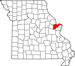 | |
| Villages | ||
| Townships |
| |
| CDP | ||
| Other unincorporated communities |
| |
| Ghost towns |
| |
| Footnotes | ‡This populated place also has portions in an adjacent county or counties | |