St. Charles, Missouri
| St. Charles, Missouri | |
|---|---|
|
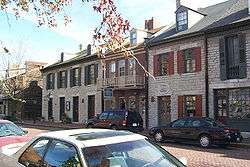
Historic Main Street | |
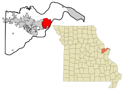 Location in the state of Missouri | |
| Country | United States |
| State | Missouri |
| County | St. Charles |
| Government | |
| • Mayor | Sally Faith |
| Area[1] | |
| • Total | 24.03 sq mi (62.24 km2) |
| • Land | 23.65 sq mi (61.25 km2) |
| • Water | 0.38 sq mi (0.98 km2) |
| Population (2010)[2] | |
| • Total | 65,794 |
| • Estimate (2012[3]) | 66,463 |
| • Density | 2,782.0/sq mi (1,074.1/km2) |
| Time zone | CST (UTC-6) |
| • Summer (DST) | CDT (UTC-5) |
| Area code(s) | 636, 314 |
| Website |
www |
St. Charles is a city in, and the county seat of, St. Charles County, Missouri, United States.[4] The population was 65,794 at the 2010 census, making St. Charles the ninth-largest city in Missouri. It lies to the northwest of St. Louis, Missouri on the Missouri River.
Founded in about 1769 as Les Petites Côtes, or "The Little Hills" in French, by Louis Blanchette, a French-Canadian fur trader,[5] when the area was nominally ruled by Spain following the Seven Years' War, it is the third-oldest city in Missouri. For a time, it played a significant role in the United States' westward expansion.
It was settled primarily by French-speaking colonists from Canada in its early days and was considered the last "civilized" stop by the Lewis and Clark Expedition in 1804, which was exploring the western territory after the United States made the Louisiana Purchase.[6] The city served as the first Missouri capital from 1821 to 1826,[7] and is the site of the Saint Rose Philippine Duchesne shrine.[8]
History
Native American cultures inhabited the area for at least 7,000 years. When the Europeans arrived the area was inhabited by the Ilini, Osage and Missouri nations.
According to Hopewell's Romantic Legends of the Missouri and Mississippi: Blanchette met another French Canadian (Bernard Guillet) at the site of St. Charles in 1765. Blanchette, determined to settle there, asked if Guillet, who had become a chief of a Dakota tribe, had chosen a name for it.
- "I called the place 'Les Petites Côtes' " replied Bernard, "from the sides of the hills that you see."
- "By that name shall it be called", said Blanchette Chasseur, "for it is the echo of nature — beautiful from its simplicity."
Blanchette settled there in about 1769 under the authority of the Spanish governor of Upper Louisiana (the area had been ceded by France to Spain under an agreement with Great Britain following French defeat in the French and Indian Wars). He was appointed as the territory's civil and military leader, serving until his death in 1793. Although the settlement was under Spanish jurisdiction, the settlers were primarily Native American and French Canadians who had migrated from northern territories.
Considered to begin in St. Charles, the Boone's Lick Trail along the Missouri River lowlands was the major overland route for settlement of central and western Missouri. This area became known as the Boonslick or "Boonslick Country." At Franklin, Missouri, the trail ended. Westward progress continued on the Santa Fe Trail.
San Carlos Borromeo
The first church, built in 1791, was Catholic and dedicated to the Italian saint Charles Borromeo, under the Spanish version of his name, San Carlos Borromeo. The town became known as San Carlos del Misuri: "St. Charles of the Missouri". The original location of the church is not known but a replica has been built just off Main Street. The fourth St. Charles Borromeo Church now stands on Fifth Street.
The Spanish Lieutenant-Governor Carlos de Hault de Lassus appointed Daniel Boone as commandant of the Femme Osage District, which he served as until the United States government assumed control in 1804 following the Louisiana Purchase. The name of the town, San Carlos, was anglicized to St. Charles. William Clark arrived in St. Charles on May 16, 1804. With him were 40 men and three boats; they made final preparations, as they waited for Meriwether Lewis to arrive from St. Louis. They attended dances, dinners, and a church service during this time, and the town residents, excited to be part of the national expedition, were very hospitable to the explorers. Lewis arrived via St. Charles Rock Road on May 20. The expedition launched the next day in a keel boat at 3:30 pm. St. Charles was the last established American town the expedition visited for more than two and a half years.
State capital and growth
When Missouri was granted statehood in 1821, the legislature decided to build a "City of Jefferson" to serve as the state capital, in the center of the state, overlooking the Missouri River. Since this land was undeveloped at the time, a temporary capital was needed. St. Charles beat eight other cities in a competition to house the temporary capital, offering free meeting space for the legislature in rooms located above a hardware store. This building is preserved as the First Missouri State Capitol State Historic Site and may be toured. The Missouri government continued to meet there until Jefferson City was ready in 1826.
Gottfried Duden was a German who visited in the area in 1824. Travelling under the guidance of Daniel M. Boone, he wrote extensive accounts of life in St. Charles County during his year there. He published these after returning to Germany in 1829, and his favorable impressions of the area led to the immigration of a number of Germans in 1833. The first permanent German settler in the region was probably Louis Eversman, who arrived with Duden but decided to stay. St. Charles, Missouri, is where the first claimed interstate project started in 1956. A state highway marker is displayed with a logo and information regarding this claim, off Interstate 70 going westbound, to the right of the First Capitol Drive exit. Kansas and Pennsylvania also lay claim to the first interstate project.
Government
St. Charles is a charter city under the Missouri Constitution, with a City Council as the governing body, consisting of one member for each of the ten wards, each serving a three-year term.[9] The executive head of the City government is the Mayor for all legal and ceremonial purposes. The Mayor appoints the members of the various Boards, Commissions, and Committees created by ordinance. The current mayor is Sally Faith; she was sworn in on April 19, 2011.[10]
| Ward | City Council Member |
|---|---|
| 1 | Mary Ann Ohms |
| 2 | Tom Besselman |
| 3 | Laurie Feldman |
| 4 | Mary West |
| 5 | Michael Weller |
| 6 | Jerry Reese |
| 7 | Dave Beckering |
| 8 | Rod Hermann |
| 9 | Ron Stivison |
| 10 | Bridget Ohmes |
Education
The City of St. Charles school district has five elementary schools, two middle schools, two high schools, and the Lewis & Clark Tech Building located on Zumbehl Road. St. Charles High School (sometimes called SCHS or simply "High") was the first built of the two high schools. St. Charles West (SCW or simply "West") was added in the late 1970s in response to the city's growing population. St. Charles West had its first graduation in 1979. St. Charles High School underwent renovation in 1995 to improve both the exterior and interior of the building, as did St. Charles West in 2005, in which a new library and auxiliary gym were built. The city is also served by Jefferson Intermediate, which has all 5th and 6th grade classes, and Hardin Middle School, which has all 7th and 8th grade classes.
St. Charles is the location of a variety of private schools, including Immanuel Lutheran (Pre-K to 8), Zion Lutheran (Pre-K to 8), St. Charles Borromeo, St. Peter's, St. Cletus (K-8), Academy of the Sacred Heart (founded by Saint Rose Philippine Duchesne, and the site of her shrine), Duchesne High School (formerly named St. Peter High school), and St. Elizabeth Ann Seton-St. Robert Bellarmine (K-8).
Other schools are associated with the Francis Howell and the Orchard Farm school districts, which also serve parts of St. Charles. Many students who live on the southern edge of St. Charles City attend Henderson, Becky David and Harvest Ridge elementary schools, Barnwell Middle, and Francis Howell North High School. The Orchard Farm School District, to the North, also serves St. Charles but is based outside the city, like Francis Howell School District, it has two elementary schools, a middle school, and a high school.
Lindenwood University is located on Kingshighway, near downtown St. Charles and St. Charles High. Founded by Major George Sibley and his wife Mary in 1827 as a women's school named Lindenwood School For Girls, the institution is the second-oldest higher-education institution west of the Mississippi River.[11] The university is a private university affiliated with the Presbyterian Church. LU is one of the fastest-growing universities in the Midwest and enrolls close to 15,000 students. In 2006 it briefly attracted publicity when People for the Ethical Treatment of Animals staged a small protest against its unusual tuition fee policies.[12] Lindenwood hosts 89.1 The Wood (KCLC), a commercial-free student-driven radio station.
St. Charles was also home to the now defunct St. Charles College (Missouri) (which should not be confused with St. Charles Community College),[13] and Vatterott College.[14]
Economy
According to the City's 2009 Comprehensive Annual Financial Report,[15] the top employers in the city are:
| # | Employer | # of Employees |
|---|---|---|
| 1 | Ameristar Casinos | 1,315 |
| 2 | SSM St. Joseph Health Center | 1,063 |
| 3 | St. Charles County | 1,291 |
| 4 | Boeing | 992 |
| 5 | Client Services Inc. | 960 |
| 6 | City of St. Charles School District | 728 |
| 7 | Lindenwood University | 600 |
| 8 | AT&T Missouri | 500 |
| 9 | Coca-Cola Refreshments | 480 |
| 10 | City of St. Charles | 456 |
Leading Contract Research Organization and Biotechnology Corporation Pharma Medica opened its first US location in St. Charles in 2013 and began operating clinical trials in February 2014, with the intent to create 320 high tech jobs by early 2017.
Recreation and development
St. Charles lies near the eastern end of the Katy Trail, a 225-mile (362 km) long state park enjoyed by bikers and walkers which was adapted from railroad right-of-way. Since the late 1970s, there has been healthy new home construction, commercial growth and explosive population growth in the St. Charles area. The phrase "Golden Triangle" was coined for this area in the Eighties, referring to the rate of real estate development in the St. Charles County region bordered by highways Interstate 70, Interstate 64, and Route 94.
St. Charles has a historic shopping district on Main street with numerous restored buildings housing restaurants and various specialty stores. It offers most standard living features (with the exception of a public golf course) usually found in a community of its size. The city also has many special events and features related to the Lewis and Clark Expedition. In 2007, St. Charles welcomed men's professional road bicycle racing riders and fans as it served as the stage 5 final for the 2007 Tour of Missouri.
As of 2015, walking food tours down Main Street can be taken through the company Dishing Up America. These tours take customers to the locally famous restaurants in the city.
A new feature (opened November 2006) of the St. Charles Parks and Recreation System is a dog park on the north side of town as a part of DuSable Park-Bales Area. This off-leash dog area has two sections- one for smaller dogs, one for larger.
The St. Charles Convention Center brings visitors to town. The Family Arena, a city-owned 11,000-seat venue, was built in 1999 near the Missouri River; it is used by minor league sports franchises and hosts events.
Sports
The city has been home to several minor league sports teams. The Missouri River Otters hockey team of the United Hockey League, played from 1999 until the team folded in 2006. The River Otters played at the 11,000-seat Family Arena owned by the city of St. Charles.[16] The St. Louis Ambush is a professional indoor soccer team that plays in the Family Arena. The RiverCity Rage professional indoor football team played in St. Charles from 2001 until 2005, and from 2007 to 2009 before suspending operations for 2010. Since 2014 there is a new minor league soccer team in town, the St. Louis Ambush at the Family Arena.[17][18]
| Team | Sport | League | Established | Venue | Championships |
|---|---|---|---|---|---|
| River City Raiders | Indoor football | Champions Indoor Football | 2013 | Family Arena | |
| St. Louis Ambush | Indoor soccer | MISL/PASL | 2013 | Family Arena | |
| St Louis RiverSharks | Basketball | MPBA | 2015 | Family Arena | |
| Gateway Steam | Basketball | MPBA | 2015 | Family Arena |
Riverfront St. Charles
The Riverfront and Main Street area in the St. Charles Historic District is a central gathering place and focal point for the community. The primary features of the riverfront and Historic Main Street are residences and businesses. Each block features shops, restaurants, and offices frequented by visitors and locals. Much is planned for the development and improvement of the area, including a northward extension of the Katy Trail, residential and commercial development, parking garage expansion, casino expansion, and development of hotels.
The "Christmas Traditions Festival", one of the nation's largest Christmas festivals, takes place on the streets of St. Charles annually. It starts the day after Thanksgiving and continues until the Saturday after Christmas. Over 30 costumed Legends of Christmas stroll the streets and interact with guests, while Victorian Era Christmas Carolers fill the air with old-fashioned carols. Every Saturday and Sunday, the Legends of Christmas and the Lewis & Clark Fife and Drum Corps take part in the Santa Parade as it heads up Historic South Main Street to the site of the First Missouri State Capitol.
On the Fourth of July fireworks displays draw large numbers on two nights, July 4 and another night before or after the Fourth. Many bring blankets to sit near the riverfront. Others opt to view the festivities from the Old Courthouse. The festival, named Riverfest, has been sponsored by the city of St. Charles and organized by a volunteer committee formed of city residents and sponsoring private organization (like the Jaycees) leaders.
The Festival of the Little Hills is a historic St. Charles tradition that takes place every year in August, the third full weekend of the month. Started in 1971, this festival is known nationally as one of the top ten craft fairs.[19] It runs through an entire weekend featuring great food, live entertainment, craft sales, and shows for kids. The festival is related to the famous Lewis & Clark expedition: many participants don clothing from the era and re-enact historic events. The city also encourages individuals to bring homemade crafts, jewelry, paintings, clothing and other items to sell at the festival.
Oktoberfest, held near the river, celebrates the historic German influence on the city. Many vendors sell beer and other German goods. It includes a parade. Missouri Tartan Day is a celebration of Scottish American Heritage and Culture held each Spring, coinciding as closely as possible with April 6. This is the anniversary of the signing of the Declaration of Arbroath in 1320. The Founding Fathers are said to have drawn from this document in drafting the our own Constitution. The event features a parade with marching bagpipers from around the World and region, Scottish heavy athletics (caber toss, hammer throw, etc.), musical entertainment, traditional and contemporary foods and lots of fun. Highlights include the Kirkin' o' the Tartans (ceremony of blessing for the Scottish clans), displays of traditional Scottish clan Tartans, and demonstrations of traditional Scottish activities and games.
The Fete de Glace is an ice carving competition and demonstration held on North Main Street in mid-January. The Missouri River Irish Festival is held every September in Frontier Park and on Main Street to celebrate Irish Heritage with music, dancing, storytelling, athletics, food, and fun.[20] During Quilts on Main Street, hundreds of quilts are displayed outside the shops on storefronts and balconies. This event is held annually in September. The Bluegrass Festival in Frontier Park on the big stage of Jaycee's pavilion is held early in September every year, featuring local and regional acts.
Sister cities
 - Ludwigsburg, Baden-Württemberg, Germany since 1996
 - Carndonagh, County Donegal, Ulster, Ireland since 2012
Transportation
According to the Federal Highway Administration, St. Charles was the site of the first interstate highway project in the nation.[21] Major highways include Interstate 70, Interstate 64, Missouri 370, Missouri 94, and Missouri 364. Also see: St. Charles Area Transit
Geography
St. Charles is located at 38°47′19″N 90°30′42″W / 38.788698°N 90.511764°WCoordinates: 38°47′19″N 90°30′42″W / 38.788698°N 90.511764°W.[22] According to the United States Census Bureau, the city has a total area of 24.03 square miles (62.24 km2), of which, 23.65 square miles (61.25 km2) is land and 0.38 square miles (0.98 km2) is water.[1]
Demographics
| Historical population | |||
|---|---|---|---|
| Census | Pop. | %± | |
| 1850 | 1,498 | — | |
| 1860 | 3,239 | 116.2% | |
| 1870 | 5,570 | 72.0% | |
| 1880 | 5,014 | −10.0% | |
| 1890 | 6,161 | 22.9% | |
| 1900 | 7,982 | 29.6% | |
| 1910 | 9,437 | 18.2% | |
| 1920 | 8,503 | −9.9% | |
| 1930 | 10,491 | 23.4% | |
| 1940 | 10,803 | 3.0% | |
| 1950 | 14,314 | 32.5% | |
| 1960 | 21,189 | 48.0% | |
| 1970 | 31,834 | 50.2% | |
| 1980 | 37,379 | 17.4% | |
| 1990 | 54,555 | 46.0% | |
| 2000 | 60,321 | 10.6% | |
| 2010 | 65,794 | 9.1% | |
| Est. 2015 | 68,796 | [23] | 4.6% |
2010 census
As of the census[2] of 2010, there were 65,794 people, 26,715 households, and 16,128 families residing in the city. The population density was 2,782.0 inhabitants per square mile (1,074.1/km2). There were 28,590 housing units at an average density of 1,208.9 per square mile (466.8/km2). The racial makeup of the city was 87.5% White, 5.9% African American, 0.3% Native American, 2.5% Asian, 0.1% Pacific Islander, 1.8% from other races, and 1.9% from two or more races. Hispanic or Latino of any race were 4.2% of the population.
There were 26,715 households of which 27.5% had children under the age of 18 living with them, 45.4% were married couples living together, 10.8% had a female householder with no husband present, 4.2% had a male householder with no wife present, and 39.6% were non-families. 31.9% of all households were made up of individuals and 10.1% had someone living alone who was 65 years of age or older. The average household size was 2.29 and the average family size was 2.90.
The median age in the city was 36.6 years. 19.7% of residents were under the age of 18; 13.8% were between the ages of 18 and 24; 25.9% were from 25 to 44; 26.6% were from 45 to 64; and 13.9% were 65 years of age or older. The gender makeup of the city was 49.0% male and 51.0% female.
According to 2014 American Community Survey 5-year Estimates the median income for a household in the city was $56,622, and the median income for a family was $73,234. Males had a median income of $51,477 versus $40,311 females. The per capita income for the city was $29,645. 8.8% of families and 11.5% of the population were below the poverty line, including 18.7% of those under age 18 and 6.0% of those age 65 or over.
2000 census
As of the census[25] of 2000, there were 60,321 people, 24,210 households, and 15,324 families residing in the city. The population density was 2,962.4 people per square mile (1,143.9/km²). There were 25,283 housing units at an average density of 1,241.6 per square mile (479.5/km²). The racial makeup of the city was 93.28% White, 3.48% African American, 0.27% Native American, 1.01% Asian, 0.04% Pacific Islander, 0.73% from other races, and 1.19% from two or more races. Hispanic or Latino of any race were 1.97% of the population.
There were 24,210 households out of which 30.1% had children under the age of 18 living with them, 49.4% were married couples living together, 10.2% had a female householder with no husband present, and 36.7% were non-families. 29.6% of all households were made up of individuals and 9.1% had someone living alone who was 65 years of age or older. The average household size was 2.38 and the average family size was 2.98.
In the city the population was spread out with 23.4% under the age of 18, 12.0% from 18 to 24, 30.5% from 25 to 44, 22.0% from 45 to 64, and 12.2% who were 65 years of age or older. The median age was 35 years. For every 100 females there were 96.3 males. For every 100 females age 18 and over, there were 93.7 males.
The median income for a household in the city was $47,782, and the median income for a family was $60,175. Males had a median income of $40,827 versus $27,778 for females. The per capita income for the city was $23,607. About 4.6% of families and 6.3% of the population were below the poverty line, including 8.1% of those under age 18 and 5.9% of those age 65 or over.
Developments
A new residential development is New Town at St. Charles.
Notable people
- Tim Hawkins, comedian
- Brandon Bollig, ice hockey player
- Lou Brock, St. Louis Cardinals Hall of Famer
- Mark Buehrle, Toronto Blue Jays pitcher
- Rose Philippine Duchesne, Catholic saint and founder of Sacred Heart Academy
- Brett Gensler, ice hockey player
- Josh Harrellson, basketball player
- Randy Orton, professional wrestler in WWE
- Jim Pendleton, Milwaukee Braves outfielder
- Mathew Pitsch, Republican member of the Arkansas House of Representatives from Fort Smith since 2015; former resident of St. Charles[26]
- Jean Baptiste Point du Sable, founder of Chicago
- Tim Ream, soccer player, New York Red Bulls and U.S. National Team defender
- Santino Rice, fashion designer and TV personality
- Nathaniel Simonds, State Treasurer of Missouri
- Jacob Turner, Chicago Cubs pitcher
References
- 1 2 "US Gazetteer files 2010". United States Census Bureau. Retrieved 2012-07-08.
- 1 2 "American FactFinder". United States Census Bureau. Retrieved 2012-07-08.
- ↑ "Population Estimates". United States Census Bureau. Retrieved 2013-05-30.
- ↑ "Find a County". National Association of Counties. Retrieved 2011-06-07.
- ↑ "Historic Saint Charles". Greatriverroad.com. Retrieved 2011-08-02.
- ↑ "Timeline". Stcharlescitymo.gov. Retrieved 2011-08-02.
- ↑ "St. Charles: Missouri's First Capitol". Slfp.com. Retrieved 2011-08-02.
- ↑ Shrine of St. Philippine Duchesne, Academy of the Sacred Heart. Retrieved 2009-10-15.
- ↑ http://www.stcharlescitymo.gov/Government/CityCouncil/tabid/147/Default.aspx
- ↑ http://www.stcharlescitymo.gov/Government/Mayor/tabid/157/Default.aspx
- ↑ "Abbeville Institute 2008 Lindenwood Summer School". Abbevilleinstitute.org. Retrieved 2010-07-11.
- ↑ "Dennis Spellmann, 70, President who Remade Struggling College, Dies." New York Times 3 September 2006. Nytimes.com. 25 Jan. 2007 (link).
- ↑ "article mentioning St. Charles College". Libraryindex.com. Retrieved 2011-08-02.
- ↑ "Vatterott College - St. Charles Missouri". Retrieved April 2015. Check date values in:
|access-date=(help) - ↑ City of St. Charles Comprehensive Annual Financial Report
- ↑ "Missouri River Otters of the UHL at". Hockeydb.com. Retrieved 2011-08-02.
- ↑ [stlouisambush.com]
- ↑ "Owner shuts down IFL's River City". Billingsgazette.com. 2009-10-17. Retrieved 2011-08-02.
- ↑ Festival of the Little Hills: Fête des Petites Côtes, Historic St. Charles, Missouri
- ↑ Missouri River Irish Fest
- ↑ "First interstate project". Fhwa.dot.gov. Retrieved 2011-08-02.
- ↑ "US Gazetteer files: 2010, 2000, and 1990". United States Census Bureau. 2011-02-12. Retrieved 2011-04-23.
- ↑ "Annual Estimates of the Resident Population for Incorporated Places: April 1, 2010 to July 1, 2015". Retrieved July 2, 2016.
- ↑ "Census of Population and Housing". Census.gov. Retrieved June 4, 2015.
- ↑ "American FactFinder". United States Census Bureau. Retrieved 2008-01-31.
- ↑ "Mathew W. Pitsch". intelius.com. Retrieved April 9, 2015.
- National Register of Historic Places - Nomination Forms
- "Frenchtown Historic District" (PDF). Missouri Department of Natural Resources. Retrieved 2008-05-30.
- "St. Charles Historic District" (PDF). Missouri Department of Natural Resources. Retrieved 2008-05-30.
- St. Charles Historic District (Boundary Increase #1). #87000903
- "St. Charles Historic District (Boundary Increase #2)" (PDF). Missouri Department of Natural Resources. Retrieved 2008-05-30.
- "St. Charles Historic District (Boundary Increase #3)" (PDF). Missouri Department of Natural Resources. Retrieved 2008-05-30.
External links
- St. Charles City
- Greater St. Charles Convention and Visitors Bureau
- St. Charles City-County Library District
- Greater St. Charles County Chamber of Commerce
- Historic maps of St. Charles in the Sanborn Maps of Missouri Collection at the University of Missouri
Municipalities and communities of St. Charles County, Missouri, United States | ||
|---|---|---|
| Cities | 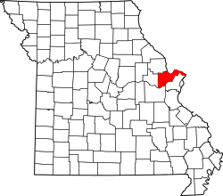 | |
| Villages | ||
| Townships |
| |
| CDP | ||
| Other unincorporated communities |
| |
| Footnotes | ‡This populated place also has portions in an adjacent county or counties | |
| Topics |  | |
|---|---|---|
| Central city | ||
| Largest cities (over 50,000 in 2010) | ||
| Medium-sized cities (over 20,000 in 2010) | ||
| Largest towns and villages (over 10,000 in 2010) |
| |
| Missouri Counties | ||
| Illinois Counties | ||
| Subregions | ||