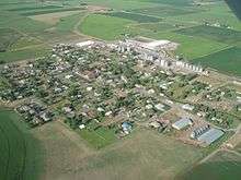
Newdale, Idaho
| Newdale, Idaho | |
|---|---|
| City | |
 Location in Fremont County and the state of Idaho | |
| Coordinates: 43°53′10″N 111°36′13″W / 43.88611°N 111.60361°WCoordinates: 43°53′10″N 111°36′13″W / 43.88611°N 111.60361°W | |
| Country | United States |
| State | Idaho |
| County | Fremont |
| Area[1] | |
| • Total | 0.21 sq mi (0.54 km2) |
| • Land | 0.21 sq mi (0.54 km2) |
| • Water | 0 sq mi (0 km2) |
| Elevation | 5,079 ft (1,548 m) |
| Population (2010)[2] | |
| • Total | 323 |
| • Estimate (2012[3]) | 314 |
| • Density | 1,538.1/sq mi (593.9/km2) |
| Time zone | Mountain (MST) (UTC-7) |
| • Summer (DST) | MDT (UTC-6) |
| ZIP code | 83436 |
| Area code(s) | 208 |
| FIPS code | 16-56800 |
| GNIS feature ID | 0396954 |
Newdale is a city in Fremont County, Idaho, United States. The population was 323 at the 2010 census. It is part of the Rexburg, Idaho Micropolitan Statistical Area.
History
In the early 1900s, there were only a few homes and farms scattered across the vast terrain east of Teton City. Early settlers in this area include the Schwendiman family consisting of 6 brothers and their mother, who relocated from Paris Idaho to Teton Idaho in 1894. The Schwendiman brothers obtained land in 160 acre parcels via one of the Homestead Acts, including the land where the City of Newdale now sits.
In 1912, a school house was built in Bowerman, an area 2 miles east of present-day Newdale, to accommodate approximately 15 school children living in the surrounding area. The school house was also used for LDS Church meetings.
The Oregon Short Line Railroad wanted to expand into this part of the country and on June 27, 1914, purchased a right of way from brothers Sam and Fred Schwendiman to lay tracks for a new branch line. A train depot was built the following year and a community started to grow. The new railroad attracted people to Newdale and in 1914 the Edwin Moroni Stocks family built a house and the Leo Schofeild family built a cabin. Mrs. Hansine C. Hansen was also one of the first people to move in, and had her sons move her house from Teton, perhaps early in 1915.
The town site was surveyed and plotted by engineers in April 2016, using land owned by Samual Schwendiman. In May, several hundred trees were planted throughout the town including many apple trees.
The LDS Newdale Ward was organized on December 17, 1916, with Lester Hanson as the first bishop.
Newdale grew rapidly and by 1919, after being only four years old, it had a national bank, a drug store, a barber shop, a blacksmith, a carpenter shop, a livery stable, several general stores, lumber yards, hardware stores, implement yards, warehouses, grain elevators, commission houses, hotels, restaurants, and even an opera house.
According to railroad shipping records, Newdale was once the 3rd largest grain shipping center in the nation. Shipments between August 1, 1918 and May 31, 1919 totaled 403 train car loads of wheat, 19 barely, 3 oats, 17 peas, 72 beets, 3 potatoes, 3 hay, 68 livestock, and 3 misc produce.
In December 1919, an 8-room, brick school house was completed on a piece of land donated by Sam Schwendiman, where the Newdale City Park is today. This school house was also used for LDS church meetings until a church house was built in 1952.
An agriculture depression in the early 1920s hurt the town, and forced many families to leave Newdale. The Great Depression of the 1930s had similar effects, and many people lost their jobs and homes, and some houses were even physically moved out of Newdale.
Geography
Newdale is located at 43°53′10″N 111°36′13″W / 43.88611°N 111.60361°W (43.886196, -111.603699),[4] one mile below the Teton Dam.
According to the United States Census Bureau, the city has a total area of 0.21 square miles (0.54 km2) (134.4 acres), all of it land.[1]
Demographics
| Historical population | |||
|---|---|---|---|
| Census | Pop. | %± | |
| 1920 | 381 | — | |
| 1930 | 368 | −3.4% | |
| 1940 | 356 | −3.3% | |
| 1950 | 312 | −12.4% | |
| 1960 | 272 | −12.8% | |
| 1970 | 267 | −1.8% | |
| 1980 | 329 | 23.2% | |
| 1990 | 377 | 14.6% | |
| 2000 | 358 | −5.0% | |
| 2010 | 323 | −9.8% | |
| Est. 2015 | 307 | [5] | −5.0% |
2010 census
As of the census[2] of 2010, there were 323 people, 104 households, and 90 families residing in the city. The population density was 1,538.1 inhabitants per square mile (593.9/km2). There were 112 housing units at an average density of 533.3 per square mile (205.9/km2). The racial makeup of the city was 90.7% White, 7.4% from other races, and 1.9% from two or more races. Hispanic or Latino of any race were 12.7% of the population.
There were 104 households of which 41.3% had children under the age of 18 living with them, 78.8% were married couples living together, 3.8% had a female householder with no husband present, 3.8% had a male householder with no wife present, and 13.5% were non-families. 11.5% of all households were made up of individuals and 4.8% had someone living alone who was 65 years of age or older. The average household size was 3.11 and the average family size was 3.38.
The median age in the city was 33.8 years. 31.3% of residents were under the age of 18; 8.6% were between the ages of 18 and 24; 20.5% were from 25 to 44; 24.5% were from 45 to 64; and 15.2% were 65 years of age or older. The gender makeup of the city was 49.8% male and 50.2% female.
2000 census
As of the census[7] of 2000, there were 358 people, 98 households, and 83 families residing in the city. The population density was 1,458.3 people per square mile (552.9/km²). There were 110 housing units at an average density of 448.1 per square mile (169.9/km²). The racial makeup of the city was 85.75% White, 0.28% African American, 13.69% from other races, and 0.28% from two or more races. Hispanic or Latino of any race were 15.92% of the population.
There were 98 households out of which 53.1% had children under the age of 18 living with them, 76.5% were married couples living together, 6.1% had a female householder with no husband present, and 14.3% were non-families. 12.2% of all households were made up of individuals and 7.1% had someone living alone who was 65 years of age or older. The average household size was 3.65 and the average family size was 4.00.
In the city the population was spread out with 41.6% under the age of 18, 7.0% from 18 to 24, 25.4% from 25 to 44, 16.2% from 45 to 64, and 9.8% who were 65 years of age or older. The median age was 26 years. For every 100 females there were 106.9 males. For every 100 females age 18 and over, there were 97.2 males.
The median income for a household in the city was $40,938, and the median income for a family was $41,500. Males had a median income of $35,455 versus $17,500 for females. The per capita income for the city was $12,532. About 11.5% of families and 14.4% of the population were below the poverty line, including 21.3% of those under age 18 and none of those age 65 or over.
References
- 1 2 "US Gazetteer files 2010". United States Census Bureau. Retrieved 2012-12-18.
- 1 2 "American FactFinder". United States Census Bureau. Retrieved 2012-12-18.
- ↑ "Population Estimates". United States Census Bureau. Retrieved 2013-06-03.
- ↑ "US Gazetteer files: 2010, 2000, and 1990". United States Census Bureau. 2011-02-12. Retrieved 2011-04-23.
- ↑ "Annual Estimates of the Resident Population for Incorporated Places: April 1, 2010 to July 1, 2015". Retrieved July 2, 2016.
- ↑ "Census of Population and Housing". Census.gov. Retrieved June 4, 2015.
- ↑ "American FactFinder". United States Census Bureau. Retrieved 2008-01-31.
Municipalities and communities of Fremont County, Idaho, United States | ||
|---|---|---|
| Cities | ||
| Unincorporated communities | ||