Fremont County, Idaho
| Fremont County, Idaho | ||
|---|---|---|
|
| ||
| ||
 Location in the U.S. state of Idaho | ||
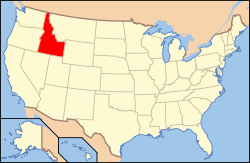 Idaho's location in the U.S. | ||
| Founded | March 4, 1893 | |
| Named for | John C. Frémont | |
| Seat | St. Anthony | |
| Largest city | St. Anthony | |
| Area | ||
| • Total | 1,896 sq mi (4,911 km2) | |
| • Land | 1,864 sq mi (4,828 km2) | |
| • Water | 32 sq mi (83 km2), 1.7% | |
| Population | ||
| • (2010) | 13,242 | |
| • Density | 7.1/sq mi (3/km²) | |
| Congressional district | 2nd | |
| Time zone | Mountain: UTC-7/-6 | |
| Website |
www | |

Fremont County is a county located in the U.S. state of Idaho. As of the 2010 census the county had a population of 13,242.[1] The county seat and largest city is St. Anthony.[2] The county was established in 1893, and was named for the explorer John C. Frémont.[3]
Fremont County is part of the Rexburg, ID Micropolitan Statistical Area, which is also included in the Idaho Falls-Rexburg-Blackfoot, ID Combined Statistical Area.
History
Fremont County was established in 1893.[3] It is named for John C. Frémont.[4]
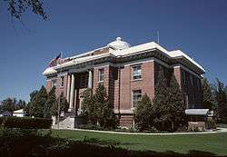
The Fremont County Courthouse in St. Anthony is on the National Register of Historic Places.[5]
Geography
According to the U.S. Census Bureau, the county has a total area of 1,896 square miles (4,910 km2), of which 1,864 square miles (4,830 km2) is land and 32 square miles (83 km2) (1.7%) is water.[6] The southern part of the county cover the northeast tip of the Snake River Basin, with the mountains of the continental divide forming its northern boundary. Montana lies to the north, and Wyoming to the east. A portion of Yellowstone National Park reaches into the county.
Adjacent Counties
- Clark County - west
- Jefferson County - southwest
- Madison County - south
- Teton County - south
- Teton County, Wyoming - east
- Gallatin County, Montana - north
- Madison County, Montana - north
- Beaverhead County, Montana - northwest
Fremont County is one of the few US counties to border two counties of the same name in different states. Fremont County borders two such pairs of counties-- Madison County, Idaho and Madison County, Montana and Teton County, Idaho and Teton County, Wyoming.
Major highways
National protected areas
- Caribou-Targhee National Forest (part)
- Yellowstone National Park (part)
Demographics
| Historical population | |||
|---|---|---|---|
| Census | Pop. | %± | |
| 1900 | 12,821 | — | |
| 1910 | 24,606 | 91.9% | |
| 1920 | 10,380 | −57.8% | |
| 1930 | 9,924 | −4.4% | |
| 1940 | 10,304 | 3.8% | |
| 1950 | 9,351 | −9.2% | |
| 1960 | 8,679 | −7.2% | |
| 1970 | 8,710 | 0.4% | |
| 1980 | 10,813 | 24.1% | |
| 1990 | 10,937 | 1.1% | |
| 2000 | 11,819 | 8.1% | |
| 2010 | 13,242 | 12.0% | |
| Est. 2015 | 12,819 | [7] | −3.2% |
| U.S. Decennial Census[8] 1790-1960[9] 1900-1990[10] 1990-2000[11] 2010-2013[1] | |||
2000 census
As of the census[12] of 2000, there were 11,819 people, 3,885 households, and 3,030 families residing in the county. The population density was 6 people per square mile (2/km²). There were 6,890 housing units at an average density of 4 per square mile (1/km²). The racial makeup of the county was 91.41% White, 0.16% Black or African American, 0.51% Native American, 0.36% Asian, 0.06% Pacific Islander, 5.94% from other races, and 1.56% from two or more races. 10.62% of the population were Hispanic or Latino of any race. 25.1% were of English, 15.1% German and 14.8% American ancestry according to Census 2000. Those citing "American" ancestry in Fremont County are of overwhelmingly English extraction, however most English Americans identify simply as having American ancestry because their roots have been in North America for so long, in some cases since the 1600s.[13][14][15][16][17]
There were 3,885 households out of which 39.50% had children under the age of 18 living with them, 67.90% were married couples living together, 6.90% had a female householder with no husband present, and 22.00% were non-families. 19.50% of all households were made up of individuals and 8.50% had someone living alone who was 65 years of age or older. The average household size was 2.96 and the average family size was 3.43.
In the county the population was spread out with 33.10% under the age of 18, 9.30% from 18 to 24, 24.70% from 25 to 44, 20.40% from 45 to 64, and 12.40% who were 65 years of age or older. The median age was 32 years. For every 100 females there were 105.80 males. For every 100 females age 18 and over, there were 105.80 males.
The median income for a household in the county was $33,424, and the median income for a family was $36,715. Males had a median income of $26,490 versus $19,670 for females. The per capita income for the county was $13,965. About 10.30% of families and 14.20% of the population were below the poverty line, including 18.40% of those under age 18 and 13.60% of those age 65 or over.
2010 census
As of the 2010 United States Census, there were 13,242 people, 4,436 households, and 3,436 families residing in the county.[18] The population density was 7.1 inhabitants per square mile (2.7/km2). There were 8,531 housing units at an average density of 4.6 per square mile (1.8/km2).[19] The racial makeup of the county was 89.5% white, 0.7% American Indian, 0.3% black or African American, 0.2% Asian, 0.1% Pacific islander, 7.6% from other races, and 1.5% from two or more races. Those of Hispanic or Latino origin made up 12.8% of the population.[18] In terms of ancestry, 29.9% were English, 22.7% were German, 7.6% were Irish, 6.1% were American, 5.7% were Scottish, and 5.1% were Danish.[20]
Of the 4,436 households, 38.7% had children under the age of 18 living with them, 65.9% were married couples living together, 7.2% had a female householder with no husband present, 22.5% were non-families, and 19.7% of all households were made up of individuals. The average household size was 2.88 and the average family size was 3.32. The median age was 33.5 years.[18]
The median income for a household in the county was $42,523 and the median income for a family was $52,510. Males had a median income of $35,907 versus $24,450 for females. The per capita income for the county was $18,616. About 6.8% of families and 8.5% of the population were below the poverty line, including 9.3% of those under age 18 and 9.7% of those age 65 or over.[21]
Government and infrastructure
The Idaho Department of Correction operates the St. Anthony Work Camp in St. Anthony. [22][23]
Communities
Cities
Unincorporated communities
Notable people
- Earl W. Bascom, rodeo champion, cowboy artist, inventor, Hollywood actor, Idaho Rodeo Hall of Fame inductee, PRCA Hall of Fame Pioneer Awardee, "father of modern rodeo"
- Brad Harris, television and movie actor
- Sherman P. Lloyd, Utah State Senator and Member of the United States House of Representatives from Utah
See also
References
- 1 2 "State & County QuickFacts". United States Census Bureau. Retrieved June 30, 2014.
- ↑ "Find a County". National Association of Counties. Retrieved 2011-06-07.
- 1 2 Idaho.gov - Fremont County - accessed 2009-05-31
- ↑ Gannett, Henry (1905). The Origin of Certain Place Names in the United States. Govt. Print. Off. p. 132.
- ↑ National Park Service (2010-07-09). "National Register Information System". National Register of Historic Places. National Park Service.
- ↑ "US Gazetteer files: 2010, 2000, and 1990". United States Census Bureau. 2011-02-12. Retrieved 2011-04-23.
- ↑ "County Totals Dataset: Population, Population Change and Estimated Components of Population Change: April 1, 2010 to July 1, 2015". Retrieved July 2, 2016.
- ↑ "U.S. Decennial Census". United States Census Bureau. Retrieved June 30, 2014.
- ↑ "Historical Census Browser". University of Virginia Library. Retrieved June 30, 2014.
- ↑ "Population of Counties by Decennial Census: 1900 to 1990". United States Census Bureau. Retrieved June 30, 2014.
- ↑ "Census 2000 PHC-T-4. Ranking Tables for Counties: 1990 and 2000" (PDF). United States Census Bureau. Retrieved June 30, 2014.
- ↑ "American FactFinder". United States Census Bureau. Retrieved 2008-01-31.
- ↑ "Ancestry of the Population by State: 1980 - Table 3" (PDF). Retrieved 2012-02-10.
- ↑ Sharing the Dream: White Males in a Multicultural America By Dominic J. Pulera.
- ↑ Reynolds Farley, 'The New Census Question about Ancestry: What Did It Tell Us?', Demography, Vol. 28, No. 3 (August 1991), pp. 414, 421.
- ↑ Stanley Lieberson and Lawrence Santi, 'The Use of Nativity Data to Estimate Ethnic Characteristics and Patterns', Social Science Research, Vol. 14, No. 1 (1985), pp. 44-6.
- ↑ Stanley Lieberson and Mary C. Waters, 'Ethnic Groups in Flux: The Changing Ethnic Responses of American Whites', Annals of the American Academy of Political and Social Science, Vol. 487, No. 79 (September 1986), pp. 82-86.
- 1 2 3 "DP-1 Profile of General Population and Housing Characteristics: 2010 Demographic Profile Data". United States Census Bureau. Retrieved 2016-01-09.
- ↑ "Population, Housing Units, Area, and Density: 2010 - County". United States Census Bureau. Retrieved 2016-01-09.
- ↑ "DP02 SELECTED SOCIAL CHARACTERISTICS IN THE UNITED STATES – 2006-2010 American Community Survey 5-Year Estimates". United States Census Bureau. Retrieved 2016-01-09.
- ↑ "DP03 SELECTED ECONOMIC CHARACTERISTICS – 2006-2010 American Community Survey 5-Year Estimates". United States Census Bureau. Retrieved 2016-01-09.
- ↑ "Locations." Idaho Department of Correction. Retrieved on June 4, 2011. "St. Anthony Work Camp (SAWC) 125 N. 8th West St. Anthony ID 83445 "
- ↑ "St. Anthony city, Idaho." U.S. Census Bureau. Retrieved on June 3, 2011.
External links
 |
Beaverhead County, Montana | Gallatin County, Montana and Madison County, Montana | | |
| Clark County | |
Teton County, Wyoming | ||
| ||||
| | ||||
| Jefferson County | Madison County and Teton County |
Municipalities and communities of Fremont County, Idaho, United States | ||
|---|---|---|
| Cities | ||
| Unincorporated communities | ||
Coordinates: 44°13′N 111°29′W / 44.22°N 111.48°W