Newtown, Missouri
- This article is about the town of Newtown Missouri. For the planned community in St. Charles County, Missouri, see: New Town St. Charles.
| Newtown, Missouri | |
|---|---|
| City | |
 Location of Newtown, Missouri | |
| Coordinates: 40°22′33″N 93°20′4″W / 40.37583°N 93.33444°WCoordinates: 40°22′33″N 93°20′4″W / 40.37583°N 93.33444°W | |
| Country | United States |
| State | Missouri |
| County | Sullivan |
| Area[1] | |
| • Total | 0.25 sq mi (0.65 km2) |
| • Land | 0.25 sq mi (0.65 km2) |
| • Water | 0 sq mi (0 km2) |
| Elevation | 951 ft (290 m) |
| Population (2010)[2] | |
| • Total | 183 |
| • Estimate (2012[3]) | 179 |
| • Density | 732.0/sq mi (282.6/km2) |
| Time zone | Central (CST) (UTC-6) |
| • Summer (DST) | CDT (UTC-5) |
| ZIP code | 64667 |
| Area code(s) | 660 |
| FIPS code | 29-52328[4] |
| GNIS feature ID | 0723348[5] |
Newtown is a city in Sullivan County, Missouri, United States. The population was 183 at the 2010 census, at which time it was a town.
Geography
Newtown is located at 40°22′33″N 93°20′4″W / 40.37583°N 93.33444°W (40.375879, -93.334578).[6]
According to the United States Census Bureau, the city has a total area of 0.25 square miles (0.65 km2), all of it land.[1]
Demographics
| Historical population | |||
|---|---|---|---|
| Census | Pop. | %± | |
| 1880 | 24 | — | |
| 1890 | 303 | 1,162.5% | |
| 1900 | 291 | −4.0% | |
| 1910 | 261 | −10.3% | |
| 1920 | 408 | 56.3% | |
| 1930 | 284 | −30.4% | |
| 1940 | 285 | 0.4% | |
| 1950 | 231 | −18.9% | |
| 1960 | 265 | 14.7% | |
| 1970 | 211 | −20.4% | |
| 1980 | 170 | −19.4% | |
| 1990 | 115 | −32.4% | |
| 2000 | 209 | 81.7% | |
| 2010 | 183 | −12.4% | |
| Est. 2015 | 175 | [7] | −4.4% |
2010 census
As of the census[2] of 2010, there were 183 people, 74 households, and 49 families residing in the city. The population density was 732.0 inhabitants per square mile (282.6/km2). There were 89 housing units at an average density of 356.0 per square mile (137.5/km2). The racial makeup of the city was 85.2% White, 7.7% Native American, 3.3% from other races, and 3.8% from two or more races. Hispanic or Latino of any race were 9.8% of the population.
There were 74 households of which 35.1% had children under the age of 18 living with them, 43.2% were married couples living together, 14.9% had a female householder with no husband present, 8.1% had a male householder with no wife present, and 33.8% were non-families. 32.4% of all households were made up of individuals and 12.2% had someone living alone who was 65 years of age or older. The average household size was 2.47 and the average family size was 3.04.
The median age in the city was 36.2 years. 31.7% of residents were under the age of 18; 8.2% were between the ages of 18 and 24; 23% were from 25 to 44; 26.8% were from 45 to 64; and 10.4% were 65 years of age or older. The gender makeup of the city was 55.7% male and 44.3% female.
2000 census
As of the census[4] of 2000, there were 209 people, 86 households, and 55 families residing in the town. The population density was 826.0 people per square mile (322.8/km²). There were 93 housing units at an average density of 367.5/sq mi (143.6/km²). The racial makeup of the town was 98.56% White, 0.48% Native American, 0.48% from other races, and 0.48% from two or more races. Hispanic or Latino of any race were 4.31% of the population.
There were 86 households out of which 36.0% had children under the age of 18 living with them, 50.0% were married couples living together, 9.3% had a female householder with no husband present, and 36.0% were non-families. 33.7% of all households were made up of individuals and 14.0% had someone living alone who was 65 years of age or older. The average household size was 2.43 and the average family size was 3.16.
In the town the population was spread out with 32.1% under the age of 18, 9.1% from 18 to 24, 26.3% from 25 to 44, 17.7% from 45 to 64, and 14.8% who were 65 years of age or older. The median age was 32 years. For every 100 females there were 91.7 males. For every 100 females age 18 and over, there were 86.8 males.
The median income for a household in the town was $21,250, and the median income for a family was $43,125. Males had a median income of $23,000 versus $19,625 for females. The per capita income for the town was $13,561. About 3.2% of families and 10.6% of the population were below the poverty line, including 7.8% of those under the age of eighteen and 25.5% of those sixty five or over.
References
- 1 2 "US Gazetteer files 2010". United States Census Bureau. Retrieved 2012-07-08.
- 1 2 "American FactFinder". United States Census Bureau. Retrieved 2012-07-08.
- ↑ "Population Estimates". United States Census Bureau. Retrieved 2013-05-30.
- 1 2 "American FactFinder". United States Census Bureau. Retrieved 2008-01-31.
- ↑ "US Board on Geographic Names". United States Geological Survey. 2007-10-25. Retrieved 2008-01-31.
- ↑ "US Gazetteer files: 2010, 2000, and 1990". United States Census Bureau. 2011-02-12. Retrieved 2011-04-23.
- ↑ "Annual Estimates of the Resident Population for Incorporated Places: April 1, 2010 to July 1, 2015". Retrieved July 2, 2016.
- ↑ "Census of Population and Housing". Census.gov. Retrieved June 4, 2015.
External links
- Historic maps of Newtown in the Sanborn Maps of Missouri Collection at the University of Missouri
Municipalities and communities of Sullivan County, Missouri, United States | ||
|---|---|---|
| Cities | 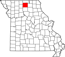 | |
| Villages | ||
| CDP | ||
| Unincorporated communities | ||
| Footnotes | ‡This populated place also has portions in an adjacent county or counties | |