North Cowichan
| North Cowichan | |||
|---|---|---|---|
| District municipality | |||
| The Corporation of the District of North Cowichan[1] | |||
 | |||
| |||
| Motto: No Steps Backwards | |||
 North Cowichan Location of North Cowichan in British Columbia | |||
| Coordinates: 48°49′25″N 123°43′9″W / 48.82361°N 123.71917°WCoordinates: 48°49′25″N 123°43′9″W / 48.82361°N 123.71917°W | |||
| Country | Canada | ||
| Province | British Columbia | ||
| Regional District | CVRD | ||
| Incorporated | 1873 | ||
| Government | |||
| • Mayor | Jon Lefebure | ||
| • Governing body | North Cowichan Council | ||
| • MPs | Jean Crowder | ||
| • MLAs | Bill Routley | ||
| Area | |||
| • Total | 195.54 km2 (75.50 sq mi) | ||
| Population (2011) | |||
| • Total | 28,807 | ||
| • Density | 147.3/km2 (382/sq mi) | ||
| Time zone | PST (UTC−8) | ||
| • Summer (DST) | PDT (UTC−7) | ||
| Area code(s) | +1-250 | ||
| Website | Municipality of North Cowichan | ||
North Cowichan (Canada 2011 Census population 28,807) is a District municipality established in 1873 located on Vancouver Island in British Columbia, Canada. The municipality is part of the Cowichan Valley Regional District. North Cowichan is noted for a landscape including forests, beaches, rivers and lakes.
Geography
Located on the east coast of Vancouver Island, North Cowichan is centrally located immediately north of and adjacent to the city of Duncan and south of Ladysmith. Spanning 193.98 square kilometers North Cowichan includes the communities of Chemainus, Crofton, Maple Bay and South End.
Geology
The last glacial period, the Fraser Glaciation occurred between 29,000 and 15,000 years ago. The glaciers that formed carved out the Cowichan Valley and left behind glaciers up to 30 metres thick. These fertile lands and mild climate have led to a history rich in agriculture.[2]
Climate
Sheltered by the mountains of the central Island and the Olympic Peninsula, North Cowichan has a temperate, Mediterranean-like climate, with mild, damp winters with little snowfall and warm, dry summers.
| Climate data for North Cowichan | |||||||||||||
|---|---|---|---|---|---|---|---|---|---|---|---|---|---|
| Month | Jan | Feb | Mar | Apr | May | Jun | Jul | Aug | Sep | Oct | Nov | Dec | Year |
| Record high °C (°F) | 13.5 (56.3) |
18.5 (65.3) |
23.5 (74.3) |
28.5 (83.3) |
32.0 (89.6) |
34.0 (93.2) |
36.0 (96.8) |
34.5 (94.1) |
35 (95) |
27 (81) |
18 (64) |
15 (59) |
36 (96.8) |
| Average high °C (°F) | 6.6 (43.9) |
8.6 (47.5) |
11.3 (52.3) |
14.9 (58.8) |
18.5 (65.3) |
21 (70) |
24.5 (76.1) |
24.3 (75.7) |
22.5 (72.5) |
15.1 (59.2) |
9.6 (49.3) |
6.1 (43) |
15.25 (59.47) |
| Daily mean °C (°F) | 3.2 (37.8) |
4.3 (39.7) |
6.3 (43.3) |
9.2 (48.6) |
12.4 (54.3) |
15.0 (59) |
17.8 (64) |
17.5 (63.5) |
15.2 (59.4) |
10.0 (50) |
5.9 (42.6) |
3.1 (37.6) |
9.99 (49.98) |
| Average low °C (°F) | −0.2 (31.6) |
−0.1 (31.8) |
1.3 (34.3) |
3.5 (38.3) |
6.3 (43.3) |
9.0 (48.2) |
11.0 (51.8) |
10.7 (51.3) |
7.9 (46.2) |
4.9 (40.8) |
2.2 (36) |
0.2 (32.4) |
4.73 (40.5) |
| Record low °C (°F) | −14.0 (6.8) |
−15.0 (5) |
−10.0 (14) |
−3.0 (26.6) |
−1.5 (29.3) |
2.5 (36.5) |
5.0 (41) |
5.0 (41) |
0.0 (32) |
−4.5 (23.9) |
−10.5 (13.1) |
−15.5 (4.1) |
−15.5 (4.1) |
| Average precipitation mm (inches) | 238.0 (9.37) |
164.0 (6.457) |
133.0 (5.236) |
85.0 (3.346) |
51.0 (2.008) |
40.0 (1.575) |
25.0 (0.984) |
33.0 (1.299) |
28.0 (1.102) |
117.0 (4.606) |
222.0 (8.74) |
229.0 (9.016) |
1,365 (53.739) |
| Source: The Weather Network[3] | |||||||||||||
Demographics
North Cowichan has a population of 27,557 people in 2006, which was an increase of 5.4% from the 2001 census count. The median family income in 2006 for North Cowichan was $62,125, which is below the British Columbia provincial average of $65,787.[4]
| Canada 2006 Census | Population | % of Total Population | |
|---|---|---|---|
| Visible minority group Source:[5] | Chinese | 195 | 0.7% |
| South Asian | 1,015 | 3.7% | |
| Black | 45 | 0.2% | |
| Filipino | 125 | 0.5% | |
| Latin American | 55 | 0.2% | |
| Southeast Asian | 75 | 0.3% | |
| Arab | 30 | 0.1% | |
| West Asian | 0 | 0% | |
| Korean | 70 | 0.3% | |
| Japanese | 75 | 0.3% | |
| Other visible minority | 0 | 0% | |
| Mixed visible minority | 35 | 0.1% | |
| Total visible minority population | 1,730 | 6.3% | |
| Aboriginal group Source:[6] | First Nations | 1,880 | 6.9% |
| Métis | 0 | 0% | |
| Inuit | 0 | 0% | |
| Total Aboriginal population | 1,880 | 6.9% | |
| White | 23,705 | 86.8% | |
| Total population | 27,315 | 100% | |
Communities
- Chemainus
- Crofton
- Maple Bay
- South End
Transportation
North Cowichan is serviced by the Maple Bay Airport (YAQ), which offers services to Vancouver Downtown, Vancouver Airport, Ganges on Salt Spring Island and Bedwell Harbour on Pender Island. Service is provided by Saltspring Air and Harbour Air.
The British Columbia Highway 1 traverses the municipality. Bus service in the municipality is provided by the Cowichan Valley Regional District.
Economy
The original economic drivers steamed from the abundance of natural resources, including the fur trade, fishing, mining, and the forest industry. Today, the forest industry, retail, construction, manufacturing, and health care are large contributors to the local economy.
Education
North Cowichan lies within the School District 79 Cowichan Valley. There are many elementary schools, two middle schools, and two secondary schools.
North Cowichan is served by one public post secondary educational institution, Vancouver Island University.
Media outlets
North Cowichan is served by three newspapers – the Duncan Journal <http://www.duncanjournal.ca>, the Cowichan Valley Citizen, and the Chemainus Valley Courier. North Cowichan is also serviced by CJSU-FM (SunFM), a member of Vista Radio.
Attractions
North Cowichan is home to the BC Forest Discovery Centre, the Pacific Northwest Raptors Bird of Prey and Raptor Visitor Center, and the world famous Chemainus Murals.
Arts
The Cowichan Theatre hosts many performers and shows during the year. The Chemainus Theatre Festival features classic and award winning comedies, musicals and dramas.
Recreation
North Cowichan is home to many recreation centres, including the Cowichan Aquatic Centre, Island Savings Centre, Fuller Lake Arena and the Cowichan Sportsplex. North Cowichan offers numerous parks and hiking trails.
Power supply
The Vancouver Island terminal of the HVDC Vancouver-Island is found here.
References
- ↑ "British Columbia Regional Districts, Municipalities, Corporate Name, Date of Incorporation and Postal Address" (XLS). British Columbia Ministry of Communities, Sport and Cultural Development. Archived from the original on July 13, 2014. Retrieved November 2, 2014.
- ↑ "Geological History of Vancouver Island". CVRD. CVRD.
- ↑ The Weather Network—Statistics: Duncan, BC. Retrieved 29 September 2011.
- ↑ "British Columbia — Community Fact" (PDF). Retrieved 2010-11-29.
- ↑ "Community Profiles from the 2006 Census, Statistics Canada - Census Subdivision". 2.statcan.gc.ca. 2010-12-06. Retrieved 2013-04-13.
- ↑ "Aboriginal Peoples - Data table". 2.statcan.ca. 2010-10-06. Retrieved 2013-04-13.
External links
 |
Cowichan Valley G, Kuper Island | | ||
| Cowichan Valley E | |
Squaw-hay-one, Tsussie 6, Capital F | ||
| ||||
| | ||||
| Duncan, Cowichan IR No. 1 |
| Subdivisions | 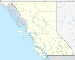 | |
|---|---|---|
| Communities | ||
| Metro areas and agglomerations | ||
| District municipalities |
| |
| ||