Oberdorff
| Oberdorff | ||
|---|---|---|
|
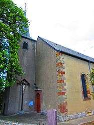
Saint-Martin church at Odenhoven. | ||
| ||
 Oberdorff | ||
|
Location within Grand Est region  Oberdorff | ||
| Coordinates: 49°16′29″N 6°35′44″E / 49.2747°N 6.5956°ECoordinates: 49°16′29″N 6°35′44″E / 49.2747°N 6.5956°E | ||
| Country | France | |
| Region | Grand Est | |
| Department | Moselle | |
| Arrondissement | Forbach-Boulay-Moselle | |
| Canton | Bouzonville | |
| Intercommunality | Communauté de communes de la Houve | |
| Government | ||
| • Mayor (2008–2014) | Jean-Victor Starck | |
| Area1 | 4.22 km2 (1.63 sq mi) | |
| Population (1999)2 | 372 | |
| • Density | 88/km2 (230/sq mi) | |
| Time zone | CET (UTC+1) | |
| • Summer (DST) | CEST (UTC+2) | |
| INSEE/Postal code | 57516 / 57320 | |
| Elevation |
263–340 m (863–1,115 ft) (avg. 300 m or 980 ft) | |
|
1 French Land Register data, which excludes lakes, ponds, glaciers > 1 km² (0.386 sq mi or 247 acres) and river estuaries. 2 Population without double counting: residents of multiple communes (e.g., students and military personnel) only counted once. | ||

Oberdorff is a commune in the Moselle department in Grand Est in north-eastern France.
The locality of Odenhoven is included in the commune.
See also
This article is issued from Wikipedia - version of the 11/17/2016. The text is available under the Creative Commons Attribution/Share Alike but additional terms may apply for the media files.