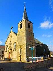
Volmerange-lès-Boulay
For other uses, see Volmerange-les-Mines.
| Volmerange-lès-Boulay | |
|---|---|
 | |
 Volmerange-lès-Boulay | |
|
Location within Grand Est region  Volmerange-lès-Boulay | |
| Coordinates: 49°10′09″N 6°26′55″E / 49.1692°N 6.4486°ECoordinates: 49°10′09″N 6°26′55″E / 49.1692°N 6.4486°E | |
| Country | France |
| Region | Grand Est |
| Department | Moselle |
| Arrondissement | Forbach-Boulay-Moselle |
| Canton | Boulay-Moselle |
| Intercommunality | Communauté de communes du Pays boulageois |
| Government | |
| • Mayor (2008–2014) | Gérard Vecrigner |
| Area1 | 5.96 km2 (2.30 sq mi) |
| Population (1999)2 | 403 |
| • Density | 68/km2 (180/sq mi) |
| Time zone | CET (UTC+1) |
| • Summer (DST) | CEST (UTC+2) |
| INSEE/Postal code | 57730 / 57220 |
| Elevation |
200–305 m (656–1,001 ft) (avg. 340 m or 1,120 ft) |
|
1 French Land Register data, which excludes lakes, ponds, glaciers > 1 km² (0.386 sq mi or 247 acres) and river estuaries. 2 Population without double counting: residents of multiple communes (e.g., students and military personnel) only counted once. | |
Volmerange-lès-Boulay (Lorraine Franconian Wolmeringen) is a commune in the Moselle department in Grand Est in north-eastern France.
See also
This article is issued from Wikipedia - version of the 11/17/2016. The text is available under the Creative Commons Attribution/Share Alike but additional terms may apply for the media files.