Panamint Valley
The Panamint Valley is a long basin located east of the Argus Range and Slate Range, and west of the Panamint Range in the northeastern reach of the Mojave Desert, in eastern California, United States.
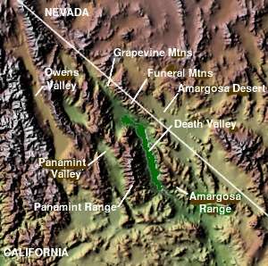
Geography
The northern end of the valley is in Death Valley National Park and Inyo County, California. The valley lies in a north-south direction, and stretches from the Panamint Dunes in the north to the Naval Air Weapons Station China Lake in San Bernardino County in the south. The valley is approximately 65 miles (105 km) in length, and is more than 10 miles (16 km) wide in the Hall Canyon area.

Features
- The ghost town of Ballarat is located in the Panamint Valley about three miles east of Trona Road, near Happy Canyon.
- The former Epsom Salts Monorail crossed the valley on a wooden trestle.
- A radar station is located near the town of Ballarat at the south end of the valley.
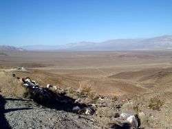
- Multiple sites along SR 190, which crosses the north part of the valley, provide excellent vantage points to view low altitude military aircraft operations.
- Barker Ranch, the last hideout of Charles Manson and the site at which he was arrested in 1969, is located at the southern end of the valley off Goler Canyon Road. Most of the Barker "Family" Ranch was burned down in 2009.
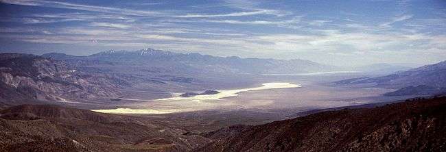
- The valley is an internally drained endorheic basin and its central salt flat/hardpan can contain an ephemeral lake, like it did after unusually heavy rains in the spring of 2005. During pluvial periods of the Pleistocene, inflow from a chain of streams and lakes to the northwest sustained a large lake that overflowed into Lake Manly in Death Valley.[1][2]
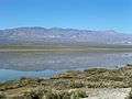 'Panamint Lake' in 2005, view near Ballarat
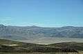 State Route 190 crosses Panamint Valley
 View on Panamint Valley from SR190 with flash floods and reflections in the water
Military use
The airspace over Panamint Valley is part of the U.S. military's vast R-2508 Special Use Airspace Complex . The Panamint Military Operating Area (MOA) covers the entire valley north to Hunter Mountain from 200 ft AGL[3] up to FL180[4] with an Air Traffic Control Assigned Airspace (ATCAA) located above the same area from FL180 up to FL600. The airspace is primarily used by military aircraft from Nellis AFB, Edwards AFB, NAWS China Lake, and NAS Lemoore for high and low altitude mission training. Military aircraft utilize radio communications on 291.6 MHz or 120.25 MHz while operating in the Panamint MOA; however, military aircraft throughout the R-2508 complex often use 315.9 MHz when conducting low altitude operations below 1500 ft AGL.
References
| Wikimedia Commons has media related to Panamint Valley. |
- Allan, Stuart (2005). California Road and Recreation Atlas. Benchmark Maps. pp. s. 87, 88 & 95. ISBN 0-929591-80-1.
- R-2508 Panamint MOA/ATCAA Operating Procedures
- Desert.usa: Panamint Valley Areas of Interest
- ↑ Houghton, Samuel G. (1994). A trace of desert waters: the Great Basin story. Reno: University of Nevada Press.
- ↑ Jayko, A. S.; Forester, R. M.; Sharpe, S.; Smith, G. I., "The last Pluvial Highstand (Late Wisconsin, Tioga Age) in Panamint Valley, Southeast California", American Geophysical Union, Fall Meeting 2001, retrieved April 8, 2011 Missing or empty
|title=(help) - ↑ Above Ground Level
- ↑ Flight Level (FL) is approximately altitude above mean sea level in hundreds of feet. Therefore, FL180 would be 18,000 feet.
Coordinates: 36°03′33″N 117°14′39″W / 36.05917°N 117.24417°W