Panna, India
| Panna | |
|---|---|
| city | |
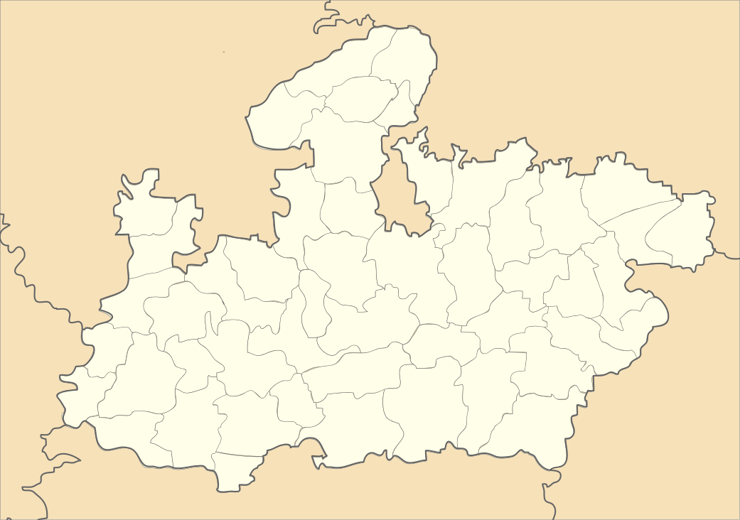 Panna Location in Madhya Pradesh, India | |
| Coordinates: 24°16′N 80°10′E / 24.27°N 80.17°ECoordinates: 24°16′N 80°10′E / 24.27°N 80.17°E | |
| Country |
|
| State | Madhya Pradesh |
| District | Panna |
| Elevation | 416 m (1,365 ft) |
| Population (2011) | |
| • Total | 59,820 |
| Languages | |
| • Official | Hindi |
| Time zone | IST (UTC+5:30) |
| ISO 3166 code | IN-MP |
| Vehicle registration | MP |
| Website |
www |
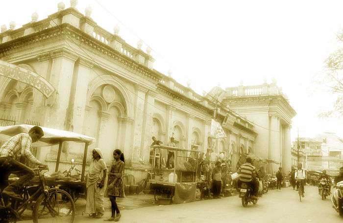
Panna is a city and a municipality in Panna district in the Indian state of Madhya Pradesh. It is famous for its diamond mines. It is the administrative center of Panna District.
History
Panna was a Gond settlement until the 13th century. When the Gondi were defeated by the Chandelas they migrated to other parts of Madhya Pradesh. Until that date, there were many rulers of the area. The famous mandir of Padmavatipuri Dham, adorned with divine lustre, is located in Panna town at the centre of Vindhyachal in Madhya Pradesh. The itinerant sage Mahamati Prannath and his disciples reached Panna with a divine message of awakening one's soul. Seeing a desert island, he decided to unfurl the flag of Jagani there. He helped the king Chhatrasal and adorned him with the title of Maharaja. He remained there for eleven years, and took samadhi inside the dome. The place, therefore, is known as the seat of salvation [Muktipitha] or Padmavatipuri Dham.
Panna was the capital of Chhatar Sal, the Bundela Rajput leader who led a revolt against the Mughal Empire. Upon his death in 1732, his kingdom was divided among his sons, with one-third of the kingdom going to his ally, the Maratha Peshwa Baji Rao I.
The Kingdom of Panna went to Harde Sah, the eldest son of Chhatar Sal. In the early 19th century, Panna became a princely state of British India, and gained control states of the states of Nagod and Sohawal. Raja Nirpat Singh assisted the British in the Revolt of 1857, and the British rewarded him with the title maharaja. Maharaja Mahendra Yadvendra Singh acceded to the Government of India on January 1, 1950, and the kingdom became Panna District of the new Indian state of Vindhya Pradesh. Vindhya Pradesh was merged into Madhya Pradesh on November 1, 1956.
Tiger Reserve
Panna has a tiger reserve which is called Panna National Park. The sightings of tigers in Panna have fallen over recent years, and official tiger population figures were disputed by naturalists. There were plans to relocate two tigresses to Panna in 2009,[1][2] which actually happened, but the last male tiger meanwhile disappeared.[3] A male tiger was relocated there. One of the relocated tigresses gave birth to three cubs in 2010.[4] The reserve is home to a wide variety of other animals,[5] many of which can be seen at closer quarters than in other reserves, because Panna has fewer visitors. There are jungle lodges and hotels near the reserve, it can also be reached from Khajuraho. Raneh fall and Pandav fall are also famous visiting spots of tourists during monsoon.

Diamond Mining
A large group of diamond deposits extends North-East on a branch of the Vindhya Range for 150 miles (240 km) or so, and is known as the Panna group.[6] They do not cover an area of more than 20 acres (81,000 m2). Great pits, 25 feet (7.6 m) in diameter and, perhaps, 30 feet (9.1 m) in depth, are dug for the sake of reaching the diamond conglomerate, which, in many cases, was only a very thin layer.[7] According to Valentine Ball, who edited the 1676 'Travels in India' of Jean-Baptiste Tavernier, Tieffenthaler was the first European to visit the mines in 1765 and claimed that the Panna diamonds could not compare in hardness and fire with other locations in India. No really large diamonds have come from this area.The most productive mines were in the 1860s and were found in Sakaria, around 20 miles (32 km) from Panna. Four classifications were given to the Panna diamonds: first, Motichul, clear and brilliant; 2nd, Manik, with a faint orange tint; 3rd, Panna, verging in tint towards green; 4th, Bunsput, sepia coloured.[7] Mines is situated in the interior of Panna district.Diamond mines in Panna are managed under the Diamond Mining Project of National Mineral Development Corporation (NMDC Ltd) of Government of India.In other mines every year the land is leased to prospective miners by the government agency. The diamonds unearthed are all collected by the district magistrate of Panna and are auctioned in the month of January. Auctions are open to the public and require a R.s 5000 deposit. Upwards of 100 diamonds of different carat and shade are offered for auction.
Bundela rajas of Panna
- Bundela Rajput Raja Chhatrasal (4 May 1649 – 20 December 1731)
- Raja Harde Sah (1731–1739)
- Raja Sabha Singh (1739–1752)
- Raja Aman Singh (1752–1758)
- Raja Hindupat Singh (1758–1778)
- Raja Anirudh Singh (1778–1779)
- interregnum (1779–1785)
- Raja Dhokal Singh (1785–1798)
- Raja Kishor Singh (1798–1834)
- Raja Harbans Rai (1834–1849)
- Maharaja Mahendra Nirpat Singh (1849–1870)
- Maharaja Rudra Pratap Singh (1870–1893) born 1848.
- Maharaja Mahendra Lokpal Singh (1893–1898)
- Maharaja Mahendra Madho Singh (1898–1902)
- Maharaja Mahendra Yadvendra Singh (1902-January 1, 1950)
Geography
Panna is located at 24°43′N 80°12′E / 24.72°N 80.2°E.[8] It has an average elevation of 416 metres (1420 ft).
Transport
Panna Airport is currently non-operational, the nearest functional airport is Khajuraho Airport. Nearest rail head is Satna 75 km away, Khajuraho 45 km away. Bus service is available to all parts of Madhya pradesh and some cities of other states like New delhi, Faridabad, Agra, Kanpur, Jhansi, Gwalior, Dholpur, Nagpur, Kamptee, Allahabad, Varanasi.For Indore, Gwalior, Jabalpur and Bhopal sleeper/luxury/AC buses are available.
Demographics
As of 2011 India census,[9] Panna had a population of 59,820. Males constitute 53% of the population and females 47%. Panna has an average literacy rate of 74%, higher than the national average of 59.5%: male literacy is 90%, and female literacy is 67%. In Panna, 14% of the population is under 6 years of age.
See also
Footnotes
- ↑ http://www.hindustantimes.com/StoryPage/StoryPage.aspx?id=897fa85e-5f56-41ec-a202-23ac52825cce
- ↑ http://www.centralchronicle.com/20081103/0311303.htm
- ↑ http://articles.timesofindia.indiatimes.com/2009-03-28/india/28031044_1_panna-tiger-reserve-male-tiger-kanha-national-park
- ↑ http://articles.timesofindia.indiatimes.com/2010-05-09/flora-fauna/28275615_1_translocated-panna-reserve-madhya-pradesh-s-panna
- ↑ http://www.kenriverlodge.com/ib.html
- ↑ See for a more extensive geological explanation: Goodchild: Precious Stones (1908) Page 113
- 1 2 Streeter: Precious Stones and Gems, (1899) on Indian Diamonds
- ↑ Falling Rain Genomics, Inc - Panna
- ↑ "Census of India 2001: Data from the 2001 Census, including cities, villages and towns (Provisional)". Census Commission of India. Archived from the original on 2004-06-16. Retrieved 2008-11-01.