Chhatarpur district
| Chhatarpur district छतरपुर जिला | |
|---|---|
| District of Madhya Pradesh | |
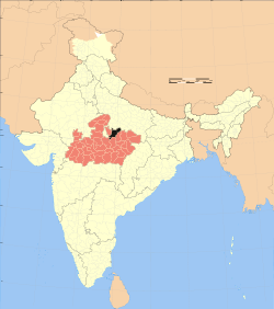 Location of Chhatarpur district in Madhya Pradesh | |
| Country | India |
| State | Madhya Pradesh |
| Administrative division | Sagar division |
| Headquarters | Chhatarpur |
| Government | |
| • Lok Sabha constituencies | Khajuraho |
| Area | |
| • Total | 8,687 km2 (3,354 sq mi) |
| Population (2011) | |
| • Total | 1,762,857 |
| • Density | 200/km2 (530/sq mi) |
| Demographics | |
| • Literacy | 64.9 per cent |
| • Sex ratio | 884 |
| Website | Official website |
Chhatarpur District (Hindi: छतरपुर जिला) is a district of Madhya Pradesh state of central India. The town of Chhatarpur is the district headquarters.
Geography
Chattarpur district located at 24.06° & 25.20°N 78.59° & 80.26° E respectively. The district has an area of 8,687 km².Chhatarpur District is bounded by Uttar Pradesh state to the north, and the Madhya Pradesh districts of Panna to the east, Damoh to the south, Sagar to the southwest, and Tikamgarh to the west. Chhatarpur District is part of Sagar Division.[1]
History
Before Indian Independence, present-day Chhatarpur district consisted of a number of princely states, including Bijawar, Chhatarpur, Gaurihar, Alipura, and Lugasi, along with most of Charkhari and portions of Panna and Ajaigarh. After independence, the rulers of the states acceded to the Government of India, and the district became part of the new state of Vindhya Pradesh. Vindhya Pradesh was merged into Madhya Pradesh on November 1, 1956. Nowgaon(near chhatarpur) was declared capital of Madhya Pradesh, after six month Bhopal became the capital of Madhya Pradesh.
Economy
It is one of the 24 districts in Madhya Pradesh currently receiving funds from the Backward Regions Grant Fund Programme (BRGF).[2]
Demographics
According to the 2011 census Chhatarpur District has a population of 1,762,857,[3] roughly equal to the nation of The Gambia[4] or the US state of Nebraska.[5] This gives it a ranking of 271st in India (out of a total of 640).[3] The district has a population density of 203 inhabitants per square kilometre (530/sq mi) .[3] Its population growth rate over the decade 2001-2011 was 19.54%.[3] Chhattarpur has a sex ratio of 884 females for every 1000 males,[3] and a literacy rate of 64.9%.[3]
Chhatarpur district has a population of 1,474,633 (2001 census), a 27% increase from its 1991 population of 1,158,853.[1]
Languages
Bundeli (Devanagari: बुन्देली or बुंदेली; Urdu: زبان بندیلی),a Western Hindi language (often considered a dialect of Hindi) is the main language spoken in the district along with Hindi. Vernaculars include Bharia, a Dravidian language spoken by at least 200 000 members of the Bharia tribe and written in the Devanagari script.[6]
Places of interest
The district is home to Khajuraho, the famous temple city created by the Chandela clan of Rajputs in the tenth century. Other notable locations are Jatashankar, Bhimkund, Panna National Park, Bambar Baini Temple in Lavkushnagar, Arjunkund, Naogaon Nowgong, Dhubela Museum, Maharajpur, Raneh Falls and Ken Gharial Sanctuary, Bijawar, Mata Temple at Harpalpur, and Hanuman Tauria.
Notable persons from the district
- Satyavrat Chaturvedi
- Asgari Bai - Dhrupad singer and recipient of Padma Shri
- Babu Gulabrai - Hindi writer
- Virendra Kumar
- Jeetendra Singh Bundela
- Shriniwas Shukla
References
- 1 2 "Chhatarpur". Chhatarpur district administration. Retrieved 2010-08-18.
- ↑ Ministry of Panchayati Raj (September 8, 2009). "A Note on the Backward Regions Grant Fund Programme" (PDF). National Institute of Rural Development. Archived from the original (PDF) on April 5, 2012. Retrieved September 27, 2011.
- 1 2 3 4 5 6 "District Census 2011". Census2011.co.in. 2011. Retrieved 2011-09-30.
- ↑ US Directorate of Intelligence. "Country Comparison:Population". Retrieved 2011-10-01.
Gambia, The 1,797,860 July 2011 est.
- ↑ "2010 Resident Population Data". U. S. Census Bureau. Archived from the original on 2013-10-19. Retrieved 2011-09-30.
Nebraska 1,826,341
- ↑ M. Paul Lewis, ed. (2009). "Bharia: A language of India". Ethnologue: Languages of the World (16th ed.). Dallas, Texas: SIL International. Retrieved 2011-09-28.
External links
| Wikimedia Commons has media related to Chhatarpur district. |

Coordinates: 24°54′57″N 79°34′56″E / 24.915709°N 79.582214°E