Pojoaque, New Mexico
| Pojoaque, New Mexico | |
|---|---|
| CDP | |
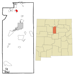 Location of Pojoaque, New Mexico. | |
 Pojoaque, New Mexico Location in the United States | |
| Coordinates: 35°53′26″N 106°0′34″W / 35.89056°N 106.00944°WCoordinates: 35°53′26″N 106°0′34″W / 35.89056°N 106.00944°W | |
| Country | United States |
| State | New Mexico |
| County | Santa Fe |
| Area | |
| • Total | 2.9 sq mi (7.5 km2) |
| • Land | 2.9 sq mi (7.5 km2) |
| • Water | 0.0 sq mi (0.0 km2) |
| Elevation | 5,853 ft (1,784 m) |
| Population (2000) | |
| • Total | 1,261 |
| • Density | 437.3/sq mi (168.8/km2) |
| Time zone | Mountain (MST) (UTC-7) |
| • Summer (DST) | MDT (UTC-6) |
| ZIP code | 87501 |
| Area code(s) | 505 |
| FIPS code | 35-58630 |
| GNIS feature ID | 0928773 |
Pojoaque (/pəˈwɑːkiː/; Tewa: P'osuwaege) is a census-designated place (CDP) in Santa Fe County, New Mexico, United States. It is part of the Santa Fe, New Mexico Metropolitan Statistical Area. The population was 1,261 at the 2000 census. Pojoaque Pueblo, a neighboring community, is an Indian Reservation, and the town of Pojoaque is a collection of communities near the Pueblo with people from various ethnic backgrounds. The area of Pojoaque includes the neighborhoods of Cuyamungue, Jacona, Jaconita, Nambe and El Rancho.
History
Pojoaque
In the early 17th century the first Spanish mission San Francisco de Pojoaque was founded. During the Pueblo Revolt of 1680, Pojoaque was abandoned, and was not resettled until about 1706. By 1712 the population had reached 79. During the revolt of 1837, New Mexico native Manuel Armijo defeated of the rebels at Puertocito Pojoaque, east of Santa Cruz de la Cañada. In the early 1900s the Pojoaque Valley School District was established to serve the educational needs of the valley.
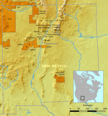
Pojoaque Pueblo
Pojoaque Pueblo is one of the six Tewa-speaking Rio Grande Pueblos, and a member of the Eight Northern Pueblos. The Pueblo was settled around 500 AD, with the population peaking in the 15th and 16th centuries.
In about 1900, a severe smallpox epidemic caused the pueblo to be abandoned once again by 1912. In 1934, Pojoaque Pueblo was reoccupied, and became a federally recognized Indian Reservation in 1936.[2]
Pojoaque Pueblo remains a major employer in the region, owning several business enterprises, including the gaming operations of three casino locations, Buffalo Thunder Resort, Cities of Gold Casino and Jakes's Casino. As of 2015, the New Mexico state gaming compacts signed by the pueblo have expired, but the pueblo has continued gaming operations.
Geography
Pojoaque is located at 35°53′26″N 106°11′34″W / 35.89056°N 106.19278°W (35.890581, -106.009511).[3]
According to the United States Census Bureau, the CDP has a total area of 2.9 square miles (7.5 km²), all land.
Demographics
As of the census[4] of 2000, there were 1,261 people, 493 households, and 332 families residing in the CDP. The population density was 437.3 people per square mile (169.1/km²). There were 533 housing units at an average density of 184.8 per square mile (71.5/km²). The racial makeup of the CDP was 52.10% White, 0.56% African American, 17.37% Native American, 26.57% from other races, and 3.41% from two or more races. Hispanic or Latino of any race were 62.17% of the population.
There were 493 households out of which 38.3% had children under the age of 18 living with them, 46.7% were married couples living together, 13.0% had a female householder with no husband present, and 32.5% were non-families. 26.6% of all households were made up of individuals and 6.9% had someone living alone who was 65 years of age or older. The average household size was 2.56 and the average family size was 3.10.
In the CDP the population was spread out with 28.9% under the age of 18, 9.3% from 18 to 24, 30.4% from 25 to 44, 23.3% from 45 to 64, and 8.1% who were 65 years of age or older. The median age was 34 years. For every 100 females there were 103.1 males. For every 100 females age 18 and over, there were 101.3 males.
The median income for a household in the CDP was $15,875, and the median income for a family was $24,719. Males had a median income of $19,830 versus $17,105 for females. The per capita income for the CDP was $13,968. About 17.2% of families and 18.7% of the population were below the poverty line, including 23.4% of those under age 18 and 15.3% of those age 65 or over.
Attractions
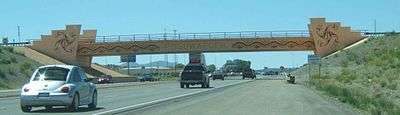
Pojoaque Pueblo opened the Poeh Museum in 1987, and the Cities of Gold Casino in the mid-1990s.
In 2008 the Pueblo opened the Buffalo Thunder resort and casino, New Mexico's largest and most expensive resort.[5] The estimated cost for the resort project in 2004 was $250 million.[6]
Education
See also
|
|
References
- ↑ Arturo Sandoval (2009-08-31). "New Mexico's rich linguistic heritage is worth protecting". New Mexico Independent. Retrieved 2012-09-29.
- ↑ Pojoaque history
- ↑ "US Gazetteer files: 2010, 2000, and 1990". United States Census Bureau. 2011-02-12. Retrieved 2011-04-23.
- ↑ "American FactFinder". United States Census Bureau. Archived from the original on 2013-09-11. Retrieved 2008-01-31.
- ↑ "A high-stakes future"
- ↑ Buffalo Thunder construction
- ↑ "New Mexico's Pojoaque Pueblo". C-SPAN. January 6, 2013. Retrieved March 16, 2013.
External links
| Wikivoyage has a travel guide for Pojoaque. |
| Reservations | |
|---|---|
| Pueblos | |
Municipalities and communities of Santa Fe County, New Mexico, United States | ||
|---|---|---|
| Cities | 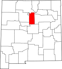 | |
| Town | ||
| CDPs |
| |
| Unincorporated communities | ||
| Indian reservation | ||
| Footnotes | ‡This populated place also has portions in an adjacent county or counties | |