Red Rock River (Montana)
| Red Rock River | |
|---|---|
|
Upper Red Rock Lake near headwaters of Red Rock River | |
| Country | Beaverhead County, Montana |
| Basin | |
| River mouth |
5,545 feet (1,690 m)[1] 44°56′33″N 112°50′43″W / 44.94250°N 112.84528°WCoordinates: 44°56′33″N 112°50′43″W / 44.94250°N 112.84528°W[1] |
| River system | Missouri River |
| Basin size | 1,548 square miles (4,010 km2) |
| Physical characteristics | |
| Length | 70 miles (110 km) |
| Discharge |
|
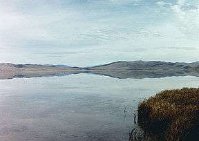
The Red Rock River is a roughly 70-mile (110 km) river in southwestern Montana in the United States. Its drainage basin covers over 1,548 square miles (4,010 km2). Its furthest tributary, Hell Roaring Creek, originates in the Beaverhead National Forest within a few hundred meters of the North American Continental Divide and Montana-Idaho border near Brower's Spring, at an elevation of about 9,100 feet (2,800 m). Brower's Spring is near the furthest headwaters of the Missouri River, one of the major watercourses of the central United States. The drainage flows north and west with its name changing to "Red Rock Creek" into the Red Rock Lakes in the middle of a wide grassy valley; the Red Rock River issues from the west side of Lower Red Rock Lake. It flows west, receiving many tributaries such as Peet Creek and Long Creek, widening into the Lima Reservoir and then passing through a canyon, which ends near Lima, Montana. From there, it flows northwest through a valley, passing Kidd and Red Rock, and into Clark Canyon Reservoir. Under the waters of the lake was once the confluence of the Red Rock and Horse Prairie Creek, forming the Beaverhead River, a tributary of the Jefferson River, in turn a headwater of the Missouri River.
Advocates
- Jefferson River Watershed Council — The mission of the Jefferson River Watershed Council is to coordinate efforts, through a spirit of community cooperation and sharing, that will enhance, conserve, and protect the natural resources, quality of life, and economic vitality of the Jefferson River watershed.[2]
- Trout Unlimited — Trout Unlimited's mission is to conserve, protect and restore North America's coldwater fisheries and their watersheds.[3]
- Western Watersheds Project — The mission of Western Watersheds Project is to protect and restore western watersheds and wildlife through education, public policy initiatives and litigation.[4]
- Montana River Action — The clean flowing waters of Montana belong to the people and are held in trust by the State for a pollution-free healthful environment guaranteed by our Montana Constitution. Montana River Action's mission is to protect and restore rivers, streams and other water bodies.[5]