Rockhampton Region
| Rockhampton Region Queensland | |||||||||||||
|---|---|---|---|---|---|---|---|---|---|---|---|---|---|
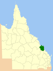 Location in Queensland, 2013, prior to de-amalgamation of Shire of Livingstone | |||||||||||||
| Population | 83,653 (2015)[1] | ||||||||||||
| • Density | 4.55602/km2 (11.8000/sq mi) | ||||||||||||
| Established | 2008 | ||||||||||||
| Postcode(s) | 4700, 4701, 4702, 4703, 4704, 4705, 4706, 4707 | ||||||||||||
| Area | 18,361 km2 (7,089.2 sq mi) | ||||||||||||
| Mayor | Margaret Strelow | ||||||||||||
| Council seat | Rockhampton | ||||||||||||
| Region | Central Queensland | ||||||||||||
| State electorate(s) | |||||||||||||
| Federal Division(s) | |||||||||||||
 | |||||||||||||
| Website | Rockhampton Region | ||||||||||||
| |||||||||||||
The Rockhampton Region in Central Queensland, Queensland, Australia, is a former Local Government Area, located on the Tropic of Capricorn, about 600 kilometers north of Brisbane, experiencing an average of over 300 days of sunshine per year. Rockhampton, the Region’s major city is often referred to as the Beef Capital of Australia which offers a broad mix of lifestyle and business opportunities. The Fitzroy River, Mount Archer National Park and Berserker Range provides a scenic backdrop for the city where its rich history is featured in the heritage listed buildings along the historic Quay Street Riverfront Precinct. The Rockhampton Region is attracting significant growth with the increase in CBD and Riverfront developments neighbouring these historical sites.
Attractions
Rockhampton Zoo: Located within the Rockhampton Botanic Gardens and adjacent to the Murray lagoon. It is home to over fifty species of native animals from across Australia and exotic animals from around the world. The Zoo includes an Australian Walkabout Zone which includes kangaroos, wallabies, koalas, wombats, chimpanzees, lion macaques, rainbow lorikeets, saltwater crocodiles, freshwater crocodiles and the rare cassowary.[2]
Rockhampton Art Gallery: Home to one of the best regional art collections in Australia. The Gallery is administered by Rockhampton Regional Council and its mission is to deliver an enriching, authentic experience of Australian and international art and cultures.[3]
Heritage Village: Representing the colourful history of the Rockhampton district in 1850-1950. Vintage vehicles, a hall of clocks, timber cutters camp, a blacksmith shop, homesteads and cottages, vintage machinery and friendly farm animals are on display. The Heritage Village Market Days are a popular attraction held every two months where a variety of stalls sell local produce, arts and crafts and plants. The Heritage Village features an Australian Shearing Shed with modern facilities and is a popular reception and conference venue in Rockhampton.[4]
Archer Park Rail Museum: Located in Denison Street, between Archer and Cambridge Streets, the Archer Park Rail Museum (previously known as the Archer Park Station and Steam Tram Museum) was built in 1899 and is owned by the Rockhampton Regional Council. The museum features a digital Soundscape system which covers tells the history of rail-based transportation in Rockhampton. The tram is believed to be the only one of its kind in the world.[5]
Mount Morgan Railway Museum: Mount Morgan Railway Museum: located 38kilometers from Rockhampton, the Mount Morgan Rail Museum is set in a former railway station including a steam train, goods shed and water tank for steam engines. The history is retold through audio-visual displays and three dimensional presentations.[6]
Walter Reid Cultural Centre: Purchased by the Rockhampton Regional Council in the 1970s the Walter Reid Cultural Centre is home to Rockhampton’s premier community arts and leisure centre. The heritage listed building is located on Quay Street.
Parks and Gardens
Rockhampton Botanic Gardens: Regarded among the best in regional Australia and spans ninety-six acres of grazing land on the Western slopes of the Athelstane Range. The beautifully manicured gardens include excellent specimens of palms, cycads and ferns with some specimens over 100 years old. The gardens include a Japanese Garden, Hugo Lassen Fernery, Cenotaph, the Murray lagoon and a Gardens Tearoom.[7]
Rockhampton’s Kershaw Gardens: Officially opened in September 1988 as part of a project celebrating the Australian Bicentenary. The gardens represent a natural Australian bush environment and stretches for one kilometer along the Bruce highway, providing a peaceful setting within the heart of Rockhampton. Rockhampton Kershaw Gardens includes a Scented Garden, playground and picnic facilities, Rainforest, Waterfall, Slab Hut, and colonial style facilities throughout.[8] Kershaw Gardens was previously a rubbish dump. In February 2015 the park was significantly damaged by Cyclone Marcia. Fallen trees exposed rubbish that had been previously buried. As at July 2015, the park remains closed to the public until the damage is repaired.[9]
Mount Archer National Park: Renowned as Rockhampton's scenic backdrop with a height of six hundred and four metres (1,982 ft). The summit is accessible by a sealed road, Pilbeam Drive, which leads to Lookouts and picnic areas located on the summit of the mountain, including Fraser Park which is managed by the Rockhampton Regional Council.[10] The park covers 4250 hectares of open forest and woodland communities dominated by eucalypts with a large pocket of dry rainforest in the deeply incised Moores Creek Valley. The park protects a range of plants and animals, including plant species with restricted distributions, also the glossy black-cockatoo.[11]
History
Established in 2008, it was preceded by four previous local government areas extending to almost the beginning of local government in Queensland. On 1 January 2014, one of those local government areas, the Shire of Livingstone was restored as an independent council.
Prior to the 2008 amalgamation, the Rockhampton Region existed as four distinct local government areas:
- the City of Rockhampton;
- the Shire of Fitzroy;
- the Shire of Livingstone;
- and the Shire of Mount Morgan.
Rockhampton was proclaimed as Queensland's fourth municipality (after Brisbane, Ipswich and Toowoomba) on 13 December 1860 under the Municipalities Act 1858,[12] a piece of New South Wales legislation inherited by Queensland when it became a separate colony in 1859. It held its first election on 26 February 1861 and its inaugural meeting on 1 March 1861. The municipality had an area of 13 km2 (5.0 sq mi) located on the south bank of the Fitzroy River and had a population of about 600. In 1864, the council was divided into three wards—Fitzroy, Archer and Leichhardt. A proposal to greatly expand its area southwards to include Gracemere and Bouldercombe was rejected in part due to opposition from influential squatters in the area.[13] It achieved a measure of autonomy in 1878 with the enactment of the Local Government Act.
On 11 November 1879, the Gogango Divisional Board was established as one of 74 divisions around Queensland under the Divisional Boards Act 1879. It covered an area of 16,239 km2 (6,270 sq mi) surrounding the municipality—an area significantly greater than the modern Rockhampton Region covers. Capital and people came to the area in greater numbers after the discovery of gold in 1882 at Mount Morgan, about 20 kilometres (12 mi) south of Rockhampton. A Municipal Borough was proclaimed there on 22 May 1890.
A bridge was built spanning the Fitzroy River in 1882, and a year later in September 1883, the North Rockhampton Borough was proclaimed. North Rockhampton had a somewhat unhappy 36-year existence—its small population and location opposite the stronger and wealthier Rockhampton borough made comparisons inevitable and development of its own identity almost impossible. In 1919, it was described as a "small and straggling hamlet". Nevertheless, it was able to get a loan to construct a Municipal Chambers in 1885, which was completed in December of that year. The town clerk's arrest for embezzlement in 1890 marked the beginning of a period of difficulties characterised by disputes with the surrounding Gogango Divisional Board over road construction, and internal conflict between members of council, in which the Queensland Government was often requested to intervene. It did not have a reliable water supply and at the time of its amalgamation was still trying to raise funds for a dam.[14]
The Fitzroy Division was proclaimed on 6 April 1899 out of the southern part of Gogango. With the passage of the Local Authorities Act 1902, Rockhampton became one of three former municipalities, alongside Brisbane and Townsville, to become a City on 31 March 1903, while North Rockhampton and Mount Morgan became Towns and the divisions of Gogango and Fitzroy became Shires. Gogango was renamed Livingstone on 8 August 1903.
The State Government became concerned in 1918 after both the City of Rockhampton and Town of North Rockhampton councils proposed separate water infrastructure projects. On Saturday 25 January 1919, an amalgamation referendum held in North Rockhampton passed with 884 of the 1,029 votes cast in favour. On 15 March 1919, elections for the new four-ward council with 11 councillors took place, with their first meeting being held five days later. North Rockhampton's chambers, located in Stapleton Park, North Rockhampton, became a Main Roads office for about four decades, and eventually was restored and, since 1985, has been the home of Rockhampton and District Historical Society.
Wards were abolished at some point and were not reintroduced until 1982, when the council was restructured with 10 divisions each electing one councillor, plus a mayor elected by the entire City. On 1 July 1984, the City grew northwards by annexing Parkhurst, where its water treatment facility was being constructed, from the Shire of Livingstone. The council tried on several occasions to expand further into the Livingstone and Fitzroy areas, but a referendum in Fitzroy on 9 February 1991 was opposed by 83% of valid votes cast.
In July 2007, the Local Government Reform Commission released a report making recommendations for statewide reform of local government boundaries, and recommended that the four areas of Rockhampton, Fitzroy, Livingstone and Mount Morgan amalgamate, due to a community of interest centred upon Rockhampton. The very weak sustainability rating given to the Shire of Mount Morgan was of particular concern.[15] On 15 March 2008, the City and Shires formally ceased to exist, and elections were held on the same day to elect councillors and a mayor to the Regional Council.
In 2012, a proposal was made to de-amalgamate the Shire of Livingstone from the Rockhampton Region.[16] On 9 March 2013, the citizens of the former Livingstone shire voted in a referendum to de-amalgamate. The Shire of Livingstone was re-established on 1 January 2014.[17][18]
Wards and elections
The Council consists of a Mayor and seven Councillors. The Mayor is elected by the public, and the Councillors are elected from ten single member divisions using an optional preferential voting system. Elections are held every four years.
Suburbs, towns and localities
The Rockhampton Region includes the following settlements:
|
Rockhampton area
|
Mount Morgan area
|
Fitzroy area |
* - shared with the Shire of Livingstone
Population
The populations given relate to the component entities prior to 2008. The next census, due in 2011, will be the first for the new Region.
| Year | Total Region | Rockhampton | Livingstone | Fitzroy | Mt Morgan |
|---|---|---|---|---|---|
| 1933 | 44,501 | 29,369 | 6,472 | 4,256 | 4,404 |
| 1947 | 50,167 | 34,988 | 6,452 | 3,773 | 4,954 |
| 1954 | 56,315 | 40,670 | 7,031 | 3,554 | 5,060 |
| 1961 | 59,895 | 44,128 | 7,320 | 3,576 | 4,871 |
| 1966 | 61,874 | 46,083 | 7,780 | 3,590 | 4,421 |
| 1971 | 66,160 | 49,164 | 9,595 | 3,434 | 3,967 |
| 1976 | 69,675 | 51,133 | 11,634 | 3,441 | 3,467 |
| 1981 | 75,875 | 52,383 | 15,711 | 4,645 | 3,136 |
| 1986 | 82,142 | 56,742 | 15,886 | 6,406 | 3,108 |
| 1991 | 89,868 | 59,394 | 19,334 | 8,047 | 3,093 |
| 1996 | 96,885 | 59,732 | 24,796 | 9,499 | 2,858 |
| 2001 | 97,728 | 58,382 | 27,017 | 9,553 | 2,776 |
| 2006 | 102,048 | 59,943 | 28,870 | 10,310 | 2,925 |
Council facilities
The council owns six business units which are city-owned enterprises managed on commercial lines:
- Rockhampton International Airport
- Fitzroy River Water
- Rockhampton Showgrounds
- Gracemere Saleyards
- Pilbeam Theatre
- Rockhampton Regional Art Gallery
References
- ↑ "3218.0 – Regional Population Growth, Australia, 2014–15". Australian Bureau of Statistics. Retrieved 29 September 2016.
- ↑ http://www.rockhamptonregion.qld.gov.au/Your_Community/Council_Venues_and_Attractions/Rockhampton_Zoo/
- ↑ http://www.rockhamptonartgallery.com.au/About_Us/History
- ↑ http://www.rockhamptonregion.qld.gov.au/Your_Community/Council_Venues_and_Attractions/Rockhampton_Heritage_Village
- ↑ http://www.rockhamptonregion.qld.gov.au/Your_Community/Council_Venues_and_Attractions/Archer_Park_Rail_Museum
- ↑ http://www.rockhamptonregion.qld.gov.au/Your_Community/Council_Venues_and_Attractions/Mount_Morgan_Railway_Museum
- ↑ http://www.rockhamptonregion.qld.gov.au/Your_Community/Parks_Gardens_and_Recreation/Parks_and_Gardens/Rockhampton_Botanic_Gardens
- ↑ http://www.rockhamptonregion.qld.gov.au/Your_Community/Parks_Gardens_and_Recreation/Parks_and_Gardens/Rockhampton_Kershaw_Gardens
- ↑ http://www.abc.net.au/news/2015-04-02/rockhampton-park-closed-after-cyclone-marcia-damage/6367434
- ↑ http://www.queenslandholidays.com.au/things-to-see-and-do/mount-archer-national-park/index.cfm
- ↑ http://www.nprsr.qld.gov.au/parks/mount-archer/about.html
- ↑ 22 Vic No. 13 (Imp), assented 27 October 1858
- ↑ McDonald, Lorna (1995). Rockhampton : a history of city and district. Rockhampton City Council. pp. 108–109. ISBN 0-9599897-3-0.
- ↑ "North Rockhampton Borough Chambers (entry 601370)". Queensland Heritage Register. Queensland Heritage Council. Retrieved 20 April 2008.
- ↑ Queensland Local Government Reform Commission (July 2007). Report of the Local Government Reform Commission (PDF). 2. pp. 273–278. ISBN 1-921057-11-4. Retrieved 3 June 2010.
- ↑ "Capricorn Coast Regional Council & Rockhampton Regional Council: a Partnership Approach for Sound Regional Governance: Unity and strength with community of interest representation: De-amalgamation Submission to the Queensland Boundary Commissioner August 2012" (PDF). Retrieved 14 August 2013.
- ↑ "De-amalgamation". Queensland Government. Retrieved 14 August 2013.
- ↑ "Local Government (De-amalgamation Implementation) Regulation 2013" (PDF). Local Government Act 2009. Queensland Government. Retrieved 14 August 2013.
Coordinates: 23°22′29.97″S 150°30′42.02″E / 23.3749917°S 150.5116722°E