Rodez–Marcillac Airport
| Rodez–Aveyron Airport Aéroport de Rodez–Aveyron | |||||||||||||||
|---|---|---|---|---|---|---|---|---|---|---|---|---|---|---|---|
 | |||||||||||||||
| IATA: RDZ – ICAO: LFCR | |||||||||||||||
| Summary | |||||||||||||||
| Airport type | Public | ||||||||||||||
| Operator | Chambre du Commerce et d'Industrie de Rodez | ||||||||||||||
| Location | Rodez, France | ||||||||||||||
| Elevation AMSL | 1,910 ft / 582 m | ||||||||||||||
| Coordinates | 44°24′08″N 02°28′58″E / 44.40222°N 2.48278°ECoordinates: 44°24′08″N 02°28′58″E / 44.40222°N 2.48278°E | ||||||||||||||
| Website |
www | ||||||||||||||
| Maps | |||||||||||||||
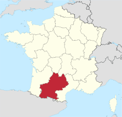 Midi-Pyrénées region in France | |||||||||||||||
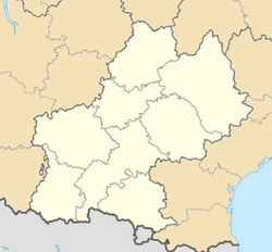 LFCR Location of airport in Midi-Pyrénées region. | |||||||||||||||
| Runways | |||||||||||||||
| |||||||||||||||
| Statistics (2007) | |||||||||||||||
| |||||||||||||||
Rodez–Aveyron Airport (IATA: RDZ, ICAO: LFCR) is a growing airport, located on the territory of the commune of Salles-la-Source approximately 10 km outside the centre of Rodez, the departmental capital of Aveyron, France. It has one international runway of 2,100m in length, as well as a second, small runway of 800m in length. It is an ideal airport for reaching the departments of Aveyron, Tarn, Tarn-et-Garonne, Lot, Hérault, Gard, Lozère, and Cantal.
It is the 25th French-Metropolitan airport.
History
- 1971 – Rodez-Aveyron Airport founded. Managed by SAEML Air 12 which comprises the CCI of Rodez, Aveyron General Council and the main regional banks.
- March 2002 – Paris Orly connection by Air France commenced operated by Brit Air. Brit Air is a regional airline operating scheduled services as an Air France franchise.
- 2003 – Extension of runway to 2,100 m and installation of a new Instrument landing system (ILS).
- May 2003 – Ryanair commences flights from London Stansted. Initial prices were 49 Euro for a return flight on a Boeing 737-800 with 189 seats.
- January 2008 – Extension of the parking to 1000 places.
- May 2008 – Ryanair commences flights from Dublin Airport.
- 2009 – Extension of the airport and creation of a new departure lounge. Addition of a new destination : Palma in Spain.
Airlines and destinations
| Airlines | Destinations |
|---|---|
| Eastern Airways operated by Denim Air | Paris–Orly[1] |
| Ryanair | Seasonal: Charleroi, Dublin |
References
External links
- Official website
- Aéroport de Rodez–Marcillac (Union of the French Airports).
This article is issued from Wikipedia - version of the 12/4/2016. The text is available under the Creative Commons Attribution/Share Alike but additional terms may apply for the media files.