Sahiwal District
| Sahiwal District ضِلع ساہِيوال Montgomery District | |
|---|---|
| District | |
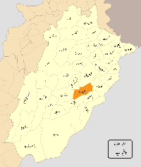 Location of Sahiwal in Punjab. | |
| Country | Pakistan |
| Province | Punjab |
| Headquarters | Sahiwal |
| Area | |
| • Total | 3,201 km2 (1,236 sq mi) |
| Population (1998) | |
| • Total | 1,843,194 |
| Time zone | PST (UTC+5) |
| Website | www.sahiwal.gov.pk |
Sahiwal District (Urdu: ضِلع ساہِيوال), is a district in the Punjab province of Pakistan. In 1998, it had a population of 1,843,194 people, 16.27% of which were in urban areas.[1] Since 2008, Sahiwal District, Okara District, and Pakpattan District have comprised the Sahiwal Division. The city of Sahiwal is the capital of the district and the division.
History
The Sahiwal District has been settled from the pre-historical era. Harappa is an archaeological site, about 35 km (22 mi) west of Sahiwal, that was built approximately 2600 BCE. The area was part of South Asian empires and in crossroads of migrations and invasions from Central Asia.
Sahiwal District was an agricultural region with forests during the Indus Valley Civilization. The Vedic period is characterized by Indo-Aryan culture that invaded from Central Asia and settled in Punjab region. The Kambojas, Daradas, Kaikayas, Madras, Pauravas, Yaudheyas, Malavas and Kurus invaded, settled and ruled ancient Punjab region. After overrunning the Achaemenid Empire in 331 BCE, Alexander marched into present-day Punjab region with an army of 50,000. The Sahiwal was ruled by Maurya Empire, Indo-Greek kingdom, Kushan Empire, Gupta Empire, White Huns, Kushano-Hephthalites and Shahi kingdoms. From the beginning of the 7th century Rajput kingdoms dominated Eastern portions of Pakistan and northern India. In 997 CE, Sultan Mahmud Ghaznavi, took over the Ghaznavid dynasty empire established by his father, Sultan Sebuktegin, In 1005 he conquered the Shahis in Kabul in 1005, and followed it by the conquests of some western Punjab region. Eastern Regions of Punjab from Multan to the Rawalpindi in north (Including region of present-day Sahiwal) remained under Rajput rule until 1193. The Delhi Sultanate and Mughal Empire later ruled the region. The Punjab region became predominantly Muslim due to missionary Sufi saints whose dargahs dot the landscape of Punjab region.
The pastoral tribes of this barren expanse did not appear to have paid more than a nominal allegiance to the Muslim rulers; the population for the most part remained in a chronic state of rebellion. After the decline of the Mughal Empire, the Sikh Empire invaded and occupied Sahiwal. The Muslims of Sahiwal faced restrictions during the Sikh rule. The district came under direct British rule in 1849, when the district was officially formed with its headquarters at Pakpattan. The district was expanded to include the trans-Ravi portion in 1852, and the district headquarters were moved to Gugera. In 1865, when the railway was opened, a village on the railway, was named Montgomery and became the capital of the district.[2] During the period of British rule, Sahiwal district increased in population and importance.
During the Indian Rebellion of 1857, there was a general rising of the Jat clans, the district formed the scene of the only rising which took place north of the Sutlej. Before the end of May 1857, emissaries from Delhi crossed the river from Sirsa and Hissar, where open rebellion was already rife, and met with a ready reception from the Kharrals and other Jat clans. The district authorities, however, kept down the threatened rising till August 26, 1857 when jail prisoners made a desperate attempt to break loose. At the same time Ahmad Khan, a famous Kharral leader, who had been detained at Gugera, broke his arrest and, though apprehended, was released on security, together with several other suspected chieftains. On September 16 they fled to their homes, and the whole country rose in open rebellion. Kot Kamalia was sacked. Major Chamberlain, moving up with a small force from Multan, was besieged for some days at Chichawatni on the Ravi. The situation at the civil station remained critical till Colonel Paton arrived with substantial reinforcements from Lahore. An attack which took place immediately after their arrival was repulsed. Several minor actions followed in the open field, until finally the rebels, driven from the plain into the wildest jungles of the interior, were utterly defeated and dispersed. The British troops then inflicted severe punishment on the insurgent clans, destroying their villages, and seizing large numbers of cattle for sale.[3]
The region was traversed by the main line of the North Western Railway, from Lahore to Multan. It is irrigated by the Upper Sutlej inundation canal system and from the Ravi. The Rechna Doab was long home to the pastoral Jats, who had constantly maintained a sturdy independence against the successive rulers of northern India. The sites of Kot Kamalia and Harappa contain large mounds of antique bricks and other ruins left by the Indus Valley Civilisation, while many other remains of ancient cities or villages lie scattered along the river bank, or dotted the then-barren stretches of the central waste.
The district comprised three towns and 1371 villages. Its population was 360,445 (1868), 426,529 (1881), 499,521 (1891) and 497,706 (1901). In 1901, 72% of the population were Muslims, while Hindus and Sikhs formed 28%.[3]
The district was part of the Lahore Division of Punjab. The predominantly Muslim population supported Muslim League and Pakistan Movement. After the independence of Pakistan in 1947, the minority Hindus and Sikhs migrated to India while the Muslim refugees from India settled in the Sahiwal.
Demographics
Language
Punjabi is the spoken language of people of the district.[4]
Location

Sahiwal Division is in the southeast of Punjab. From Multan Division it lies between 30-40 north latitude and 73-06 longitude. It is 500 ft (150 m) above sea level. It forms a parallelogram lying NE-SW along the River Ravi. It is 100 km from east to west and 45 km from the north-western boundary of the Division of Sahiwal, Division Faisalabad, District Toba Tek Singh. The dry River Khushak Bias separates it from the District Pakpattan. Okara District is east of the division. District Khanewal and District Vehari form boundaries with the division. On the southern side is District Pakpattan, where there is a shrine of the Sufi Hazrat Baba Fareed Shaker Gunj.
Administration
Sahiwal District consists of 531 villages in two subdivisions.
| Tehsils |
|---|
| Sahiwal |
| Chichawatni |
It is on the main bypass, 3 kilometers from the main city. Sahiwal Division has an area of 301 km². Sahiwal Division contains subtowns like Qadirabad, Yousafwala, Iqbal Nagar, Kassowal, Noorshah, Harappa and Ghaziabad. There are transport connections via Highway Services and Pakistan Railways to all over Pakistan.
Sahiwal dairy cattle breed
The Sahiwal cattle breed is the best dairy breed of zebu or humped cattle (Bos Indicus), followed by the very similar Red Sindhi and Butana breeds.[5] It originated in the dry Punjab region which lies along the Indo-Pakistani border and was once kept in large herds by herdsmen called "Jaanglees." With the introduction of irrigation to the region their numbers dripped, and farmers used them as draft and dairy animals. The Division Sahiwal has one of the best dairy breeds in India and Pakistan. It is tick-resistant, heat-tolerant and resistant to internal and external parasites. Cows average 2270 kilograms of milk while suckling a calf and much higher milk yields have been recorded. Due to their heat tolerance and high milk production they have been exported to other Asian countries, Africa, Caribbean and around the world. As oxen, they are docile and slow, making them more useful for slow work.
Their colour can range from reddish brown to red, with varying amounts of white on the neck, and the underline. In males, the colour darkens towards the extremities, such as the head, legs and tails. Sahiwal breed arrived in Australia via New Guinea in the early 1950s. In Australia, the Sahiwal breed was initially selected as a dual-purpose breed. It played a valuable role in the development of the two Australian tropical dairy breeds, the Australian milking zebu and the Australian Fresian Sahiwal. Sahiwal breeds are now used in Australia for beef production, as crossing high-grade Sahiwal sires with Bos taurus animals produced a carcass of lean quality with desirable fat cover.
The Sahiwal breed is the heaviest milker of all zebu breeds and displays a well-developed udder. It sires small, fast-growing calves and is noted for its hardiness under unfavourable climatic conditions.[6][7][8][9][10]
Harappa
One of the ancient civilizations on archaeological evidence dated 3000 to 5000 B.C. 15 miles (24 km) southwest from downtown in suburb of Harapa which was the northern city of Indus Valley Civilization.[11] Harrapa is now a large village in the Sahiwal Division of Punjab, 15 miles (24 km) southwest of the district capital. Archaeologists think that in ancient times Harappa was the urban centre in the upper Indus region, much like Mohenjo-daro dominated the lower Indus Valley and Ganweriwala might have been the urban centre for what is now Rajasthan. The site at Harappa was first excavated by Sir Alexander Cunningham in 1872-73, two decades after Brick Robbers carried off the visible remains of the city. He found an Indus seal of an unknown origin.
The first extensive excavations at Harappa were started by Rai Bahadur Daya Ram Sahni in 1920. His excavations at Mohenjo-daro called attention to the Indus Valley civilization as the earliest urban culture in the Indian Sub-Continent. His work was followed later in the decade by that of Madho Sarup Vats, also of the Archaeological Survey of India. Excavations continued in the 1930s. In 1946, Sir Mortimer Wheeler excavated the fortification walls and found the first pre-Indus Valley civilization (Kot Dijian) deposits. After Independence in 1947, Harappa was excavated by Mohammed Rafique Mughal of the Archaeological Survey Department of Pakistan in 1966.
In 1986, the first systematic, multi-disciplinary excavations of an Indus Valley city were begun by the Harappa Archaeological Project (HARP), under the direction of George F. Dales and Jonathan Mark Kenoyer. The main features of the plan, the citadel on the west and the mounds of the ‘lower city’ towards the east and southeast have already been indicated. To the north, a hollowed belt containing green crops marks an old bed of the River Ravi, which today flows six miles (10 km) further north between the citadel and the riverbed, Mound F contains much of the town planning; to the south of the citadel lie the outlying hills, the Harappan cemetery and the post Harappan cemetery. To the southeast, sporadic digging has been carried out in Area G, but the ragged Mound E and its surroundings are unexplored. Most of the site remains unexcavated. The earliest deposits on the site go back to 5300 B.C. and the area seems to have been continuously inhabited ever since.
Climate
The climate of Sahiwal Division is extremely hot, reaching 45-50 degrees Celsius max in summers, and cold in winter down to 5-10 degree Celsius. The soil of the division is very fertile. The average rainfall is about 2000 mm.
Sports
Sahiwal has produced many cricketers, such as Mushtaq Ahmed, Manzoor Elahi, Zahoor Elahi and Saleem Elahi.
Notable residents
- Abdus Salam, Pakistan's first Nobel Prize winner, was born in Santokdas, Division Sahiwal, according to his elder sister and his obituary,[12] although he grew up in Jhang. He was awarded the Nobel Prize for his achievements in the field of Theoretical Physics in 1979. He is buried in Rabwah, in the Chiniot district.
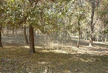
- Majeed Amjad, one of the founding forefathers of modern Urdu literature, was born in Sahiwal and received his education from Government College Lahore. He was inspired by the greenery of Sahiwal and wrote about its trees and greenery. There is a park named for him.
- Begum Sarwat Imtiaz who took oath in 1959 as Lambardar of Village Chak 43/12 L, Chichawatni, District Montgomery (now Sahiwal), was the first ever female Lambardar in West Pakistan. Presently her daughter Begum Arshia Azhar is Lambardar of said village. That was recognized as a milestone for women empowerment in Pakistan and the Muslim world.[13]
Education
- Divisional Public School and College
- Allama Iqbal Polytechnic Institute
- Govt. Post Graduate College Sahiwal
- Army Public Schools Colleges System
References
- ↑ Population Table, Urban Resource Centre
- ↑ Montgomery District, Imperial Gazetteer of India, v. 17, p. 410, 1860-1922
- 1 2 Montgomery District, Imperial Gazetteer of India, v. 17, p. 411
- ↑ http://www.findpk.com/cities/Explorer-pakistan-Sahiwal.html
- ↑ Synthetic Dairy Breed Proposal
- ↑ Handbook of Australian Livestock, Australian Meat & Livestock Corporation, 1989, 3rd edition.
- ↑ Genus Bos: Cattle Breeds of the World, 1985, MSO-AGVET (Merck & Co., Inc.), Rahway, N.J.
- ↑ Mason, I.L. 1996. A World Dictionary of Livestock Breeds, Types and Varieties. Fourth Edition. C.A.B International. 273 pp.
- ↑ Sahiwal Cattle
- ↑ Research Centre for Conservation of Sahiwal Cattle
- ↑ Harappa
- ↑ T. W. B. Kibble, "Muhammad Abdus Salam, K. B. E., (29 January 1926-21 November 1996)" Biographical Memoirs of Fellows of the Royal Society, Vol. 44, Nov., 1998, pp. 386-401.
- ↑ (20 March 2016)" CAMP,
Neighbourhoods of Sahiwal | ||
|---|---|---|
Administrations: Sahiwal Division and Sahiwal District | ||
| Tehsils |  | |
| Cities |
| |
| Towns and councils | ||
| Villages | ||
Website: Sahiwal District at NRB | ||
Provincial capital: Lahore | ||
| Bahawalpur | _Districts.svg.png) | |
| Dera Ghazi Khan | ||
| Faisalabad | ||
| Gujranwala | ||
| Lahore | ||
| Multan | ||
| Rawalpindi | ||
| Sargodha | ||
| Sahiwal | ||
| Sheikhupura | ||
See also: Districts of Punjab, India | ||
Coordinates: 30°35′N 73°20′E / 30.583°N 73.333°E