Mandi Bahauddin District
| Mandi-Bahauddin District ضلع منڈی بہاؤالدین | |
|---|---|
| District | |
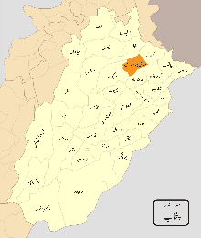 Map of Punjab with Mandi-Bahauddin District highlighted | |
| Coordinates: 32°35′N 73°30′E / 32.583°N 73.500°E | |
| Country | Pakistan |
| Province | Punjab |
| Headquarters | Mandi Bahauddin |
| Government | |
| • DCO | Muzaffar khan Sial |
| Area | |
| • Total | 7,623 km2 (2,943 sq mi) |
| Population (1998) | |
| • Total | 1,160,552 |
| Time zone | PST (UTC+5) |
| Number of tehsils | 3 |
Mandi Bahauddin (also spelled Mandi Baha ud Din) (Urdu: ضلع منڈی بہاؤالدین ) is a district in the Punjab province of Pakistan. It is bordered on the northwest by the Jhelum River, on the southeast by the Chenab River (which separates it from Gujranwala District and Gujrat District), and on the southwest by the Sargodha District. The district has an area of 2,673 square kilometres (1,032 sq mi).
Administration
Mandi Bahauddin is subdivided into three tehsils and 65 Union Councils:[1]
| Name of Tehsil | Number of Union Councils |
|---|---|
| Malakwal | 17 |
| Mandi Bahauddin | 27 |
| Phalia | 21 |
| Total | 65 |
History
The Battle of the Hydaspes River, between Alexander the Great and the Raja Porus of India, took place to the west of Mandi Bahauddin in 325 BCE. Raja Porus was staying nearby, in a portion of ancient India that is now a part of Pakistan. This was the last major war fought by Alexander. Harry Roy, the son of Raja Porus, and Bucephalus, Alexander the Great's horse, both died on the first day of this battle. After the death of his son, Raja Porus, who had been stationed at Nazampur, brought elephants and fought Alexander the Great himself. As a result of this battle, Alexander founded two cities; Nicaea ("Victory") at the site of modern-day Mong, and Bucephala at the site (possibly) of Phalia in Pakistan.
In 997 CE, Sultan Mahmud Ghaznavi took over the Ghaznavid Empire established by his father, Sultan Sebuktegin. In 1005 he conquered the Shahis in Kabul, followed by the conquest of the Punjab region. The Delhi Sultanate and Mughal Empire later ruled the region. The Punjab region became predominantly Muslim as a result of the influence of missionary Sufi saints, whose dargahs dot the landscape of the Punjab.
In 1506, Hazrat Bahauddin, a Sufi Darvesh, migrated to this area from Pindi Shah Jahanian and established a settlement named Pindi Bahauddin, later renamed Mandi Bahauddin.
After the decline of the Mughal Empire, the native Sikhs of Punjab formed the Sikh Empire and took charge of Mandi Bahauddin District.
The Second Anglo-Sikh War of 1849 took place nearby; Lord Guff led the British forces against the Khalsa Sikh Army at Chillianwala. A graveyard at Rakh Minar near Chillianwala has its own Ancient memorial where many British Army soldiers and officers were buried. During the period of British rule, the Mandi Bahauddin district increased in population and importance. The British established public services such as canals and irrigation facilities, and also the North-Western Railway to facilitate the northern defence of their empire. It was at this time that the Mandi Bahauddin Railway Station was built.
In 1920, the town name became official, and in 1924 Pindi-Bahauddin Railway Station was officially granted its name. In 1937, the town of Mandi-Bahauddin was granted permission to form a town committee, which became a municipal committee in 1941. In the 1923 master reconstruction plan, all the streets and roads were straightened and widened. In 1946, in response to local riots, the nine gates and the wall surrounding the town were completed..
The predominantly Muslim population supported the Muslim League and the Pakistan Movement. After the independence of Pakistan in 1947, the minority Hindus and Sikhs migrated to India, while Muslim refugees from India settled in the Mandi Bahauddin District. In 1960, Phalia was granted the status of a Sub-Division of the District of Gujrat and Mandi Bahauddin was named as its headquarters.
In 1963, the Rasul Barrage and Rasul-Qadirabad link canal project was created as a component of the Indus Basin irrigation project. The project was managed by the Water and Power Development Authority (WAPDA), and a colony for government employees and foreign contractors was constructed a few kilometres from Mandi Bahauddin. The canal project was completed in 1968 by engineer Riazur Rahman Shariff, enhancing the commercial power of the community.
In 1993, Mian Manzoor Ahmed Wattoo, the Chief Minister of Punjab, declared this city the headquarters of the new district of Mandi Bahauddin.
Geography
The district forms a central portion of the Chaj Doab lying between the Jhelum and Chenab rivers. It lies from 30° 8' to 32° 40' N and 73° 36' to 73° 37' E. The tehsil headquarters towns of Phalia and Malikwal are 22.5 and 28.5 kilometres (14.0 and 17.7 mi) from Mandi Bahauddin, respectively. It is bounded on the north by the Jhelum river, which separates it from Jehlam district; on the west by Sargodha district; on the south by the river Chenab (which separates it from the Gujranwala and Hafizabad districts); and on the east by Gujrat district. The total area of the district is 2,673 square kilometres (1,032 sq mi). The district comprises the Mandi Bahauddin, Phalia, and Malikwal tehsils.
Demography and language
According to the 1998 Pakistan census, the population of the district was 1,160,552, 14.93% of which lived in urban environments.[2]
Punjabi is the most commonly spoken language, and Urdu is also widely spoken.
Climate
This district has a moderate climate, hot in summer and cold in winter. During the peak of summer the temperature may rise to 45 °C (113 °F) during the day, but in the winter months the minimum temperature may fall below 12 °C (54 °F). The average rainfall in the district is 388 millimetres (15.3 in).[3]
Education
There are numerous schools and colleges in the district, including District Jinnah Public School and College Mandi Bahauddin, LGS,Beacon House School System, American Lycetuff, The Educators, Rangers public school and college and the University of Engineering & Technology, Rasul.
Notable people
- Ch. Nazar Muhammad Gondal,
- Dr Ch Abrar Majid, Advocate/Human Rights Activist
- Muhammad Lehrasib Khan Gondal
- Naved Arif Gondal, Pakistani cricketer
- Nasir Iqbal Bosal, M.N.A.
- Mumtaz Ahmed Tarar, M.N.A
- Muhammad Tariq Tarar
- Chaudhry Imtiaz Ahmed Ranjha
- Basma Riaz Choudhry
- Asif Bashir Bhagat
- Pir Syed Tariq Yaqoob Rizvi
- Pir Syed Muhammad Binyamin Rizvi
- Pir Syed Mohammad Yaqoob Shah
- Pir Syed Muhammad Mahfooz Mashhadi, M.P.A [4]
References
- ↑ Tehsils & Unions in the District of Mandi Bahauddin
- ↑ Population – Urban Resource Centre (1998 census details)
- ↑ "Average rainfall & Temperature in mandi bahauddin". World Weather. Retrieved 25 October 2013.
- ↑ http://www.pap.gov.pk/index.php/members/profile/en/20/973
Coordinates: 32°35′0″N 73°30′0″E / 32.58333°N 73.50000°E
Provincial capital: Lahore | ||
| Bahawalpur | _Districts.svg.png) | |
| Dera Ghazi Khan | ||
| Faisalabad | ||
| Gujranwala | ||
| Lahore | ||
| Multan | ||
| Rawalpindi | ||
| Sargodha | ||
| Sahiwal | ||
| Sheikhupura | ||
See also: Districts of Punjab, India | ||
Choudry Azamat Ullah Marth