San Miguel, New Mexico
| San Miguel, New Mexico | |
|---|---|
| Census-designated place | |
 San Miguel | |
| Coordinates: 32°09′19″N 106°44′06″W / 32.15528°N 106.73500°WCoordinates: 32°09′19″N 106°44′06″W / 32.15528°N 106.73500°W | |
| Country | United States |
| State | New Mexico |
| County | Doña Ana |
| Area[1] | |
| • Total | 2.288 sq mi (5.93 km2) |
| • Land | 2.288 sq mi (5.93 km2) |
| • Water | 0 sq mi (0 km2) |
| Elevation | 3,822 ft (1,165 m) |
| Population (2010)[1] | |
| • Total | 1,153 |
| • Density | 500/sq mi (190/km2) |
| Time zone | Mountain (MST) (UTC-7) |
| • Summer (DST) | MDT (UTC-6) |
| ZIP code | 88058 |
| Area code(s) | 575 |
| GNIS feature ID | 920696[2] |
San Miguel is a census-designated place in Doña Ana County, New Mexico, United States. Its population was 1,153 as of the 2010 census.[1] San Miguel has a post office with ZIP code 88058.[3] The community is located at the junction of New Mexico State Road 28 and New Mexico State Road 192.
Geography
San Miguel is located at 32°09′12″N 106°43′37″W / 32.153459°N 106.726850°W. According to the U.S. Census Bureau, the community has an area of 2.288 square miles (5.93 km2), all of it land.[1]
Education
The Gadsden Independent School District operates public schools, including North Valley Elementary School.[4]
See also
References
- 1 2 3 4 "2010 Census Gazetteer Files - Places: New Mexico". U.S. Census Bureau. Retrieved August 21, 2014.
- ↑ "San Miguel". Geographic Names Information System. United States Geological Survey.
- ↑ https://tools.usps.com/go/ZipLookupResultsAction!input.action?resultMode=0&companyName=&address1=&address2=&city=San+Miguel&state=NM&urbanCode=&postalCode=&zip=
- ↑ "Elementary schools." Gadsden Independent School District. Retrieved on August 19, 2015.
Municipalities and communities of Doña Ana County, New Mexico, United States | ||
|---|---|---|
| Cities | 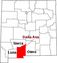 | |
| Town | ||
| Village | ||
| CDPs | ||
| Ghost towns | ||
This article is issued from Wikipedia - version of the 11/4/2015. The text is available under the Creative Commons Attribution/Share Alike but additional terms may apply for the media files.