Vado, New Mexico
| Vado, New Mexico | |
|---|---|
| Census-designated place | |
 Location of Vado, New Mexico | |
| Coordinates: 32°7′45″N 106°39′4″W / 32.12917°N 106.65111°WCoordinates: 32°7′45″N 106°39′4″W / 32.12917°N 106.65111°W | |
| Country | United States |
| State | New Mexico |
| County | Dona Ana |
| Settled | 1886[1] |
| Area | |
| • Total | 3.0 sq mi (7.7 km2) |
| • Land | 3.0 sq mi (7.7 km2) |
| • Water | 0.0 sq mi (0.0 km2) |
| Elevation | 3,822 ft (1,165 m) |
| Population (2010) | |
| • Total | 3,194 |
| • Density | 1,072/sq mi (414.0/km2) |
| Time zone | Mountain (MST) (UTC-7) |
| • Summer (DST) | MDT (UTC-6) |
| ZIP codes | 88048, 88072 |
| Area code(s) | 575 |
| FIPS code | 35-81590 |
| GNIS feature ID | 0920727 |
Vado is an unincorporated community and census-designated place (CDP) in Doña Ana County, New Mexico, United States. The population was 3,194 at the 2010 census.[2] The ZIP code for Vado is 88072, its area code is 575, and it is part of the Las Cruces Metropolitan Statistical Area.
Geography
Vado is located in southeastern Doña Ana County at 32°7′45″N 106°39′4″W / 32.12917°N 106.65111°W (32.129233, -106.651006).[3] It is in the Mesilla Valley, on the east side of the Rio Grande. Interstate 10 forms the eastern edge of the CDP, with access from Exit 155. I-10 leads north 17 miles (27 km) to Las Cruces, the county seat, and south 32 miles (51 km) to El Paso, Texas.
According to the United States Census Bureau, the CDP has a total area of 3.0 square miles (7.7 km2), all land.[2]
Demographics
As of the census[4] of 2000, there were 3,003 people, 776 households, and 709 families residing in the CDP. The population density was 1,013.8 people per square mile (391.7/km²). There were 814 housing units at an average density of 274.8 per square mile (106.2/km²). The racial makeup of the CDP was 53.98% White, 1.03% African American, 1.50% Native American, 0.07% Asian, 39.93% from other races, and 3.50% from two or more races. Hispanic or Latino of any race were 95.00% of the population.
There were 776 households out of which 61.0% had children under the age of 18 living with them, 68.6% were married couples living together, 16.9% had a female householder with no husband present, and 8.6% were non-families. 7.0% of all households were made up of individuals and 3.0% had someone living alone who was 65 years of age or older. The average household size was 3.87 and the average family size was 4.03.
In the CDP the population was spread out with 39.2% under the age of 18, 11.6% from 18 to 24, 26.7% from 25 to 44, 16.1% from 45 to 64, and 6.4% who were 65 years of age or older. The median age was 24 years. For every 100 females there were 100.3 males. For every 100 females age 18 and over, there were 94.7 males.
The median income for a household in the CDP was $23,538, and the median income for a family was $24,136. Males had a median income of $16,335 versus $15,121 for females. The per capita income for the CDP was $6,323. About 32.8% of families and 34.0% of the population were below the poverty line, including 46.2% of those under age 18 and 24.4% of those age 65 or over.
Education
The Gadsden Independent School District operates public schools, including Vado Elementary School, the designated high school for this area would be Gadsden High School.[5] or Alta Vista Early College High School.
References
- ↑ United States. (2004). Delivering results to colonias and farmworker communities = Entrega de resultados a las colonias y comunidades de trabajadores del campo. Entrega de resultados a las colonias y comunidades de trabajadores del campo. Washington, D.C.: U.S. Dept. of Housing and Urban Development, Office of Dept. Operations and Coordination. Retrieved 2015-04-09.
- 1 2 "Geographic Identifiers: 2010 Demographic Profile Data (G001): Vado CDP, New Mexico". U.S. Census Bureau, American Factfinder. Retrieved November 4, 2015.
- ↑ "US Gazetteer files: 2010, 2000, and 1990". United States Census Bureau. 2011-02-12. Retrieved 2011-04-23.
- ↑ "American FactFinder". United States Census Bureau. Retrieved 2008-01-31.
- ↑ "Elementary schools." Gadsden Independent School District. Retrieved on August 19, 2015.
Further reading
- Sorrentino, Joseph (2014). "Off the grid: life in a colonia". Commonweal (13): 25. ISSN 0010-3330. Retrieved 2015-03-20.
Municipalities and communities of Doña Ana County, New Mexico, United States | ||
|---|---|---|
| Cities | 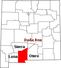 | |
| Town | ||
| Village | ||
| CDPs | ||
| Ghost towns | ||