Silver Grove, Kentucky
| Silver Grove, Kentucky | |
|---|---|
| City | |
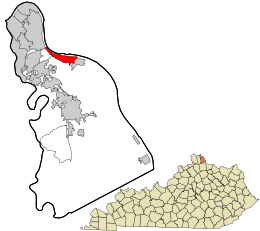 Location in Campbell County and the state of Kentucky. | |
| Coordinates: 39°2′13″N 84°23′55″W / 39.03694°N 84.39861°WCoordinates: 39°2′13″N 84°23′55″W / 39.03694°N 84.39861°W | |
| Country | United States |
| State | Kentucky |
| County | Campbell |
| Incorporation | December 29, 1950[1] |
| Government | |
| • Type | Mayor-Council |
| • Mayor | Neal Bedel[2] (R) |
| Area | |
| • Total | 1.7 sq mi (4.3 km2) |
| • Land | 1.1 sq mi (2.9 km2) |
| • Water | 0.5 sq mi (1.4 km2) |
| Elevation | 495 ft (151 m) |
| Population (2010) | |
| • Total | 1,102[3] |
| • Density | 971/sq mi (374.9/km2) |
| Time zone | Eastern (EST) (UTC-5) |
| • Summer (DST) | EDT (UTC-4) |
| ZIP code | 41085 |
| Area code(s) | 859 |
| FIPS code | 21-70644 |
| GNIS feature ID | 0503511 |
| Website |
cityofsilvergroveky |
Silver Grove is a home rule-class city[4] along the Ohio River in Campbell County, Kentucky, in the United States. The population was 1,102 during the 2010 U.S. Census.[3]
History
Silver Grove is a railroad town founded in 1911 for the Chesapeake and Ohio Railway. In 1914, a newspaper described it as a modern town, because it boasted electric lights, an urban water and sewer system, a modernized fire department, a school, and a spacious park. In 1948, C&O wanted out of the city. In 1951, Gerald Losey was selected as the first mayor.[5]
Geography
Silver Grove is located in northeastern Campbell County at 39°2′13″N 84°23′55″W / 39.03694°N 84.39861°W (39.036902, −84.398652), on the south bank of the Ohio River.[6] Kentucky Route 8 passes through the city, leading northwest (downstream) along the river 8 miles (13 km) to Dayton and southeast 32 miles (51 km) to Augusta. Downtown Cincinnati, Ohio, is 10 miles (16 km) to the northwest via Interstate 471.
According to the United States Census Bureau, Silver Grove has a total area of 1.7 square miles (4.3 km2), of which 1.1 square miles (2.9 km2) is land and 0.54 square miles (1.4 km2), or 31.61%, is water.[7]
Climate
Silver Grove is located within a climatic transition zone, being at the extreme northern limit of the humid subtropical climate and the extreme southern limit of the humid continental climate. The overall climate in Silver Grove is more mild than would normally be expected for this area primarily because the area is moderated by the Ohio River, being situated in a valley, and lying to the east of several metropolitan areas (Cincinnati, Covington, Newport) which combine to produce an urban heat microclimate for the area.
Demographics
| Historical population | |||
|---|---|---|---|
| Census | Pop. | %± | |
| 1960 | 1,207 | — | |
| 1970 | 1,365 | 13.1% | |
| 1980 | 1,260 | −7.7% | |
| 1990 | 1,102 | −12.5% | |
| 2000 | 1,215 | 10.3% | |
| 2010 | 1,102 | −9.3% | |
| Est. 2015 | 1,120 | [8] | 1.6% |
As of the census[10] of 2010, there were 1,102 people,[3] 417 households,[3] and 260 families residing in the city.[3] The population density was 999.8 people per square mile (384.5/km²). There were 496 housing units[3] at an average density of 408.1 per square mile (157.0/km²). The racial makeup of the city was 98% White,[3] 0.1% African American,[3] 0.1% Asian,[3] 0.4% from other races,[3] and 1.5% from two or more races.[3] Hispanic or Latino of any race were 0.2% of the population.[3]
There were 417 households out of which 31.4% had children under the age of 18 living with them,[3] 42.2% were married couples living together,[3] 11.5% had a female householder with no husband present,[3] and 37.6% were non-families.[3] 30.2% of all households were made up of individuals and 6.71% had someone living alone who was 65 years of age or older.[3] The average household size was 2.63 and the average family size was 3.31.[3]
In the city the population was spread out with 28.1% under the age of 18, 10.0% from 18 to 24, 32.4% from 25 to 44, 18.0% from 45 to 64, and 11.4% who were 65 years of age or older. The median age was 32 years. For every 100 females there were 115.0 males. For every 100 females age 18 and over, there were 109.4 males.
The median income for a household in the city was $32,448, and the median income for a family was $41,691. Males had a median income of $36,083 versus $23,977 for females. The per capita income for the city was $15,129. About 8.8% of families and 10.7% of the population were below the poverty line, including 12.2% of those under age 18 and 12.9% of those age 65 or over.
In the 2012 U.S. presidential election, unlike most of Kentucky, the city supported the Democratic candidate Barack Obama.[11]
Education
Silver Grove has an inclusive school system, K – 12. The population of each class is approximately 25 children per class which is one of the smallest in the state. The independent school was to be absorbed into the Campbell County school system as an elementary school in 1980, but local civic action raised enough public awareness to remain an independent school system. The price of school tax was a driving factor in eliminating a community based school. Silver Grove has the distinction of being the only school in Kentucky with an inanimate object as the school mascot. The boys teams go by "Big Train" and the girls teams go by "Lady Trains", a heritage from being founded by the railroad.
See also
References
- ↑ Commonwealth of Kentucky. Office of the Secretary of State. Land Office. "Silver Grove, Kentucky". Accessed 26 Aug 2013.
- ↑ Clarity Elections.com. "Campbell Co. Election Results".
- 1 2 3 4 5 6 7 8 9 10 11 12 13 14 15 16 17 18 http://factfinder2.census.gov/faces/tableservices/jsf/pages/productview.xhtml?pid=DEC_10_DP_DPDP1&prodType=table
- ↑ "Summary and Reference Guide to House Bill 331 City Classification Reform" (PDF). Kentucky League of Cities. Retrieved December 30, 2014.
- ↑ Northern Kentucky.com. "City of Silver Grove, Kentucky". Accessed 17 October 2011.
- ↑ "US Gazetteer files: 2010, 2000, and 1990". United States Census Bureau. 2011-02-12. Retrieved 2011-04-23.
- ↑ "Geographic Identifiers: 2010 Demographic Profile Data (G001): Silver Grove city, Kentucky". U.S. Census Bureau, American Factfinder. Retrieved August 6, 2014.
- ↑ "Annual Estimates of the Resident Population for Incorporated Places: April 1, 2010 to July 1, 2015". Retrieved July 2, 2016.
- ↑ "Census of Population and Housing". Census.gov. Retrieved June 4, 2015.
- ↑ "American FactFinder". United States Census Bureau. Retrieved 2008-01-31.
- ↑
External links
Municipalities and communities of Campbell County, Kentucky, United States | ||
|---|---|---|
| Cities | 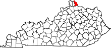 | |
| CDP | ||
| Unincorporated communities | ||