California, Kentucky
| California, Kentucky | |
|---|---|
| City | |
 Location in Campbell County and the state of Kentucky. | |
| Coordinates: 38°55′9″N 84°15′48″W / 38.91917°N 84.26333°WCoordinates: 38°55′9″N 84°15′48″W / 38.91917°N 84.26333°W | |
| Country | United States |
| State | Kentucky |
| County | Campbell |
| Area | |
| • Total | 0.25 sq mi (0.66 km2) |
| • Land | 0.25 sq mi (0.66 km2) |
| • Water | 0 sq mi (0 km2) |
| Elevation | 482 ft (147 m) |
| Population (2010) | |
| • Total | 90 |
| • Density | 351/sq mi (135.5/km2) |
| Time zone | Eastern (EST) (UTC-5) |
| • Summer (DST) | EDT (UTC-4) |
| ZIP code | 41007 |
| Area code(s) | 859 |
| FIPS code | 21-11872 |
| GNIS feature ID | 0488613 |
California is a Home rule class city in Campbell County, Kentucky, United States. The population was 90 at the 2010 census.[1]
Geography
California is located in southeastern Campbell County at 38°55′9″N 84°15′48″W / 38.91917°N 84.26333°W (38.919144, −84.263381),[2] along the Ohio River. Kentucky Route 8 passes just west of the community, leading northwest (downstream) along the river 23 miles (37 km) to Covington and southeast (upstream) 21 miles (34 km) to Augusta. Clermontville, in Clermont County, Ohio, is directly across the river from California, but the closest bridge across the river is Interstate 275 14 miles (23 km) downriver.
According to the United States Census Bureau, the city of California has a total area of 0.25 square miles (0.66 km2), all land.[1]
Climate
The climate in this area is characterized by hot, humid summers and generally mild to cool winters. According to the Köppen Climate Classification system, California has a humid subtropical climate, abbreviated "Cfa" on climate maps.[3]
History
A post office has been in operation at California since 1852.[4] The community was named after the state of California.[5] California was incorporated as a city on February 7, 1874.[6]
The Elijah Herndon House in California is listed on the National Register of Historic Places in Campbell County.
Demographics
| Historical population | |||
|---|---|---|---|
| Census | Pop. | %± | |
| 1880 | 179 | — | |
| 1890 | 316 | 76.5% | |
| 1900 | 292 | −7.6% | |
| 1910 | 248 | −15.1% | |
| 1920 | 146 | −41.1% | |
| 1930 | 144 | −1.4% | |
| 1940 | 106 | −26.4% | |
| 1950 | 117 | 10.4% | |
| 1960 | 163 | 39.3% | |
| 1970 | 90 | −44.8% | |
| 1980 | 135 | 50.0% | |
| 1990 | 130 | −3.7% | |
| 2000 | 86 | −33.8% | |
| 2010 | 90 | 4.7% | |
| Est. 2015 | 86 | [7] | −4.4% |
As of the census[9] of 2000, there were 86 people, 26 households, and 21 families residing in the city. The population density was 358.2 people per square mile (138.4/km²). There were 27 housing units at an average density of 112.5 per square mile (43.4/km²). The racial makeup of the city was 100.00% White.
There were 26 households out of which 57.7% had children under the age of 18 living with them, 73.1% were married couples living together, 3.8% had a female householder with no husband present, and 19.2% were non-families. 19.2% of all households were made up of individuals and none had someone living alone who was 65 years of age or older. The average household size was 3.31 and the average family size was 3.76.
In the city the population was spread out with 36.0% under the age of 18, 7.0% from 18 to 24, 37.2% from 25 to 44, 16.3% from 45 to 64, and 3.5% who were 65 years of age or older. The median age was 32 years. For every 100 females there were 68.6 males. For every 100 females age 18 and over, there were 89.7 males.
The median income for a household in the city was $37,500, and the median income for a family was $38,000. Males had a median income of $43,750 versus $30,625 for females. The per capita income for the city was $15,143. None of the population and none of the families were below the poverty line.
The U.S. Postal Service ZIP code area for California serves a population of approximately 4,000, almost all of whom live outside the city limits.
Education
Residents are within the Campbell County School District.[10] Residents are zoned to Campbell County High School in Alexandria.
See also
References
- 1 2 "Geographic Identifiers: 2010 Demographic Profile Data (G001): California city, Kentucky". U.S. Census Bureau, American Factfinder. Retrieved August 5, 2014.
- ↑ "US Gazetteer files: 2010, 2000, and 1990". United States Census Bureau. 2011-02-12. Retrieved 2011-04-23.
- ↑ Climate Summary for California, Kentucky
- ↑ "Campbell County". Jim Forte Postal History. Retrieved 16 April 2015.
- ↑ "Towns named after states". Reading Eagle. Jul 2, 1897. p. 3. Retrieved 14 October 2015.
- ↑ Commonwealth of Kentucky. Office of the Secretary of State. Land Office. "California, Kentucky". Accessed 22 Jul 2013.
- ↑ "Annual Estimates of the Resident Population for Incorporated Places: April 1, 2010 to July 1, 2015". Retrieved July 2, 2016.
- ↑ "Census of Population and Housing". Census.gov. Archived from the original on May 11, 2015. Retrieved June 4, 2015.
- ↑ "American FactFinder". United States Census Bureau. Archived from the original on 2013-09-11. Retrieved 2008-01-31.
- ↑ "SCHOOL DISTRICT REFERENCE MAP (2010 CENSUS): Campbell County, KY" (Archive). U.S. Census Bureau. Retrieved on May 8, 2014.
Municipalities and communities of Campbell County, Kentucky, United States | ||
|---|---|---|
| Cities | 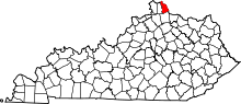 | |
| CDP | ||
| Unincorporated communities | ||