South Cotabato
| South Cotabato | |||
|---|---|---|---|
| Province | |||
| Province of South Cotabato | |||
| |||
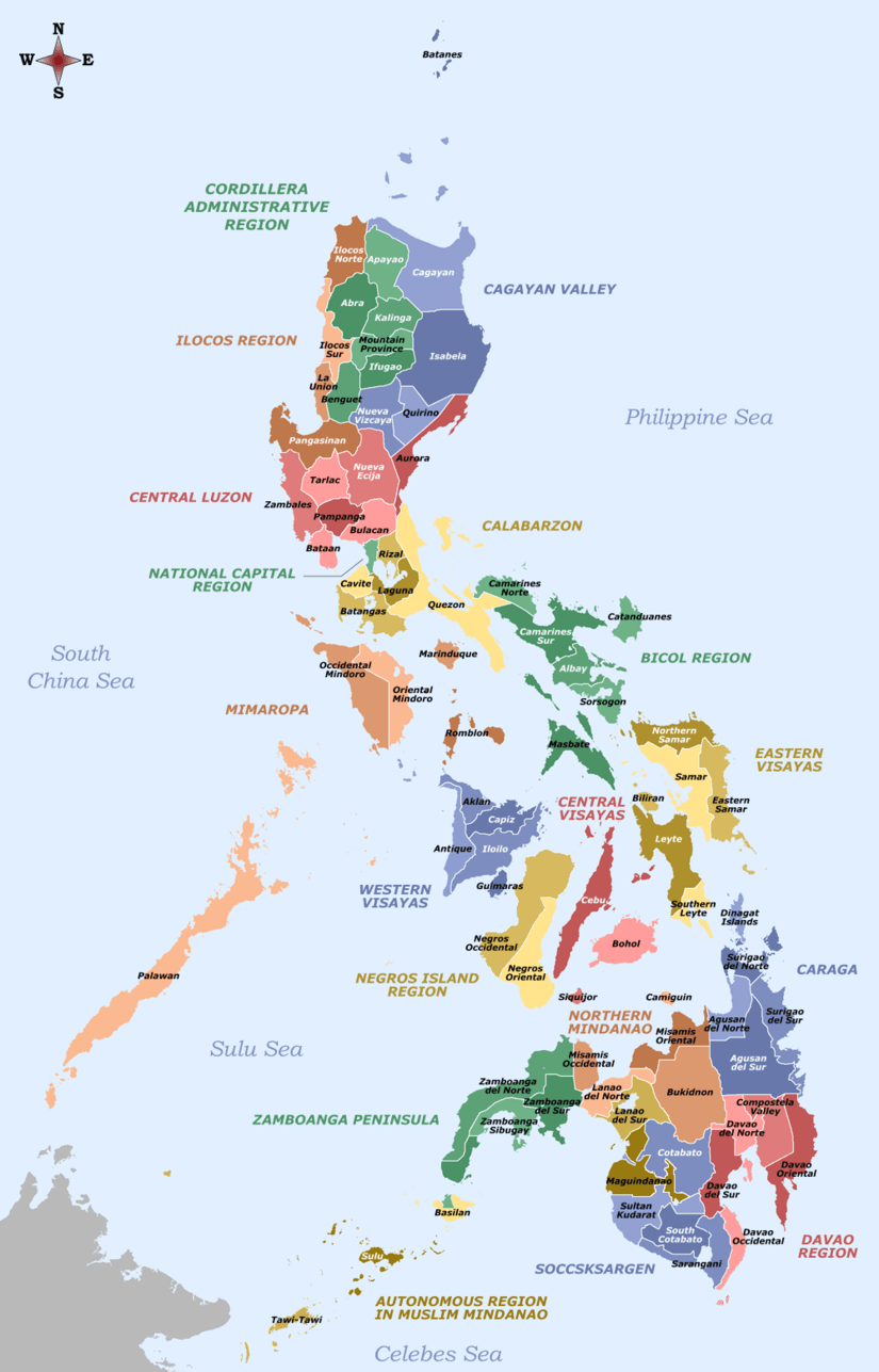
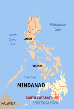 Location in the Philippines | |||
| Coordinates: 6°10′N 125°00′E / 6.17°N 125°ECoordinates: 6°10′N 125°00′E / 6.17°N 125°E | |||
| Country | Philippines | ||
| Region | Soccsksargen (Region XII) | ||
| Founded | June 18, 1966 | ||
| Capital | Koronadal | ||
| Government | |||
| • Type | Sangguniang Panlalawigan | ||
| • Governor | Daisy Avance-Fuentes (NPC) | ||
| • Vice Governor | Vicente De Jesus (NPC) | ||
| Area[1] | |||
| • Total | 3,935.95 km2 (1,519.68 sq mi) | ||
| Area rank | 32nd out of 81 | ||
| (excluding General Santos) | |||
| Population (2015 census)[2] | |||
| • Total | 915,289 | ||
| • Rank | 28th out of 81 | ||
| • Density | 230/km2 (600/sq mi) | ||
| • Density rank | 41st out of 81 | ||
| (excluding General Santos) | |||
| Divisions | |||
| • Independent cities | |||
| • Component cities | |||
| • Municipalities | |||
| • Barangays |
| ||
| • Districts | 1st and 2nd districts of South Cotabato (shared with General Santos City) | ||
| Time zone | PST (UTC+8) | ||
| ZIP code | 9500–9513 | ||
| IDD : area code | +63 (0)83 | ||
| ISO 3166 code | PH-SCO | ||
| Spoken languages | |||
| Website |
www | ||


South Cotabato, officially the Province of South Cotabato (Hiligaynon: Bagatnan nga Kotabato; Cebuano: Habagatang Kotabato; Maguindanaon: Kuta Wato Saut; Filipino: Timog Kotabato), is a province in the Philippines located in the SOCCSKSARGEN region in Mindanao. Its capital is Koronadal City, and it borders Sultan Kudarat to the north and west, Sarangani to the south and northeast, and Davao del Sur to the far northeast. To the southeast lies Sarangani Bay.
General Santos, located on the shores of Sarangani Bay, is the most populous city in the region, but is governed independently from the province. The province of Sarangani used to be part of South Cotabato until it was made an independent province in 1992.
History
Centuries ago, the area that would be the South Cotabato was sparsely inhabited by Malay pioneers which later evolved into various ethnic groupings that still exist in the province today. The Spaniards launched expeditions to subdue the area throughout the colonial era but they never gained control of the region until the middle of the 19th century after the Spaniards established a military post at what is now Barangay Tamontaka, one of the earliest Christian settlements founded south of the Philippines, in present-day Cotabato City. Spaniards already took with them Chabacanos and Chabacano-speaking Muslims from Zamboanga and Basilan and Cebuanos.

The area of what is now South Cotabato and Sarangani provinces used to be part of Davao province until 1914, when the reorganization of the districts in Mindanao took place, thus it became part of the then-undivided Cotabato province. Settlers, who would lay the foundation of what would become a progressive province, started trooping down 1914.
The significant thrust occurred during the term of President Quezon in late 1930s. General Paulino Santos led the first of wave of settlers that time. After World War II, the final exodus of settlers from Luzon and Visayas poured into the area's virgin land.
In the early 1960s as population, trade and industries grew in southern part of Cotabato, a clamor of local self-governance arose. Thus, on July 18, 1966, South Cotabato was separated from Cotabato as an independent province.[3] At that time, the province consisted of 11 municipalities, namely: Banga, South Cotabato, General Santos (now a city), Glan, Kiamba, Koronadal, Maitum, Norala, Polomolok, Surallah, Tantangan, and Tupi. These municipalities were established long before the creation of the province. Other component municipalities were formed after it fully functioned as a province.
With the creation of regions under Pres. Ferdinand Marcos, South Cotabato was grouped with Region XI, also known as Southern Mindanao, in 1975.[4]
In 1992, the province of Sarangani was formed out of South Cotabato. Seven towns in southern and coastal section of the province (Malungon, Alabel, Malapatan, Glan, Maasim, Kiamba and Maitum) became part of the new province, leaving South Cotabato with 11 remaining municipalities.[5]
Regional offices were relocated to South Cotabato in accordance with EO 429 dated October 12, 1990, issued by President Corazon C. Aquino during the expansion of the newly created Autonomous Region in Muslim Mindanao,[6] and EO No. 36 dated September 19, 2001, issued by President Gloria Macapagal Arroyo which says South Cotabato is to be transferred from Southern Mindanao region to Region XII and having the city of Koronadal as the regional center of Region XII.[7]
On August 16, 2000, Republic Act No. 8803 was approved, that converted the municipality of Koronadal into a component city of South Cotabato.[8]
In 2015, the National Competitiveness Council declared the province as the 4th most competitive province in the country.
Geography
South Cotabato covers a total land area of 3,935.95 square kilometres (1,519.68 sq mi).[9] When General Santos City is included for geographical purposes, the province's land area is 4,428.81 square kilometres (1,709.97 sq mi).[9] The province is situated on the southern section of central Mindanao, bounded by the provinces of Sultan Kudarat to the north and west, Sarangani to the south and northeast, Davao del Sur to the far northeast, and the Sarangani Bay to the southeast.
The province is generally flat dotted with some hills and mountains.
Climate
South Cotabato belongs to the fourth type of climate, that is rainfall is more or less evenly distributed throughout the year. The average number of rainy days for the year 2004 is recorded between 122 and 180 days with the months of May, June, July, August and October having the most occurrence.
Air humidity generally follows closely the rainfall pattern. Humidity is highest during the period of June to October with 88% being recorded at the Tupi seed farm. The months of February and April have the lowest air humidity recorded at about 72%.

Maximum daytime temperature throughout the province is in the range of 36 to 38 °C (97 to 100 °F), falling to 23 to 32 °C (73 to 90 °F) during the night depending on the elevation. The hottest period is January to April while July to December being the coolest.
South Cotabato enjoys a mild, pleasant climate with no pronounced dry or wet season, and is practically typhoon-free.
Administrative divisions
South Cotabato comprises 10 municipalities and 1 component city. The highly urbanized city of General Santos is traditionally grouped with, but administered independently from the province.
- † Provincial capital and component city
- Municipality
- ‡ Highly urbanized city (geographically within but independent from the province)
| |||||||||||||||||||||||||||||||||||||||||||||||||||||||||||||||||||||||||||||||||||||||||||||||||||||||||||||||||||||||||||||||||||||||||||||||||||||||||||||||||||||||||||||||||||||||||||||||||||||||||
Demographics
| Population census of South Cotabato | ||
|---|---|---|
| Year | Pop. | ±% p.a. |
| 1990 | 539,458 | — |
| 1995 | 621,155 | +2.68% |
| 2000 | 690,728 | +2.30% |
| 2007 | 767,254 | +1.46% |
| 2010 | 827,200 | +2.78% |
| 2015 | 915,289 | +1.95% |
| (excluding General Santos City) Source: Philippine Statistics Authority[2][10][10] | ||
The population of South Cotabato (excluding General Santos City) was 915,289 in the 2015 census,[2] making it one of the country's most populous province. The population density is 230 inhabitants per square kilometre or 600 inhabitants per square mile.
When General Santos City is included for geographical purposes, the province's population is 1,509,735 people,[2] with a density of 341 inhabitants per square kilometre (880/sq mi).
Inhabitants
The people of South Cotabato have diverse heritages. The Hiligaynon-speaking peoples from Panay and Negros in the Visayas settled the municipalities/towns of Norala, Banga, Surallah, Sto. Niño and the province's capital city, Koronadal, The province's major communication media is Filipino, English or Hiligaynon. On the other hand, people from the Ilocano-speaking peoples of Luzon settled in Tampakan, Tantangan and Tupi, and the Ilocano language may still be heard spoken in these towns. Cebuano is also the main ethnic ethnolinguistic group of the municipality of Polomolok and is one of the main ethnolinguistic groups of Tupi (along with Hiligaynon and Tagalog, which slightly differs from Manila Tagalog). Both towns are near to General Santos City, which speaks both, Ilonggo and Cebuano. Chavacano-speaking peoples are even found scattered in some areas of the province, as well as Maguindanaons.
Religion
As a result of several decades of migration from Visayas and Luzon, South Cotabato became a Roman Catholic predominated province with 57% adherence while Islam is a significant minority religion which is 35% of the population. Other minorities are various Christian Churches which can be found in some urban parts of the province.
The Maguindanao tribe is the major Muslim Filipino tribe in the province. Although many of them still wear their traditional costumes and practice their native customs, others have come to adapt the more liberal practices of their Christian neighbors such as wearing shorts and sleeveless shirts, eschewing the use of the headscarf, and attending dances/mixed gatherings. Other indigenous Filipino tribes are the T'boli and B'laan tribes in Lake Sebu and T'boli municipalities, famous for their brassworks, beadwork and t'nalak weave. The people of these tribes wear colorful embroidered native costumes and beadwork accessories. The women of these tribes, particularly, wear heavy brass belts with brass 'tassels' ending in tiny brass bells that herald their approach even when they are a long way off.
The people of South Cotabato still retain many of the practices and traditions of their particular tribal heritages, although infused with a flavor that is distinctly Mindanaoan and the product of cultural interaction between the immigrants and the indigenous peoples of the area. One vivid example of this is the predominant use of the native malong, the colorful, tubelike garment used as a skirt by the indigenous tribes, in place of a blanket or sleeping bag.
Language
The people of South Cotabato are multilingual, able to communicate in Hiligaynon and/or Cebuano, as well as in both Tagalog and English. Other languages spoken are Ilocano and Maguindanao. The indigenous tribes, in addition, use their own tribal languages. A situation wherein several people, each speaking solely in his own language and are still able to communicate with the others, is not unheard of.
Government
- Governor: Daisy Avance-Fuentes
- Vice Governor: Vicente De Jesus
The Local Provincial Government holds its official functions in the City of Koronadal. The Provincial Capitol, Provincial Hospital, and all related offices are found in the city.
| District | City | Municipality | Population (2015)[2] |
|---|---|---|---|
| 1st | General Santos City | 856,536 | |
| 2nd | Koronadal City | 653,199 |
- 1st District Representative: Pedro B. Acharon Jr.
- 2nd District Representative: Ferdinand L. Hernandez
In January 2011, South Cotabato officials began pushing for the separation of General Santos city into a separate legislative district before the May 2013 midterm national and local elections. The province's first district will be reshaped into the towns of Polomolok, Tupi, Tampakan and T’boli. Koronadal City and the six remaining towns will compose the province’s second district.[11]
Musical heritage
The native Maguindanaon of South Cotabato have a culture that revolves around kulintang music, a specific type of gong music, found among both Muslim and non-Muslim groups of the Southern Philippines.
Sister province
Notable people
- Kenneth Duremdes, professional basketball player
- Manny Pacquiao, professional boxer and politician
- Gerald Anderson, actor
- Melai Cantiveros, comedian/actress
- Orlando Quevedo, archbishop and cardinal-elect
- Shamcey Supsup, actress, television presenter, model, architect and beauty pageant titleholder
References
- ↑ "List of Provinces". PSGC Interactive. Makati City, Philippines: National Statistical Coordination Board. Retrieved 14 May 2014.
- 1 2 3 4 5 6 "Region XII (SOCCSKSARGEN)". Census of Population (2015): Total Population by Province, City, Municipality and Barangay (Report). PSA. Retrieved 20 June 2016.
- ↑ "Republic Act No. 4849 - An Act Creating the Province of South Cotabato". Chan Robles Virtual Law Library. Retrieved 8 January 2016.
- ↑ "Presidential Decree No. 742; Restructuring the Regional Organization of Mindanao, Basilan, Sulu and Tawi-Tawi". The LawPhil Project. 7 July 1975. Retrieved 8 January 2016.
- ↑ "An Act Creating the Province of Sarangani" (PDF). House of Representatives of the Philippines. 16 March 1992. Retrieved 8 January 2016.
- ↑ "Executive Order No. 429; Providing for the Reorganization of the Administrative Regions in Mindanao, And for Other Purposes". The LawPhil Project. 12 October 1990. Retrieved 8 January 2016.
- ↑ "Executive Order No. 36; Providing for the Reorganization of the Administrative Regions in Mindanao and for Other Purposes". The LawPhil Project. 19 September 2001. Retrieved 8 January 2016.
- ↑ "Republic Act No. 8803; An Act Converting the Municipality of Koronadal, South Cotabato Province, Into a Component City to Be Known As the City of Koronadal" (PDF). House of Representatives of the Philippines. Retrieved 8 January 2016.
- 1 2 3 4 "Province: South Cotabato". PSGC Interactive. Quezon City, Philippines: Philippine Statistics Authority. Retrieved 8 January 2016.
- 1 2 3 "Region XII (SOCCSKSARGEN)". Census of Population and Housing (2010): Total Population by Province, City, Municipality and Barangay (Report). NSO. Retrieved 29 June 2016.
- ↑ "House Bill 6038". Congress.gov.ph. 2012-05-07. Retrieved 2013-02-06.
External links
-
 Media related to South Cotabato at Wikimedia Commons
 -
 Geographic data related to South Cotabato at OpenStreetMap
 |
Sultan Kudarat | Davao del Sur | | |
| Sultan Kudarat | |
Sarangani | ||
| ||||
| | ||||
| Sarangani | Sarangani Bay |
Koronadal (capital) | |
| Municipalities | |
| Component City | |
| Highly Urbanized City |
|