St John Berchmans College, Brussels
| St John Berchmans College Sint-Jan Berchmanscollege | |
|---|---|
| Location | |
| Brussels, Belgium | |
| Information | |
| Type | Secondary |
| Established | 16 July 1604 |
| Affiliation | Jesuit (Roman Catholic) |
| Website | St John Berchmans College |
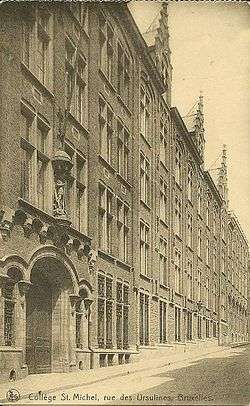 Early 20th century college | |
St John Berchmans College (Dutch: Sint-Jan Berchmanscollege) is a Roman Catholic secondary school founded by the Society of Jesus in Brussels. It is situated close to Chapel Church and is named after John Berchmans.
History
The school was founded by the Jesuits on 16 July 1604 and had 400 students that same year. However, in 1773, the Jesuits were ordered to cease providing educational services by Pope Clement XIV. The school was closed on 20 September 1773. The furniture was confiscated and sold and in 1816, the building became a court house. Later, the Belgian state archives were housed in the building. In 1891, the archives were moved and the building was razed to make way for a road.[1]
In 1814, the Jesuits returned to Belgium and opened the French-speaking St Michael's College 19 years later in the Chapel Church area of the city. In 1905, the expanding population forced the Jesuits to not only expand the college but to also look for a location for a new college. In 1908, the college on Ursuline Street (Dutch: Ursulinenstraat) was renamed as St John Berchmans College and the new college in the Etterbeek part of the city became St Michael's College. In 1912, Saint John Berchmans Church was opened next to St Michael's College.[2]
Starting in the late 1930s, a shift in language was made which would result in St John Berchmans College speaking Dutch and English and the French-speaking section of the college being transferred to St Michael's College.[3]
Notable former students
Former students of the college include:[4]
See also
References
- ↑ Manresa-SJ.org retrieved 20 February 2014
- ↑ Info from St Michel College, retrieved 20 February 2014
- ↑ Cegesoma.be retrieved 20 February 2014
- ↑ Site for Royal News and Discussion retrieved 20 February 2014
External links
The Society of Jesus in Flanders | ||
|---|---|---|
| Secondary schools | ||
| Higher Education | ||
| Spirituality | ||
| Churches | ||
| ||
Coordinates: 50°50′31″N 4°20′57″E / 50.841833°N 4.349303°E