Stafford Springs, Connecticut
| Stafford Springs | |
|---|---|
| Census-designated place | |
|
The Holt Memorial Fountain circa. 1910 | |
| Coordinates: 41°57′12″N 72°18′11″W / 41.9534°N 72.3030°WCoordinates: 41°57′12″N 72°18′11″W / 41.9534°N 72.3030°W | |
| Country |
|
| State |
|
| Town | Stafford |
| Website |
staffordct |

Stafford Springs is a census-designated place located in Stafford, Connecticut. The population was 4,988 at the 2010 Census.[1] The village was a borough until November 1991, when it was disincorporated.[2]
Located on the mouth of the Willimantic River,[3] the mill industry grew in the town due to its location and became the largest industry in the area.[4] The village has the Holt Memorial Fountain and the former railroad station.[5]
In the 18th century, the spring at Stafford Springs was famous for its reputed ability to cure "the gout, sterility, pulmonary, hysterics, etc."[6] In 1771, John Adams, then a young lawyer, visited Stafford Springs for several days after suffering from overwork and anxiety.[6]
Stafford Springs was once the headquarters of Station C of the Connecticut State Police, and subsequently was the site of the Troop C Barracks.[7]
Currently Route 32, Route 190, Route 19, and Route 140 pass through or originate in the village.[8]
References
- ↑ "American FactFinder - Community Facts: Stafford Springs, Connecticut". U.S. Census Bureau. Retrieved 2016-11-25.
- ↑ 1992 Census of Wholesale Trade: Geographic Area Series, Connecticut. U.S. Census Bureau. 1994. p. Appendix F: Geographic Notes.
- ↑ "Stafford". connecticuthistory.org. Connecticut Humanities. Retrieved 2016-11-25.
- ↑ "About Stafford, Connecticut: History". Town of Stafford. Retrieved 2016-11-25.
- ↑ "Holt Memorial Fountain, Stafford Springs". CTMonuments.net. Retrieved 2016-11-25.
- 1 2 Frank Chapelle, Wellsprings: A Natural History of Bottled Spring Waters (Rutgers University Press, 2005), pp. 107-08.
- ↑ Jerry Longo, Images of America: Connecticut State Police (Arcadia Publishing: 2003), p. 2.
- ↑ "Highway Log Connecticut State Numbered Routes and Roads" (PDF). ct.gov/dot. Connecticut Department of Transportation. December 31, 2014. Retrieved November 27, 2016.
External Links
Municipalities and communities of Tolland County, Connecticut, United States | ||
|---|---|---|
| Towns | 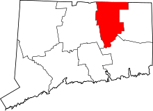 | |
| Other communities | ||