Staples, Minnesota
| City of Staples | |
|---|---|
| City | |
|
Combined city hall and public library | |
 Location of Staples, Minnesota | |
| Coordinates: 46°21′N 94°48′W / 46.350°N 94.800°W | |
| Country | United States |
| State | Minnesota |
| Counties | Todd, Wadena |
| Government | |
| • Mayor | Chris Etzler |
| • City Administrator | Jerel Nelsen |
| • Economic Development | Melissa Radermacher |
| • Police Chief | Melissa Birkholtz |
| • Fire Chief | Scott Braith |
| Area[1] | |
| • Total | 4.68 sq mi (12.12 km2) |
| • Land | 4.67 sq mi (12.10 km2) |
| • Water | 0.01 sq mi (0.03 km2) |
| Elevation | 1,280 ft (390 m) |
| Population (2010)[2] | |
| • Total | 2,981 |
| • Estimate (2012[3]) | 2,931 |
| • Density | 638.3/sq mi (246.4/km2) |
| Time zone | CST (UTC-6) |
| • Summer (DST) | CDT (UTC-5) |
| Zip code | 56479 |
| Area code(s) | 218 |
| FIPS code | 27-62446[4] |
| GNIS feature ID | 0652547[5] |
| Website |
www |

Staples is a city in Todd and Wadena counties in the U.S. state of Minnesota. The population was 2,981 at the 2010 census.[6]
History
Staples developed around a sawmill.[7] The settlement was originally called Staples Mill, and under the latter name was platted in 1889, and named for Samuel and Isaac Staples, businessmen in the lumber industry.[8]
Geography
According to the United States Census Bureau, the city has a total area of 4.68 square miles (12.12 km2); 4.67 square miles (12.10 km2) is land and 0.01 square miles (0.03 km2) is water.[1]
U.S. Route 10 and Minnesota State Highway 210 are two of the main routes in the city. The Empire Builder, an Amtrak route connecting Chicago, Illinois with Seattle, Washington and Portland, Oregon, stops at the train station in Staples.
Demographics
| Historical population | |||
|---|---|---|---|
| Census | Pop. | %± | |
| 1890 | 585 | — | |
| 1900 | 1,504 | 157.1% | |
| 1910 | 2,558 | 70.1% | |
| 1920 | 2,570 | 0.5% | |
| 1930 | 2,667 | 3.8% | |
| 1940 | 2,952 | 10.7% | |
| 1950 | 2,782 | −5.8% | |
| 1960 | 2,706 | −2.7% | |
| 1970 | 2,755 | 1.8% | |
| 1980 | 2,887 | 4.8% | |
| 1990 | 2,754 | −4.6% | |
| 2000 | 3,104 | 12.7% | |
| 2010 | 2,981 | −4.0% | |
| Est. 2015 | 2,885 | [9] | −3.2% |
| U.S. Decennial Census | |||
2010 census
As of the census[2] of 2010, there were 2,981 people, 1,222 households, and 696 families residing in the city. The population density was 638.3 inhabitants per square mile (246.4/km2). There were 1,469 housing units at an average density of 314.6 per square mile (121.5/km2). The racial makeup of the city was 95.9% White, 0.5% African American, 0.9% Native American, 0.7% Asian, 0.3% from other races, and 1.6% from two or more races. Hispanic or Latino of any race were 1.5% of the population.
There were 1,222 households of which 30.5% had children under the age of 18 living with them, 39.0% were married couples living together, 12.7% had a female householder with no husband present, 5.3% had a male householder with no wife present, and 43.0% were non-families. 37.0% of all households were made up of individuals and 16.8% had someone living alone who was 65 years of age or older. The average household size was 2.26 and the average family size was 2.94.
The median age in the city was 38.8 years. 24.1% of residents were under the age of 18; 10% were between the ages of 18 and 24; 21.8% were from 25 to 44; 22.5% were from 45 to 64; and 21.6% were 65 years of age or older. The gender makeup of the city was 47.6% male and 52.4% female.
2000 census
As of the census[4] of 2000, there were 3,104 people, 1,278 households, and 732 families residing in the city. The population density was 684.5 people per square mile (264.6/km²). There were 1,436 housing units at an average density of 316.7 per square mile (122.4/km²). The racial makeup of the city was 97.49% White, 0.26% African American, 0.81% Native American, 0.35% Asian, 0.23% from other races, and 0.87% from two or more races. Hispanic or Latino of any race were 1.48% of the population. 33.5% were of German, 12.5% Norwegian, 6.4% American, 6.0% Irish and 5.9% Swedish ancestry according to Census 2000.
There were 1,278 households out of which 30.5% had children under the age of 18 living with them, 41.8% were married couples living together, 12.1% had a female householder with no husband present, and 42.7% were non-families. 35.8% of all households were made up of individuals and 19.2% had someone living alone who was 65 years of age or older. The average household size was 2.36 and the average family size was 3.09.
In the city the population was spread out with 27.2% under the age of 18, 11.4% from 18 to 24, 24.0% from 25 to 44, 18.6% from 45 to 64, and 18.8% who were 65 years of age or older. The median age was 36 years. For every 100 females there were 92.4 males. For every 100 females age 18 and over, there were 91.6 males.
The median income for a household in the city was $25,208, and the median income for a family was $33,472. Males had a median income of $26,481 versus $18,407 for females. The per capita income for the city was $14,244. About 15.4% of families and 20.3% of the population were below the poverty line, including 23.9% of those under age 18 and 9.4% of those age 65 or over.
Notable people
- Norbert P. Arnold, Minnesota State Senator[10]
- Loren Bain, pitcher for the San Francisco Giants of Major League Baseball[11]
- Dick Bremer, TV broadcaster for the Minnesota Twins[12]
- Kathryn Edin, professor of sociology at Harvard University[13]
- Rose Edin, watercolor painter, teacher, and author[14]
- Scott Grossman, actor and choreographer[15][16]
- Jon Hassler (March 30, 1933 – March 20, 2008),[17] American writer and teacher known for his novels about small-town life in Minnesota[18]
- David Joerger, an American professional basketball coach who is currently the head coach with the Sacramento Kings of the National Basketball Association (NBA)[19]
- Alfred E. Perlman, President of the New York Central Railroad and Western Pacific Railroad
- Frankie Thorn, actress
- Dallas Sams, Minnesota legislator
- Gil Skeate, fullback for the Green Bay Packers of the National Football League[20]
- LaVyrle Spencer, best-selling author of contemporary and historical romance novels, attended high school in Staples[21]
Transportation
The Amtrak station sees more than 5,000 riders a year get on or off the daily Empire Builder service.[22] The west bound train from Chicago and St Paul arrives an hour or two after midnight, heading toward Fargo and Seattle/Portland. East bound Empire Builders from Fargo arrive about 4 a.m. heading toward a daylight arrival in St Paul and an afternoon arrival in Chicago.[23]
There is also a municipal airport.
Media
The official weekly newspaper of Staples is the Staples World, with a circulation of 2,400.
Government
Staples' current City Council members are Chris Etzler (Mayor), Roy Miles (Mayor Pro-Tem), Mary Theurer, Mike Isenberg, Kevin Jenkins, Ron Murray, and Doug Case.
The City Administrator is Jerel Nelsen. Other department heads include Phil Lindaman, Clerk; Melissa Radermacher, Economic Development; Melissa Birkholtz, Police Chief; Scott Braith, Fire Chief; Doug Bendorf, Public Works; Kevin Grondahl, Parks & Recreation.
References
- 1 2 "US Gazetteer files 2010". United States Census Bureau. Retrieved 2012-11-13.
- 1 2 "American FactFinder". United States Census Bureau. Retrieved 2012-11-13.
- ↑ "Population Estimates". United States Census Bureau. Retrieved 2013-05-28.
- 1 2 "American FactFinder". United States Census Bureau. Retrieved 2008-01-31.
- ↑ "US Board on Geographic Names". United States Geological Survey. 2007-10-25. Retrieved 2008-01-31.
- ↑ "2010 Census Redistricting Data (Public Law 94-171) Summary File". American FactFinder. U.S. Census Bureau, 2010 Census. Retrieved 23 April 2011.
- ↑ Winser, Henry Jacob; Riley, William C. (1897). The Official Northern Pacific Railway Guide: For the Use of Tourists and Travelers Over the Lines of the Northern Pacific Railway and Its Branches. Northern Pacific Railway. p. 53.
- ↑ Upham, Warren (1920). Minnesota Geographic Names: Their Origin and Historic Significance. Minnesota Historical Society. p. 546.
- ↑ "Annual Estimates of the Resident Population for Incorporated Places: April 1, 2010 to July 1, 2015". Retrieved July 2, 2016.
- ↑ Mineesota State Legislators Past and Present-Norbert P. Arnold
- ↑ http://www.baseball-reference.com/players/b/bainlo01.shtml
- ↑ Dorr, Luther. "TIMEOUT: Twins heat up Hot Stove League". Princeton Union-Eagle. Retrieved 2007-03-22.
- ↑ http://www.covchurch.org/cov/news/item7356
- ↑ http://www.roseedin.com/Rose%20Bio.htm
- ↑ http://www.thefreelibrary.com/Gotta+dance%3A+out+choreographer-actor+Scott+Grossman+shines+on+top+TV...-a0119441811
- ↑ http://www.imdb.com/name/nm0343712/
- ↑ Baenen, Jeff (AP) (March 21, 2008). "'Staggerford' author Jon Hassler dies at 74 (obituary)". USA Today. Retrieved June 15, 2010.
- ↑ http://home.comcast.net/~ktebo/biography.htm
- ↑ "NBA.COM". NBA.COM. Retrieved 2013-07-10.
- ↑ http://www.nfl.com/players/gilskeate/profile?id=SKE415291
- ↑ "LaVyrle Spencer". IMDb. Retrieved October 4, 2012.
- ↑ https://www.narprail.org/site/assets/files/1038/states_2015.pdf
- ↑ https://www.amtrak.com/ccurl/181/823/Empire-Builder-Schedule-011116,0.pdf
Municipalities and communities of Todd County, Minnesota, United States | ||
|---|---|---|
| Cities | 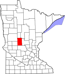 | |
| Townships | ||
| Unincorporated communities | ||
| Footnotes | ‡This populated place also has portions in an adjacent county or counties | |
Municipalities and communities of Wadena County, Minnesota, United States | ||
|---|---|---|
| Cities | 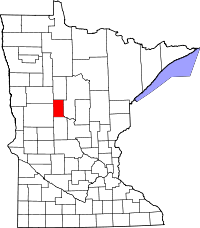 | |
| Townships | ||
| Unincorporated communities | ||
| Ghost towns | ||
| Footnotes | ‡This populated place also has portions in an adjacent county or counties | |
Coordinates: 46°21′N 94°48′W / 46.350°N 94.800°W