Stratford, Iowa
| Stratford, Iowa | |
|---|---|
| City | |
|
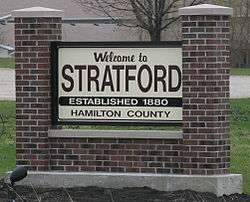
City sign | |
| Motto: The place to be | |
 Location of Stratford, Iowa | |
| Coordinates: 42°16′15″N 93°55′37″W / 42.27083°N 93.92694°WCoordinates: 42°16′15″N 93°55′37″W / 42.27083°N 93.92694°W | |
| Country |
|
| State |
|
| Counties | Hamilton, Webster |
| Area[1] | |
| • Total | 1.91 sq mi (4.95 km2) |
| • Land | 1.91 sq mi (4.95 km2) |
| • Water | 0 sq mi (0 km2) |
| Elevation | 1,109 ft (338 m) |
| Population (2010)[2] | |
| • Total | 743 |
| • Estimate (2012[3]) | 729 |
| • Density | 389.0/sq mi (150.2/km2) |
| Time zone | Central (CST) (UTC-6) |
| • Summer (DST) | CDT (UTC-5) |
| ZIP code | 50249 |
| Area code(s) | 515 |
| FIPS code | 19-75810 |
| GNIS feature ID | 0462029 |
| Website | www.stratfordiowa.com |
Stratford is a city in Hamilton and Webster counties in the U.S. state of Iowa. The population was 743 at the 2010 census.
History
Stratford was platted in 1880.[4] It was named after Stratford-upon-Avon, in England.[4] A post office has been in operation in Stratford since 1881.[5] Stratford was actually first founded at Hook's Point, Hamilton County, Iowa. Stratford had a train coming through from 1880 until World War Two. Stratford has an independent school system with an elementary school located on the corner of Shakespeare Avenue and Dryden Street.
An F3 tornado struck Stratford on November 12, 2005.
Geography
Stratford's longitude and latitude coordinates
in decimal form are 42.270919, -93.926862.[6]
According to the United States Census Bureau, the city has a total area of 1.91 square miles (4.95 km2), all of it land.[1]
Demographics
| Historical populations | ||
|---|---|---|
| Year | Pop. | ±% |
| 1900 | 458 | — |
| 1910 | 554 | +21.0% |
| 1920 | 694 | +25.3% |
| 1930 | 699 | +0.7% |
| 1940 | 712 | +1.9% |
| 1950 | 673 | −5.5% |
| 1960 | 703 | +4.5% |
| 1970 | 710 | +1.0% |
| 1980 | 806 | +13.5% |
| 1990 | 715 | −11.3% |
| 2000 | 746 | +4.3% |
| 2010 | 743 | −0.4% |
| 2014 | 720 | −3.1% |
| 2015 | 725 | +0.7% |
| Source:"American FactFinder". United States Census Bureau. and Iowa Data Center Source: | ||

2010 census
As of the census[2] of 2010, there were 743 people, 307 households, and 183 families residing in the city. The population density was 389.0 inhabitants per square mile (150.2/km2). There were 334 housing units at an average density of 174.9 per square mile (67.5/km2). The racial makeup of the city was 99.2% White and 0.8% from two or more races. Hispanic or Latino of any race were 1.3% of the population.
There were 307 households of which 26.1% had children under the age of 18 living with them, 49.2% were married couples living together, 7.8% had a female householder with no husband present, 2.6% had a male householder with no wife present, and 40.4% were non-families. 36.2% of all households were made up of individuals and 21.2% had someone living alone who was 65 years of age or older. The average household size was 2.25 and the average family size was 2.96.
The median age in the city was 46.3 years. 22.2% of residents were under the age of 18; 6.3% were between the ages of 18 and 24; 19.1% were from 25 to 44; 25.5% were from 45 to 64; and 26.9% were 65 years of age or older. The gender makeup of the city was 49.3% male and 50.7% female.
2000 census
As of the census[8] of 2000, there were 746 people, 307 households, and 186 families residing in the city. The population density was 387.7 people per square mile (150.0/km2). There were 324 housing units at an average density of 168.4 per square mile (65.2/km2). The racial makeup of the city was 99.06% White, and 0.94% from two or more races. Hispanic or Latino of any race were 0.27% of the population.
There were 307 households out of which 24.1% had children under the age of 18 living with them, 52.4% were married couples living together, 5.5% had a female householder with no husband present, and 39.1% were non-families. 35.5% of all households were made up of individuals and 22.5% had someone living alone who was 65 years of age or older. The average household size was 2.21 and the average family size was 2.90.
In the city the population was spread out with 20.2% under the age of 18, 6.6% from 18 to 24, 22.8% from 25 to 44, 20.9% from 45 to 64, and 29.5% who were 65 years of age or older. The median age was 45 years. For every 100 females there were 91.8 males. For every 100 females age 18 and over, there were 80.9 males.
The median income for a household in the city was $29,375, and the median income for a family was $41,042. Males had a median income of $28,571 versus $22,344 for females. The per capita income for the city was $15,553. About 2.3% of families and 5.7% of the population were below the poverty line, including 5.9% of those under age 18 and 3.2% of those age 65 or over.
References
- 1 2 "US Gazetteer files 2010". United States Census Bureau. Retrieved 2012-05-11.
- 1 2 "American FactFinder". United States Census Bureau. Retrieved 2012-05-11.
- ↑ "Population Estimates". United States Census Bureau. Retrieved 2013-05-23.
- 1 2 Chicago and North Western Railway Company (1908). A History of the Origin of the Place Names Connected with the Chicago & North Western and Chicago, St. Paul, Minneapolis & Omaha Railways. p. 127.
- ↑ "Hamilton County". Jim Forte Postal History. Retrieved 29 March 2015.
- ↑ "US Gazetteer files: 2010, 2000, and 1990". United States Census Bureau. 2011-02-12. Retrieved 2011-04-23.
- ↑ "Census of Population and Housing". Census.gov. Retrieved June 4, 2015.
- ↑ "American FactFinder". United States Census Bureau. Retrieved 2008-01-31.
External links
| Wikimedia Commons has media related to Stratford, Iowa. |
Municipalities and communities of Hamilton County, Iowa, United States | ||
|---|---|---|
| Cities | ||
| Footnotes | ‡This populated place also has portions in an adjacent county or counties | |
Municipalities and communities of Webster County, Iowa, United States | ||
|---|---|---|
| Cities | ||
| Townships | ||
| CDP | ||
| Communities | ||
| Footnotes | ‡This populated place also has portions in an adjacent county or counties | |