Eminence, Missouri
| Eminence, Missouri | |
|---|---|
| City | |
|
Main Street, Eminence | |
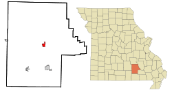 Location of Eminence, Missouri | |
| Coordinates: 37°8′54″N 91°21′32″W / 37.14833°N 91.35889°WCoordinates: 37°8′54″N 91°21′32″W / 37.14833°N 91.35889°W | |
| Country | United States |
| State | Missouri |
| County | Shannon |
| Township | Eminence |
| Government | |
| • Mayor | Jim Anderson |
| Area[1] | |
| • Total | 1.88 sq mi (4.87 km2) |
| • Land | 1.88 sq mi (4.87 km2) |
| • Water | 0 sq mi (0 km2) |
| Elevation | 673 ft (205 m) |
| Population (2010)[2] | |
| • Total | 600 |
| • Estimate (2012[3]) | 590 |
| • Density | 319.1/sq mi (123.2/km2) |
| Time zone | Central (CST) (UTC-6) |
| • Summer (DST) | CDT (UTC-5) |
| ZIP code | 65466 |
| Area code(s) | 573 |
| FIPS code | 29-22276[4] |
| GNIS feature ID | 0717575[5] |
.JPG)
Eminence is a city in Shannon County, Missouri, United States. The population was 600 at the time of the 2010 census. It is the county seat of Shannon County.[6]
History
Eminence was named from its high elevation.[7]
Geography
Eminence is located in the center of the Ozark National Scenic Riverways, Missouri's largest national park and the nation's first protected river system. Popular activities in the Eminence area include canoeing, hunting, fishing, and horseback riding.
Eminence maintains a small town feel, but in the summer becomes a resort city with several locally owned restaurants, motels, bed & breakfasts, including America's largest trail riding establishment.[8]
According to the United States Census Bureau, the city has a total area of 1.88 square miles (4.87 km2), all of it land.[1]
Demographics
| Historical population | |||
|---|---|---|---|
| Census | Pop. | %± | |
| 1880 | 91 | — | |
| 1950 | 527 | — | |
| 1960 | 516 | −2.1% | |
| 1970 | 520 | 0.8% | |
| 1980 | 614 | 18.1% | |
| 1990 | 582 | −5.2% | |
| 2000 | 548 | −5.8% | |
| 2010 | 600 | 9.5% | |
| Est. 2015 | 587 | [9] | −2.2% |
2010 census
As of the census[2] of 2010, there were 600 people, 254 households, and 140 families residing in the city. The population density was 319.1 inhabitants per square mile (123.2/km2). There were 334 housing units at an average density of 177.7 per square mile (68.6/km2). The racial makeup of the city was 95.17% White, 1.83% Native American, 0.17% Asian, and 2.83% from two or more races. Hispanic or Latino of any race were 0.83% of the population.
There were 254 households of which 28.7% had children under the age of 18 living with them, 35.8% were married couples living together, 11.4% had a female householder with no husband present, 7.9% had a male householder with no wife present, and 44.9% were non-families. 41.3% of all households were made up of individuals and 20% had someone living alone who was 65 years of age or older. The average household size was 2.30 and the average family size was 3.10.
The median age in the city was 41 years. 24.5% of residents were under the age of 18; 9.7% were between the ages of 18 and 24; 19.3% were from 25 to 44; 28.5% were from 45 to 64; and 18% were 65 years of age or older. The gender makeup of the city was 46.7% male and 53.3% female.
2000 census
As of the census[4] of 2000, there were 548 people, 256 households, and 142 families residing in the city. The population density was 290.4 people per square mile (111.9/km²). There were 316 housing units at an average density of 167.5 per square mile (64.6/km²). The racial makeup of the city was 91.61% White, 0.91% African American, 2.55% Native American, and 4.93% from two or more races. Hispanic or Latino of any race were 1.09% of the population.
There were 256 households, of which 19.9% included children of 18 or fewer years, 44.5% comprised married couples living together, 7.8% included a female householder with no husband present, and 44.5% were non-families. 41.8% of all households comprised a sole person, and 23.8% comprised a sole person of 65 or more years of age. The average household size was 2.09 people and the average family size was 2.85 people.
In the city, the population comprised 19.5% under the age of 18, 7.5% aged from 18 to 24, 25.9% aged from 25 to 44, 22.3% aged from 45 to 64, and 24.8% of 65 or more years of age. The median age was 43 years. For every 100 females, there were 82.7 males. For every 100 females aged 18 and over, there were 80.0 males.
The median income for an urban household was $17,422, and the median income for a city-dwelling family was $21,607. City-dwelling males had a median income of $20,250, versus $13,125 for females. The per capita income for the city was $10,696. Approximately 23.8% of families and 31.4% of the population as a whole were classified as living below the poverty line, including 41.7% of those aged 18 years or younger, and 21.7% of those aged 65 years or older.
Transportation
Eminence is accessed from Missouri Route 19 and Missouri Route 106.
Notable events
- In 1981 Eminence High School won the Missouri Class 1A-2A volleyball state championship.[11]
- In 2011 Eminence High School won the Missouri Class 1 volleyball state championship.[12]
- In 2012 Eminence High School won the Missouri Class 1 girls basketball state championship.[13]
- In 2013 Eminence High School won the Missouri Class 1 boys basketball state championship.[14]
Notable People from Eminence
- Thomas Dale Akers, former four-time Shuttle astronaut
References
- 1 2 "US Gazetteer files 2010". United States Census Bureau. Retrieved 2012-07-08.
- 1 2 "American FactFinder". United States Census Bureau. Retrieved 2012-07-08.
- ↑ "Population Estimates". United States Census Bureau. Retrieved 2013-05-30.
- 1 2 "American FactFinder". United States Census Bureau. Retrieved 2008-01-31.
- ↑ "US Board on Geographic Names". United States Geological Survey. 2007-10-25. Retrieved 2008-01-31.
- ↑ "Find a County". National Association of Counties. Retrieved 2011-06-07.
- ↑ Eaton, David Wolfe (1918). How Missouri Counties, Towns and Streams Were Named. The State Historical Society of Missouri. p. 363.
- ↑ "Eminence Missouri Chamber of Commerce". Eminence Missouri Chamber of Commerce website.
- ↑ "Annual Estimates of the Resident Population for Incorporated Places: April 1, 2010 to July 1, 2015". Retrieved July 2, 2016.
- ↑ "Census of Population and Housing". Census.gov. Retrieved June 4, 2015.
- ↑ List of Missouri state high school girls volleyball championships
- ↑ "Class 1 State Tournament Bracket". Missouri State High School Activities Association website. November 2011. Retrieved 2012-04-19.
- ↑ "Class 1 State Tournament Bracket". Missouri State High School Activities Association website. 2012-03-17. Retrieved 2012-03-18.
- ↑ "Class 1 State Tournament Bracket". Missouri State High School Activities Association website.
External links
 Eminence travel guide from Wikivoyage
- Chamber of Commerce
Municipalities and communities of Shannon County, Missouri, United States | ||
|---|---|---|
| Cities | 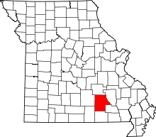 | |
| Villages | ||
| Townships |
| |
| Unincorporated communities | ||
| Ghost towns |
| |
| Footnotes | ‡This populated place also has portions in an adjacent county or counties | |