Takikawa, Hokkaido
| Takikawa 滝川市 | ||
|---|---|---|
| City | ||
| ||
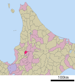 Location of Takikawa in Hokkaido (Sorachi Subprefecture) | ||
 Takikawa Location in Japan | ||
| Coordinates: 43°33′N 141°55′E / 43.550°N 141.917°ECoordinates: 43°33′N 141°55′E / 43.550°N 141.917°E | ||
| Country | Japan | |
| Region | Hokkaido | |
| Prefecture | Hokkaido (Sorachi Subprefecture) | |
| Government | ||
| • Mayor | Kōkichi Maeda (since April 2011) | |
| Area | ||
| • Total | 115.82 km2 (44.72 sq mi) | |
| Population (January 31, 2012) | ||
| • Total | 43,270 | |
| • Density | 373.68/km2 (967.8/sq mi) | |
| Symbols | ||
| • Tree | Platanus | |
| • Flower | Azalea and Cosmos | |
| Time zone | Japan Standard Time (UTC+9) | |
| City hall address |
1-2-15, Ōmachi, Takikawa-shi, Hokkaidō 073-8686 | |
| Website |
www | |

Takikawa (滝川市 Takikawa-shi) is a city located in Sorachi Subprefecture, Hokkaido, Japan.
As of January 31, 2012, the city has an estimated population of 43,270, with 21,486 households, and the density of 373.68 persons per km². The total area is 115.82 km².
History
- 1890 Takikawa Village opened
- 1906 Takikawa becomes a Second Class Municipality
- 1909 Takikawa becomes a First Class Municipality. Ebeotsu Village splits off
- 1910 Takikawa Village becomes Takikawa Town
- 1952 Ebeotsu Village becomes Ebeotsu Town
- July 1, 1958 Takikawa Town becomes Takikawa City
- 1971 Ebeotsu Town merged
Education
Junior college
High schools
- Hokkaido Takikawa High School
- Hokkaido Takikawa Technical High School
- Hokkaido Takikawa Nishi High School (Municipal)
Transportation
- Hakodate Main Line : Takikawa - Ebeotsu
- Nemuro Main Line : Takikawa - Higashi-Takikawa
- Hokkaidō Expressway : Takikawa IC
Famous people
- Miki Fujimoto - singer, radio show host. Hello! Project soloist, ex-Morning Musume member, half of the pop duo GAM
- Iwahashi Eien (1903–1999) - Japanese-style artist.
- Aya Oomasa - model, actress
Sister city
 Tochigi, Tochigi[1]
- Nago, Okinawa

 Springfield, Massachusetts, United States - an historic, American city where basketball was invented. The gasoline-powered car, motorcycle, and radio station were invented there too. It has 160,000 residents and is renowned as "The City of Homes" for its beautiful architecture.[2]
References
External links
| Wikimedia Commons has media related to Takikawa, Hokkaidō. |
- (Japanese) Official website
- Art Challenge Takikawa
- (English) http://www.city.takikawa.hokkaido.jp/200soumubu/08kokusaika/english_index.html
This article is issued from Wikipedia - version of the 10/3/2016. The text is available under the Creative Commons Attribution/Share Alike but additional terms may apply for the media files.