Thornfield, Missouri
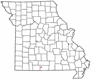
Thornfield is an unincorporated community in Ozark County, Missouri.[1] It is 15 miles (24 km) northwest of Gainesville. It is located on Route 95 at the Little North Fork of the White River on the edge of the Mark Twain National Forest between Wasola to the northeast and Longrun to the southwest.[2][3] Hammond, the site of the historic Hammond Mill,[4] lies on the Little North Fork 2.5 miles (4.0 km) southeast of Thornfield. Although it is unincorporated, Thornfield has a post office with ZIP code 65762.[5]
A post office called Thornfield has been in operation since 1878.[6] The area has the name of the local Thornfield family.[7]
Thornfield R-1 Elementary School lies about one mile east of the town on Route 95.[2][8]
References
- ↑ U.S. Geological Survey Geographic Names Information System: Thornfield
- 1 2 Thornfield, MO, 7.5 Minute Topographic Quadrangle, USGS, 2004
- ↑ Ava, MO, 30x60 Minute Topographic Quadrangle, USGS, 1985
- ↑ Ozark County’s Historic Mills, Hammond Mill
- ↑ USPS
- ↑ "Post Offices". Jim Forte Postal History. Retrieved 27 November 2016.
- ↑ "Ozark County Place Names, 1928–1945". The State Historical Society of Missouri. Archived from the original on June 24, 2016. Retrieved November 27, 2016.
- ↑ MO Dept. of Education
Coordinates: 36°42′31″N 92°39′34″W / 36.70861°N 92.65944°W
Municipalities and communities of Ozark County, Missouri, United States | ||
|---|---|---|
| Cities | 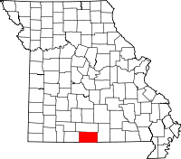 | |
| Villages | ||
| Townships |
| |
| CDPs | ||
| Other unincorporated communities | ||
| Ghost towns | ||