Pontiac, Missouri
| Pontiac, Missouri | |
|---|---|
| Census-designated place | |
 Pontiac, Missouri Location of Pontiac, Missouri | |
| Coordinates: 36°30′56″N 92°36′14″W / 36.51556°N 92.60389°WCoordinates: 36°30′56″N 92°36′14″W / 36.51556°N 92.60389°W[1] | |
| Country | U. S. A. |
| State | Missouri |
| County | Ozark County |
| Elevation[1] | 251 m (823 ft) |
| Time zone | CST (UTC-6) |
| • Summer (DST) | CDT (UTC-5) |
| Zip Code | 65729 |
Pontiac is a census-designated place in southern Ozark County, Missouri.[2] It lies six miles south of Isabella and 18.5 miles southwest of Gainesville.[3] It is located on the northeast shore of Bull Shoals Lake.
A post office called Pontiac has been in operation since 1887.[4] The community was named in honor of the Ottawa Indian chief Pontiac, perhaps via Pontiac, Michigan.[5]
The town is located on a ridge above the lake at an elevation of about 820 feet. The lake has a normal surface elevation of 654 feet.[1] The town consists of a post office, a marina and campgrounds on the lake, a restaurant, and a church. Pontiac is accessed via state route W from U.S. Route 160 east of Isabella.[6]

Sunrise on Highway W In Pontiac, Missouri
References
- 1 2 3 Isabella, MO, 7.5 Minute Topographic Quadrangle, USGS, 2004
- ↑ U.S. Geological Survey Geographic Names Information System: Pontiac Census Designated Place
- ↑ Moser, Paul, A Directory of Towns, Villages, and Hamlets Past and Present of Ozark County, Missouri
- ↑ "Post Offices". Jim Forte Postal History. Retrieved 27 November 2016.
- ↑ Ozark County Place Names, 1928-1945, The State Historical Society of Missouri
- ↑ Ava, Missouri, 30x60 Minute Topographic Quadrangle, USGS, 1985
Municipalities and communities of Ozark County, Missouri, United States | ||
|---|---|---|
| Cities | 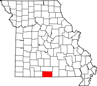 | |
| Villages | ||
| Townships |
| |
| CDPs | ||
| Other unincorporated communities | ||
| Ghost towns | ||
This article is issued from Wikipedia - version of the 11/28/2016. The text is available under the Creative Commons Attribution/Share Alike but additional terms may apply for the media files.