Town of Pines, Indiana
| Town of Pines, Indiana | |
|---|---|
| Town | |
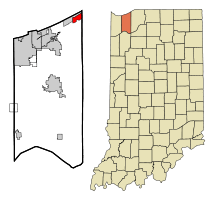 Location of Town of Pines in the state of Indiana | |
| Coordinates: 41°41′19″N 86°56′47″W / 41.68861°N 86.94639°WCoordinates: 41°41′19″N 86°56′47″W / 41.68861°N 86.94639°W | |
| Country | United States |
| State | Indiana |
| County | Porter |
| Township | Pine |
| Area[1] | |
| • Total | 2.26 sq mi (5.85 km2) |
| • Land | 2.26 sq mi (5.85 km2) |
| • Water | 0 sq mi (0 km2) |
| Elevation | 627 ft (191 m) |
| Population (2010)[2] | |
| • Total | 708 |
| • Estimate (2012[3]) | 707 |
| • Density | 313.3/sq mi (121.0/km2) |
| Time zone | Central (CST) (UTC-6) |
| • Summer (DST) | CDT (UTC-5) |
| FIPS code | 18-76256[4] |
| GNIS feature ID | 0444832[5] |
Town of Pines is a town in Pine Township, Porter County, Indiana, United States. The population was 708 at the 2010 census.
Geography
Town of Pines is located at 41°41′19″N 86°56′47″W / 41.68861°N 86.94639°W (41.688486, -86.946297).[6]
According to the 2010 census, Town of Pines has a total area of 2.25 square miles (5.83 km2), all land.[1]
Demographics
| Historical population | |||
|---|---|---|---|
| Census | Pop. | %± | |
| 1960 | 939 | — | |
| 1970 | 1,007 | 7.2% | |
| 1980 | 962 | −4.5% | |
| 1990 | 789 | −18.0% | |
| 2000 | 798 | 1.1% | |
| 2010 | 708 | −11.3% | |
| Est. 2015 | 706 | [7] | −0.3% |
2010 census
As of the census[2] of 2010, there were 708 people, 302 households, and 184 families residing in the town. The population density was 313.3 inhabitants per square mile (121.0/km2). There were 353 housing units at an average density of 156.2 per square mile (60.3/km2). The racial makeup of the town was 93.9% White, 2.3% African American, 0.4% Native American, 0.3% Asian, 0.1% from other races, and 3.0% from two or more races. Hispanic or Latino of any race were 3.1% of the population.
There were 302 households of which 21.9% had children under the age of 18 living with them, 46.0% were married couples living together, 10.6% had a female householder with no husband present, 4.3% had a male householder with no wife present, and 39.1% were non-families. 31.1% of all households were made up of individuals and 9.9% had someone living alone who was 65 years of age or older. The average household size was 2.34 and the average family size was 2.94.
The median age in the town was 45.3 years. 18.8% of residents were under the age of 18; 6.6% were between the ages of 18 and 24; 24.2% were from 25 to 44; 36% were from 45 to 64; and 14.5% were 65 years of age or older. The gender makeup of the town was 50.4% male and 49.6% female.
2000 census
As of the census[4] of 2000, there were 798 people, 332 households, and 226 families residing in the town. The population density was 350.5 people per square mile (135.1/km²). There were 360 housing units at an average density of 158.1 per square mile (61.0/km²). The racial makeup of the town was 96.24% White, 0.13% African American, 1.38% Native American, 0.50% Asian, 0.13% from other races, and 1.63% from two or more races. Hispanic or Latino of any race were 2.13% of the population.
There were 332 households out of which 27.1% had children under the age of 18 living with them, 56.0% were married couples living together, 7.8% had a female householder with no husband present, and 31.9% were non-families. 26.8% of all households were made up of individuals and 6.9% had someone living alone who was 65 years of age or older. The average household size was 2.40 and the average family size was 2.92.
In the town the population was spread out with 20.7% under the age of 18, 8.6% from 18 to 24, 30.1% from 25 to 44, 29.6% from 45 to 64, and 11.0% who were 65 years of age or older. The median age was 40 years. For every 100 females there were 108.9 males. For every 100 females age 18 and over, there were 110.3 males.
The median income for a household in the town was $41,875, and the median income for a family was $47,143. Males had a median income of $41,000 versus $22,969 for females. The per capita income for the town was $19,856. About 4.6% of families and 8.7% of the population were below the poverty line, including 11.8% of those under age 18 and 14.9% of those age 65 or over.
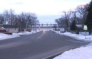
Transportation
Town of Pines is the home of Indiana State Road 520, a 0.2-mile-long (0.3 km) state highway connecting U.S. Highway 12 to U.S. Highway 20. It is the shortest state highway in Indiana.
References
- 1 2 "G001 - Geographic Identifiers - 2010 Census Summary File 1". United States Census Bureau. Retrieved 2015-07-25.
- 1 2 "American FactFinder". United States Census Bureau. Retrieved 2012-12-11.
- ↑ "Population Estimates". United States Census Bureau. Retrieved 2013-06-25.
- 1 2 "American FactFinder". United States Census Bureau. Retrieved 2008-01-31.
- ↑ "US Board on Geographic Names". United States Geological Survey. 2007-10-25. Retrieved 2008-01-31.
- ↑ "US Gazetteer files: 2010, 2000, and 1990". United States Census Bureau. 2011-02-12. Retrieved 2011-04-23.
- ↑ "Annual Estimates of the Resident Population for Incorporated Places: April 1, 2010 to July 1, 2015". Retrieved July 2, 2016.
- ↑ "Census of Population and Housing". Census.gov. Retrieved June 4, 2015.
Municipalities and communities of Porter County, Indiana, United States | ||
|---|---|---|
| Cities | ||
| Towns | ||
| Townships | ||
| CDPs | ||
| Other unincorporated communities | ||
| Ghost towns | ||
| Footnotes | ‡This populated place also has portions in an adjacent county or counties | |