Burns Harbor, Indiana
| Town of Burns Harbor, Indiana | |
|---|---|
| Town | |
 | |
 Location in the state of Indiana | |
| Coordinates: 41°36′53″N 87°7′28″W / 41.61472°N 87.12444°WCoordinates: 41°36′53″N 87°7′28″W / 41.61472°N 87.12444°W | |
| Country | United States |
| State | Indiana |
| County | Porter |
| Township | Westchester |
| Area[1] | |
| • Total | 6.79 sq mi (17.59 km2) |
| • Land | 6.67 sq mi (17.28 km2) |
| • Water | 0.12 sq mi (0.31 km2) |
| Elevation | 610 ft (186 m) |
| Population (2010)[2] | |
| • Total | 1,156 |
| • Estimate (2012[3]) | 1,222 |
| • Density | 173.3/sq mi (66.9/km2) |
| Time zone | CST (UTC-6) |
| • Summer (DST) | CDT (UTC-5) |
| ZIP code | 46304 |
| Area code(s) | 219 |
| FIPS code | 18-09370[4] |
| GNIS feature ID | 0449809[5] |
| Website | http://www.burnsharbor-in.gov |
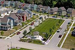
Burns Harbor is a town in Westchester Township, Porter County, Indiana, United States on the shores of Lake Michigan in Northwest Indiana. It is part of the Chicago metropolitan area. The population was 1,156 at the 2010 census. Burns Harbor is located adjacent to the Indiana Dunes, an area that conservationists have fought hard to preserve.[6][7][8]
Geography
Burns Harbor is located at 41°36′53″N 87°07′28″W / 41.61472°N 87.12444°W (41.614685, -87.124560).[9]
According to the 2010 census, Burns Harbor has a total area of 6.78 square miles (17.56 km2), of which 6.66 square miles (17.25 km2) (or 98.23%) is land and 0.12 square miles (0.31 km2) (or 1.77%) is water.[1]
Demographics
| Historical population | |||
|---|---|---|---|
| Census | Pop. | %± | |
| 1970 | 1,284 | — | |
| 1980 | 920 | −28.3% | |
| 1990 | 786 | −14.6% | |
| 2000 | 766 | −2.5% | |
| 2010 | 1,156 | 50.9% | |
| Est. 2015 | 1,609 | [10] | 39.2% |
| Source: US Census Bureau | |||
2010 census
As of the census[2] of 2010, there were 1,156 people, 456 households, and 305 families residing in the town. The population density was 173.3 inhabitants per square mile (66.9/km2). There were 495 housing units at an average density of 74.2 per square mile (28.6/km2). The racial makeup of the town was 95.4% White, 1.8% African American, 0.3% Native American, 0.3% Asian, 1.1% from other races, and 1.1% from two or more races. Hispanic or Latino of any race were 5.8% of the population.
There were 456 households of which 37.3% had children under the age of 18 living with them, 51.5% were married couples living together, 10.3% had a female householder with no husband present, 5.0% had a male householder with no wife present, and 33.1% were non-families. 26.1% of all households were made up of individuals and 7.4% had someone living alone who was 65 years of age or older. The average household size was 2.54 and the average family size was 3.10.
The median age in the town was 34.6 years. 26.2% of residents were under the age of 18; 6.4% were between the ages of 18 and 24; 31% were from 25 to 44; 25.6% were from 45 to 64; and 10.6% were 65 years of age or older. The gender makeup of the town was 50.8% male and 49.2% female.
2000 census
As of the census[4] of 2000, there were 766 people, 303 households, and 219 families residing in the town. The population density was 112.1 people per square mile (43.3/km²). There were 323 housing units at an average density of 47.3 per square mile (18.3/km²). The racial makeup of the town was 94.26% White, 0.26% African American, 1.17% Native American, 1.04% Asian, 0.39% from other races, and 2.87% from two or more races. Hispanic or Latino of any race were 4.31% of the population.
There were 303 households out of which 30.7% had children under the age of 18 living with them, 57.1% were married couples living together, 7.9% had a female householder with no husband present, and 27.4% were non-families. 22.8% of all households were made up of individuals and 7.3% had someone living alone who was 65 years of age or older. The average household size was 2.53 and the average family size was 2.95.
In the town the population was spread out with 24.7% under the age of 18, 8.0% from 18 to 24, 28.5% from 25 to 44, 28.3% from 45 to 64, and 10.6% who were 65 years of age or older. The median age was 38 years. For every 100 females there were 103.7 males. For every 100 females age 18 and over, there were 111.4 males.
The median income for a household in the town was $53,929, and the median income for a family was $57,188. Males had a median income of $43,393 versus $22,143 for females. The per capita income for the town was $23,344. About 4.2% of families and 6.3% of the population were below the poverty line, including 5.4% of those under age 18 and 5.6% of those age 65 or over.
History
Burns Harbor was founded in 1966.[11] The town took its name from a local port which was named for the harbor's promoter Randall W. Burns.[12]
Transportation
Burns Harbor benefits from close access to many major forms of transportation.
Airports
- Gary/Chicago International Airport (GYY) in Gary
- O'Hare International Airport (ORD) in Chicago
- Chicago Midway International Airport (MDW) in Chicago
- South Bend Regional Airport (SBN) in South Bend
- Porter County Regional Airport (VPZ) in Valparaiso
Commuter Rail
- Chicago SouthShore and South Bend Railroad (CSS), known to locals as the South Shore, provides service between Chicago and South Bend. The closest station is located at Ogden Dunes, Indiana. The South Shore is operated by Northern Indiana Commuter Transportation District (NICTD)
Ports
- The Port of Indiana-Burns Harbor which includes an international shipping port and the Burns Waterway Small Boat Harbor for public access to Lake Michigan. The Port of Indiana-Burns Harbor is divided between Burns Harbor and Portage.

Highways
Education
Burns Harbor is served by Duneland Schools (http://www.duneland.k12.in.us) providing education for grades Kindergarten through 12, and is in close proximity to many higher education facilities including:
- Indiana University Northwest (IUN)
- Ivy Tech Community College of Indiana (Ivy Tech)
- Purdue University North Central (PNC)
- Purdue University Calumet (Purdue Cal)
- Valparaiso University (Valpo)
References
- 1 2 "G001 - Geographic Identifiers - 2010 Census Summary File 1". United States Census Bureau. Retrieved July 13, 2015.
- 1 2 "American FactFinder". United States Census Bureau. Retrieved December 11, 2012.
- ↑ "Population Estimates". United States Census Bureau. Archived from the original on June 17, 2013. Retrieved June 25, 2013.
- 1 2 "American FactFinder". United States Census Bureau. Archived from the original on September 11, 2013. Retrieved January 31, 2008.
- ↑ "US Board on Geographic Names". United States Geological Survey. October 25, 2007. Retrieved January 31, 2008.
- ↑ Smith, S. & Mark, S. (2009). "The Historical Roots of the Nature Conservancy in the Northwest Indiana/Chicagoland Region: From Science to Preservation." The South Shore Journal, 3. http://www.southshorejournal.org/index.php/issues/volume-3-2009/83-journals/vol-3-2009/75-the-historical-roots-of-the-nature-conservancy-in-the-northwest-indianachicagoland-region-from-science-to-preservation
- ↑ Smith, S. & Mark, S. (2006). "Alice Gray, Dorothy Buell, and Naomi Svihla: Preservationists of Ogden Dunes." The South Shore Journal, 1. http://www.southshorejournal.org/index.php/issues/volume-1-2006/78-journals/vol-1-2006/117-alice-gray-dorothy-buell-and-naomi-svihla-preservationists-of-ogden-dunes
- ↑ Smith, S. & Mark, S. (2007). "The cultural impact of a museum in a small community: The Hour Glass of Ogden Dunes." The South Shore Journal, 2. http://www.southshorejournal.org/index.php/issues/volume-2-2007/82-journals/vol-2-2007/104-the-cultural-impact-of-a-museum-in-a-small-community-the-hour-glass-in-ogden-dunes
- ↑ "US Gazetteer files: 2010, 2000, and 1990". United States Census Bureau. February 12, 2011. Retrieved April 23, 2011.
- ↑ "Annual Estimates of the Resident Population for Incorporated Places: April 1, 2010 to July 1, 2015". Retrieved July 2, 2016.
- ↑ "Burns Harbor". Indiana Dunes Tourism. Retrieved October 6, 2015.
- ↑ Mark Skertic (2003). A Native's Guide to Northwest Indiana. Lake Claremont Press. p. 181. ISBN 978-1-893121-08-9.
External links
| Wikimedia Commons has media related to Burns Harbor, Indiana. |
- Town of Burns Harbor, Indiana website
- Photographs of the ArcelorMittal steel works
- Burns Harbor Waterway
Municipalities and communities of Porter County, Indiana, United States | ||
|---|---|---|
| Cities | ||
| Towns | ||
| Townships | ||
| CDPs | ||
| Other unincorporated communities | ||
| Ghost towns | ||
| Footnotes | ‡This populated place also has portions in an adjacent county or counties | |
| Major city |  | |
|---|---|---|
| Cities (over 30,000 in 2010) | ||
| Towns and villages (over 30,000 in 2010) |
| |
| Counties | ||
| Regions | ||
| Sub-regions | ||
