Trowbridge
| Trowbridge | |
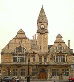 Trowbridge Town Hall, seen from Fore Street |
|
 Trowbridge |
|
| Population | 33,108 (in 2011)[1] |
|---|---|
| OS grid reference | ST8557 |
| Unitary authority | Wiltshire |
| Ceremonial county | Wiltshire |
| Region | South West |
| Country | England |
| Sovereign state | United Kingdom |
| Post town | Trowbridge |
| Postcode district | BA14 |
| Dialling code | 01225 |
| Police | Wiltshire |
| Fire | Dorset and Wiltshire |
| Ambulance | South Western |
| EU Parliament | South West England |
| UK Parliament | South West Wiltshire |
| Website | Town Council |
Coordinates: 51°19′N 2°13′W / 51.32°N 2.21°W
Trowbridge /ˈtroʊbrɪdʒ/ is the county town of Wiltshire, England on the River Biss in the west of the county, 8 miles (13 km) south east of Bath, Somerset, from which it is separated by the Mendip Hills which rise 3 miles (4.8 km) to the west.
Trowbridge has a railway station on the Wessex Main Line. On 5 September 1848, the first train steamed through as the Wilts, Somerset and Weymouth Railway was established. Long a market town, the Kennet and Avon canal runs to the north of Trowbridge and played an instrumental part in the town's development as it enabled coal to be transported from the Somerset Coalfield and so marked the advent of steam-powered manufacturing in woollen cloth mills. The town was foremost producer of this mainstay of contemporary clothing and blankets in south west England in the late 18th and early 19th centuries by which time it held the nickname "The Manchester of the West".[2]
The civil parish of Trowbridge had a population of 33,108 at the 2011 census.[1] The parish encompasses the settlements of Longfield, Lower Studley, Upper Studley, Studley Green and Trowle Common. Adjacent parishes include Staverton, Hilperton, West Ashton, North Bradley, Southwick and Wingfield; nearby towns are Bradford on Avon, Westbury, Melksham and Devizes.
History
Toponymy
The origin of the name Trowbridge is uncertain; one source claims derivation from treow-brycg, meaning "Tree Bridge", referring to the first bridge over the Biss,[3][4] while another states that the true meaning is the bridge by Trowle, the name of a hamlet and a common to the west of the town.[5] On John Speed's map of Wiltshire (1611), the name is spelt Trubridge.
Ancient history and the Domesday Book
There is evidence that the land on which Trowbridge is built was being farmed more than 3,000 years ago. In the 10th century written records and architectural ruins begin marking Trowbridge's existence as a village. In the Domesday Book the village of Straburg, as Trowbridge was then known, was recorded as having 24 households, very well endowed with land, particularly arable ploughlands, and rendering 8 pounds sterling to its feudal lord a year.[4][6] Its feudal lord was an Anglo-Saxon named Brictric who was the largest landowner in Wiltshire. He seems to have administered his estates from Trowbridge.
Castle
The first mention of Trowbridge Castle was in 1139 when it was besieged.[7] The castle is thought to have been a motte-and-bailey castle, and its influence can still be seen in the town today. Fore Street follows the path of the castle ditch,[8] and town has a Castle Street and the Castle Place Shopping Centre.
It is likely that the Castle was built by Humphrey I de Bohun; his family dominated the town for over a hundred years.
The most notable member of the family was Henry de Bohun, born around 1176, who became lord of the manor when he was about 15 years of age. It was he who really began to shape the medieval town. In 1200 he obtained a market charter, arguably the earliest for a town in Wiltshire, and one of the earliest in England. His officials were to lay out burgage plots for traders, artisans, and shopkeepers. The outline of these plots can still be seen today in the footprints of some of the present shops in Fore Street.
Within Trowbridge Castle was a 10th-century Anglo-Saxon church. Henry de Bohun turned this to secular use and instead had a new church built outside the Castle; this was the first St James' Church. In the base of the tower of the present day church, below the subsequently added spire, can be seen the Romanesque architecture of the period.
In 1200 Henry de Bohun was created Earl of Hereford by King John. Like other barons, Henry was later threatened by King John and his caput (headquarters) of Trowbridge was taken from him. Henry then joined with the other barons to oppose John's arbitrary rule and forced him to seal Magna Carta (the Great Charter) at Runnymede; and was elected as one of the 25 enforcers of the charter. Soon after Runnymede, Henry regained control of Trowbridge.
A statue of Henry de Bohun stands high up in the House of Lords, looking down on the Lords in the chamber. This commemorates his presence at Runnymede and his role as one of the enforcers of the Charter. In 2015, the 800th anniversary of Magna Carta, a copy of the statue, from the now closed Westgate Tower Museum in Canterbury, was loaned to Trowbridge Museum where it is now on display.
The capita[9] or headquarters of the 25 enforcers are known as the Magna Carta Baron Towns. Most of these towns are in the north and east of England: only Trowbridge and the small village of Curry Mallet in Somerset are in the West of England.
Woollen cloth industry
Trowbridge developed as a centre for woollen cloth production from the 14th century. Thus before the start of the Tudor period, the towns of south-west Wiltshire stood out from the rest of the county with all the signs of increasing wealth and prosperity during the period of trade recovery led by exports begun under Yorkist Edward IV and, still more, during expansion under Henry VII, when England's annual woollen exports increased from some 60,000 to some 80,000 cloths of assize.[10]
During the 17th century, the production of woollen cloth became increasingly industrialised. However, mechanisation was resisted by workers in traditional trades; there were riots in 1785 and 1792 and again in the era of Luddism owing to the introduction of the flying shuttle.[11] Thomas Helliker, a shearman's apprentice, became one of the martyrs of the Industrial Revolution in 1803 when he was hanged at Fisherton Jail Salisbury. Nevertheless, at one point in 1820 Trowbridge's scale of production was such that it was described as the "Manchester of the West". It had over 20 woollen cloth producing factories, making it comparable to Northern industrial towns such as Rochdale.[12] The woollen cloth industry declined in the late 19th century with the advent of ring-spinning and this decline continued throughout the 20th century. However, Trowbridge's West of England cloth maintained a reputation for excellent quality until the end. The last mill, Salter's Home Mill, closed in 1982 and is now the home of Boswell's Café and Trowbridge Museum and Art Gallery,[13] integrated into the Shires Shopping Centre. The museum portrays the history of woollen cloth production in the town; the displays include an extremely rare Spinning Jenny, one of only five remaining worldwide. There are also working looms on display. Clark's Mill is now home to offices and the County Court; straddling the nearby River Biss is the "Handle House", formerly used for drying and storage of teazles used to raise the nap of cloth. This is one of very few such buildings still known to exist in the United Kingdom.[14]
- Buildings associated with the textile industry
 Clark's Mill, now home of the County Court
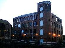 Clark's Mill from Wicker Hill
 Handle House adjacent to Clark's Mill
 Ashton Mill, once a major employer
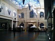 Salter's Mill, now the centrepiece of the Shires Shopping Centre
1800s to present
In its place a bedding industry developed, initially using wool cast off from the mills – the company now known as Airsprung Furniture Group PLC was started in the town in the 1870s. Food production also developed in the town when Abraham Bowyer started his business in 1805 which eventually, as Pork Farms Bowyers, became one of the largest employers in the town until closure in April 2008 when production moved to the Shaftesbury and Nottingham factories.
The town became the county town of Wiltshire in 1889 when Wiltshire County Council was formed and needed a place where representatives from Swindon and Salisbury, among others, could reach and return home in one day. Trowbridge fulfilled this criterion by dint of its railway connections and thus evolved as the county town, further reinforced by the construction of the county hall in 1939.[15]
The brewing company Ushers of Trowbridge opened in 1824, and developed the brewery in the town – this was finally shut in 2000 following several changes of ownership and the equipment sold to North Korea. It now forms the core of the Taedonggang brewery, located just outside Pyongyang.[16][17]
. Food production continues in the town through companies such as frozen food processor Apetito. The largest employers in the town are Wiltshire Council and Apetito.
Architecture
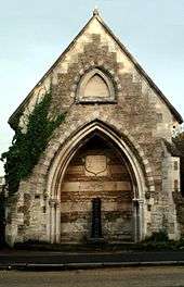
There is much of architectural interest in Trowbridge, including many of the old buildings associated with the textile industry, and the Newtown conservation area, a protected zone of mostly Victorian houses. The town hall is in Market Street, opposite the entrance to the pedestrianised Fore Street. This "imposing building" was presented to the residents of the town by a local businessman, Sir William Roger Brown in 1889, to celebrate Queen Victoria's golden jubilee.[18] It is currently used for military and other inquests.[19][20] The town has six Grade I listed buildings, being St James' Church, Lovemead House and numbers 46, 64, 68 and 70, Fore Street. There is also the Polebarn Hotel which is a Grade II* listed building.
Transport
Trowbridge railway station, which has two platforms, is situated on the Wessex mainline between Bradford-on-Avon and Westbury. Services from Trowbridge join the Great Western main line at Bath and Chippenham. Between Trowbridge and Chippenham the line is a single track with limited services. Services from Trowbridge join the Reading to Taunton line at Westbury.
Trowbridge is about 18 miles (29 km) from junction 18 of the M4 motorway (Bath) and the same distance from junction 17 (Chippenham). The A361 runs through the town connecting it to Swindon to the north-east and Barnstaple to the south-west, while the north-south A350 primary route to Poole passes close to the town.
The nearest airport is Bristol Airport, which is 30 miles (48 km) west.
Shopping and other facilities
The town centre is compact, and the focus for shops is the ancient Fore Street; the more modern Shires and Castle Place shopping centres provide a wide variety of outlets. The Shires Gateway, situated by the entrance to the Shires shopping centre car park, was opened in 2009. The new civic centre is a conference and entertainment venue and home to the town's information centre. It is also the headquarters of Trowbridge Town Council. It is located in the heart of Trowbridge's Town Park.[21]
Demography
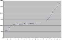
The first official census of 1801 showed Trowbridge having 5,799 inhabitants, which rose very rapidly to 9,545 in 1821. The population rose by less than 50% in the 130 years to 1951, compared to a considerably larger increase in the population of the country as a whole. No census was taken in 1941 due to the Second World War. From 1951 to 2011, the population increased by 133%.[22] Coinciding with this increase a considerable conversion of arable fields and some riverside meadows to residential estates took place.
- Ethnicity
While the proportion of people in 2011 who identified themselves as within an ethnic minority is lower than the average for England, at 11.7% (compared with 20.2%), approximately 1% of the population (0.93%) described themselves to be in the mixed/multiple ethnic group: white and black Caribbean, with the next largest minority being of black Caribbean ethnicity and descent. In order of percentage, the next largest minority are people of ethnicity which is 'other Asian' which does not refer to India, China, Pakistan or Bangladesh but to other Asian countries, outside of the Arab ethnicity area, which in turn falls one place behind this classification. Although this fourth group accounted in 2011 for less than 0.4% of the population, Trowbridge has one of the highest demographics of Moroccan birth or ancestry in the United Kingdom outside London.[1][23][24]
| Year | 1801 | 1811 | 1821 | 1831 | 1841 | 1851 | 1881 | 1891 | |
|---|---|---|---|---|---|---|---|---|---|
| Population | 5,799 | 6,075 | 9,545 | 10,863 | 11,050 | 11,148 | 11,040 | 11,717 | |
| Year | 1901 | 1911 | 1921 | 1931 | 1941 | 1951 | 1961 | 2001 | 2011 |
| Population | 11,526 | 11,815 | 12,130 | 12,011 | n/a | 13,859 | 15,844 | 28,163 | 32,304 |
Government
There are 7 electoral wards in Trowbridge. Their total area and population is identical to that quoted above.
Trowbridge is within the South West Wiltshire parliamentary constituency and represented by Andrew Murrison (Conservative).

It is the centre for Wiltshire Council, a unitary authority created in April 2009 which replaced (for relevant purposes) West Wiltshire District Council and the former Wiltshire County Council.
The Town Council is the lowest level of government.[25]
Education
Primary schools in the town include Bellefield Primary School, Grove Primary School, Holbrook Primary School, Oasis Academy Longmeadow, Paxcroft Primary School, St John's Catholic Primary School, Studley Green Primary School and Walwayne Court Primary School.
Secondary schools in Trowbridge include the Clarendon Academy, the John of Gaunt School and St Augustine's Catholic College.[26][27][28] All of the secondary schools also operate their own sixth forms. Larkrise School is a special school for children aged 3 to 19 which is also located in the town.[29]
Wiltshire College operates a campus in Trowbridge offering a range of vocational courses aimed at school-leavers.[30]
Entertainment and communications
The Arc Theatre (West Wiltshire's playhouse), based in Trowbridge, shows international theatre and dance. In 2011 it was announced by Wiltshire College that the Arc Theatre would close as a professional theatre, but would continue as a resource for the students of the college and for amateur productions.
Plans were unveiled in March 2012 to redevelop Trowbridge Town Hall as an arts centre, including a 300-seat auditorium by former Arc Theatre Director and Trowbridge Arts Development Manager Tracy Sullivan.
Trowbridge is part of the historic West Country Carnival circuit, and has also given its name to the Trowbridge Village Pump Festival. The festival was originally held in the old stablehouse of the Lamb Inn public house on Mortimer Street in Trowbridge, and was founded by Alan Briars and Dave Newman, although the event is now held at Stowford Manor Farm between Wingfield near Trowbridge and Farleigh Hungerford in Somerset.
Notable people
Trowbridge was the birthplace of Sir Isaac Pitman, developer of the Pitman Shorthand system of shorthand writing.[31] He is remembered in the town through several memorial plaques, and his name has been taken by a pub in the town centre run by Wetherspoons.[32] Matthew Hutton (Archbishop of Canterbury) was the town's rector from 1726 to 1730.[33] The poet George Crabbe held the same position from 1814 until his death in 1832.[34]
John Dyer was a Trowbridge-born inventor and engineer whose most important invention was the rotary fulling machine in 1833. A version of the machine, developed for the local woollen industry, is still in use today.[35]
Sir William Cook KCB Kt FRS, born in Trowbridge in 1905, was involved with the development of the British nuclear bomb at Aldermaston in the 1950s, becoming the establishment's deputy director.[36]
Nick Blackwell, professional boxer and former British middleweight champion, is from Trowbridge, as is disgraced[37] snooker player Stephen Lee.
The Oliver Twins, who created the Dizzy series of games amongst others and founded Interactive Studios (now known as Blitz games) grew up in Trowbridge. A building at the Clarendon Academy is named after the brothers.[38]
Town redevelopment

Since 2002, there have been plans in place to redevelop significant town centre sites.[39]
In the early 1990s the supermarket chain Tesco moved from St Stephen's Place to a site adjoining the A361 on County Way. The former site remained dormant for a decade. The building was demolished but a pile of rubble, nicknamed 'Mount Crushmore' by local media, remained. Legal and General acquired the land and construction of St Stephen’s Place Leisure Park began in 2012. A seven screen Odeon cinema and Nando's restaurant opened to the public in October 2013. A Premier Inn, Frankie and Benny's and Prezzo were due to open in 2014.
Developers Modus had signed up to provide a Vue cinema in the plan for the Waterside complex.[40] In March 2008, an outline planning application for the proposed development was approved by West Wiltshire District Council, to include a new library, cinema, ten-pin bowling, hotel and restaurants, however the proposals fell through.[41]
The developer Parkridge has constructed a retail centre between the Shires and the railway station, bringing firms such as Next and Brantano to the town.
The former Usher's brewery site has also undergone redevelopment over a number of years with Newland Homes building town centre flats incorporating the former frontage of the building.
In April 2009, building work started on one of the town's biggest brownfield sites, the former Usher's bottling plant. This site developed into a Sainsbury supermarket, a public square and housing.[42]
TCAF
Trowbridge Community Area Future (TCAF) is responsible for the production of the Trowbridge Community Area Plan,[43] which will help influence service providers to improve Trowbridge and guide future development. This is part of a county-wide commitment by Wiltshire Council to deliver services in a more community focused way that relates more directly to the needs and aspirations of local people via Community Area Partnerships.[44] These community run, independent and autonomous groups are producing local Community Area Plans across the county in partnership with Wiltshire Council and other organisations, stake holders and service providers.
Sport and leisure
Trowbridge Town has a Non-League football club Trowbridge Town F.C. who play at Woodmarsh to the south of the town, near North Bradley.
Trowbridge also has a cricket club who play at Trowbridge Cricket Club Ground. They have four adult teams and a thriving youth section. Trowbridge Cricket Club 1st XI currently play in the West of England Premier League Gloucestershire & Wiltshire division.
Town twinning
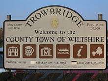
Trowbridge is twinned with four towns: Oujda, the area of Morocco where most the town's immigrant population originate,[24] since 2006.[45] Leer in Germany, since 1989;[45] Charenton-le-Pont in France since 1996;[45][46] and Elbląg in Poland, as part of West Wiltshire district twinning, since 2000.[45] Trowbridge was the first English town to twin with an Arab Muslim country.[23]
See also
References
- 1 2 3 "Trowbridge - 2011 Census". Neighbourhood Statistics. Office for National Statistics. Retrieved 5 June 2015.
- ↑ "Wiltshire Council – Wiltshire Community History Get Community Information". history.wiltshire.gov.uk. Retrieved 4 March 2011.
- ↑ Town Official Guide, Trowbridge Town Council, 2008
- 1 2 Origins of the name Trowbridge: Strum.co.uk website. Retrieved on 25 January 2008.
- ↑ Lewis, Harold (1978). The Church Rambler, Volume 2. Hamilton, Adams & Co. pp. 199–226.
- ↑ Anna Powell-Smith. "Domesday Map". Domesday Map. Retrieved 2016-10-08.
- ↑ First mention of Trowbridge Castle: Local Authority Publishing website. Retrieved on 25 January 2008.
- ↑ Graham, Alan H., and Susan M. Davies (1993). Excavations in Trowbridge, Wiltshire, 1977 and 1986–1988: The Prehistoric, Saxon, and Saxo-Norman Settlements and the Anarchy Period Castle. Salisbury: Wessex Archaeology. p. 1.
- ↑ plural of caput
- ↑ Elizabeth Crittall (editor) (1959). "The woollen industry before 1550". A History of the County of Wiltshire: Volume 4. Institute of Historical Research. Retrieved 27 September 2013.
- ↑ "Machine-breaking in England and France during the Age of Revolution". Retrieved 16 March 2008.
- ↑ "Economic History". Retrieved 16 March 2008.
- ↑ The Trowbridge Woollen Industry as Illustrated by the Stock Books of John and Thomas Clark, 1804–1824, John Clark & Thomas Clark & R. P. Beckinsale, Wiltshire Record Society/Biddles Ltd, 1973.
- ↑ "Wiltshire History Questions Search Results". 26 April 2007. Retrieved 8 November 2010.; another example is at Bowlish near Shepton Mallet.
- ↑ Wiltshire Council - Wiltshire Community History Get Wiltshire History Question Information
- ↑ "How Ushers' Trowbridge brewery is now the toast of North Korea". Wiltshire Times. 2009-07-05. Retrieved 2009-11-21.
- ↑ "Kim Jong-ale: How did Ushers brewery of Trowbridge end up in North Korea producing Pyongyang's number one beer - and what did it take to set up a taste test back in Wiltshire?". independent.co.uk. 18 April 2014. Retrieved 2016-10-08.
- ↑ Architecture – Trowbridge Town Hall: Local Authority Publishing website. Retrieved on 25 January 2008.
- ↑ Town Hall used for military inquests: Wiltshire Times article. Retrieved on 7 February 2008
- ↑ Other inquests also at the Town Hall: The Independent newspaper article. Retrieved on 7 February 2008
- ↑ :Town Council website. Retrieved 16 August 2011.
- 1 2 "Census: Trowbridge". Wiltshire Community History. Wiltshire Council. Retrieved 5 June 2015.
- 1 2 "Backing For Link To Morocco (from Wiltshire Times)". wiltshiretimes.co.uk. 22 September 2006. Retrieved 28 July 2008.
- 1 2 "Understanding Muslim Ethnic Communities – The Moroccan Muslim Community in England" (PDF). Change Institute. Communities and Local Government. April 2009.
- ↑ "Trowbridge Community Website". trowbridge.gov.uk. Retrieved 9 May 2009.
- ↑ "The John of Gaunt School". The John of Gaunt School. Retrieved 2016-08-15.
- ↑ "Clarendon Academy". Clarendon Academy. Retrieved 2016-08-15.
- ↑ "St Augustine's Catholic College". St Augustine’s Catholic College. Retrieved 2016-08-15.
- ↑ "Larkrise School". Larkrise School. Retrieved 2016-08-15.
- ↑ "Trowbridge campus". Wiltshire College. Retrieved 2016-08-15.
- ↑ Sir Isaac Pitman, born in Trowbridge: NNDB website. Retrieved on 25 January 2008.
- ↑ The "Sir Isaac Pitman" pub (Wetherspoon's): Carling.com website. Retrieved on 25 January 2008.
- ↑ Matthew Hutton, Archbishop of Canterbury, town's rector: Troweb website. Retrieved on 25 January 2008.
- ↑ George Crabbe, poet and rector of Trowbridge: Britain Unlimited website. Retrieved on 25 January 2008.
- ↑ "Trowbridge Inventors". Trowbridge Museum. Retrieved 3 June 2016.
- ↑ Sir William Cook KCB Kt FRS, notable resident: Local Authority Publishing website. Retrieved on 25 January 2008.
- ↑ Keogh, Frank (25 September 2013). "Stephen Lee: Snooker player given 12-year ban for match-fixing". BBC Sport. Retrieved 3 June 2016.
- ↑ "News :: Archive :: Oliver Twins honoured with naming of school building". Blitz Games Studios. 2013-09-12. Retrieved 2016-10-08.
- ↑ Redevelopment plans (since 2002): Transforming Trowbridge website. Retrieved on 25 January 2008.
- ↑ Plan for cinema in Trowbridge (Waterside development): West Wiltshire District Council website. Retrieved 25 January 2008.
- ↑ "Go-ahead for Waterside project", County Hall East area, March 2008: Wiltshire Times website. Retrieved 8 March 2008.
- ↑ Ushers Brewery site, proposed plans for redevelopment: Wiltshire Times website. Retrieved 25 January 2008.
- ↑ Trowbridge Community Area Plan, Community Area Plan: Trowbridge Town Council website. Retrieved 26 August 2010.
- ↑ Wiltshire Council Community Area Partnership, Community Area Partnership: Wiltshire Council website. Retrieved 26 August 2010.
- 1 2 3 4 "Trowbridge - Market town twins with Arab city". BBC News. BBC News Channel. 2006-10-03. Archived from the original on 2007-10-21. Retrieved 2013-08-01.
- ↑ "British towns twinned with French towns [via WaybackMachine.com]". Archant Community Media Ltd. Archived from the original on 5 July 2013. Retrieved 2013-07-20.
External links
| Wikimedia Commons has media related to Trowbridge. |
 Trowbridge travel guide from Wikivoyage
- Town Council website
- Trowbridge history (Wiltshire County Council)
- Trowbridge at DMOZ