U.S. Route 50 in Maryland
| ||||
|---|---|---|---|---|
|
U.S. Route 50 highlighted in red | ||||
| Route information | ||||
| Maintained by MDSHA | ||||
| Length: | 149.67 mi[1] (240.87 km) | |||
| Existed: | 1926 – present | |||
| Tourist routes: |
| |||
| Western section | ||||
| Length: | 9.17 mi[1] (14.76 km) | |||
| West end: |
| |||
| Major junctions: |
| |||
| East end: |
| |||
| Eastern section | ||||
| Length: | 140.50 mi[1] (226.11 km) | |||
| West end: |
| |||
| Major junctions: |
| |||
| East end: |
| |||
| Location | ||||
| Counties: | Garrett, Prince George's, Anne Arundel, Queen Anne's, Talbot, Dorchester, Wicomico, Worcester | |||
| Highway system | ||||
| ||||
_map.png)
U.S. Route 50 (US 50) is a major east–west route of the U.S. Highway system, stretching just over 3,000 miles (4,800 km) from Ocean City, Maryland on the Atlantic Ocean to West Sacramento, California. In the U.S. state of Maryland, US 50 exists in two sections. The longer of these serves as a major route connecting Washington, D.C. with Ocean City; the latter is the eastern terminus of the highway. The other section passes through the southern end of Garrett County for less than 10 miles (16 km) as part of the Northwestern Turnpike, entering West Virginia at both ends. One notable section of US 50 is the dual-span Chesapeake Bay Bridge across the Chesapeake Bay, which links the Baltimore–Washington metropolitan area with the Eastern Shore region, allowing motorists to reach Ocean City and the Delaware Beaches.
US 50 has received numerous upgrades during its existence in Maryland, including the building of the John Hanson Highway (which is also the unsigned Interstate 595), its extension onto the Eastern Shore and replacement of U.S. Route 213 due to the construction of the Chesapeake Bay Bridge, and the full dualization of the eastern segment of the route. Many of the older alignments of US 50 are still part of the Maryland and US highway systems, such as U.S. Route 50 Business in Salisbury, Maryland. US 50 continues to be upgraded on the Eastern Shore to better accommodate beach travelers and locals alike.
Route description
George Washington Highway
US 50 leaves Preston County in West Virginia and enters the state of Maryland in Garrett County. US 50 is routed along the old Northwestern Turnpike, presently named George Washington Highway after George Washington. This section of US 50 is a quiet, rural highway with little traffic, which stands in sharp contrast to the other, longer section. US 50 intersects only two numbered highways along this stretch: US 219 in Red House, and MD 560 east of there.
Near the West Virginia community of Gormania, US 50 crosses the Potomac River and exits Maryland. It then passes through West Virginia, Virginia, and the District of Columbia, before reentering Maryland.
John Hanson Highway
.svg.png)
US 50 exits the District as the John Hanson Highway, a freeway alignment extended from the east end of New York Avenue in Prince George's County. It instantly interchanges with the Baltimore-Washington Parkway at a hybrid interchange with a full cloverleaf and partial-Y elements. The B-W Parkway also allows access to MD 201 (Kenilworth Avenue). MD 450, a former alignment of US 50, runs parallel to the highway to the north for the entire trip between the District of Columbia and Annapolis. The freeway parallels the Orange Line of the Washington Metro and the Amtrak Northeast Corridor as it weaves through the suburban area, interchanging with MD 202 (Landover Road) and MD 410 (Veterans Parkway). It passes over the Orange Line and the Northeast Corridor before meeting a hybrid turbine interchange with Interstates 95 and 495, the Capital Beltway.
East of the Beltway, US 50 enters the Interstate Highway System as the unsigned I-595. The route is 10 lanes wide; beyond the MD 704 interchange, it narrows to eight lanes, with the innermost two being HOV lanes. Up to and slightly beyond the US 301/MD 3 interchange, the road surface is concrete; the roadway beyond there is asphalt. Within the US 301 interchange, the HOV lanes that began at the Capital Beltway come to an end, and US 301 joins US 50 and I-595, forming a three-route concurrency.
Anne Arundel County
The central portion of the route runs through undeveloped forest and parkland, meeting MD 424 (Davidsonville Road) three miles (5 km) east of US 301. After meeting Interstate 97 at a directional-T interchange, the carriageways from I-97 straddle US 50 for a short distance before becoming MD 665, continuing toward downtown Annapolis as a direct freeway spur.
The route now runs through the Annapolis urban area where it meets MD 450 (West Street), which leads into downtown Annapolis, and MD 2 (Solomons Island Road), which joins the highway. Continuing southeast, the highway (now a four-route concurrency of US 50, US 301, I-595 and MD 2) eventually reaches the MD 70 (Rowe Boulevard) interchange, where I-595 silently terminates.
Blue Star Memorial Highway
US 50 now becomes a Blue Star Memorial Highway, bearing this as its official name past MD 70. The route utilizes the Pearl Harbor Memorial Bridge to cross the Severn River and interchanges with the eastern end of MD 450 (Governor Ritchie Highway). This interchanges also releases MD 2 from the concurrency, which continues Governor Ritchie Highway northward to Baltimore. The US 50/US 301 freeway passes through a heavily wooded area, interchanging with few routes and offering rest stops along its final stretch through the Western Shore region. The freeway then interchanges with Oceanic Road, which passes over the toll plaza for the Chesapeake Bay Bridge.
Officially the William Preston Lane, Jr. Memorial Bridge, the bridge connects Sandy Point on the Western Shore with Kent Island on the Eastern Shore, raising US 50 and US 301 over two shipping channels marked by the suspension and through-truss spans of the structure. The bridge's asymmetrical dual spans are also a point of traffic congestion. The bridge brings the two routes down on Kent Island, and shortly after it meets MD 8 (Romancoke Road) at a diamond interchange. The freeway portion on the island continues, interchanging with many streets with sharp right-in/right-out ramps, until it meets the Kent Narrows Bridge, raising the routes over the Kent Narrows and bringing them down on the Eastern Shore's mainland.
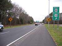
Most of the interchanges along the final stretch of the freeway give access to Maryland Route 18, which parallels US 50/US 301 as a local route and a former alignment of the highway. After interchanging with Nesbit Road at another diamond interchange and approaching Queenstown, development ceases, and US 50 and US 301 separate at a half-trumpet interchange. US 301 continues straight along the carriageways, heading northeast and retaining the Blue Star Memorial Highway designation all the way to the Delaware state line. US 50 exits the highway, becoming Ocean Gateway and later turning south towards Easton and Cambridge.
Queen Anne's County

The Ocean Gateway name for US 50 is retained mostly for the remainder of its routing, changing only twice more for short distances. Continuing east from the US 50 and US 301 split, the highway becomes a four-lane, dual highway and immediately intersects MD 18 (Main Street) for the last time. It continues through open farmland, bearing southeast as it passes the northern terminus of MD 662 (Wye Mills Road) and MD 213, both former alignments of the highway, which surround Chesapeake College. US 50 then makes a curve, aiming almost perfectly south as it meets MD 404 (Shore Highway), which forms the Queen Anne's–Talbot border.
Talbot County
US 50 continues to be signed as east–west, although it follows a north–south path. MD 662 weaves back and forth across this alignment through open farmlands in Talbot County as it approaches Easton, sometimes merging with it as well. North of Easton, MD 322 (Easton Parkway) leaves US 50 to the west, which functions as a bypass of the town. US 50 passes east of the center of town, the speed limit dropping from 55 mph (89 km/h) to 35 mph (56 km/h) as it passes through the commercial sector. Outside of town, the speed limit returns to 55 mph (89 km/h), and MD 322 meets US 50 again. MD 565 silently joins US 50 at this intersection, running concurrent for a short distance and exiting at Old Trappe Road. MD 565 is another former alignment of US 50, possessing the residential development in the southern Talbot area. US 50 continues by Trappe, meeting the southern end of MD 565 before continuing to the Choptank River.
Dorchester County
US 50 then passes over the Senator Frederick C. Malkus Bridge and enters Cambridge and Dorchester County, the speed limit once again dropping to 35 miles per hour (56 km/h), as the route starts bearing east once more. The entirety of US 50 in the city of Cambridge is named Sunburst Highway; this name is carried until the corporate boundaries at Woods Road. Here, the route's name returns to The Ocean Gateway, and later it intersects MD 16 (Church Creek Road), which travels with US 50 for a short while until East New Market, where it leaves to the north as Mount Holly Road. From here, US 50 travels through mostly rural countryside in Dorchester County with several loops of older alignments of US 50 crossing the highway. As it dodges around Vienna on the Nanticoke River, the route intersects Old Route 50 as a direct spur into the town. This road, formerly US 50 and then formerly MD 731, was the original crossing of the Nanticoke River, utilizing a drawbridge, until 1991. US 50 then interchanges with MD 331 (Rhodesdale–Vienna Road) at a partial cloverleaf and rises onto the Nanticoke Memorial Bridge, passing over the Nanticoke River.
Wicomico County
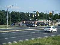
US 50 then enters Wicomico County, and soon after passes by Mardela Springs. As it does so, it intersects MD 313 (Main Street)/MD 54 (Delmar Road). The route continues through open farmland in a general southeastern alignment, passing by Hebron and MD 347 (Quantico Road) and MD 670 (East Lillian Street), both of which grant access. Northwest of Salisbury, US 50 becomes the Salisbury Bypass, a freeway bypass forming a 3/4 beltway around the city. US 50 Business, which goes directly through downtown Salisbury and is a former alignment of US 50, exits at a partial-Y interchange. The Salisbury Bypass soon after interchanges with Naylor Mill Road, providing missing movements from the US 50 Business split. The Bypass passes through the Northwood business park on an earthen viaduct within the city limits, interchanging partially with Northwood Drive to grant access. Soon after this, US 50 interchanges with US 13/US 13 Business (Salisbury Boulevard), picking up a concurrency with mainline US 13.
The two routes circle the city to the northeast and eventually meet US 50 Business at a partial cloverleaf. Here, US 50 leaves the Bypass, bearing east along a wide four-lane, divided alignment; US 13 continues southward, alone, on the Salisbury Bypass. US 50 passes by the campus of Wor-Wic Community College and continues through woods and farmland once more, intersecting various routes as it parallels MD 346 (Old Ocean City Road) and bypasses Parsonsburg, Pittsville, and Willards, until it crosses the Pocomoke River, where the route leaves the county.
Worcester County
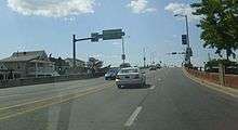
MD 610 (Whaleyville Road) intersects US 50 just beyond the border, bound for Whaleyville. Shortly after, MD 90 (Ocean City Expressway) branches off to the north, bypassing the town of Berlin and bearing toward northern Ocean City. Past this interchange, MD 346 crosses US 50 and heads into downtown Berlin. US 50 passes north of Berlin, where it meets a full cloverleaf interchange with US 113 (Worcester Highway). US 50 and two ramps cross the Snow Hill Line of the Maryland and Delaware Railroad, which parallels US 113, at-grade. The route meets the eastern terminus of MD 346 and continues through the heavily developed West Ocean City, with MD 707, yet another former alignment, paralleling and weaving across the highway. MD 589 (Racetrack Road) also intersects the route, which leads to Ocean Pines. Just before the bridge, MD 611 (Stephen Decatur Highway) intersects the route, bound south for Assateague Island and the Ocean City Municipal Airport. US 50 finally passes over the Sinepuxent Bay on the Harry W. Kelly Memorial Bridge, touching down in the town of Ocean City, where U.S. Route 50 meets its national eastern terminus.
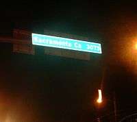
Although the route's ceremonial eastern terminus is at MD 528 (Philadelphia Avenue), eastbound US 50 actually continues beyond MD 528 as North Division Street and ends at MD 378 (Baltimore Avenue), a short distance from the Atlantic Ocean and Ocean City Boardwalk. As with most long-distance U.S. Routes and Interstate highways, a sign displaying the distance to its opposite terminus in Sacramento, California is posted; however, the measurement of 3,073 miles, shared on California's end of US 50, is outdated.
History
While the portion of US 50 in Garrett County has remained largely unchanged, the eastern portion has changed significantly since the route was established in 1926.
Original 1926 plan
On the Western Shore, US 50 was on the alignment currently known as MD 450. It ended at Church Circle in Annapolis, near St. Anne's Church.[2] Beyond the end of US 50 was a ferry which connected the route to what was then Maryland Route 17 on the Eastern Shore, in Talbot County.
Extension to the Eastern Shore

Just before the Chesapeake Bay Bridge's completion, in 1948, the route was extended to Ocean City. This extension brought the route across the bay via an existing ferry service, and US 50 replaced much of US 213 and portions of MD 404 on the Eastern Shore. As a result of US 50 being routed onto the Eastern Shore, US 213 north of what is now US 50 was removed from the U.S. Highway system, and became the current MD 213 by the late 1970s. Once the original two-lane span of the bridge was completed in 1952, it replaced the ferry, which had been in service since the 1930s.
The John Hanson Highway, named for John Hanson, was the first section of US 50 to be upgraded to a freeway in Maryland. It was completed soon after the Bay Bridge was built, and the older alignment was redesignated MD 450. A slight extension of MD 450 was then built to reconnect it with US 50 near the present-day intersection with MD 2.
Dualization of US 50
High volumes of beach traffic as a result of the Chesapeake Bay Bridge made further upgrades to the route necessary. A very straight alignment south through Talbot County was built, the former alignment becoming MD 662. In Salisbury, US 50 was moved from Main Street to Church Street. In Worcester County, its present-day alignment was built, though only dualized east of US 113 in Berlin. Following this, in the mid-1960s, the present four-lane section of US 50 was completed between Salisbury at then-US 13 and Berlin at US 113, its old alignment east of East Main Street becoming MD 346, and Church Street was returned to the city. The rest of US 50 on the Eastern Shore was in the process of being dualized at this time. This included the adjacent span of the Chesapeake Bay Bridge built in 1973, widening the thoroughfare to an asymmetrical five lanes.
In 1991, just as the final two-lane section of US 50 was falling into severe disrepair, Vienna was bypassed to the northeast, completing the dualization of the eastern section of US 50. The drawbridge was then dismantled, and portions of the old road were designated MD 731. The designations have been rolled back over time, however, and MD 731 is no longer signed. The 1990s also saw two extra lanes added to the John Hanson Highway in both directions as it was upgraded to enter the Interstate Highway System, being granted the Interstate 595 designation. However, the Interstate 595 shields were never installed on the highway; although the sign gantries installed during the upgrade contain space for the I-595 shields to be installed, this never happened to prevent motorist confusion, and as a result the designation is only used internally.[3] The freeway portion was extended to the Eastern Shore, from the Chesapeake Bay Bridge east to the US 50/301 split in Queenstown. The US 50/301 portion of the Blue Star Memorial Highway was upgraded to a freeway mostly during the late 1980s and early 1990s; prior to this it was only a divided highway with several local roads intersecting it. After being upgraded, many of these intersections became sharp right-in/right-out ramps.
The most recent upgrade to US 50 came in October 2002, when the Salisbury Bypass was extended to circle the north side of the city. US 50 was rerouted onto this, and the alignment within the city, already bypassed numerous times, became present-day US 50 Business.
Future
There are currently plans to upgrade US 50 in Queen Anne's County to a full limited access freeway, the freeway portion ending at an interchange with Maryland Route 404 atop the Queen Anne's/Talbot County border. This comes along with plans to fully dualize the latter highway in the state of Maryland.
Points of interest
- Severn River Bridge in Annapolis (rededicated as the Pearl Harbor Memorial Bridge in December 2006)
- US Naval Academy (has its own exit off US 50)
- Chesapeake Bay Bridge
- Kent Island (site of the oldest English settlement in Maryland)
- Kent Narrows Bridge between Kent Island and Grasonville
- Frederick C. Malkus Bridge in Cambridge
- Nanticoke River Memorial Bridge in Vienna
- Harry W. Kelly Memorial Bridge in Ocean City
- Ocean City Boardwalk, near the eastern terminus
Junction list
| County | Location | mi[1] | km | Exit | Destinations | Notes |
|---|---|---|---|---|---|---|
| Garrett | | 0.00 | 0.00 | Western terminus of western segment of US 50 in Maryland; West Virginia state line | ||
| Red House | 2.08 | 3.35 | ||||
| Gorman | 9.10 | 14.65 | ||||
| 9.17 | 14.76 | Eastern terminus of western segment of US 50 in Maryland; West Virginia state line at Potomac River | ||||
| US 50 passes through West Virginia, Virginia, and Washington, D.C. | ||||||
| Prince George's | Cheverly | 0.00 | 0.00 | Western terminus of eastern segment of US 50 in Maryland; District of Columbia boundary | ||
| 0.00 | 0.00 | West end of freeway | ||||
| 0.20 | 0.32 | Baltimore–Washington Parkway (MD 295 north) – Baltimore | Eastbound exit, westbound entrance | |||
| 0.50 | 0.80 | Split into exits for MD 201 north and MD 201 south | ||||
| 1.45 | 2.33 | Columbia Park Road – Cheverly | No exit westbound; Columbia Park Road is MD 459 | |||
| 2.80 | 4.51 | 3 | Split into exits 3A (north) and 3B (south) eastbound | |||
| Landover Hills | 4.10 | 6.60 | 5 | |||
| 4.52 | 7.27 | 6 | No exit eastbound; Garden City Drive is MD 950; Ardwick Ardmore Road is US 50PA | |||
| Lanham | 5.04 | 8.11 | 7 | I-95 / I-495 Exit 19; Split into exits 7A (south) and 7B (north) Western terminus of unsigned I-595 | ||
| 6.06 | 9.75 | 8 | ||||
| Bowie | 11.72 | 18.86 | 11 | |||
| 13.12 | 21.11 | 13 | Split into exits 13A (US 301), 13B (MD 3), and 13C (Belair Drive); South end of concurrency with US 301 | |||
| Anne Arundel | | 16.54 | 26.62 | 16 | ||
| Parole | 21.32 | 34.31 | 21 | |||
| 22.38 | 36.02 | 22 | ||||
| 23.04 | 37.08 | 23 | ||||
| 23.49 | 37.80 | 23A | No exit eastbound; west end of concurrency with MD 2 | |||
| 24.76 | 39.85 | 24 | Split into exits 24A (MD 70) and 24B (Bestgate Road) westbound; eastern terminus of unsigned I-595 | |||
| Severn River | 25.48– 26.03 | 41.01– 41.89 | Severn River Bridge / Pearl Harbor Memorial Bridge | |||
| Arnold | 26.67 | 42.92 | 27 | Split into exits 27A (MD 450) and 27B (MD 2) westbound; east end of concurrency with MD 2 | ||
| 26.97 | 43.40 | Baltimore–Annapolis Boulevard north | Unmarked right-in/right-out interchange westbound; officially MD 648F | |||
| 27.62 | 44.45 | 28 | Bay Dale Drive to Old Mill Bottom Road / Ferguson Road | |||
| Cape St. Claire | 29.15 | 46.91 | 29 | Split into exits 29A (Busch's Frontage Road) and 29B (Cape St. Claire Road) eastbound; Busch's Frontage Road and East College Parkway are MD 908A and MD 908B, respectively | ||
| 29.66 | 47.73 | 30 | Whitehall Road | Eastbound exit and entrance; Whitehall Road is MD 908C | ||
| 30.64 | 49.31 | 31 | Whitehall Road | Right-in/right-out interchange eastbound; Whitehall Road is MD 908C | ||
| Skidmore | 31.44 | 50.60 | 32 | Oceanic Drive – Sandy Point State Park | Oceanic Drive is MD 908D | |
| 31.73 | 51.06 | Chesapeake Bay Bridge Toll Plaza (eastbound) | ||||
| Chesapeake Bay | 32.10– 36.16 | 51.66– 58.19 | Chesapeake Bay Bridge / William Preston Lane Jr. Memorial Bridge | |||
| Queen Anne's | Stevensville | 37.22 | 59.90 | 37 | ||
| 37.87 | 60.95 | 38A | Duke Street | Right-in/right-out interchange westbound | ||
| 37.89 | 60.98 | 38A | Thompson Creek Road | Right-in/right-out interchange eastbound | ||
| Chester | 38.86 | 62.54 | 38B | Services | Westbound exit and entrance; frontage road is US 50QC | |
| 38.98 | 62.73 | 39A | Cox Neck Road | Right-in/right-out interchange eastbound | ||
| 38.99 | 62.75 | 39A | Castle Marina Road to | Right-in/right-out interchange westbound; Castle Marina Road is MD 18H | ||
| 39.49 | 63.55 | 39B | Piney Creek Road | Right-in/right-out interchange westbound; Piney Creek Road is MD 18T; connector road is MD 552A (Chester Station Road) | ||
| 39.51 | 63.59 | 39B | Right-in/right-out interchange eastbound | |||
| 40.14 | 64.60 | 40A | South Piney Road | Right-in/right-out interchange eastbound | ||
| 40.17 | 64.65 | 40A | Piney Creek Road | Right-in/right-out interchange westbound | ||
| 40.52 | 65.21 | 40B | Dundee Avenue | Right-in/right-out interchange eastbound | ||
| Kent Narrows | 40.76 | 65.60 | 41 | Westbound ramps are with Piney Narrows Road | ||
| Kent Narrows | 41.04– 41.62 | 66.05– 66.98 | Kent Narrows Bridge | |||
| Kent Narrows | 41.92 | 67.46 | 42 | Westbound right-in/right-out interchange with MD 835G (Kent Narrows Road); eastbound right-in/right-out interchange with MD 835 (Seward Marina Road) | ||
| Grasonville | 42.80 | 68.88 | 43A | Jackson Creek Road | Westbound right-in/right-out interchange; Jackson Creek Road is MD 18U | |
| 42.82 | 68.91 | 43A | Eastbound right-in/right-out interchange with unnamed MD 18F | |||
| 43.37 | 69.80 | 43B | Chester River Beach Road | No westbound exit; Chester River Beach road is MD 18V | ||
| 43.77 | 70.44 | 44A | VFW Avenue | Westbound right-in/right-out interchange; VFW Avenue is MD 18W | ||
| 43.78 | 70.46 | 44A | Station Lane | Eastbound right-in/right-out interchange; Station Lane is MD 18I | ||
| 44.13 | 71.02 | 44B | Winchester Creek Road | Westbound right-in/right-out interchange; Winchester Creek Road is MD 835H | ||
| 44.14 | 71.04 | 44B | Evans Avenue | Eastbound right-in/right-out interchange; Evans Avenue is MD 18Z | ||
| 44.47 | 71.57 | 45A | Hissey Road | Westbound right-in/right-out interchange; Hissey Road is MD 835I | ||
| 44.48 | 71.58 | 45A | Hess Road | Eastbound right-in/right-out interchange; Hess Road is MD 18X | ||
| 44.90 | 72.26 | 45B | Nesbit Road | Nesbit Road is MD 835K | ||
| Queenstown | 46.09 | 74.17 | 46 | Eastbound exit, westbound entrance; east end of concurrency with US 301 | ||
| 46.09 | 74.17 | East end of freeway | ||||
| 46.37 | 74.63 | Right-in/right-out intersections with MD 18B eastbound and MD 18S westbound, plus a turn from westbound US 50 to MD 18B; no direct access between MD 18B and MD 18S | ||||
| 47.72 | 76.80 | |||||
| Wye Mills | 50.70 | 81.59 | ||||
| 51.57 | 82.99 | |||||
| Queen Anne's–Talbot county line | 53.05 | 85.38 | ||||
| Talbot | | 55.36 | 89.09 | |||
| | 55.82 | 89.83 | Officially MD 662B | |||
| | 57.68 | 92.83 | Old Skipton Road is MD 662B; Longwoods Road is MD 662C | |||
| Easton | 61.57 | 99.09 | Connector is unnamed MD 662D | |||
| 61.77 | 99.41 | |||||
| 62.71 | 100.92 | |||||
| 64.20 | 103.32 | |||||
| 64.54 | 103.87 | |||||
| 66.87 | 107.62 | No access from southbound MD 322 to westbound US 50 | ||||
| | 67.70 | 108.95 | ||||
| Trappe | 72.97 | 117.43 | Barber Road east / Main Street north to | |||
| Choptank River | 77.47– 79.11 | 124.68– 127.32 | Frederick C. Malkus Memorial Bridge | |||
| Dorchester | Cambridge | 80.05 | 128.83 | No direct access from eastbound MD 343 to westbound US 50 | ||
| 80.79 | 130.02 | West end of concurrency with MD 16 | ||||
| 81.20 | 130.68 | |||||
| 82.00 | 131.97 | |||||
| | 83.45 | 134.30 | No direct access from westbound MD 16 to eastbound US 50 | |||
| Vienna | 93.47 | 150.43 | Old Ocean Gateway – Vienna | Eastbound exit and entrance | ||
| 94.58 | 152.21 | Partial cloverleaf interchange | ||||
| Nanticoke River | 95.14– 96.14 | 153.11– 154.72 | Nanticoke River Memorial Bridge | |||
| Wicomico | Mardela Springs | 99.93 | 160.82 | |||
| Hebron | 104.80 | 168.66 | ||||
| 105.96 | 170.53 | No direct access from eastbound MD 670 to westbound US 50 | ||||
| | 107.88 | 173.62 | West end of freeway | |||
| | 107.88 | 173.62 | Eastbound exit, westbound entrance | |||
| | 108.59 | 174.76 | Naylor Mill Road | Diamond interchange; Naylor Mill Road is US 50UA | ||
| Salisbury | 110.86 | 178.41 | Northwood Drive | Eastbound exit, westbound entrance | ||
| 111.38 | 179.25 | Partial cloverleaf interchange with flyover; no access from northbound US 13 Business to westbound US 50; west end of concurrency with US 13 | ||||
| 114.46 | 184.21 | Partial cloverleaf interchange; east end of concurrency with US 13 | ||||
| 114.46 | 184.21 | East end of freeway | ||||
| Willards | 124.61 | 200.54 | ||||
| Worcester | Whaleyville | 126.94 | 204.29 | |||
| | 129.06 | 207.70 | Eastbound exit, westbound entrance | |||
| Berlin | 131.06 | 210.92 | ||||
| 132.81 | 213.74 | |||||
| 133.14 | 214.27 | Cloverleaf interchange | ||||
| 133.97 | 215.60 | |||||
| 134.48 | 216.42 | |||||
| | 135.74 | 218.45 | ||||
| West Ocean City | 138.21 | 222.43 | Officially MD 707A | |||
| 139.03 | 223.75 | |||||
| Sinepuxent Bay | 139.89– 140.38 | 225.13– 225.92 | Harry W. Kelley Memorial Bridge | |||
| Ocean City | 140.43 | 226.00 | Eastern terminus of westbound US 50 | |||
| 140.50 | 226.11 | Eastern terminus of eastbound US 50 | ||||
| 1.000 mi = 1.609 km; 1.000 km = 0.621 mi | ||||||
See also
 Maryland Roads portal
References
- 1 2 3 4 Highway Information Services Division (December 31, 2013). Highway Location Reference. Maryland State Highway Administration. Retrieved 2012-09-07.
- Garrett County (PDF)
- Prince George's County (PDF)
- Anne Arundel County (PDF)
- Queen Anne's County (PDF)
- Talbot County (PDF)
- Dorchester County (PDF)
- Wicomico County (PDF)
- Worcester County (PDF)
- ↑ Map of Maryland (Map). Maryland State Highway Administration. 1927. Retrieved 2009-03-03.
- ↑ "Interstate 595 in Maryland (US-50 from I-95/I-495 to Annapolis)". Roadstothefuture.com. Retrieved 2010-02-06.
External links
| Wikimedia Commons has media related to U.S. Route 50 in Maryland. |
| Previous state: West Virginia |
Maryland | Next state: West Virginia |
| Previous state: District of Columbia |
Next state: Terminus | |