Umaria district
| Umaria district उमरिया जिला | |
|---|---|
| District of Madhya Pradesh | |
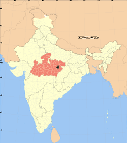 Location of Umaria district in Madhya Pradesh | |
| Country | India |
| State | Madhya Pradesh |
| Administrative division | Shahdol |
| Headquarters | Umaria |
| Area | |
| • Total | 4,548 km2 (1,756 sq mi) |
| Population (2011) | |
| • Total | 643,579 |
| • Density | 140/km2 (370/sq mi) |
| Demographics | |
| • Literacy | 67.34 per cent |
| • Sex ratio | 953 |
| Website | Official website |
Umaria is an important north eastern district in shahdol division of Madhya Pradesh state, having a global location between north latitude 23º38' to 24º20' and east longitude 80º28' to 82º12'. The town of Umaria is the district headquarters. The district is part of Shahdol Division.
The total geographical area of the district sums up to 4548 square kilometers and has a population of 515,963. Umaria is enriched with its vast resources of forests and minerals. The coal mines are a steady source of revenue for the district.
The most important mineral found in the district is coal and as a result 8 mines are being operated by South Eastern Coalfields Limited in the district. The famous Bandhavgarh National Park (Tala) and Sanjay Gandhi Thermal Power Station at Mangthar (Pali) are located in the district. Umaria was formerly the headquarters of the South Rewa District and thereafter the headquarters town of the Bandhavgarh tehsil. It is situated at a distance of about 69 km. from Shahdol, the parent district. Metalled roads connect the town with Katni, Rewa Shahdol, etc., on which regular buses ply. Umaria is also a railway station on the Katni-Bilaspur section of the South-Eastern Railway.
As of 2011 it is the second least populous district of Madhya Pradesh (out of 50), after Harda.[1]
History
Umaria was a part of Shahdol district before separation in 1998. Umariya is ruled by Lodhi Rajputs (Malgujars). The Lodhi Rajput Family built the famous and important temple of Lakshmi Narayan on southern bank of Narbada Barman ghat. They also built on the steps of the northern bank of Barman ghat Kareli a great gateway called the Hathi Darwaza, to allow their elephants passage. Later the Baghel Rajputs of Rewa won it from Lodhis, it became the Southern Capital of Rewa Riyasat after some years. Umaria was always a favourite town for many a princes and kings because the dense forests and tigers. The forests of Bandhavgarh was game reserve of Maharaja of Rewa.
Climate
Average Rainfall : 1093 m.m.
Average Max. Temperature :46.2 °C
Average Min. Temperature : -0.1 °C
Economy
In 2006 the Ministry of Panchayati Raj named Umaria one of the country's 250 most backward districts (out of a total of 640).[2] It is one of the 24 districts in Madhya Pradesh currently receiving funds from the Backward Regions Grant Fund Programme (BRGF).[2]
Demographics
According to the 2011 census Umaria District has a population of 643,579,[1] roughly equal to the nation of Montenegro[3] or the US state of Vermont.[4] This gives it a ranking of 513th in India (out of a total of 640).[1] The district has a population density of 158 inhabitants per square kilometre (410/sq mi) .[1] Its population growth rate over the decade 2001-2011 was 24.73%.[1] Umaria has a sex ratio of 953 females for every 1000 males,[1] and a literacy rate of 67.34%.[1]
Languages
Vernaculars spoken in Umaria include Bagheli, which has a lexical similarity of 72-91% with Hindi[5] (compared to 60% for German and English)[6] and is spoken by about 7,800,000 people in Bagelkhand.[5]
Bandhavgarh National Park
Bandhavgarh (The ancient Name is Bandhogarh) is a relatively small park, in the last few years this former game reserve has become one of India's most prominent National Parks. The major reason for all the interest is Bandhavgarh high density of tigers, which roam the mixed forests of sal, bamboo and ambilica officinale in search of an easy kill. The tigers have not only bolstered the local population by breeding successfully, they have also brought international media attention to the park and to the plight of the Royal Bengal Tiger. The density of the tiger population at Bandhavgarh is the highest known in India. 60 Tigers at 450 km2. area in Bandhavgarh National Park. This is also "WHITE TIGER" country. The last known as captured by Maharaja Martand Singh in 1951. This White Tiger "Mohan", is now stuffed and display in the place of Maharajah of Rewa.
Attractions
Bandhavgarh Fort
Bandhavgarh is the name of tehsil in Umaria District. Formerly it was the capital of the Bandhavgarh Kingdom of the Magha dynasty, then the headquarters of the tehsil. At present its headquarters is Umaria.
The fort of Bandhavgarh is a place of considerable archaeological and historical importance.
It is a natural impregnable fort and stands on a hill, at an attitude of about 2430 metres above sea-level. The Bamnia hill is also a part of the fort, because it is enclosed by a rampart. The fort is on the Rewa-Uma-Katni road, at a distance of about 21 km. from Umaria. The railway station of Chandia road, known as Chandia railway station.
The most important spot of Chandia Khas is a small temple, enshrining Goddess Kalika. Her mouth is wide open, but her outstretched tongue is broken. There is also an old temple of god Rama and his consort Janaki. It was the seat of Thakur of Chandia. A small fair meets at Suraswahi Chandia for 3 days in February/March, on the occasion of Shivaratri.
Pali Birsinghpur
Pali is situated on the Umaria-Shahdol road, at a distance of about 36 km from Umaria. Another road goes from Pali to Mandla via Dindori. Pali is also a railway station, and there is a rest house for the tourists to stay. The station is known as the Pali-Birsinghpur station. Near the railway station there is a temple, enshrining Birasinidevi. By popular belief she is Goddess Kali, represented here as skeleton Goddess, but with her mouth closed. Many remains of old jain idols kept here in some Hindu temples. The annual fairs are held both in October and March, on the occasion of Navaratri, near the temple of Goddess.
Umaria Town
The headquarters town of the Umaria district and Bandhavgarh tehsil, formerly Umaria was the headquarters of the South Rewa District. It is situated at a distance of about 69 km from Shahdol.
Near the railway station stands a Siva temple, known as the Sagara temple. It was an old shrine, recently remodeled. Its main gates are still intact with beautiful stone statues, carved in Khajuraho models. Near about is Jwalamukhi temple. about 6.5 km from the town, there is another temple, with similar carvings of the Khajuraho pattern. It is known as the Mariwal temple.
Umaria is famous for its coal-mines, which were opened in 1881 by the Government of India and transferred to the Rewa Darbar in the same year, mainly to meet the requirement of railway at Katni
MANPUR Manpur is a block and biggest tehsil in umaria district. It is situated about 45 km from district headquarter and about 12 km from Bandhavgarh National Park in Tala-Jaisinghnagar road. There are 84 Gram Panchayats in Manpur tehsil. There is Hanumant Kunj Aashram Chhapdaur famous for religios view in Manpur-Byohari road.
CHANDPUR The region of PARIHAR Rajput.
References
- 1 2 3 4 5 6 7 "District Census 2011". Census2011.co.in. 2011. Retrieved 2011-09-30.
- 1 2 Ministry of Panchayati Raj (September 8, 2009). "A Note on the Backward Regions Grant Fund Programme" (PDF). National Institute of Rural Development. Retrieved September 27, 2011.
- ↑ US Directorate of Intelligence. "Country Comparison:Population". Retrieved 2011-10-01.
Montenegro 661,807 July 2011 est.
- ↑ "2010 Resident Population Data". U. S. Census Bureau. Retrieved 2011-09-30.
Vermont 625,741
- 1 2 M. Paul Lewis, ed. (2009). "Bagheli: A language of India". Ethnologue: Languages of the World (16th ed.). Dallas, Texas: SIL International. Retrieved 2011-09-28.
- ↑ M. Paul Lewis, ed. (2009). "English". Ethnologue: Languages of the World (16th ed.). Dallas, Texas: SIL International. Retrieved 2011-09-28.
External links
| Wikimedia Commons has media related to Umaria district. |
- Umaria District
- Syna Tiger Resort Bandhavgarh
- List of places in Umaria
 |
Satna district | | ||
| Katni district | |
Shahdol district | ||
| ||||
| | ||||
| Jabalpur district | Dindori district | Anuppur district |
Coordinates: 23°31′37″N 80°50′17″E / 23.526847°N 80.838106°E