Khandwa district
| Khandwa district खंडवा जिला | |
|---|---|
| District of Madhya Pradesh | |
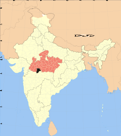 Location of Khandwa district in Madhya Pradesh | |
| Country | India |
| State | Madhya Pradesh |
| Administrative division | Indore |
| Headquarters | Khandwa |
| Tehsils | Khandwa,Punasa(Mundi), Harsud, Pandhana |
| Government | |
| • Lok Sabha constituencies | Khandwa |
| Area | |
| • Total | 6,206 km2 (2,396 sq mi) |
| Population (2011) | |
| • Total | 1,309,443 |
| • Density | 210/km2 (550/sq mi) |
| Demographics | |
| • Literacy | 67.53 per cent |
| • Sex ratio | 944 |
| Major highways |
Khandwa-Indore State Highway Khandwa-Mundi-Ashta State Highway Khandwa-Amrawati Road |
| Website | Official website |
Khandwa District (Hindi: खंडवा जिला), formerly known as East Nimar District, is a district of Madhya Pradesh state in central India. The city of Khandwa is the administrative headquarters of the district. Other notable towns in the district include Mundi, Harsud, Pandhana and Omkareshwar.
Geography
The district has an area of 6206 km², and a population 1,309,443 (2011 census). Khandwa District lies in the Nimar region, which includes the lower valley of the Narmada River,Kherkhali River,Choti Tawa River,Shiva River. The Narmada forms part of the northern boundary of the district, and the Satpura Range form the southern boundary of the district. Burhanpur District, to the south, lies in the basin of the Tapti River. The pass through the Satpuras connecting Khandwa and Burhanpur is one of the main routes connecting northern and southern India, and the fortress of Asirgarh, which commands the pass, is known as the "Key to the Deccan". Betul and Harda districts lie to the east, Dewas District to the north, and Khargone District to the west.
History
Khandwa district was surrendered by the Marathas to the British Raj in 1818, and later became part of the Central Provinces and Berar. The area to the west, which forms the present Khargone district, was part of the princely state of Indore. After India's independence in 1947, the Central Provinces and Berar became the new Indian state of Madhya Pradesh.
Khandwa District was known as Nimar District before 1956, when the state of Madhya Bharat to the west was merged with the state of Madhya Pradesh. The present-day Khargone District of Madhya Bharat was also called Nimar, so the districts were renamed West and East Nimar. Nimar district was part of the Nerbudda (Narmada) Division of the Central Provinces and Berar, which became the state of Madhya Bharat (later Madhya Pradesh) after India's independence in 1947.[1] Khandwa was known as East Nimar until recently. Burhanpur District was separated from Khandwa District on 15 August 2003. Khandwa District is part of Indore Division. Tabish.In Main Cities is Mundi, Harsud, Pandhana, Omkareshwar
Economy
In 2006 the Ministry of Panchayati Raj named Khandawa one of the country's 250 most backward districts (out of a total of 640).[2] It is one of the 24 districts in Madhya Pradesh currently receiving funds from the Backward Regions Grant Fund Programme (BRGF).[2]
Demographics
According to the 2011 census Khandwa District has a population of 1,309,443,[3] This gives it a ranking of 374th in India (out of a total of 640).[3] The district has a population density of 178 inhabitants per square kilometre (460/sq mi).[3] Its population growth rate over the decade 2001–2011 was 21.44%.[3] East Nimar has a sex ratio of 944 females for every 1000 males,[3] and a literacy rate of 67.53%.[3]
Languages
Languages spoken include Nimadi, a Bhil language with approximately 64 000 speakers, written in the Devanagari script.[4]
Rank in Cities of Khandwa Dist.
- 1st-Khandwa-2,90,000.
- 2nd-Mundi-30,000.
- 3rd-Harsud-27,000.
- 4th-Pandhana-25,000.
- 5th-Omkareshwer-20,000.
Famous people from Khandwa
Actor Ashok Kumar and his singer/actor brother Kishore Kumar and Anoop Kumar were brought up in Khandwa before moving to Bombay to make their mark.
Former Chief Minister of Madhya Pradesh Bhagwantrao Mandloi was born in Khandwa.
Dadaji Dhuniwale who was a religious saint of Hindus also lived here. A large number of Hindu devotees also come on Gurupurnima for worship on his Samadhi.
Great Hindi poet & freedom fighter Pt. Makhanlal Chaturvedi has chosen Khandwa as his place of work. He was editor of Karmveer news-paper which had played a major role in freedom struggle of India. His well known poem is "Pushpa ki Abhilasha" (wish of a flower).
Saint Singaji, a great poet and saint also lived here. His status is same as the great poet Kabir. He born in fifteenth century in a poor gavali (herdsman) family of Khajuri Village of Barwani state of that time (now Barwani[5] is a District of Madhya Pradesh). Later he came at Piplia village of Harsud Tehsil and remained here till samadhi. He came in touch of saint Manrangeer and after that dedicated his life to God. He practiced the Nirguna Sect of Hindu religion (the believer of Nirguna sect believes that the God is Absolute, abstract and has no form, incarnation etc.). He became the object of wide population devotion, especially among the Gavalis of Nimar Districts. A fair is held in his holy memory every year on Sharad Purnima at his samadhi place Piplia-Singaji (now submerged into Indira Sagar Project) which nearly runs for 15 days. A huge number of devotees coming form many villages in and around the area gather near his temple and offer puja to Singaji Maharaj on the occasion. His Bhajans are being sung in villages.
Saroo Brierley was born in Khandwa and lived there until about the age of five years when he was dramatically lost and adopted by a family in Australia. He did not know the name or location of his birthplace and so, at the age of twenty-five years, began a systematic search using Google Earth, ultimately finding that he came from Ganesh Talai, a suburb within Khandwa. Brierley describes his early life in India, becoming lost, his adoption and life in Australia, and his successful search for his family in his book A Long Way Home.[6]
See Also
References
- ↑ Hunter, William Wilson, Sir, et al. (1908). Imperial Gazetteer of India, Volume 6. 1908-1931; Clarendon Press, Oxford
- 1 2 Ministry of Panchayati Raj (8 September 2009). "A Note on the Backward Regions Grant Fund Programme" (PDF). National Institute of Rural Development. Retrieved 27 September 2011.
- 1 2 3 4 5 6 "District Census 2011". Census2011.co.in. 2011. Retrieved 2011-09-30.
- ↑ M. Paul Lewis, ed. (2009). "Bareli, Rathwi: A language of India". Ethnologue: Languages of the World (16th ed.). Dallas, Texas: SIL International. Retrieved 2011-09-28.
- ↑ Wel-Come to Barwani (M.P.). Barwani.nic.in. Retrieved on 2012-06-20.
- ↑ Brierley, Saroo (2013). A Long Way Home. Viking, Australia ISBN 9780670077045
External links
| Wikimedia Commons has media related to Khandwa district. |
 |
Dewas district | Harda district | | |
| West Nimar district | |
Betul district | ||
| ||||
| | ||||
| Burhanpur district | Amravati district, Maharashtra |
Coordinates: 21°49′48″N 76°20′24″E / 21.83000°N 76.34000°E
Tabish