Union Township, Carroll County, Ohio
| Union Township, Carroll County, Ohio | |
|---|---|
| Township | |
|
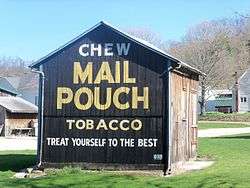
Algonquin Mill Barn in Petersburg, Union Township | |
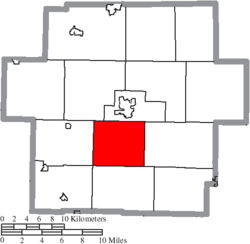 Location of Union Township in Carroll County | |
| Coordinates: 40°30′50″N 81°6′28″W / 40.51389°N 81.10778°WCoordinates: 40°30′50″N 81°6′28″W / 40.51389°N 81.10778°W | |
| Country | United States |
| State | Ohio |
| County | Carroll |
| Area | |
| • Total | 22.6 sq mi (58.6 km2) |
| • Land | 22.5 sq mi (58.3 km2) |
| • Water | 0.2 sq mi (0.4 km2) |
| Elevation[1] | 1,161 ft (354 m) |
| Population (2010) | |
| • Total | 977 |
| • Density | 44/sq mi (16.8/km2) |
| Time zone | Eastern (EST) (UTC-5) |
| • Summer (DST) | EDT (UTC-4) |
| FIPS code | 39-78260[2] |
| GNIS feature ID | 1085836[1] |
Union Township is one of the fourteen townships of Carroll County, Ohio, United States. As of the 2010 census, the population was 977.[3]
Geography
Located in the south central part of the county, it borders the following townships:
- Center Township - northeast
- Lee Township - east
- Perry Township - south
- Orange Township - southwest corner
- Monroe Township - west
- Harrison Township - northwest
No municipalities are located in Union Township.
Name and history
It is one of twenty-seven Union Townships statewide.[4] It was named Union because it was formed as a union from more than one previous townships.[5]
Government
| Historical population | |||
|---|---|---|---|
| Census | Pop. | %± | |
| 1840 | 889 | — | |
| 1850 | 804 | −9.6% | |
| 1860 | 664 | −17.4% | |
| 1870 | 609 | −8.3% | |
| 1880 | 684 | 12.3% | |
| 1890 | 653 | −4.5% | |
| 1900 | 578 | −11.5% | |
| 1910 | 513 | −11.2% | |
| 1920 | 513 | 0.0% | |
| 1930 | 432 | −15.8% | |
| 1940 | 497 | 15.0% | |
| 1950 | 515 | 3.6% | |
| 1960 | 460 | −10.7% | |
| 1970 | 482 | 4.8% | |
| 1980 | 830 | 72.2% | |
| 1990 | 900 | 8.4% | |
| 2000 | 1,059 | 17.7% | |
| 2010 | 977 | −7.7% | |
| [6] | |||
The township is governed by a three-member board of trustees, who are elected in November of odd-numbered years to a four-year term beginning on the following January 1. Two are elected in the year after the presidential election and one is elected in the year before it. There is also an elected township fiscal officer,[7] who serves a four-year term beginning on April 1 of the year after the election, which is held in November of the year before the presidential election. Vacancies in the fiscal officership or on the board of trustees are filled by the remaining trustees.
Education
Students attend the Carrollton Exempted Village School District.[8]
References
- 1 2 "US Board on Geographic Names". United States Geological Survey. 2007-10-25. Retrieved 2008-01-31.
- ↑ "American FactFinder". United States Census Bureau. Archived from the original on September 11, 2013. Retrieved 2008-01-31.
- ↑ "Geographic Identifiers: 2010 Demographic Profile Data (G001): Union township, Carroll County, Ohio". U.S. Census Bureau, American Factfinder. Retrieved January 9, 2015.
- ↑ "Detailed map of Ohio" (PDF). United States Census Bureau. 2000. Retrieved 2007-02-16.
- ↑ Eckley, H.J.; Perry, W.T. (1921). History of Carroll and Harrison Counties. The Lewis Publishing Co. p. 204.
- ↑ census data: 1840, 1880 : Howe, Henry (1907). Historical Collections of Ohio, The Ohio Centennial Edition. The State of Ohio. p. 359. , 1850 : 1850 page 14 , 1860 : 1860 page 13 , 1870 : 1870 page 24 , 1890, 1900 : Hunt, William C. (1901). Population of the United States by states and territories, counties, and minor Civil Divisions, as returned at the Twelfth Census: 1900. United States Census Printing Office. p. 306. , 1900, 1910, 1920 : Austin, William Lane; Teele, Ray Palmer (1921). Fourteenth census of the United States, Volume 1. Government Printing Office. p. 561. , 1930 : 1930 page 40 , 1940 : 1940 page 83 , 1950 : 1950 page 14 , 1960 : 1960 page 16 , 1970 : 1970 page 124 , 1980 : 1980 & 1990 Census Information, at reference desk, Carroll County District Library , 1990 : 1990 , 2000 : 2000, 2010 :
- ↑ §503.24, §505.01, and §507.01 of the Ohio Revised Code. Accessed 4/30/2009.
- ↑ PUC Ohio map of School Districts Archived February 20, 2009, at the Wayback Machine.
External links
Municipalities and communities of Carroll County, Ohio, United States | ||
|---|---|---|
| Villages |  | |
| Townships | ||
| CDP | ||
| Unincorporated communities | ||
| Footnotes | ‡This populated place also has portions in an adjacent county or counties | |