Walnut, Iowa
| Walnut, Iowa | |
|---|---|
| City | |
 | |
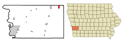 Location of Walnut, Iowa | |
| Coordinates: 41°28′52″N 95°13′16″W / 41.48111°N 95.22111°WCoordinates: 41°28′52″N 95°13′16″W / 41.48111°N 95.22111°W | |
| Country |
|
| State |
|
| County | Pottawattamie |
| Area[1] | |
| • Total | 2.15 sq mi (5.57 km2) |
| • Land | 2.15 sq mi (5.57 km2) |
| • Water | 0 sq mi (0 km2) |
| Elevation | 1,332 ft (406 m) |
| Population (2010)[2] | |
| • Total | 785 |
| • Estimate (2012[3]) | 776 |
| • Density | 365.1/sq mi (141.0/km2) |
| Time zone | Central (CST) (UTC-6) |
| • Summer (DST) | CDT (UTC-5) |
| ZIP code | 51577 |
| Area code(s) | 712 |
| FIPS code | 19-82065 |
| GNIS feature ID | 0462626 |
| Website | City of Walnut |

Walnut is a city in Pottawattamie County, Iowa, United States. The population was 785 at the 2010 census. Walnut is located on Interstate 80 and is famous for its many antique stores. In recent years Walnut has become a regional center of wind turbine electrical generation.
History
Walnut was incorporated as a city in 1877.[4]
Geography
Walnut is located at 41°28′52″N 95°13′16″W / 41.48111°N 95.22111°W (41.480999, -95.221116).[5]
According to the United States Census Bureau, the city has a total area of 2.15 square miles (5.57 km2), all of it land.[1]
Demographics
| Historical populations | ||
|---|---|---|
| Year | Pop. | ±% |
| 1880 | 733 | — |
| 1890 | 811 | +10.6% |
| 1900 | 878 | +8.3% |
| 1910 | 950 | +8.2% |
| 1920 | 1,072 | +12.8% |
| 1930 | 935 | −12.8% |
| 1940 | 902 | −3.5% |
| 1950 | 888 | −1.6% |
| 1960 | 777 | −12.5% |
| 1970 | 870 | +12.0% |
| 1980 | 897 | +3.1% |
| 1990 | 857 | −4.5% |
| 2000 | 778 | −9.2% |
| 2010 | 785 | +0.9% |
| 2014 | 773 | −1.5% |
| Source:"American FactFinder". United States Census Bureau. and Iowa Data Center Source: | ||
2010 census
As of the census[2] of 2010, there were 785 people, 354 households, and 214 families residing in the city. The population density was 365.1 inhabitants per square mile (141.0/km2). There were 411 housing units at an average density of 191.2 per square mile (73.8/km2). The racial makeup of the city was 96.9% White, 1.0% African American, 0.8% Asian, 0.4% from other races, and 0.9% from two or more races. Hispanic or Latino of any race were 1.4% of the population.
There were 354 households of which 23.4% had children under the age of 18 living with them, 48.9% were married couples living together, 7.3% had a female householder with no husband present, 4.2% had a male householder with no wife present, and 39.5% were non-families. 34.7% of all households were made up of individuals and 21.2% had someone living alone who was 65 years of age or older. The average household size was 2.22 and the average family size was 2.85.
The median age in the city was 46.9 years. 22.5% of residents were under the age of 18; 6.2% were between the ages of 18 and 24; 18.6% were from 25 to 44; 31.4% were from 45 to 64; and 21.4% were 65 years of age or older. The gender makeup of the city was 47.1% male and 52.9% female.
2000 census
As of the census[7] of 2000, there were 778 people, 326 households, and 231 families residing in the city. The population density was 362.8 people per square mile (140.4/km²). There were 350 housing units at an average density of 163.2 per square mile (63.1/km²). The racial makeup of the city was 97.56% White, 0.51% African American, 0.39% Asian, and 1.54% from two or more races. Hispanic or Latino of any race were 0.77% of the population.
There were 326 households out of which 28.5% had children under the age of 18 living with them, 61.7% were married couples living together, 6.1% had a female householder with no husband present, and 29.1% were non-families. 27.3% of all households were made up of individuals and 15.3% had someone living alone who was 65 years of age or older. The average household size was 2.39 and the average family size was 2.88.
25.2% are under the age of 18, 6.4% from 18 to 24, 22.5% from 25 to 44, 26.0% from 45 to 64, and 19.9% who were 65 years of age or older. The median age was 42 years. For every 100 females there were 95.5 males. For every 100 females age 18 and over, there were 89.6 males.
The median income for a household in the city was $36,154, and the median income for a family was $44,500. Males had a median income of $29,464 versus $18,750 for females. The per capita income for the city was $16,489. About 5.2% of families and 8.5% of the population were below the poverty line, including 14.9% of those under age 18 and 2.6% of those age 65 or over.
Notable people
- Arnold W. Jacobsen, Major General in the United States Marine Corps during World War II
References
- 1 2 "US Gazetteer files 2010". United States Census Bureau. Retrieved 2012-05-11.
- 1 2 "American FactFinder". United States Census Bureau. Retrieved 2012-05-11.
- ↑ "Population Estimates". United States Census Bureau. Retrieved 2013-05-23.
- ↑ History of Pottawattamie County, Iowa: Containing a History from the Earliest Settlement to the Present Time. O. L. Baskin & Company. 1883. p. 254.
- ↑ "US Gazetteer files: 2010, 2000, and 1990". United States Census Bureau. 2011-02-12. Retrieved 2011-04-23.
- ↑ "Census of Population and Housing". Census.gov. Retrieved June 4, 2015.
- ↑ "American FactFinder". United States Census Bureau. Retrieved 2008-01-31.
External links
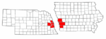
Metropolitan area of Omaha–Council Bluffs | ||||||||
|---|---|---|---|---|---|---|---|---|
| Primary Cities |
|  | ||||||
| Cities over 10,000 (per 2010 Census) |
| |||||||
| Cities of 5,000 to 10,000 (per 2010 Census) |
| |||||||
| Cities of 1,000 to 5,000 (per 2010 Census) |
| |||||||
| Census-designated places |
| |||||||
| Cities and villages of fewer than 1,000 (per 2010 Census) |
| |||||||
| Counties |
| |||||||
Municipalities and communities of Pottawattamie County, Iowa, United States | ||
|---|---|---|
| Cities | ||
| Townships | ||
| CDPs | ||
| Other community | ||
| Footnotes | ‡This populated place also has portions in an adjacent county or counties | |