Papillion, Nebraska
| Papillion, Nebraska | |
|---|---|
| City | |
|
Downtown Papillion | |
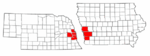
 Location of Papillion within Nebraska and Sarpy County | |
| Coordinates: 41°9′21″N 96°2′27″W / 41.15583°N 96.04083°WCoordinates: 41°9′21″N 96°2′27″W / 41.15583°N 96.04083°W | |
| Country | United States |
| State | Nebraska |
| County | Sarpy |
| Area[1] | |
| • Total | 6.47 sq mi (16.76 km2) |
| • Land | 6.45 sq mi (16.71 km2) |
| • Water | 0.02 sq mi (0.05 km2) |
| Elevation | 1,010 ft (308 m) |
| Population (2010)[2] | |
| • Total | 18,894 |
| • Estimate (2013[3]) | 21,921 |
| • Density | 2,929.3/sq mi (1,131.0/km2) |
| Time zone | Central (CST) (UTC-6) |
| • Summer (DST) | CDT (UTC-5) |
| ZIP codes | 68046, 68133, 68157 |
| Area code(s) | 402 |
| FIPS code | 31-38295 |
| GNIS feature ID | 0831967[4] |
| Website | papillion.org |

Papillion is a city in Sarpy County in the State of Nebraska. It is an 1870s railroad town that is part of the larger five-county metro area of neighboring Omaha, and is the county seat of Sarpy County.[5] The population of Papillion was 18,894 at the 2010 census.
Overview
The city was named after the creek of the same name which flows through its center. The name Papillion (papillon) is derived from the French term for butterfly. According to local tradition the early French explorers named the creek Papillion because many butterflies were found along its grassy banks.[6] Papillion was platted in 1870 when the railroad was extended to that point.[7] Papillion (sometimes referred to as "Papio" by its residents) is one of the last of the late-18th-Century Paris-inspired frontier cities left in the Midwest. Halleck Park, a recreation area in the heart of the city, includes many trails, open spaces, trees and a number of areas of interest, including Papio Fun Park, Papio Bay Aquatic Park, Papio Pool, and Papio Bowl. In addition to trails, trees and much green space, inside the park there are tennis courts, volleyball courts, playgrounds, "The Duck Pond", Monarch Field ("The Pit"), and E.A. Fricke Field.

There are also nine other baseball diamonds within the park for youth. The baseball diamonds are spread across three fields: Halleck, Blonde, and Papio Bay. Village Park, Papio Bay Aquatic Center (including two water slides and a zero depth pool) and Walnut Creek recreational park round out just a few of the many parks and recreational interest points of the city. Papillion Junior High School is in the downtown area south of Papio Creek; the building was the high school until August 1971 while the old junior high was directly west, across the street. Also downtown is the Old A.W. Clarke banking house, Sump Memorial Library, City Hall, Portal One-Room School House, Papillion Municipal Building (Sarpy County Courthouse until 1970), and the John Sutter House.
Other areas of interest in Papillion include Sarpy County Court House and Jail, Shadow Lake Towne Center, and Midlands Hospital all along Nebraska Highway 370 in the southern portion of the city.
Papillion is now Nebraska's home of Triple-A minor league baseball. Werner Park, located less than three miles (5 km) west of the city on Highway 370 in unincorporated Sarpy County, opened in 2011 as the new home of the Omaha Storm Chasers of the Pacific Coast League. The Storm Chasers were formerly the Omaha Royals; after 42 years at Rosenblatt Stadium in south Omaha, the team moved out following the 2010 season and changed their nickname. They have been the only AAA-affiliate of the Kansas City Royals, an expansion club that entered the American League in 1969.
Politics

Papillion is divided into four wards with two councilmembers representing each. One seat for each ward is up for election every two years with each term lasting four years. The mayor is the head of the city council and is elected to four-year terms. The council meets every two weeks. Following former Mayor James Blinn's resignation on July 7, 2009, city council president David Black became mayor of Papillion. Black was elected for his first full term in 2010.
Geography
According to the United States Census Bureau, the city has a total area of 6.47 square miles (16.76 km2), of which 6.45 square miles (16.71 km2) is land and 0.02 square miles (0.05 km2) is water.[1]
Demographics
| Historical population | |||
|---|---|---|---|
| Census | Pop. | %± | |
| 1880 | 444 | — | |
| 1890 | 600 | 35.1% | |
| 1900 | 594 | −1.0% | |
| 1910 | 624 | 5.1% | |
| 1920 | 666 | 6.7% | |
| 1930 | 718 | 7.8% | |
| 1940 | 763 | 6.3% | |
| 1950 | 1,034 | 35.5% | |
| 1960 | 2,235 | 116.2% | |
| 1970 | 5,606 | 150.8% | |
| 1980 | 6,399 | 14.1% | |
| 1990 | 10,372 | 62.1% | |
| 2000 | 16,363 | 57.8% | |
| 2010 | 18,894 | 15.5% | |
| Est. 2015 | 19,510 | [8] | 3.3% |
| U.S. Decennial Census[9] 2013 Estimate[3] | |||
2000 census
As of the census of 2000, there were 16,363 people, 5,505 households, and 4,337 families residing in the city. The population density was 3,927.9 people per square mile (1,515.1/km²). There were 5,751 housing units at an average density of 1,380.5 per square mile (532.5/km²). The racial makeup of the city was 93.02% White, 2.46% African American, 0.38% Native American, 1.41% Asian, 0.02% Pacific Islander, 1.00% from other races, and 1.71% from two or more races. Hispanic or Latino of any race were 2.92% of the population.
There were 5,505 households out of which 46.0% had children under the age of 18 living with them, 67.3% were married couples living together, 8.8% had a female householder with no husband present, and 21.2% were non-families. 17.4% of all households were made up of individuals and 6.2% had someone living alone who was 65 years of age or older. The average household size was 2.90 and the average family size was 3.30.
In the city the population was spread out with 31.6% under the age of 18, 8.2% from 18 to 24, 30.2% from 25 to 44, 22.0% from 45 to 64, and 8.0% who were 65 years of age or older. The median age was 34 years. For every 100 females there were 95.1 males. For every 100 females age 18 and over, there were 92.3 males.
As of 2000 the median income for a household in the city was $63,992, and the median income for a family was $70,737 (these figures had risen to $72,136 and $80,923 respectively as of a 2007 estimate). Males had a median income of $45,678 versus $27,984 for females. The per capita income for the city was $24,521. About 2.5% of families and 2.7% of the population were below the poverty line, including 2.6% of those under age 18 and 2.3% of those age 65 or over.
2010 census
As of the census[2] of 2010, there were 18,894 people, 6,925 households, and 5,079 families residing in the city. The population density was 2,929.3 inhabitants per square mile (1,131.0/km2). There were 7,240 housing units at an average density of 1,122.5 per square mile (433.4/km2). The racial makeup of the city was 90.7% White, 3.3% African American, 0.4% Native American, 1.5% Asian, 1.5% from other races, and 2.7% from two or more races. Hispanic or Latino of any race were 5.2% of the population.
There were 6,925 households of which 38.1% had children under the age of 18 living with them, 59.5% were married couples living together, 10.1% had a female householder with no husband present, 3.7% had a male householder with no wife present, and 26.7% were non-families. 22.5% of all households were made up of individuals and 9% had someone living alone who was 65 years of age or older. The average household size was 2.68 and the average family size was 3.15.
The median age in the city was 36.8 years. 27.3% of residents were under the age of 18; 9.1% were between the ages of 18 and 24; 24.3% were from 25 to 44; 28.5% were from 45 to 64; and 11% were 65 years of age or older. The gender makeup of the city was 48.8% male and 51.2% female.
Schools
Papillion is part of the Papillion-La Vista Public School District, which includes two high schools, two junior high schools and six public elementary schools within the city limits. Papillion-La Vista South High School, the newer of the two high schools, opened in 2003. It is located in southwest Papillion while Papillion-La Vista High School, opened in 1971, is located in the northern part of the city close to the LaVista border. The school district has well over 8,000 students and is one of the fastest-growing districts in Nebraska. There are a few private elementary schools in the city as well.
Papillion is home to Nebraska Christian College, an accredited baccalaureate college.
Climate
| Climate data for Papillion, Nebraska | |||||||||||||
|---|---|---|---|---|---|---|---|---|---|---|---|---|---|
| Month | Jan | Feb | Mar | Apr | May | Jun | Jul | Aug | Sep | Oct | Nov | Dec | Year |
| Average high °F (°C) | 32 (0) |
38 (3) |
50 (10) |
63 (17) |
74 (23) |
84 (29) |
87 (31) |
85 (29) |
77 (25) |
65 (18) |
48 (9) |
35 (2) |
61.5 (16.3) |
| Average low °F (°C) | 12 (−11) |
18 (−8) |
28 (−2) |
40 (4) |
51 (11) |
61 (16) |
66 (19) |
64 (18) |
54 (12) |
41 (5) |
28 (−2) |
16 (−9) |
39.9 (4.4) |
| Average precipitation inches (mm) | 0.77 (19.6) |
0.80 (20.3) |
2.13 (54.1) |
2.94 (74.7) |
4.44 (112.8) |
3.95 (100.3) |
3.86 (98) |
3.21 (81.5) |
3.17 (80.5) |
2.21 (56.1) |
1.82 (46.2) |
0.92 (23.4) |
30.22 (767.6) |
| Source: The Weather Channel[10] | |||||||||||||
References
- 1 2 "US Gazetteer files 2010". United States Census Bureau. Retrieved 2012-06-24.
- 1 2 "American FactFinder". United States Census Bureau. Retrieved 2012-06-24.
- 1 2 "Population Estimates". United States Census Bureau. Retrieved 2014-07-15.
- ↑ "US Board on Geographic Names". United States Geological Survey. 2007-10-25. Retrieved 2008-01-31.
- ↑ "Find a County". National Association of Counties. Retrieved 2011-06-07.
- ↑ usgennet.org - Nebraska place names - Sarpy County - accessed 2011-09-08
- ↑ "Papillion, Sarpy County". Center for Advanced Land Management Information Technologies. University of Nebraska. Retrieved 23 August 2014.
- ↑ "Annual Estimates of the Resident Population for Incorporated Places: April 1, 2010 to July 1, 2015". Retrieved July 2, 2016.
- ↑ United States Census Bureau. "Census of Population and Housing". Retrieved June 22, 2013.
- ↑ "Monthly Averages for Papillion, Nebraska". Weather.com. 2010. Retrieved 2010-03-31.
External links
- papillion.org - City of Papillion website
- Papillion Community Foundation - Papillion Community Foundation website
- OmahaWiki.org - wiki website for the Omaha-Council Bluffs metro area
- Sump Memorial Library in Papillion, NE
- Papillion page on visitnebraska.org
- CNN Money Best Places to Live 2009
- Sarpy County Museum
Municipalities and communities of Sarpy County, Nebraska, United States | ||
|---|---|---|
| Cities | ||
| CDPs | ||
| Other unincorporated communities | ||
Metropolitan area of Omaha–Council Bluffs | ||||||||
|---|---|---|---|---|---|---|---|---|
| Primary Cities |
|  | ||||||
| Cities over 10,000 (per 2010 Census) |
| |||||||
| Cities of 5,000 to 10,000 (per 2010 Census) |
| |||||||
| Cities of 1,000 to 5,000 (per 2010 Census) |
| |||||||
| Census-designated places |
| |||||||
| Cities and villages of fewer than 1,000 (per 2010 Census) |
| |||||||
| Counties |
| |||||||