Wasioja, Minnesota
| Wasioja, Minnesota | |
|---|---|
| Unincorporated community | |
 Wasioja, Minnesota  Wasioja, Minnesota Location of the community of Wasioja | |
| Coordinates: 44°04′49″N 92°49′10″W / 44.08028°N 92.81944°WCoordinates: 44°04′49″N 92°49′10″W / 44.08028°N 92.81944°W | |
| Country | United States |
| State | Minnesota |
| County | Dodge |
| Township | Wasioja Township |
| Elevation | 1,168 ft (356 m) |
| Time zone | Central (CST) (UTC-6) |
| • Summer (DST) | CDT (UTC-5) |
| ZIP code | 55927 |
| Area code(s) | 507 |
| GNIS feature ID | 653827[1] |
Wasioja is an unincorporated community in Wasioja Township, Dodge County, Minnesota, United States. The community is located near the junction of Dodge County Roads 9 and 16. The South Branch Middle Fork of the Zumbro River and Dodge Center Creek meet at Wasioja. Nearby places include Dodge Center, Mantorville, and Kasson.
History
Wasioja was platted in 1856.[2] A post office was established at Wasioja in 1856, and remained in operation until 1911.[3] Wasioja is the native Sioux-language name for the Zumbro River.[2]
References
- ↑ "Wasioja, Minnesota". Geographic Names Information System. United States Geological Survey.
- 1 2 Upham, Warren (1920). Minnesota Geographic Names: Their Origin and Historic Significance. Minnesota Historical Society. p. 174.
- ↑ "Dodge County". Jim Forte Postal History. Retrieved 14 May 2015.
Municipalities and communities of Dodge County, Minnesota, United States | ||
|---|---|---|
| Cities | 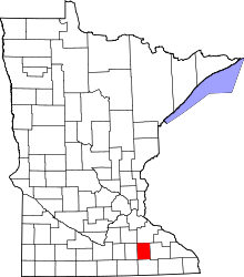 | |
| Townships | ||
| Unincorporated communities | ||
| Ghost town | ||
| Footnotes | ‡This populated place also has portions in an adjacent county or counties | |
This article is issued from Wikipedia - version of the 10/26/2016. The text is available under the Creative Commons Attribution/Share Alike but additional terms may apply for the media files.